Category:Hempstead, Stody
Jump to navigation
Jump to search
English: Hempstead is a village and civil parish in the north of the English county of Norfolk. The village is 2.7 miles south-southeast of the town of Holt, and 11.2 miles west of Cromer. Hempstead is within the area covered by North Norfolk District Council. In the last Census, carried out in 2001, the population of Hempstead was counted as 179.
village near Holt, Norfolk, UK .JPG) | |||||
| Upload media | |||||
| Instance of | |||||
|---|---|---|---|---|---|
| Location | North Norfolk, Norfolk, East of England, England | ||||
| Population |
| ||||
| Area |
| ||||
| Said to be the same as | Hempstead (Wikimedia duplicated page, civil parish) | ||||
 | |||||
Subcategories
This category has the following 2 subcategories, out of 2 total.
A
H
- Hempstead Watermill (5 F)
Media in category "Hempstead, Stody"
The following 95 files are in this category, out of 95 total.
-
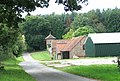
 "The Great Barn" at Hempstead - geograph.org.uk - 515733.jpg 640 × 480; 151 KB
-
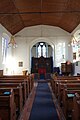
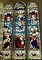
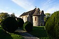 All Saints Church, Hempstead - geograph.org.uk - 5974794.jpg 1,600 × 1,064; 666 KB
-
 All Saints Church, Hempstead - geograph.org.uk - 5974796.jpg 1,600 × 1,064; 878 KB
-
 All Saints Church, Hempstead - geograph.org.uk - 5974799.jpg 1,054 × 1,600; 439 KB
-
 All Saints Church, Hempstead - geograph.org.uk - 5974805.jpg 1,064 × 1,600; 443 KB
-
 All Saints Church, Hempstead - geograph.org.uk - 5974844.jpg 965 × 1,600; 643 KB
-
 All Saints Church, Hempstead - geograph.org.uk - 5974860.jpg 1,121 × 1,600; 912 KB
-
 All Saints Church, Hempstead - geograph.org.uk - 5974864.jpg 1,064 × 1,600; 450 KB
-
 All Saints Church, Hempstead - geograph.org.uk - 5974868.jpg 1,600 × 1,064; 474 KB
-
 All Saints Church, Hempstead - geograph.org.uk - 5974871.jpg 1,348 × 1,600; 394 KB
-
 All Saints Church, Hempstead - geograph.org.uk - 5974929.jpg 1,600 × 1,064; 720 KB
-
 All Saints Parish Church. Hempstead - geograph.org.uk - 6147686.jpg 3,456 × 4,608; 4.67 MB
-

-
 All Saints' Church, Hempstead - geograph.org.uk - 4847287.jpg 1,600 × 1,200; 605 KB
-
 Baconsthorpe Meadows camping field - geograph.org.uk - 4851357.jpg 1,600 × 1,200; 614 KB
-
 Barn next to Red House - geograph.org.uk - 4189411.jpg 640 × 427; 91 KB
-
 Barns at Redhouse - geograph.org.uk - 5974940.jpg 1,600 × 1,064; 701 KB
-
 Bend in Hempstead Road toward Holt - geograph.org.uk - 6147690.jpg 3,014 × 2,221; 3.69 MB
-

-
 Bluebells beside the path to Hempstead - geograph.org.uk - 2394610.jpg 640 × 480; 343 KB
-
 Bluebells in woodland north of Dam Hill - geograph.org.uk - 2394613.jpg 640 × 480; 356 KB
-
 Bluebells in woodland north of Dam Hill - geograph.org.uk - 2394616.jpg 487 × 640; 371 KB
-
 Chapel Lane - geograph.org.uk - 4851352.jpg 1,600 × 1,200; 671 KB
-
 Cottages in Hempstead - geograph.org.uk - 4847283.jpg 1,600 × 1,200; 539 KB
-
 Crop spraying at Green Farm - geograph.org.uk - 4847279.jpg 1,600 × 1,200; 691 KB
-
 Crossroads at Court Green - geograph.org.uk - 5974935.jpg 1,600 × 1,064; 711 KB
-

-
 Cultivated fields west of Hempstead - geograph.org.uk - 2394621.jpg 640 × 480; 220 KB
-
 Cultivated fields west of Hempstead - geograph.org.uk - 2394630.jpg 640 × 480; 188 KB
-
 Drilling by Hole Farm - geograph.org.uk - 3664082.jpg 640 × 444; 150 KB
-
 Drilling by Hole Farm - geograph.org.uk - 3664083.jpg 612 × 640; 278 KB
-
 Entering Hempstead - geograph.org.uk - 4847288.jpg 1,600 × 1,200; 571 KB
-
 Farm building by the crossing of tracks - geograph.org.uk - 2394634.jpg 640 × 480; 171 KB
-
 Field boundary west of Hempstead - geograph.org.uk - 2394647.jpg 640 × 480; 244 KB
-
 Field Lane leaving Hempstead - geograph.org.uk - 4847293.jpg 1,600 × 1,200; 470 KB
-
 Field near Baconsthorpe - geograph.org.uk - 4851354.jpg 1,600 × 1,200; 573 KB
-
 Field on Gravelpit Hill - geograph.org.uk - 4847159.jpg 1,600 × 1,200; 773 KB
-
 Fields by Hole Farm - geograph.org.uk - 3664078.jpg 640 × 384; 171 KB
-

-
 Footpath and campsite - geograph.org.uk - 4851356.jpg 1,600 × 1,200; 775 KB
-
 Footpath to Hempstead - geograph.org.uk - 2394642.jpg 640 × 480; 202 KB
-
 Footpath to Hempstead Hall - geograph.org.uk - 4848614.jpg 1,600 × 1,200; 585 KB
-
 Forest track at Edgefield - geograph.org.uk - 4294369.jpg 640 × 480; 220 KB
-
 Former school, Hempstead - geograph.org.uk - 1053165.jpg 640 × 431; 88 KB
-
 Frosty road and bare trees - geograph.org.uk - 4294373.jpg 640 × 480; 158 KB
-
 Hare and Hounds Inn, Hempstead, Norfolk, 28th March 2009.JPG 2,560 × 1,920; 3.39 MB
-
 Headwaters of the River Glaven - geograph.org.uk - 515764.jpg 480 × 640; 188 KB
-
 Hempstead All Saints' church - geograph.org.uk - 2261780.jpg 640 × 480; 103 KB
-

-
 Hempstead Road toward Holt - geograph.org.uk - 6147688.jpg 3,011 × 2,220; 3.5 MB
-
 Hempstead village sign - geograph.org.uk - 6707589.jpg 2,644 × 2,644; 2.07 MB
-
 Hempstead village sign - geograph.org.uk - 6707593.jpg 4,608 × 3,072; 5.09 MB
-
 Hempstead Village Sign October 25th 2007 (1).JPG 2,560 × 1,920; 1.14 MB
-
 Hole Farm - geograph.org.uk - 3664076.jpg 640 × 430; 189 KB
-
 Junction of Chapel Lane and The Street. Hempstead - geograph.org.uk - 6147682.jpg 4,416 × 3,184; 5.48 MB
-
 Minor road to Holt - geograph.org.uk - 4848611.jpg 1,600 × 1,200; 454 KB
-
 Minor road to Selbrigg Pond - geograph.org.uk - 4853035.jpg 1,600 × 1,200; 700 KB
-

-
 Path to Beckett's Farm - geograph.org.uk - 5633635.jpg 640 × 425; 56 KB
-
 Path towards Hempstead - geograph.org.uk - 5633637.jpg 640 × 425; 102 KB
-
 Pond Hills Road, Hempstead - geograph.org.uk - 5620789.jpg 3,456 × 2,592; 3.92 MB
-
 Pond near Hempstead - geograph.org.uk - 4847275.jpg 1,600 × 1,200; 663 KB
-

-
 Private road to the Hall - geograph.org.uk - 2394629.jpg 640 × 480; 186 KB
-
 Public footpath to Hempstead - geograph.org.uk - 2394607.jpg 640 × 480; 329 KB
-
 River Glaven between Holt and Edgefield - geograph.org.uk - 4374488.jpg 3,482 × 1,536; 2.88 MB
-
 Road junction near Hole Farm - geograph.org.uk - 4294377.jpg 640 × 480; 149 KB
-
 Road leading to Becketts Farm - geograph.org.uk - 5974790.jpg 1,600 × 1,064; 451 KB
-
 Selbrigg Pond - geograph.org.uk - 4189436.jpg 640 × 427; 63 KB
-
 Selbrigg Pond - geograph.org.uk - 4853026.jpg 1,600 × 1,200; 604 KB
-

-
 Square hedge - geograph.org.uk - 4847271.jpg 1,600 × 1,208; 632 KB
-
 Stubble field south of Hole Farm - geograph.org.uk - 3664080.jpg 640 × 416; 187 KB
-

-
 The lane to Hole Farm - geograph.org.uk - 3664081.jpg 640 × 480; 225 KB
-
 The River Glaven east of Edgefield Woods - geograph.org.uk - 2394572.jpg 480 × 640; 291 KB
-
 The River Glaven east of Edgefield Woods - geograph.org.uk - 2394601.jpg 640 × 480; 339 KB
-
 The site of Edgefield Mill - geograph.org.uk - 2394590.jpg 640 × 480; 335 KB
-
 The site of Edgefield Mill - geograph.org.uk - 2394597.jpg 640 × 480; 295 KB
-
 The Street, Hempstead - geograph.org.uk - 4847139.jpg 1,600 × 1,200; 859 KB
-
 The Village sign - geograph.org.uk - 1223958.jpg 640 × 480; 79 KB
-
 The War Memorial and Roll of Honour at Hempstead - geograph.org.uk - 4592815.jpg 2,592 × 3,456; 2.38 MB
-
 Track and footpath to Edgefield Woods - geograph.org.uk - 2394650.jpg 640 × 480; 254 KB
-
 Track descending to the Glaven valley - geograph.org.uk - 2394618.jpg 640 × 480; 311 KB
-
 Track past flint and brick farm building - geograph.org.uk - 2394626.jpg 640 × 480; 207 KB
-
 Water tower in the woods at Edgefield - geograph.org.uk - 4294371.jpg 640 × 480; 226 KB
-
 Water tower near Edgefield - geograph.org.uk - 5300827.jpg 640 × 480; 238 KB
-

-
 WW1 Memorial ^ Roll of Honour - geograph.org.uk - 5971309.jpg 1,064 × 1,600; 408 KB
-
 WW1 Memorial ^ Roll of Honour - geograph.org.uk - 5971311.jpg 1,105 × 1,600; 478 KB
-

-

-
 Heading south-west towards Red House - geograph.org.uk - 521373.jpg 480 × 640; 189 KB
-
-
 Selbrigg Cottage - geograph.org.uk - 515779.jpg 640 × 417; 99 KB


