Category:Helfent (Bertrange)
Jump to navigation
Jump to search
| Object location | | View all coordinates using: OpenStreetMap |
|---|
forest in Luxembourg | |||||
| Upload media | |||||
| Pronunciation audio | |||||
|---|---|---|---|---|---|
| Instance of | |||||
| Location | Bertrange, Canton of Luxembourg, Luxembourg | ||||
 | |||||
Media in category "Helfent (Bertrange)"
The following 5 files are in this category, out of 5 total.
-
 Helfent, Konfluenz Grouf-Péitruss.JPG 3,456 × 2,592; 3.08 MB
-
 Helfent, Péitruss km 5,5.JPG 3,456 × 2,592; 3.11 MB
-
 Luxembourg road sign E,9a Helfent.jpg 3,202 × 2,446; 1.67 MB
-
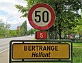
 Luxembourg road sign F,14a.jpg 3,456 × 2,592; 3.88 MB
-
 Luxembourg road sign F,14b.jpg 3,456 × 2,592; 3.93 MB


