Category:Heksenwielpad
Jump to navigation
Jump to search
| Camera location | | View all coordinates using: OpenStreetMap |
|---|
street in Breda, the Netherlands | |||||
| Upload media | |||||
| Instance of | |||||
|---|---|---|---|---|---|
| Named after | |||||
| Location | Breda, North Brabant, Netherlands | ||||
| Street address |
| ||||
 | |||||
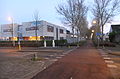
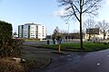
Nederlands: Afbeeldingen van de Heksenwielpad, een lang fiets- en wandelpad in de wijken Overkroeten en Heksenwiel. Gelegen in het grote stadsdeel de Haagse Beemden in het noorden van Breda in de provincie Noord-Brabant in het zuiden van Nederland. Nabij een deel van het Heksenwielpad ligt onder meer de basisschool de Kievitsloop en het Plantsoen 't Blok. Het Heksenwielpad is niet ver van het winkelcentrum Heksenwiel
Subcategories
This category has the following 3 subcategories, out of 3 total.
Media in category "Heksenwielpad"
The following 75 files are in this category, out of 75 total.
-
 Basisschool de Kievitsloop DSCF9350.JPG 2,816 × 1,864; 2.59 MB
-
 Basisschool de Kievitsloop P1520799.jpg 4,000 × 2,672; 6 MB
-
 Bushalte Heksenwiellaan P1030432.jpg 4,000 × 2,672; 5.61 MB
-
 Fietspad Heksenwiellaan P1100937.jpg 4,000 × 2,672; 6.17 MB
-
 Fietspad Heksenwielpad DSCF1014.jpg 2,816 × 2,112; 2.88 MB
-
 Fietspad Heksenwielpad DSCF1849.jpg 4,000 × 2,664; 4.01 MB
-
 Fietspad Heksenwielpad DSCF1851.jpg 2,664 × 4,000; 4.21 MB
-
 Fietspad Heksenwielpad DSCF1854.jpg 4,000 × 2,664; 4.3 MB
-
 Fietspad Heksenwielpad DSCF7277.jpg 2,048 × 1,536; 1.56 MB
-
 Fietspad Heksenwielpad DSCF8318.jpg 2,816 × 1,864; 2.61 MB
-
 Fietspad Heksenwielpad DSCF8319.jpg 2,816 × 1,864; 2.55 MB
-
 Fietspad Heksenwielpad DSCF8321.jpg 2,816 × 1,864; 2.57 MB
-
 Fietspad Heksenwielpad P1100940.jpg 4,000 × 2,672; 6.02 MB
-
 Fietspad Heksenwielpad P1460600.jpg 4,000 × 2,672; 6.18 MB
-
 Fietspad Heksenwielpad P1540123.jpg 4,000 × 2,672; 5.48 MB
-
 Fietspad Heksenwielpäd P1100936.jpg 4,000 × 2,672; 5.91 MB
-
 Heksenwiel DSCF0018.JPG 4,000 × 2,664; 4.49 MB
-
 Heksenwiel DSCF0019.JPG 2,816 × 1,864; 2.56 MB
-
 Heksenwiel DSCF0024.JPG 2,816 × 1,864; 2.59 MB
-
 Heksenwiel DSCF0025.JPG 4,000 × 2,664; 4.3 MB
-
 Heksenwiel DSCF0027.JPG 4,000 × 2,664; 4.35 MB
-
 Heksenwiel DSCF1215.JPG 4,000 × 2,664; 4.4 MB
-
 Heksenwiel DSCF2380.JPG 2,112 × 2,816; 2.78 MB
-
 Heksenwiel DSCF8915.JPG 2,816 × 2,112; 2.86 MB
-
 Heksenwiel DSCF8933.JPG 2,816 × 1,864; 2.59 MB
-
 Heksenwiel DSCF9097.JPG 2,816 × 1,864; 2.52 MB
-
 Heksenwiel DSCF9113.JPG 1,864 × 2,816; 2.55 MB
-
 Heksenwiel DSCF9353.JPG 2,816 × 1,864; 2.47 MB
-
 Heksenwiel DSCF9398.JPG 2,816 × 2,112; 2.85 MB
-
 Heksenwiel DSCF9625.JPG 2,816 × 1,864; 2.6 MB
-
 Heksenwiellaan Breda DSCF0834.jpg 2,816 × 2,112; 2.86 MB
-
 Heksenwiellaan Bruggetje P1100929.jpg 4,000 × 2,672; 5.75 MB
-
 Heksenwiellaan DSCF7100.jpg 2,816 × 1,864; 2.59 MB
-
 Heksenwiellaan P1100927.jpg 4,000 × 2,672; 5.85 MB
-
 Heksenwiellaan P1100931.jpg 4,000 × 2,672; 5.94 MB
-
 Heksenwiellaan P1420346.jpg 4,000 × 2,672; 6.19 MB
-
 Heksenwiellaan P1420489.jpg 4,000 × 2,672; 5.92 MB
-
 Heksenwielpad DSCF0833 copy.jpg 2,816 × 2,112; 1.75 MB
-
 Heksenwielpad DSCF6769.jpg 2,816 × 2,112; 2.72 MB
-
 Heksenwielpad DSCF7827.jpg 2,816 × 1,864; 2.59 MB
-
 Heksenwielpad DSCF7828.jpg 2,816 × 1,864; 2.52 MB
-
 Heksenwielpad DSCF7829.jpg 2,816 × 1,864; 2.53 MB
-
 Heksenwielpad DSCF7830.jpg 2,816 × 1,864; 2.57 MB
-
 Heksenwielpad DSCF7831.jpg 1,864 × 2,816; 2.38 MB
-
 Heksenwielpad DSCF7870.jpg 1,864 × 2,816; 2.59 MB
-
 Heksenwielpad DSCF8031.jpg 2,816 × 1,864; 2.51 MB
-
 Heksenwielpad DSCF8032.jpg 2,816 × 1,864; 2.6 MB
-
 Heksenwielpad DSCF8035.jpg 2,816 × 1,864; 2.51 MB
-
 Heksenwielpad P1030421.jpg 4,000 × 2,672; 5.83 MB
-
 Heksenwielpad P1030422.jpg 4,000 × 2,672; 5.82 MB
-
 Heksenwielpad P1420485.jpg 4,000 × 2,672; 5.84 MB
-
 Heksenwielpad P1420487.jpg 4,000 × 2,672; 5.92 MB
-
 Heksenwielpad P1490144.jpg 4,000 × 2,672; 5.72 MB
-
 Heksenwielpad P1490147.jpg 4,000 × 2,672; 5.72 MB
-
 Heksenwielpad P1520781.jpg 4,000 × 2,672; 5.78 MB
-
 Heksenwielpad P1520782.jpg 4,000 × 2,672; 5.69 MB
-
 Heksenwielpad P1520783.jpg 4,000 × 2,672; 5.86 MB
-
 Heksenwielpad P1520785.jpg 4,000 × 2,672; 5.86 MB
-
 Heksenwielpad P1520786.jpg 4,000 × 2,672; 6.01 MB
-
 Heksenwielpad P1520787.jpg 4,000 × 2,672; 5.92 MB
-
 Heksenwielpad P1520788.jpg 4,000 × 2,672; 5.86 MB
-
 Heksenwielpad P1520801.jpg 4,000 × 2,672; 6.07 MB
-
 Heksenwielpad P1620573.jpg 4,000 × 3,000; 6.75 MB
-
 Keislagen DSCF1168.JPG 4,000 × 2,664; 4.12 MB
-
 Keislagen DSCF1191.JPG 4,000 × 2,664; 4.34 MB
-
 Keislagen P1100943.jpg 4,000 × 2,672; 6.13 MB
-
 Overkroeten DSCF3063.jpg 2,816 × 2,112; 2.84 MB
-
 P1030035Heksenwiel.JPG 3,264 × 2,448; 3.73 MB
-
 Sluisblok Overkroeten DSCF3062.jpg 2,816 × 2,112; 2.85 MB
-
 Straat Asterd DSCF1221.JPG 4,000 × 2,664; 4.32 MB
-
 Straat Heksenwiel DSCF1227.JPG 4,000 × 2,664; 4.3 MB
-
 Vuilcontainers P1160644.jpg 4,000 × 2,672; 6.25 MB
-
 Woningen Overkroeten DSCF1852.jpg 4,000 × 2,664; 4.33 MB
-
 Zebrapad Heksenwiellaan DSCF1015.jpg 2,816 × 2,112; 2.91 MB
-
 Zebrapad Heksenwiellaan DSCF1017.jpg 2,816 × 2,112; 2.94 MB


