Category:Heene
Jump to navigation
Jump to search
English: Heene is a neighbourhood of the Borough of Worthing in West Sussex, England. It lies on the A259 road 0.6 miles (1km) west of the town centre.
suburb in Worthing, West Sussex, England, UK  | |||||
| Upload media | |||||
| Instance of |
| ||||
|---|---|---|---|---|---|
| Part of | |||||
| Location | Worthing, West Sussex, South East England, England | ||||
 | |||||
Subcategories
This category has the following 4 subcategories, out of 4 total.
Media in category "Heene"
The following 15 files are in this category, out of 15 total.
-
 Beach, West Worthing, Sussex - geograph.org.uk - 4106153.jpg 1,024 × 768; 280 KB
-
 Heene CE First School - geograph.org.uk - 1163663.jpg 640 × 480; 59 KB
-
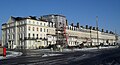 Heene Terrace, Worthing (IoE Code 432601).JPG 2,592 × 1,400; 940 KB
-
 Kitesurfing at Worthing - geograph.org.uk - 4743216.jpg 800 × 600; 34 KB
-
 Looking back to shore - geograph.org.uk - 2557300.jpg 1,600 × 1,200; 572 KB
-

-

-
 Low tide at Worthing Beach - geograph.org.uk - 2500331.jpg 1,024 × 768; 161 KB
-
 Low tide beach, West Worthing - geograph.org.uk - 6469983.jpg 1,024 × 685; 353 KB
-
 Low tide beach, West Worthing - geograph.org.uk - 6469987.jpg 1,024 × 685; 393 KB
-
 MGM House, Grand Avenue, West Worthing.JPG 2,300 × 1,600; 896 KB
-
 Sand and seaweed, Worthing beach - geograph.org.uk - 2031115.jpg 640 × 480; 70 KB
-
 Stones, Seagulls and Seaweed - geograph.org.uk - 5119841.jpg 4,608 × 3,456; 5.11 MB
-
 The things I do for a geograph^ - geograph.org.uk - 4747173.jpg 800 × 469; 61 KB
-
 Wet soggy sand at low tide - geograph.org.uk - 2557296.jpg 1,600 × 1,200; 676 KB


.JPG)


