Category:Hedleyhope
Jump to navigation
Jump to search
civil parish in County Durham, England  | |||||
| Upload media | |||||
| Instance of | |||||
|---|---|---|---|---|---|
| Location | County Durham, North East England, England | ||||
| Population |
| ||||
 | |||||
Media in category "Hedleyhope"
The following 77 files are in this category, out of 77 total.
-
 Access to Wind Turbines - geograph.org.uk - 4532540.jpg 640 × 480; 73 KB
-
 B6301 - geograph.org.uk - 2638813.jpg 640 × 480; 101 KB
-
 B6301 at Hedley Hill - geograph.org.uk - 2638818.jpg 640 × 480; 141 KB
-
 B6301 at Hedley Hill Farm - geograph.org.uk - 2638817.jpg 640 × 480; 124 KB
-
 B6301 north-east of Tow Law - geograph.org.uk - 2228531.jpg 2,000 × 1,500; 2.66 MB
-
 Barley field from Hedleyhill Lane - geograph.org.uk - 2464936.jpg 1,500 × 1,125; 1.34 MB
-
 Bridleway behind Wood View - geograph.org.uk - 3371651.jpg 640 × 480; 89 KB
-

-
 Bus stop at East Hedleyhope - geograph.org.uk - 3583410.jpg 3,648 × 2,736; 3.03 MB
-

-

-
 Deerness View at East Hedleyhope - geograph.org.uk - 6540497.jpg 640 × 480; 79 KB
-
 East Hedleyhope Village Hall - geograph.org.uk - 6540477.jpg 640 × 467; 64 KB
-
 Elizabeth II postbox, East Hedleyhope - geograph.org.uk - 5890818.jpg 1,672 × 3,118; 1.06 MB
-
 Farm buildings at Low West House - geograph.org.uk - 2762414.jpg 1,500 × 843; 1.31 MB
-
 Farm road to Bell's House Farm - geograph.org.uk - 3371638.jpg 640 × 480; 120 KB
-
 Farm Road with Public Footpath - geograph.org.uk - 1832625.jpg 640 × 480; 452 KB
-
 Farm track off Hedleyhill Lane - geograph.org.uk - 5028923.jpg 4,608 × 3,456; 6.67 MB
-
 Farmhouse at Headley Hill Farm - geograph.org.uk - 3665208.jpg 3,299 × 2,260; 2.57 MB
-
 Field above the Rowley Burn - geograph.org.uk - 3371642.jpg 640 × 480; 96 KB
-

-
 Field north of River Deerness - geograph.org.uk - 2762197.jpg 1,500 × 843; 1.23 MB
-
 Fields in the upper Deerness valley - geograph.org.uk - 2763355.jpg 1,500 × 843; 1.04 MB
-
 Fields near East Hedleyhope - geograph.org.uk - 5526313.jpg 640 × 480; 46 KB
-
 Fields south of High Hedleyhope - geograph.org.uk - 5526308.jpg 640 × 480; 47 KB
-
 Footpath to High Hedley Hope - geograph.org.uk - 5890980.jpg 640 × 480; 67 KB
-

-

-
 Grazing near Low Hedleyhope Hall - geograph.org.uk - 5890993.jpg 640 × 480; 49 KB
-
 Grazing towards Hedleyhope Wood - geograph.org.uk - 5891008.jpg 640 × 480; 61 KB
-
 Hedleyhill Lane - geograph.org.uk - 2638820.jpg 640 × 480; 105 KB
-
 Hedleyhill Lane Farm - geograph.org.uk - 5028931.jpg 4,608 × 3,456; 4.87 MB
-
 Hedleyhill Lane passing Wood View Farm - geograph.org.uk - 3666346.jpg 3,374 × 2,384; 3.17 MB
-
 Hedleyhope Wood with wind turbines - geograph.org.uk - 1832665.jpg 639 × 359; 237 KB
-
 High Hedley Hope Farm - geograph.org.uk - 3582125.jpg 3,648 × 2,736; 3.24 MB
-
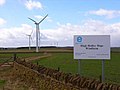 High Hedley Hope Windfarm - geograph.org.uk - 146415.jpg 640 × 480; 31 KB
-
 High West House - geograph.org.uk - 3123163.jpg 4,608 × 3,456; 4.9 MB
-
 House at Hedley Hill - geograph.org.uk - 3133561.jpg 4,608 × 3,456; 5.21 MB
-
 Houses at East Hedleyhope - geograph.org.uk - 3583431.jpg 3,648 × 2,736; 3.38 MB
-
 Ivesley Lane off Hedleyhill Lane - geograph.org.uk - 2638819.jpg 640 × 480; 107 KB
-
 Lane beside woodland, Hedley Hill - geograph.org.uk - 5890968.jpg 640 × 480; 85 KB
-
 Long road to Low West House - geograph.org.uk - 5526252.jpg 640 × 480; 64 KB
-
 Looking along Hedleyhill Lane to Wood View - geograph.org.uk - 5029764.jpg 4,608 × 3,456; 7.49 MB
-
 Looking west along the road to East Hedleyhope - geograph.org.uk - 3583484.jpg 3,648 × 2,736; 3.34 MB
-
 Low Hedleyhope - geograph.org.uk - 146414.jpg 640 × 480; 149 KB
-
 Minor road towards East Hedleyhope - geograph.org.uk - 5890990.jpg 640 × 480; 97 KB
-
 Minor road towards Waterhouses - geograph.org.uk - 5891021.jpg 640 × 480; 97 KB
-
 Path leading west - geograph.org.uk - 3582092.jpg 3,648 × 2,736; 3.26 MB
-

-

-
 Road junction on the B6301 - geograph.org.uk - 2638816.jpg 640 × 480; 88 KB
-
 Road to East Hedleyhope - geograph.org.uk - 4532541.jpg 640 × 480; 118 KB
-
 Rose Terrace, East Hedleyhope - geograph.org.uk - 3583472.jpg 3,648 × 2,736; 3.12 MB
-
 Seat in Stanley Wood - geograph.org.uk - 3583448.jpg 3,648 × 2,736; 3.44 MB
-
 South View, East Hedleyhope - geograph.org.uk - 3583425.jpg 3,648 × 2,736; 3.2 MB
-
 Sun setting on wind turbines - geograph.org.uk - 4434937.jpg 640 × 480; 25 KB
-
 Terraced housing, East Hedleyhope - geograph.org.uk - 5891000.jpg 640 × 480; 56 KB
-
 The B6301 north east to Cornsay Colliery - geograph.org.uk - 3666338.jpg 3,648 × 2,736; 2.83 MB
-
 Track by River Deerness - geograph.org.uk - 5526247.jpg 640 × 480; 85 KB
-

-
 Turn off for Rowley Farm - geograph.org.uk - 5028632.jpg 4,608 × 3,456; 6.02 MB
-
 View along Hedleyhill Lane - geograph.org.uk - 5028696.jpg 4,608 × 3,456; 5.68 MB
-
 View east from Hedleyhill Lane - geograph.org.uk - 5028661.jpg 4,608 × 3,456; 6.1 MB
-

-
 Village green at East Hedleyhope - geograph.org.uk - 6540484.jpg 640 × 480; 65 KB
-
 Village Hall, East Hedleyhope - geograph.org.uk - 5890820.jpg 3,609 × 2,215; 1.28 MB
-
 West View at East Hedleyhope - geograph.org.uk - 6540495.jpg 640 × 480; 67 KB
-
 West View of East Hedleyhope - geograph.org.uk - 2228583.jpg 2,000 × 1,500; 2.66 MB
-
 Wind Farm - geograph.org.uk - 614145.jpg 640 × 480; 39 KB
-
 Wind Generators at Hedley Hill - geograph.org.uk - 1832676.jpg 639 × 359; 298 KB
-
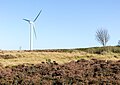 Wind turbine above Hedley Edge - geograph.org.uk - 6272976.jpg 1,600 × 1,134; 542 KB
-

-
 Wind turbine at High Hedley Hope - geograph.org.uk - 6540387.jpg 469 × 640; 54 KB
-
 Wind turbines near and far - geograph.org.uk - 2465019.jpg 1,125 × 1,500; 1.33 MB
-
 Windmills by the B6301 - geograph.org.uk - 1307277.jpg 640 × 346; 28 KB
-
 Wood View - geograph.org.uk - 3371647.jpg 640 × 480; 57 KB
-
 Wood View, Hedleyhill Lane - geograph.org.uk - 5028902.jpg 4,608 × 3,456; 6.42 MB


_-_geograph.org.uk_-_4462956.jpg)


