Category:Hedges in Millington, East Riding of Yorkshire
Jump to navigation
Jump to search
Media in category "Hedges in Millington, East Riding of Yorkshire"
The following 17 files are in this category, out of 17 total.
-
 A crossroads - geograph.org.uk - 902413.jpg 640 × 480; 115 KB
-
 Footpath to Millington Dale - geograph.org.uk - 902425.jpg 640 × 480; 85 KB
-
 Former chapel now Village Hall. Church Lane, Millington (geograph 7158953).jpg 5,152 × 3,864; 5.25 MB
-
 Holiday cottages on Main Street, Millington (geograph 7052207).jpg 640 × 465; 56 KB
-
 House on Main Street, Millington (geograph 7052206).jpg 1,024 × 649; 106 KB
-
 Looking down Church Lane, Millington (geograph 7158959).jpg 5,152 × 3,864; 6.8 MB
-
 Millington (geograph 5808267).jpg 1,024 × 768; 228 KB
-
 Millington (geograph 7051368).jpg 1,024 × 710; 173 KB
-
 Millington - geograph.org.uk - 257182.jpg 640 × 480; 56 KB
-
 Millington from the Wolds Way.jpg 640 × 480; 119 KB
-
 Millington Village - geograph.org.uk - 16887.jpg 640 × 480; 93 KB
-
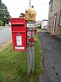 Red Post Box with knitted beehive in Millington (geograph 7291074).jpg 1,944 × 2,592; 954 KB
-
 Road by Millington Wood (geograph 5794411).jpg 640 × 480; 75 KB
-
 The road to Huggate - geograph.org.uk - 1399874.jpg 640 × 480; 84 KB
-
 View back down towards Beck Cottage - geograph.org.uk - 334112.jpg 640 × 480; 97 KB
-
 View from road just south of Millington - geograph.org.uk - 334103.jpg 640 × 480; 101 KB
-
 View over Millington from f-p on top of Whinney Hill (geograph 6844988).jpg 4,608 × 3,456; 4.14 MB


.jpg)
.jpg)
.jpg)
.jpg)
.jpg)
.jpg)


.jpg)
.jpg)


.jpg)