Category:Heanor and Loscoe
Jump to navigation
Jump to search
English: Heanor and Loscoe is a civil parish with a town council, in the Amber Valley district of Derbyshire, England. According to the 2001 census it had a population of 16,040 people.
civil parish in Amber Valley, Derbyshire, England | |||||
| Upload media | |||||
| Instance of | |||||
|---|---|---|---|---|---|
| Location | Amber Valley, Derbyshire, East Midlands, England | ||||
| Population |
| ||||
 | |||||
Subcategories
This category has the following 2 subcategories, out of 2 total.
Media in category "Heanor and Loscoe"
The following 200 files are in this category, out of 553 total.
(previous page) (next page)-
 Al's Autos Sign - geograph.org.uk - 5137331.jpg 1,200 × 1,600; 156 KB
-
 Al's Autos Sign - geograph.org.uk - 5137332.jpg 1,200 × 1,600; 165 KB
-
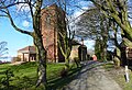 All Saints Church in Marlpool - geograph.org.uk - 4858360.jpg 800 × 549; 182 KB
-
 All Saints Church, Marlpool - geograph.org.uk - 4725316.jpg 640 × 480; 86 KB
-
 Banana Moon Day Nursery Sign - geograph.org.uk - 5078357.jpg 1,600 × 1,200; 217 KB
-
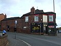 Barber's shop, Marlpool - geograph.org.uk - 4725320.jpg 640 × 480; 59 KB
-
 Benchmark on Heanor and Loscoe Town Hal - geograph.org.uk - 5614552.jpg 1,024 × 658; 199 KB
-
 Between Godfrey St and Wilmot St, Heanor - geograph.org.uk - 6468872.jpg 4,608 × 3,456; 4.52 MB
-
-
 Blend Youth Project Sign - geograph.org.uk - 5078381.jpg 1,600 × 1,200; 256 KB
-
 Breach Road - geograph.org.uk - 4725326.jpg 640 × 480; 54 KB
-
 Break Away Day Centre Sign - geograph.org.uk - 5078351.jpg 1,600 × 1,200; 202 KB
-
 Bridge abutments - geograph.org.uk - 1893676.jpg 1,280 × 854; 352 KB
-
 Bridge over the swamp - geograph.org.uk - 1893733.jpg 1,280 × 854; 419 KB
-
 Brook Street, Loscoe - geograph.org.uk - 6463679.jpg 1,024 × 768; 101 KB
-
 BT Sport Sign - geograph.org.uk - 5142732.jpg 1,600 × 1,200; 225 KB
-
 Bus Stop Sign - geograph.org.uk - 5050939.jpg 1,200 × 1,600; 168 KB
-
 Bus Stop Sign - geograph.org.uk - 5073030.jpg 1,200 × 1,600; 150 KB
-
 Charles Hill playing fields - geograph.org.uk - 1897334.jpg 1,280 × 829; 288 KB
-
 Charles Hill Sports Fields - geograph.org.uk - 3748982.jpg 3,648 × 2,736; 3.21 MB
-
 Church Street, Heanor - geograph.org.uk - 6468854.jpg 4,608 × 3,456; 3.78 MB
-
 Coach and Horses - geograph.org.uk - 3263264.jpg 4,000 × 3,000; 2.45 MB
-
 Corfield Church of England Infant School Sign - geograph.org.uk - 6296626.jpg 1,600 × 1,200; 217 KB
-
 Corfield Church of England Infant School Sign - geograph.org.uk - 6296628.jpg 1,572 × 1,162; 335 KB
-
 Corfield Church of England Infant School Sign - geograph.org.uk - 6296630.jpg 1,200 × 1,600; 246 KB
-
 Corfield Church of England Infant School Sign - geograph.org.uk - 6296632.jpg 1,200 × 1,600; 216 KB
-
 Cost Cutter Sign - geograph.org.uk - 6106938.jpg 768 × 1,024; 117 KB
-
 Cul de sac off Brook Street, Loscoe - geograph.org.uk - 6463749.jpg 1,024 × 768; 152 KB
-
 Dam House - geograph.org.uk - 1893681.jpg 1,280 × 854; 239 KB
-
 Demolished Institute - geograph.org.uk - 3036141.jpg 640 × 480; 109 KB
-

-
 Derbyshire UK parish map highlighting Heanor and Loscoe.svg 888 × 1,308; 2.34 MB
-
 Eddie's here - geograph.org.uk - 1897287.jpg 834 × 1,280; 327 KB
-
 Entrance to Brook Farm - geograph.org.uk - 3263257.jpg 4,000 × 3,000; 2.56 MB
-
 Fall Road - geograph.org.uk - 1893751.jpg 1,280 × 854; 188 KB
-
 Farmyard at the end of Fall Road - geograph.org.uk - 1893746.jpg 1,280 × 854; 252 KB
-
 Fire Action Sign - geograph.org.uk - 5154599.jpg 1,200 × 1,600; 172 KB
-

-

-
 Footpath alongside Loscoe Brook, Loscoe - geograph.org.uk - 6463756.jpg 1,024 × 768; 262 KB
-
 Footpath and empty flats - geograph.org.uk - 3556322.jpg 960 × 1,280; 380 KB
-
 Footpath near Langley - geograph.org.uk - 4725333.jpg 640 × 480; 80 KB
-
 Footpath to Heanor - geograph.org.uk - 1893736.jpg 1,280 × 854; 347 KB
-
 Footpath to Heanor - geograph.org.uk - 1893739.jpg 1,280 × 854; 259 KB
-
 Footpath west of Loscoe (1) - geograph.org.uk - 6463675.jpg 1,024 × 768; 178 KB
-
 Footpath west of Loscoe (2) - geograph.org.uk - 6463677.jpg 1,024 × 768; 147 KB
-
 Frederic Avenue, Marlpool - geograph.org.uk - 6472051.jpg 4,608 × 3,122; 4.13 MB
-
 Furnace Lane - geograph.org.uk - 3772761.jpg 3,648 × 2,736; 2.84 MB
-
 Garden Shed - geograph.org.uk - 5403725.jpg 1,600 × 1,200; 201 KB
-
 Garden Shed - geograph.org.uk - 5403727.jpg 1,600 × 1,200; 186 KB
-
 Gate Lodge - geograph.org.uk - 1710238.jpg 800 × 600; 229 KB
-
 Give Way Sign - geograph.org.uk - 5049593.jpg 1,200 × 1,600; 172 KB
-
 Grazing near Langley - geograph.org.uk - 4725335.jpg 640 × 480; 49 KB
-
 Have you got a light, mate^ - geograph.org.uk - 3241478.jpg 3,648 × 2,736; 3.64 MB
-
 Heading north east on Breach Road - geograph.org.uk - 4725328.jpg 640 × 480; 68 KB
-
 Heanor Road - geograph.org.uk - 4725021.jpg 640 × 480; 74 KB
-
 Heanor Technical College and Church of St Lawrence - geograph.org.uk - 6468883.jpg 4,608 × 2,718; 3.49 MB
-
 Heanor Town Football Club Sign - geograph.org.uk - 6425542.jpg 1,200 × 1,600; 145 KB
-
 Heanor Town Football Club Sign - geograph.org.uk - 6425547.jpg 1,200 × 1,600; 155 KB
-
 Heanor ^ Loscoe Town Hall, Market Street - geograph.org.uk - 5614560.jpg 1,024 × 683; 162 KB
-
 Here's as good as anywhere - geograph.org.uk - 1897291.jpg 1,280 × 854; 242 KB
-
 Hogbarn Lane - geograph.org.uk - 1872661.jpg 1,280 × 854; 276 KB
-
 Hogbarn Lane - geograph.org.uk - 2898885.jpg 3,172 × 2,296; 1.24 MB
-
 Hogbarn Lane - geograph.org.uk - 3770464.jpg 3,648 × 2,736; 3.17 MB
-
 Hogsbarn Lane - geograph.org.uk - 1893695.jpg 1,280 × 854; 356 KB
-
 Houses on Lockton Avenue - geograph.org.uk - 4725309.jpg 640 × 480; 68 KB
-
 Houses on Lockton Avenue - geograph.org.uk - 4725314.jpg 640 × 480; 59 KB
-
 Huge Bush - geograph.org.uk - 5403757.jpg 1,600 × 1,200; 286 KB
-
 Ilkeston Road in Shipley - geograph.org.uk - 4858417.jpg 800 × 565; 144 KB
-
 Information Blackboard - geograph.org.uk - 6425551.jpg 1,168 × 1,576; 241 KB
-
 Information Blackboard - geograph.org.uk - 6425554.jpg 1,200 × 1,600; 176 KB
-
 Information Blackboard - geograph.org.uk - 6425555.jpg 1,200 × 1,600; 168 KB
-
 Information Blackboard - geograph.org.uk - 6425558.jpg 1,200 × 1,600; 209 KB
-
 Information Blackboard - geograph.org.uk - 6425567.jpg 1,200 × 1,600; 258 KB
-
 J Wildman Builder Langley Mill Drain Cover - geograph.org.uk - 5410532.jpg 1,600 × 1,200; 267 KB
-

-
 Lockton Avenue - geograph.org.uk - 4725310.jpg 640 × 480; 74 KB
-
 Lockton Avenue - geograph.org.uk - 4725311.jpg 640 × 480; 68 KB
-
 Lockton Avenue - geograph.org.uk - 4725313.jpg 640 × 480; 65 KB
-

-
-
 Looking Down At A UK Zebra Crossing - geograph.org.uk - 5144072.jpg 1,200 × 1,600; 216 KB
-
 Looking Down At Mayfield Avenue, - geograph.org.uk - 5144044.jpg 1,200 × 1,600; 132 KB
-
 Looking Down Burnthouse Road - geograph.org.uk - 5142739.jpg 1,200 × 1,600; 177 KB
-
 Looking Down Thorpes Road - geograph.org.uk - 6425565.jpg 1,200 × 1,600; 259 KB
-
 Looking Up At A UK Zebra Crossing - geograph.org.uk - 5144074.jpg 1,200 × 1,600; 209 KB
-
 Looking Up Burnthouse Road - geograph.org.uk - 5144058.jpg 1,200 × 1,600; 139 KB
-
 Loscoe Chilled Foods - geograph.org.uk - 1897325.jpg 1,280 × 854; 183 KB
-
 Loscoe Dam - geograph.org.uk - 1893685.jpg 1,280 × 854; 286 KB
-
 Loscoe Dam - geograph.org.uk - 1893688.jpg 1,280 × 854; 247 KB
-
 Loscoe Dam - geograph.org.uk - 3770472.jpg 3,648 × 2,736; 2.89 MB
-
 Loscoe Dam in winter - geograph.org.uk - 1710245.jpg 800 × 602; 108 KB
-
 Loscoe Fields - geograph.org.uk - 1893655.jpg 1,280 × 854; 264 KB
-
 Low railway bridge on Milnhay Road - geograph.org.uk - 4725343.jpg 640 × 480; 78 KB
-
 Lower Clara Mount Road, Langley - geograph.org.uk - 3859207.jpg 1,280 × 960; 280 KB
-
 Malik Way - geograph.org.uk - 3576734.jpg 640 × 480; 91 KB
-
 Mansfield Road - geograph.org.uk - 3761620.jpg 3,648 × 2,736; 2.6 MB
-
 Mansfield Road - geograph.org.uk - 3762403.jpg 3,648 × 2,736; 2.38 MB
-
 Mansfield Road Methodist Church - geograph.org.uk - 3762419.jpg 3,648 × 2,736; 2.49 MB
-
 Market Place - geograph.org.uk - 3761371.jpg 3,327 × 2,551; 2.56 MB
-
 Meadow south of Loscoe - geograph.org.uk - 3749005.jpg 3,648 × 2,736; 2.03 MB
-
 Meadows west of Heanor - geograph.org.uk - 3749027.jpg 3,648 × 2,736; 3.06 MB
-
 Memorial garden on Furnace Lane - geograph.org.uk - 3774965.jpg 3,648 × 2,736; 3.68 MB
-
 Memory Lane, now closed - geograph.org.uk - 3241466.jpg 3,648 × 2,736; 3.53 MB
-
 Midland Road - geograph.org.uk - 1897271.jpg 1,280 × 854; 198 KB
-
 Milnhay Road railway bridge - geograph.org.uk - 3556294.jpg 1,280 × 960; 331 KB
-
 New Car Park Meter - geograph.org.uk - 6296680.jpg 1,200 × 1,600; 242 KB
-
 New house, 102 Park Street - geograph.org.uk - 4186407.jpg 640 × 480; 70 KB
-
 Newlands Drive - geograph.org.uk - 1893748.jpg 1,280 × 854; 184 KB
-
 NewLife Sign - geograph.org.uk - 5143997.jpg 1,200 × 1,600; 197 KB
-
 Northern part of The Nook, Loscoe - geograph.org.uk - 6463759.jpg 1,024 × 768; 126 KB
-
 Not a fall of snow - geograph.org.uk - 1893670.jpg 1,280 × 854; 431 KB
-
 Not the yellow peril - geograph.org.uk - 1893741.jpg 1,280 × 854; 427 KB
-
 Old Pelican Crossing Signals - geograph.org.uk - 5072983.jpg 1,200 × 1,600; 102 KB
-
 Old railway bridge at Loscoe - geograph.org.uk - 3771917.jpg 3,648 × 2,736; 4.14 MB
-
 Osborne's Pond - geograph.org.uk - 1985358.jpg 640 × 480; 132 KB
-
 Park and playground - geograph.org.uk - 1897269.jpg 1,280 × 854; 290 KB
-
 Parking For Tenants And Their Visitors Only Sign - geograph.org.uk - 5160175.jpg 1,200 × 1,600; 104 KB
-
 Path junction at Loscoe Fields - geograph.org.uk - 3770420.jpg 3,648 × 2,736; 3.26 MB
-
 Postbox DE75 645 - geograph.org.uk - 1897275.jpg 854 × 1,280; 248 KB
-
 Power lines over Loscoe - geograph.org.uk - 6463753.jpg 1,024 × 768; 85 KB
-
 Pub and Antiques Centre - geograph.org.uk - 3241491.jpg 3,648 × 2,736; 4.54 MB
-
 Public Footpath Sign - geograph.org.uk - 6427679.jpg 1,172 × 1,580; 268 KB
-
 Pubs close on Derby Road - geograph.org.uk - 3758300.jpg 3,338 × 2,539; 1.88 MB
-
 Puffin Crossing Part 1 - geograph.org.uk - 5123506.jpg 1,200 × 1,600; 201 KB
-
 Puffin Crossing Part 2 - geograph.org.uk - 5123509.jpg 1,200 × 1,600; 124 KB
-
 Puffin Crossing Part 3 - geograph.org.uk - 5123511.jpg 1,200 × 1,600; 123 KB
-
 Re-used railway - geograph.org.uk - 1897283.jpg 1,280 × 854; 262 KB
-
 Recycling Depot - geograph.org.uk - 1897322.jpg 1,280 × 854; 318 KB
-
 Red River Nature Area - geograph.org.uk - 1897333.jpg 1,280 × 854; 381 KB
-
 Red River Nature Area - geograph.org.uk - 1897339.jpg 1,280 × 854; 434 KB
-
 Red River Nature Area - geograph.org.uk - 1897340.jpg 854 × 1,280; 445 KB
-
 Red River Nature Area - geograph.org.uk - 1897344.jpg 1,280 × 854; 378 KB
-
 Red River Nature Area - geograph.org.uk - 1897347.jpg 1,280 × 854; 396 KB
-
 Restricted Byway near Loscoe - geograph.org.uk - 2898876.jpg 3,254 × 2,414; 1.43 MB
-
 Restricted Byway to the West of Langley Mill - geograph.org.uk - 2898864.jpg 3,230 × 2,380; 1.31 MB
-
 Right of way - geograph.org.uk - 1897297.jpg 1,280 × 854; 219 KB
-
 Right of way - geograph.org.uk - 1897302.jpg 1,280 × 849; 199 KB
-
 Right of way - geograph.org.uk - 1897314.jpg 1,280 × 854; 272 KB
-
 Road Closed Sign - geograph.org.uk - 6234552.jpg 1,200 × 1,600; 165 KB
-
 Salcare Back Entrance - geograph.org.uk - 5078333.jpg 1,200 × 1,600; 221 KB
-
 Salcare Cooking Poster - geograph.org.uk - 5122027.jpg 1,200 × 1,600; 158 KB
-
 Salcare Poster Part 1 - geograph.org.uk - 5122019.jpg 1,200 × 1,600; 130 KB
-
 Salcare Poster Part 2 - geograph.org.uk - 5122021.jpg 1,200 × 1,600; 192 KB
-
 Salcare Poster Part 3 - geograph.org.uk - 5122024.jpg 1,200 × 1,600; 211 KB
-
 Salcare Poster Part 4 - geograph.org.uk - 5122029.jpg 1,200 × 1,600; 135 KB
-
 Salcare Van - geograph.org.uk - 5122031.jpg 1,600 × 1,200; 178 KB
-
 Sarahs' Foot Clinic Sign - geograph.org.uk - 5162665.jpg 1,600 × 1,200; 233 KB
-
 Scots Pine in Shipley Country Park - geograph.org.uk - 3058819.jpg 3,296 × 2,472; 1.53 MB
-
 Service station off Derby Road - geograph.org.uk - 4725117.jpg 640 × 480; 55 KB
-
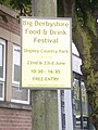
 Shipley Country Park Sign - geograph.org.uk - 6296647.jpg 1,200 × 1,600; 163 KB
-
 Shop premises to let - geograph.org.uk - 3241482.jpg 3,648 × 2,736; 3.22 MB
-
 Sign for the Memory Lane - geograph.org.uk - 4725095.jpg 537 × 640; 79 KB
-
 Sign for the Queens Head, Marlpool - geograph.org.uk - 4725319.jpg 516 × 640; 55 KB
-
 Sign for the White Lion, Marlpool - geograph.org.uk - 4725325.jpg 608 × 640; 60 KB
-
 Site of Bailey Brook Colliery - geograph.org.uk - 1893742.jpg 1,280 × 854; 283 KB
-
 Site of Bailey Brook Colliery - geograph.org.uk - 1897318.jpg 1,280 × 854; 289 KB
-
 Site of old railway - geograph.org.uk - 1893668.jpg 1,280 × 866; 321 KB
-
 Small Bush - geograph.org.uk - 5403760.jpg 1,200 × 1,600; 287 KB
-
 Small Plant In A Box - geograph.org.uk - 5403763.jpg 1,600 × 1,200; 322 KB
-
 Stepping Stones Day Care Community Centre - geograph.org.uk - 5078328.jpg 1,200 × 1,600; 182 KB
-
 Stile at Hogsbarn Lane - geograph.org.uk - 1893692.jpg 1,280 × 854; 364 KB
-
 Table And Chairs - geograph.org.uk - 5161283.jpg 1,600 × 1,200; 166 KB
-
 Taylor Lane - geograph.org.uk - 1893651.jpg 1,280 × 854; 202 KB
-
 Tesco supermarket and fuel - geograph.org.uk - 3241470.jpg 3,648 × 2,736; 3.66 MB
-
 Texaco Petrol Station - geograph.org.uk - 5078349.jpg 1,600 × 1,200; 179 KB
-

-
 The bottom of Lee Lane - geograph.org.uk - 3556297.jpg 1,280 × 960; 352 KB
-
 The Food Warehouse Coming Soon Sign - geograph.org.uk - 6427697.jpg 1,600 × 1,200; 185 KB
-
 The Furniture Mega Store Sign - geograph.org.uk - 5160202.jpg 1,200 × 1,600; 223 KB
-
 The Furniture Mega Store Sign - geograph.org.uk - 5160204.jpg 1,200 × 1,600; 218 KB
-
 The Jolly Colliers Pub Sign - geograph.org.uk - 5078375.jpg 1,200 × 1,600; 93 KB
-
 The Marlpool Ale House - geograph.org.uk - 3862649.jpg 1,280 × 960; 275 KB
-
 The Marlpool Ale House - geograph.org.uk - 3862654.jpg 960 × 1,280; 148 KB
-
 The Marlpool Ale House - geograph.org.uk - 3862660.jpg 960 × 1,280; 235 KB
-
 The Memory Lane - geograph.org.uk - 4725092.jpg 640 × 480; 59 KB
-
 The Queens Head on Breach Road, Marlpool - geograph.org.uk - 4858380.jpg 800 × 511; 107 KB
-
 The Queens Head, Marlpool - geograph.org.uk - 4725318.jpg 640 × 480; 60 KB
-
 The Sunnyside W.M.C Sign - geograph.org.uk - 5078368.jpg 1,200 × 1,600; 107 KB
-
 The Sunnyside W.M.C Sign Part 1 - geograph.org.uk - 5123499.jpg 1,200 × 1,600; 263 KB
-
 The Sunnyside W.M.C Sign Part 2 - geograph.org.uk - 5123500.jpg 1,200 × 1,600; 266 KB
-
 The VW factory - geograph.org.uk - 1897323.jpg 1,280 × 854; 291 KB
-
 The White Lion, Marlpool - geograph.org.uk - 3424662.jpg 1,280 × 856; 158 KB
-
 The White Lion, Marlpool - geograph.org.uk - 4725322.jpg 640 × 480; 51 KB
-
 Thieves Be Aware Forensic Marking Sign - geograph.org.uk - 6425570.jpg 1,200 × 1,600; 130 KB
-
 This is the front entrance sign of Salcare - geograph.org.uk - 5078339.jpg 1,600 × 1,200; 185 KB
-
 Tudor Falls - geograph.org.uk - 1897277.jpg 1,280 × 850; 173 KB
-
 UK 1 Way Sign - geograph.org.uk - 5070529.jpg 1,200 × 1,600; 109 KB
-
 UK 1 Way Street Sign - geograph.org.uk - 5078409.jpg 1,200 × 1,600; 249 KB
-
 UK 1 Way Street Sign - geograph.org.uk - 6419760.jpg 1,200 × 1,600; 263 KB
-
 UK 1 Way Street Sign - geograph.org.uk - 6419762.jpg 1,200 × 1,600; 273 KB
-
 UK 1 Way Street Sign - geograph.org.uk - 6419763.jpg 1,200 × 1,600; 253 KB
-
 UK 10 Speed Limit Sign - geograph.org.uk - 5094593.jpg 1,200 × 1,600; 91 KB
-
 UK 2 Keep Right Signs - geograph.org.uk - 6235819.jpg 1,200 × 1,600; 128 KB
-
 UK Amber Traffic Light Signal - geograph.org.uk - 5116420.jpg 1,200 × 1,600; 100 KB
-
 UK Back of a No Entry Sign - geograph.org.uk - 5075869.jpg 960 × 1,280; 92 KB
-
 UK Back Of A No Entry Sign - geograph.org.uk - 5091973.jpg 1,200 × 1,600; 121 KB
-
 UK Back Of A Speed Hump Sign - geograph.org.uk - 5091951.jpg 1,200 × 1,600; 194 KB
-
 UK Bend From The Right Ahead Sign - geograph.org.uk - 5136342.jpg 1,200 × 1,600; 91 KB
-
 UK Bend To Left Ahead Sign - geograph.org.uk - 5211362.jpg 1,200 × 1,600; 116 KB


_-_geograph.org.uk_-_6463670.jpg)
_-_geograph.org.uk_-_6463672.jpg)


_-_geograph.org.uk_-_6463675.jpg)
_-_geograph.org.uk_-_6463677.jpg)


