Category:Heald Green
Jump to navigation
Jump to search
defunct electoral ward of Stockport Metropolitan Borough Council (abolished 2023) .png) | |||||
| Upload media | |||||
| Instance of |
| ||||
|---|---|---|---|---|---|
| Location | Stockport, Greater Manchester, North West England, England | ||||
| Dissolved, abolished or demolished date |
| ||||
| |||||
English: Heald Green is a suburb in the Metropolitan Borough of Stockport, Greater Manchester, England. It is bordered by Gatley and Cheadle to the north, Cheadle Hulme to the east, Handforth and Styal to the south and Moss Nook and Peel Hall to the west.
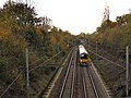
Heald Green railway station, on the Styal Line, is linked by a spur to Manchester Airport station.
Subcategories
This category has the following 2 subcategories, out of 2 total.
H
- Heald Green railway station (20 F)
L
Media in category "Heald Green"
The following 139 files are in this category, out of 139 total.
-

-
 A34 Wilmslow-Handforth Bypass - geograph.org.uk - 3206339.jpg 640 × 481; 383 KB
-
 Alder Close, Wilmslow Road - geograph.org.uk - 4037850.jpg 2,233 × 1,489; 898 KB
-
 Along Finney Lane - geograph.org.uk - 5340903.jpg 640 × 427; 231 KB
-
 Along Wilmslow Road - geograph.org.uk - 5340914.jpg 640 × 427; 206 KB
-
 Atlas Trading Estate - geograph.org.uk - 5240378.jpg 576 × 640; 111 KB
-
 B5358 - geograph.org.uk - 52424.jpg 640 × 480; 102 KB
-
 B5358 North - geograph.org.uk - 52425.jpg 640 × 480; 64 KB
-
 Back alley shops, near Finney Lane - geograph.org.uk - 1316520.jpg 617 × 421; 68 KB
-

-
 Bolshaw Farm Lane - geograph.org.uk - 3206295.jpg 640 × 481; 523 KB
-
 Bolshaw Road, Heald Green - geograph.org.uk - 3206290.jpg 640 × 481; 542 KB
-
 Care home, Heald Green.jpg 4,032 × 3,024; 4.88 MB
-
 Cast iron sign in Heald Green.jpg 2,147 × 2,914; 1.83 MB
-
 Christ Church - geograph.org.uk - 5959059.jpg 480 × 640; 68 KB
-
 Christ Church Heald Green Manchester.jpg 3,120 × 2,631; 957 KB
-
 Christ Church on Finney Lane - geograph.org.uk - 3393179.jpg 2,763 × 1,842; 1.22 MB
-
 Church in Heald Green - geograph.org.uk - 5340904.jpg 640 × 427; 237 KB
-
 Contrails 2.jpg 2,874 × 1,656; 2.21 MB
-
 Cottages on Daisy Bank Lane - geograph.org.uk - 1538187.jpg 640 × 427; 74 KB
-
 Cottages on Wilmslow Road - geograph.org.uk - 1537933.jpg 640 × 360; 57 KB
-
 Cottages on Wilmslow Road - geograph.org.uk - 1606812.jpg 640 × 427; 130 KB
-
 Cycle lane on Turves Road - geograph.org.uk - 5233513.jpg 1,000 × 750; 736 KB
-
 Cycle path along Styal Road - geograph.org.uk - 5340886.jpg 640 × 427; 203 KB
-
 Detached Houses at Heald Green - geograph.org.uk - 5048846.jpg 640 × 480; 386 KB
-
 East Avenue Park - geograph.org.uk - 1531566.jpg 640 × 402; 107 KB
-
 EIIR Postbox (SK8 170) - geograph.org.uk - 5233270.jpg 1,000 × 750; 512 KB
-

-
 Etchells Road, Heald Green during April showers - geograph.org.uk - 4910014.jpg 6,000 × 4,000; 4.1 MB
-

-
 Finney Lane - geograph.org.uk - 5233439.jpg 1,000 × 750; 588 KB
-
 Finney Lane - geograph.org.uk - 6010459.jpg 1,024 × 768; 459 KB
-
 Finney Lane - geograph.org.uk - 6241456.jpg 1,280 × 1,043; 1.23 MB
-
 Finney Lane at Heald Green Station - geograph.org.uk - 4035894.jpg 640 × 479; 52 KB
-
 Finney Lane near Rosslyn Road - geograph.org.uk - 5340908.jpg 640 × 427; 196 KB
-
-
 Finney Lane, Heald Green - geograph.org.uk - 1958637.jpg 3,811 × 2,489; 2.45 MB
-
 Finney Lane, Heald Green - geograph.org.uk - 1958659.jpg 3,872 × 2,494; 2.65 MB
-
 Finney Lane, Heald Green, near Stockport - geograph.org.uk - 4302557.jpg 1,024 × 683; 141 KB
-
 Fistral Avenue, Heald Green - geograph.org.uk - 1093057.jpg 640 × 426; 72 KB
-
 Flight BA1396 from LHR to MAN, 15 May 2017 12.jpg 4,032 × 3,024; 5.64 MB
-
 Footbridge over the A555, Manchester..jpg 4,160 × 3,120; 3.24 MB
-
 Four telecom cabinets beside Etchells Road - geograph.org.uk - 3415736.jpg 3,276 × 2,184; 904 KB
-
 Green space beside St. Annes Road - geograph.org.uk - 2717456.jpg 3,516 × 2,215; 1.73 MB
-
 Griffin Farm - geograph.org.uk - 1520842.jpg 640 × 360; 58 KB
-

-
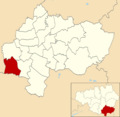 Heald Green (Stockport Council Ward).png 1,754 × 1,713; 340 KB
-
 Heald Green - geograph.org.uk - 3206300.jpg 640 × 481; 546 KB
-
 Heald Green - geograph.org.uk - 52435.jpg 640 × 480; 118 KB
-
 Heald Green - geograph.org.uk - 52438.jpg 640 × 480; 93 KB
-
 Heald Green Beefeater - geograph.org.uk - 5233436.jpg 1,000 × 750; 606 KB
-
 Heald Green Health Centre - geograph.org.uk - 5340901.jpg 640 × 427; 217 KB
-
 Heald Green Library - geograph.org.uk - 5071214.jpg 1,024 × 683; 214 KB
-
 Heald Green Library.jpg 4,032 × 3,024; 4.8 MB
-
 Heald Green Methodist Church - geograph.org.uk - 3207981.jpg 640 × 481; 458 KB
-
 Heald Green Post Office - geograph.org.uk - 5637140.jpg 1,280 × 1,105; 1.03 MB
-
 Heald Green shopping parade, Finney Lane, Heald Green.jpg 4,032 × 3,024; 2.9 MB
-
 Heald Green Shops - geograph.org.uk - 52436.jpg 640 × 480; 110 KB
-
 Heald Green United Reformed Church - geograph.org.uk - 3206312.jpg 640 × 481; 574 KB
-
 Heald Green United Reformed Church - geograph.org.uk - 5340912.jpg 640 × 427; 229 KB
-
 Heald Green Village Hall - geograph.org.uk - 3206276.jpg 640 × 481; 423 KB
-
 Heald Green, Bolshaw Farm Lane - geograph.org.uk - 3206296.jpg 640 × 481; 497 KB
-
 Heald Green, Davies Avenue - geograph.org.uk - 3206289.jpg 640 × 481; 371 KB
-
 Heald Green, Outwood Road - geograph.org.uk - 3206305.jpg 640 × 481; 526 KB
-
 Heald Green, Rose Vale Park - geograph.org.uk - 3207727.jpg 640 × 481; 584 KB
-
 Heald Green, Shops on Finney Lane - geograph.org.uk - 3206269.jpg 640 × 481; 464 KB
-
 Heald Green, Shops on Wilmslow Road - geograph.org.uk - 3206318.jpg 640 × 481; 508 KB
-

-
 Houses along Ringway Road - geograph.org.uk - 5340859.jpg 640 × 427; 231 KB
-
 Houses on Bradgate Avenue - geograph.org.uk - 1525365.jpg 640 × 416; 66 KB
-
 Houses on Bradshaw Hall Lane - geograph.org.uk - 1525389.jpg 640 × 429; 69 KB
-
 Houses on Hambleton Road - geograph.org.uk - 1531576.jpg 640 × 431; 74 KB
-
 Junction on Finney Lane - geograph.org.uk - 5340889.jpg 640 × 427; 205 KB
-
 Lloyds Bank - geograph.org.uk - 5340895.jpg 640 × 427; 199 KB
-
 Long Lane Post Office - geograph.org.uk - 1549857.jpg 640 × 480; 65 KB
-

-
 Long Lane Post Office and Other Shops - geograph.org.uk - 3206325.jpg 640 × 480; 465 KB
-
 Mableden Close - geograph.org.uk - 5340911.jpg 640 × 427; 228 KB
-
 Manchester Heald Green Business Park Geese Fog.jpg 3,120 × 2,062; 1.31 MB
-
 Mona Avenue - geograph.org.uk - 1531652.jpg 640 × 427; 76 KB
-
 NatWest Bank, Heald Green - geograph.org.uk - 5232951.jpg 1,000 × 750; 541 KB
-
 Notice board, Heald Green.jpg 4,032 × 3,024; 4.18 MB
-
 Office block at the Southgate Centre - geograph.org.uk - 1520774.jpg 640 × 360; 81 KB
-
 Old Cheadle ^ Gatley UDC signpost - geograph.org.uk - 6241433.jpg 1,280 × 1,364; 1.91 MB
-
 Old Cheadle ^ Gatley UDC signpost - geograph.org.uk - 6241441.jpg 1,280 × 960; 1.42 MB
-
 Outwood Farm and Nurseries - geograph.org.uk - 3206279.jpg 640 × 481; 546 KB
-

-
 Outwood Farm, Heald Green.jpg 4,160 × 3,120; 3.94 MB
-
 Outwood Farm, Nixon's Farm Shop - geograph.org.uk - 3206284.jpg 640 × 481; 461 KB
-
 Outwood Road - geograph.org.uk - 5340897.jpg 640 × 427; 260 KB
-
 Outwood Road - geograph.org.uk - 6241414.jpg 1,280 × 960; 1.1 MB
-

-
 Pedestrian Crossing on Wilmslow Road - geograph.org.uk - 5340915.jpg 640 × 427; 249 KB
-

-
 Railway at Heald Green - geograph.org.uk - 3207985.jpg 640 × 480; 501 KB
-
 Railway at Heald Green - geograph.org.uk - 3207990.jpg 640 × 480; 584 KB
-
 Railway at Heald Green - geograph.org.uk - 5233274.jpg 1,000 × 750; 834 KB
-
 Rainbow in the fountain Lake at Cheadle Royal Business Park.jpg 3,603 × 2,687; 2.5 MB
-
 Red sky at sunset, Heald Green.jpg 2,285 × 1,199; 693 KB
-
 Rose Vale Park, Heald Green - geograph.org.uk - 3207725.jpg 640 × 481; 709 KB
-
 Rose Vale Park, Under the Flight Path - geograph.org.uk - 3207734.jpg 480 × 640; 529 KB
-
 Roundabout near The David Lloyd gymnasium - geograph.org.uk - 2161458.jpg 3,968 × 2,232; 4.37 MB
-
 Semi-Detached Houses at Heald Green - geograph.org.uk - 5048848.jpg 640 × 480; 411 KB
-
 Sheep may safely graze - geograph.org.uk - 2332856.jpg 3,518 × 2,533; 3.35 MB
-
 Shops on Finney Lane - geograph.org.uk - 5233242.jpg 1,000 × 708; 534 KB
-
-
 Shops on Wilmslow Road - geograph.org.uk - 1514111.jpg 640 × 388; 59 KB
-
 Shops on Wilmslow Road - geograph.org.uk - 5340909.jpg 640 × 427; 211 KB
-

-
 Southgate Centre, Heald Green - geograph.org.uk - 3206303.jpg 640 × 481; 439 KB
-
 St Annes Hospice - geograph.org.uk - 52441.jpg 640 × 480; 123 KB
-
 St Catherine's Parish Church - geograph.org.uk - 3206272.jpg 640 × 481; 589 KB
-
 St.Catherine's Church.jpg 4,032 × 3,024; 7.19 MB
-
 Start of Finney Lane - geograph.org.uk - 5340891.jpg 640 × 427; 217 KB
-
 Stockport Gigantic Leap 2021.jpg 4,608 × 2,592; 4.47 MB
-
 Styal Road - geograph.org.uk - 5340872.jpg 640 × 427; 200 KB
-
 Styal Road from the air - geograph.org.uk - 4029880.jpg 640 × 480; 229 KB
-
 Suburban housing in Neal Avenue - geograph.org.uk - 3231964.jpg 640 × 482; 71 KB
-
 SVS Car Sales, Heald Green.jpg 4,160 × 3,120; 2.85 MB
-
 Tatton Arms - geograph.org.uk - 5340864.jpg 640 × 427; 194 KB
-
 Tatton Arms boozer, Ringway - panoramio.jpg 3,072 × 2,304; 3.16 MB
-
-
 Telephone exchange, Heald Green..jpg 3,024 × 4,032; 4.38 MB
-
 Terrace of cottages on Wilmslow Road - geograph.org.uk - 1531517.jpg 640 × 411; 77 KB
-
 The Co-Op supermarket, Finney Lane - geograph.org.uk - 1305627.jpg 562 × 385; 63 KB
-

-
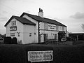
 The Griffin - geograph.org.uk - 3206346.jpg 640 × 481; 400 KB
-
 The Griffin. - geograph.org.uk - 291818.jpg 637 × 407; 360 KB
-
 The Health Centre on Finney Lane - geograph.org.uk - 1251346.jpg 600 × 399; 79 KB
-
 Trading estate, Heald Green - geograph.org.uk - 3140858.jpg 3,264 × 2,448; 3.45 MB
-

-
 Trenchard Drive - geograph.org.uk - 5340869.jpg 640 × 427; 222 KB
-
 United Reformed Church, Heald Green.jpg 4,160 × 3,120; 3.23 MB
-
 West Avenue - geograph.org.uk - 5340906.jpg 640 × 427; 201 KB
-
 Wilmslow Rd by Long Lane post office - geograph.org.uk - 2475034.jpg 800 × 592; 57 KB
-
 Wilmslow Road (B5358) - geograph.org.uk - 3206308.jpg 640 × 481; 521 KB
-

-
 Wimslow Road at Griffin Farm Drive - geograph.org.uk - 4035877.jpg 640 × 481; 51 KB
-
 Rainbow over the Peaks - geograph.org.uk - 357810.jpg 640 × 427; 52 KB


_-_geograph.org.uk_-_5233270.jpg)


_meets_Wilmslow_Road_-_geograph.org.uk_-_1538066.jpg)


_butts_up_to_East_Avenue_-_geograph.org.uk_-_1531597.jpg)


,_Finney_Lane,_Heald_Green,_near_Stockport_-_geograph.org.uk_-_4302529.jpg)


_-_geograph.org.uk_-_3206308.jpg)


