Category:Hazleton, Gloucestershire
Jump to navigation
Jump to search
village and civil parish in Gloucestershire, England, UK  | |||||
| Upload media | |||||
| Instance of | |||||
|---|---|---|---|---|---|
| Location | Cotswold, Gloucestershire, South West England, England | ||||
| Population |
| ||||
 | |||||
Subcategories
This category has the following 2 subcategories, out of 2 total.
S
Media in category "Hazleton, Gloucestershire"
The following 88 files are in this category, out of 88 total.
-
 A Cotswold valley - geograph.org.uk - 3793500.jpg 1,024 × 680; 279 KB
-
 A40 near Hazleton - geograph.org.uk - 2511728.jpg 640 × 480; 68 KB
-
 Arable land and Farhill Farm - geograph.org.uk - 1734937.jpg 3,008 × 2,000; 1.5 MB
-
 Autumn colours near Hazleton, Gloucestershire - geograph.org.uk - 2133287.jpg 3,008 × 2,000; 1.61 MB
-
 Away from the railway - geograph.org.uk - 3085701.jpg 4,320 × 3,240; 4.95 MB
-
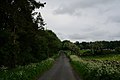
 Belt of trees by lane to Hazleton - geograph.org.uk - 5324874.jpg 640 × 480; 243 KB
-
 Bridleway at Farhill Farm - geograph.org.uk - 3189677.jpg 640 × 427; 199 KB
-

-
 Bridleway to Hazleton - geograph.org.uk - 3189662.jpg 640 × 427; 207 KB
-
 Buildings at Hill Farm - geograph.org.uk - 4013435.jpg 1,600 × 1,064; 430 KB
-
 Cotswold , The A40 - geograph.org.uk - 6113367.jpg 6,000 × 4,000; 3.22 MB
-
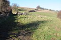
 Cotswold grazing land - geograph.org.uk - 3793512.jpg 800 × 531; 143 KB
-
 Crossing the railway - geograph.org.uk - 3189630.jpg 640 × 427; 236 KB
-
 Derelict bus shelter on the A40 - geograph.org.uk - 4013362.jpg 1,600 × 1,064; 791 KB
-
 Derelict shed by Salt Way - geograph.org.uk - 5344107.jpg 640 × 480; 230 KB
-
 Diamond Way - geograph.org.uk - 6405618.jpg 800 × 600; 191 KB
-
 Diamond Way - geograph.org.uk - 6405639.jpg 800 × 600; 160 KB
-
 Diamond Way - geograph.org.uk - 6405644.jpg 800 × 600; 136 KB
-
 Disused quarry - geograph.org.uk - 3083556.jpg 4,320 × 3,240; 4.92 MB
-
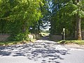
 Entrance to Salperton Park - geograph.org.uk - 5324892.jpg 640 × 480; 171 KB
-
 Farhill Barn - geograph.org.uk - 3816062.jpg 800 × 531; 155 KB
-
 Farhill Farm - geograph.org.uk - 1736630.jpg 640 × 426; 94 KB
-
 Farm track near Salperton - geograph.org.uk - 1736626.jpg 640 × 426; 89 KB
-
 Farming at Crows' Castle - geograph.org.uk - 3189628.jpg 640 × 427; 209 KB
-
 Farmland at Hazleton - geograph.org.uk - 880656.jpg 640 × 426; 96 KB
-
 Farmland near Hazleton - geograph.org.uk - 2821731.jpg 2,592 × 1,944; 1.89 MB
-
 Farmland near Hazleton - geograph.org.uk - 2821736.jpg 2,592 × 1,944; 1.18 MB
-
 Farmland near Stow Road Plantation - geograph.org.uk - 3398129.jpg 640 × 480; 96 KB
-
 Farmland near Turkdean - geograph.org.uk - 3816242.jpg 1,024 × 680; 246 KB
-
 Farmland track near Salperton - geograph.org.uk - 1736617.jpg 640 × 426; 87 KB
-
 Field of winter cereal - geograph.org.uk - 3816053.jpg 800 × 531; 162 KB
-
 Fields east of Hampen Farm - geograph.org.uk - 3002183.jpg 2,592 × 1,944; 1.45 MB
-

-
 Follow the railway - geograph.org.uk - 3085589.jpg 4,320 × 3,240; 4.92 MB
-
 Follow the track - geograph.org.uk - 3085479.jpg 4,320 × 3,240; 4.86 MB
-
 Follow the track - geograph.org.uk - 3085535.jpg 4,320 × 3,240; 4.73 MB
-
 Footpath behind the Inn - geograph.org.uk - 4980371.jpg 1,600 × 1,200; 431 KB
-
 Garniche at the Puesdown - geograph.org.uk - 4980367.jpg 3,855 × 2,615; 2.31 MB
-
 Glorious Gloucestershire - geograph.org.uk - 3085440.jpg 4,320 × 3,240; 4.46 MB
-
 Grassed Slope by Copse - geograph.org.uk - 6405634.jpg 800 × 600; 178 KB
-
 Houses at junction on A40 - geograph.org.uk - 5324756.jpg 640 × 428; 96 KB
-

-
 Minor road leading to Hazleton - geograph.org.uk - 4013375.jpg 1,600 × 1,064; 788 KB
-
 Minor road leading to Hazleton - geograph.org.uk - 4013377.jpg 1,600 × 1,064; 501 KB
-
 Minor road leading to the A40 - geograph.org.uk - 4013418.jpg 1,600 × 1,064; 573 KB
-
 Minor road leading to the A40 - geograph.org.uk - 4013442.jpg 1,600 × 1,064; 701 KB
-
 Minor road near Salt Way - geograph.org.uk - 4013370.jpg 1,600 × 1,064; 475 KB
-
 Muddy valley bottom - geograph.org.uk - 3085743.jpg 4,320 × 3,240; 4.9 MB
-
 Near the Puesdown Inn - geograph.org.uk - 4980380.jpg 1,600 × 1,200; 620 KB
-
 New Covert - geograph.org.uk - 3085735.jpg 4,320 × 3,240; 5.17 MB
-
 Notgrove Railway Cutting - geograph.org.uk - 3085694.jpg 4,320 × 3,240; 4.96 MB
-
 Old barn with, stone Tallet steps - geograph.org.uk - 1556274.jpg 640 × 479; 93 KB
-
 Once were trains - geograph.org.uk - 3085470.jpg 4,320 × 3,240; 4.79 MB
-
 Once were trains - geograph.org.uk - 3085574.jpg 4,320 × 3,240; 4.99 MB
-
 Pasture and woodland - geograph.org.uk - 3189626.jpg 640 × 427; 233 KB
-
 Path to Downs Barn - geograph.org.uk - 3793933.jpg 800 × 531; 144 KB
-
 Priory Farm, Hazleton - geograph.org.uk - 221740.jpg 640 × 480; 134 KB
-
 Private road - geograph.org.uk - 3085722.jpg 4,320 × 3,240; 4.78 MB
-
 Rainbow over the Cotswolds - geograph.org.uk - 1734868.jpg 2,000 × 3,008; 1.48 MB
-
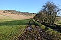
 Restricted Byway from Hazleton - geograph.org.uk - 2821728.jpg 2,592 × 1,944; 2.28 MB
-
 Road heading for the A40 - geograph.org.uk - 6405651.jpg 800 × 600; 132 KB
-
 Road to Hazleton - geograph.org.uk - 1610586.jpg 640 × 480; 100 KB
-
 Start of track - geograph.org.uk - 3085456.jpg 4,320 × 3,240; 5.86 MB
-
 Strip farming^ - geograph.org.uk - 3085524.jpg 4,320 × 3,240; 4.78 MB
-
 The Diamond Way at Hazleton - geograph.org.uk - 4013416.jpg 1,600 × 1,064; 585 KB
-
 The road to Hazleton - geograph.org.uk - 2821718.jpg 2,592 × 1,944; 1.56 MB
-
 The road to Salperton - geograph.org.uk - 2515968.jpg 4,288 × 3,216; 2.78 MB
-
 The road to Salperton - geograph.org.uk - 3083541.jpg 4,320 × 3,240; 4.59 MB
-
 The track divides - geograph.org.uk - 3085712.jpg 4,320 × 3,240; 4.76 MB
-
 There is a lot of it about - geograph.org.uk - 3083546.jpg 4,320 × 3,240; 5.06 MB
-
 Towards Salperton - geograph.org.uk - 3189638.jpg 640 × 427; 231 KB
-
 Track and footpath - geograph.org.uk - 6059509.jpg 1,024 × 768; 307 KB
-
 Track and horse jump - geograph.org.uk - 6059506.jpg 1,024 × 768; 259 KB
-
 Track in a Cotswold valley - geograph.org.uk - 3793523.jpg 1,024 × 680; 336 KB
-
 Track in a valley bottom - geograph.org.uk - 6059503.jpg 1,024 × 768; 289 KB
-
 Track on the Salperton estate - geograph.org.uk - 3189670.jpg 640 × 428; 242 KB
-
 Tree in a Cotswold valley - geograph.org.uk - 3816045.jpg 800 × 531; 131 KB
-
 Valley below Milkwell Covert - geograph.org.uk - 3793921.jpg 1,024 × 680; 380 KB
-
 Valley bottom track - geograph.org.uk - 6059499.jpg 1,024 × 768; 253 KB
-
 Valley track - geograph.org.uk - 3816243.jpg 1,024 × 680; 265 KB
-
 Valley view - geograph.org.uk - 3085544.jpg 4,320 × 3,240; 4.83 MB
-
 Walking to Salperton - geograph.org.uk - 3189629.jpg 640 × 427; 226 KB
-
 Woodland east of Salt Way - geograph.org.uk - 5324886.jpg 640 × 428; 84 KB
-
 Clock tower at Hazleton Manor - geograph.org.uk - 466230.jpg 640 × 477; 86 KB
-
 Clock tower at Hazleton Manor Farm - geograph.org.uk - 466237.jpg 640 × 477; 91 KB
-
 Not this way^ - geograph.org.uk - 356546.jpg 640 × 480; 125 KB
-
 Traditional farm building, Hazleton - geograph.org.uk - 225604.jpg 640 × 480; 169 KB
-


