Category:Hayscastle (community)
Jump to navigation
Jump to search
Subcategories
This category has the following 5 subcategories, out of 5 total.
Media in category "Hayscastle (community)"
The following 18 files are in this category, out of 18 total.
-
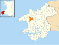
 2010 Wales Pembrokeshire Community Hayscastle map.svg 512 × 393; 1,018 KB
-
 2024 Wales Pembrokeshire Community Hayscastle map.svg 512 × 393; 1.19 MB
-
 Earthwork at Llanedren - geograph.org.uk - 1250561.jpg 640 × 480; 127 KB
-
 Entrance to Walterston Farm - geograph.org.uk - 1248739.jpg 640 × 463; 124 KB
-
 St Margaret's, Ford - geograph.org.uk - 470445.jpg 640 × 480; 103 KB
-
 Garden at Stone Hall - geograph.org.uk - 1248172.jpg 640 × 480; 142 KB
-
 Next door to the chapel - geograph.org.uk - 1248676.jpg 640 × 480; 83 KB
-
 Noddfa Newton, date stone - geograph.org.uk - 1248667.jpg 640 × 480; 134 KB
-
 Noddfa Newton, facade - geograph.org.uk - 1248663.jpg 480 × 640; 110 KB
-
 Old rectory , Welsh Hook - geograph.org.uk - 1248130.jpg 640 × 480; 117 KB
-
 Pale view of the hills - geograph.org.uk - 1248234.jpg 640 × 480; 110 KB
-
 St Lawrence camp, Welsh Hook - geograph.org.uk - 1246659.jpg 640 × 480; 126 KB
-
 Stone Hall - geograph.org.uk - 1248150.jpg 640 × 480; 87 KB
-
 Stone Hall, south face - geograph.org.uk - 1248165.jpg 640 × 480; 112 KB
-
 Tre-saeson - geograph.org.uk - 1248683.jpg 640 × 480; 89 KB
-
 Trehale House - geograph.org.uk - 1250551.jpg 640 × 480; 97 KB
-
 Trehale Lodge - geograph.org.uk - 1250500.jpg 640 × 480; 90 KB
-
 Across the river valley - geograph.org.uk - 1053629.jpg 640 × 480; 62 KB


