Category:Haworth
Jump to navigation
Jump to search
village in West Yorkshire, UK  Main Street s obchody a podniky v roce 2005 | |||||
| Upload media | |||||
| Instance of | |||||
|---|---|---|---|---|---|
| Location | Haworth, Cross Roads and Stanbury, Bradford, West Yorkshire, Yorkshire and the Humber, England | ||||
| Population |
| ||||
| official website | |||||
 | |||||
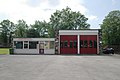
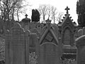
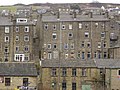
English: Haworth is a village and tourist attraction in the English ceremonial county of West Yorkshire best known for its association with the Brontë sisters.
Español: Haworth es un pueblo situado en el condado inglés de West Yorkshire. Tradicionalmente asociado con las hermanas Brontë (Emily,Charlotte y Anne) Haworth es también un centro turístico.
Suomi: Haworth on kylä ja turistikohde, joka sijaitsee Englannin West Yorkshiressa. Kylä tunnetaan parhaiten 1800-luvulla eläneiden, kuuluisien Brontën kirjailijasisarten Charlotte, Emily ja Anne Brontën sekä heidän perheensä kotipaikkana. Brontë-yhteyksiensä takia kylä on suosittu turistikohde. Sen muihin nähtävyyksiin kuuluu esimerkiksi Haworthin rautatieasema, joka on osa Keighley and Worth Valley Railway -rautatietä. Rautatie on turistikohde höyryjuniensa takia.
Français : Haworth est un village du West Yorkshire, dont il constitue une des attractions touristiques, du fait de sa connection étroite avec l'histoire des sœurs Brontë
Frysk: Haworth is in doarp yn it Ingelske greefskip (county) West Yorkshire. Haworth leit yn de high Pennine moors.
Nederlands: Haworth is een dorp en toeristische trekpleister in het Engelse graafschap (county) West Yorkshire.
Русский: Хауорт — деревня в Англии, Западный Йоркшир, известная, в первую очередь, как родина английских писательниц XIX века — сестер Бронте (Шарлотты, Эмили и Анны). Деревня является популярным туристическим местом среди поклонников творчества сестёр.
Subcategories
This category has the following 11 subcategories, out of 11 total.
Media in category "Haworth"
The following 141 files are in this category, out of 141 total.
-
 2005 windowbox England 2276534150.jpg 1,200 × 1,600; 1.03 MB
-
 A quiet corner of Haworth - geograph.org.uk - 5246646.jpg 3,888 × 5,184; 3.69 MB
-
 A View towards Haworth - geograph.org.uk - 6136294.jpg 5,184 × 3,456; 5.45 MB
-
 Bamford's Improved Oil Cake Breaker.jpg 2,662 × 2,662; 7.07 MB
-
 Bars of soap Pcs34560 IMG1666.jpg 5,472 × 3,648; 6.3 MB
-
 Bath, Parson's Field, Haworth - geograph.org.uk - 849497.jpg 640 × 479; 145 KB
-
 BDUK WYorks Haworth3 (15457694508).jpg 6,048 × 4,032; 8.47 MB
-
 Benchmark on North Street building - geograph.org.uk - 5620471.jpg 684 × 1,024; 239 KB
-
 Benchmark on ^21 Victoria Avenue - geograph.org.uk - 5621516.jpg 1,024 × 684; 217 KB
-
 Bird houses - panoramio.jpg 4,288 × 3,216; 6.17 MB
-
 Blue gears (2590206855).jpg 1,890 × 1,557; 2.33 MB
-
 Bridgehouse Beck - geograph.org.uk - 5781046.jpg 1,024 × 768; 221 KB
-
 Bronte Bridge (26898662073).jpg 1,802 × 1,802; 3.57 MB
-
 Bronte Foods factory ruins - geograph.org.uk - 962652.jpg 640 × 485; 289 KB
-
 Bronte Way approaching Sowdens Farm - geograph.org.uk - 6136280.jpg 5,184 × 3,456; 6.25 MB
-
 Chapel and Graveyard (2585552212).jpg 2,560 × 1,920; 3.05 MB
-
 Chimneys at Mytholmes (8693066665).jpg 3,754 × 2,503; 9.41 MB
-
 Derelict buildings (27508969485).jpg 4,000 × 2,857; 9.69 MB
-
 Derelict farm and guardlamb (27434441551).jpg 2,301 × 2,876; 5.84 MB
-
 Derelict farm near Haworth (26919193534).jpg 4,000 × 2,079; 7.85 MB
-
 Don't forget to write (2597765679).jpg 1,599 × 1,552; 1.82 MB
-
 Dry stone dykes - geograph.org.uk - 929742.jpg 640 × 480; 58 KB
-
 Dry Stone Dykes - geograph.org.uk - 929745.jpg 640 × 480; 64 KB
-
 Enfield Side Road, Haworth (27476931271).jpg 4,000 × 3,000; 10.85 MB
-
 Flowers at Haworth (9361788944).jpg 1,840 × 2,768; 3.46 MB
-
 Flowers by Haworth Parish Church (5912719953).jpg 2,784 × 4,176; 10.42 MB
-
 Footpath and Milestone (9208337855).jpg 2,590 × 3,238; 8.71 MB
-

-
 Footpath from Haworth - geograph.org.uk - 1375705.jpg 640 × 480; 166 KB
-
-

-

-
 Former Springhead Mills - geograph.org.uk - 6158984.jpg 1,024 × 768; 175 KB
-
 Foul (15789125715).jpg 3,622 × 2,587; 6.72 MB
-
 Graggy's Pantry - geograph.org.uk - 5336425.jpg 1,024 × 768; 335 KB
-
 Grease holes - geograph.org.uk - 1252840.jpg 428 × 640; 98 KB
-
 Haworth (25334132732).jpg 3,942 × 2,365; 7.1 MB
-
 Haworth (506345) (39304628504).jpg 3,924 × 2,616; 4.99 MB
-
 Haworth (506346) (28235237619).jpg 3,985 × 2,659; 3.68 MB
-
 Haworth (506347) (39304634864).jpg 4,585 × 2,579; 3.28 MB
-
 Haworth (506348) (39325061874).jpg 5,028 × 2,828; 4.09 MB
-
 Haworth (506349) (40002795692).jpg 5,121 × 2,880; 3.8 MB
-
 Haworth (5551382516).jpg 2,432 × 3,857; 6.54 MB
-
 Haworth (9184530189).jpg 2,917 × 3,683; 8.22 MB
-
 Haworth (9184541801).jpg 2,691 × 3,767; 9.68 MB
-
 Haworth fire station - geograph.org.uk - 188148.jpg 640 × 427; 212 KB
-
 Haworth Flowers (9365464581).jpg 2,145 × 2,145; 3.59 MB
-
 Haworth Flowers (9368252386).jpg 2,300 × 2,300; 3.8 MB
-
 Haworth from Height Lane, Oxenhope (14877414136).jpg 4,524 × 3,076; 11.24 MB
-
 Haworth graveyard (5561734175).jpg 3,979 × 2,971; 5.39 MB
-
 Haworth houses.JPG 2,592 × 1,944; 2.17 MB
-
 Haworth Medical Centre - Rawdon Road - geograph.org.uk - 1278463.jpg 640 × 482; 203 KB
-
 Haworth Moor (24648621914).jpg 4,000 × 2,857; 9.74 MB
-
 Haworth Moor (24852877494).jpg 4,000 × 3,000; 10.25 MB
-
 Haworth Moor (24963665624).jpg 4,000 × 2,857; 9.22 MB
-
 Haworth Primary School - geograph.org.uk - 76790.jpg 367 × 550; 57 KB
-
 Haworth School Board - geograph.org.uk - 1043462.jpg 640 × 480; 78 KB
-
 Haworth Social Centre - geograph.org.uk - 1043466.jpg 640 × 480; 103 KB
-
 Haworth Tennis Club - Rawdon Road - geograph.org.uk - 1278461.jpg 640 × 490; 223 KB
-
 Haworth Tree (9365483907).jpg 3,000 × 4,000; 4.33 MB
-
 Haworth View - geograph.org.uk - 5964325.jpg 800 × 520; 156 KB
-
 Haworth Village.JPG 2,592 × 1,944; 2.19 MB
-
 Haworth vintage car.JPG 2,592 × 1,944; 2.23 MB
-
 Heathcliff, Haworth - geograph.org.uk - 853468.jpg 640 × 480; 169 KB
-
 Houses at Haworth - geograph.org.uk - 1043458.jpg 640 × 480; 100 KB
-
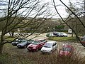 Jaggers Quarry Car Park, Haworth - geograph.org.uk - 128218.jpg 640 × 480; 123 KB
-
 Knock Knock^ - panoramio.jpg 3,216 × 3,934; 3.05 MB
-
 Lees Primary School - Haworth Road - geograph.org.uk - 600212.jpg 640 × 417; 26 KB
-
 Legs (8700376146).jpg 2,440 × 3,889; 10.29 MB
-
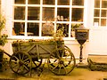 Little cart - panoramio.jpg 4,288 × 3,216; 2.94 MB
-
 Living Artwork - panoramio.jpg 4,275 × 2,799; 5.67 MB
-
 Lonely Tree - panoramio (2).jpg 4,288 × 3,216; 1.52 MB
-
 Long Bridge - geograph.org.uk - 1410520.jpg 640 × 480; 163 KB
-
 Long Bridge, Nr Haworth - geograph.org.uk - 33523.jpg 640 × 480; 148 KB
-
 Low Eye View - panoramio.jpg 3,216 × 4,288; 5.37 MB
-

-
 Milepost, Bocking.jpg 683 × 1,024; 171 KB
-
 Milestone - Hebden Road (geograph 4610618).jpg 480 × 640; 106 KB
-
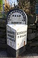 Milestone beside A6033 opposite Dean Street, Haworth Brow (geograph 6566671).jpg 683 × 1,024; 204 KB
-
 Modern housing at Haworth - geograph.org.uk - 916567.jpg 640 × 480; 88 KB
-
 Naylor Hill Quarry Wind Turbine - geograph.org.uk - 572214.jpg 640 × 480; 72 KB
-

-
 Oh La La La - panoramio.jpg 3,216 × 4,288; 2.81 MB
-
 Old Milestone, A6033, Hebden Road, 'top' road (geograph 6746099).jpg 493 × 693; 73 KB
-
 Old Quarry near Haworth - panoramio.jpg 4,288 × 3,216; 3.62 MB
-
 One man went to mow (27548563876).jpg 2,474 × 1,828; 4.48 MB
-
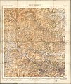 Ordnance Survey One-Inch Tourist Map of Ilkley District, Published 1935.jpg 13,058 × 15,538; 24.8 MB
-
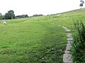
 Overgrown path to Field Head Farm - geograph.org.uk - 5817860.jpg 640 × 480; 87 KB
-

-
 Parson's Field, Haworth - geograph.org.uk - 849491.jpg 640 × 480; 179 KB
-
 Parson's Field, Haworth - geograph.org.uk - 853471.jpg 640 × 480; 200 KB
-

-
-
 Pcs34560 IMG1583.JPG 3,648 × 5,472; 8.09 MB
-
 Pcs34560 IMG1598.JPG 5,472 × 3,648; 6.41 MB
-
 Private Road - geograph.org.uk - 847775.jpg 640 × 480; 72 KB
-
 Quarry waste, Haworth - geograph.org.uk - 849837.jpg 640 × 480; 175 KB
-
 Reading the hobbit (3415104377).jpg 2,048 × 1,371; 835 KB
-
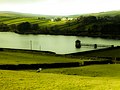 Reservoir Near Haworth - panoramio.jpg 4,288 × 3,216; 3.44 MB
-
 Ruined Mill, Haworth (9219464492).jpg 3,897 × 2,598; 9.49 MB
-
 Shop Window, Haworth (9361472318).jpg 2,672 × 2,541; 4.83 MB
-
 Sign, Brow Moor, Haworth (4964480543).jpg 1,664 × 2,496; 3.53 MB
-
 Stanbury Barn.JPG 1,944 × 2,592; 1.85 MB
-
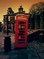 Telephone Box - panoramio.jpg 3,216 × 4,288; 7.15 MB
-
 That is Haworth.jpg 1,920 × 2,560; 2.34 MB
-
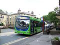 THE BRONTE BUS - HOWARTH (27509559074).jpg 2,848 × 2,134; 1.34 MB
-
 The Brontës, Their Home And Familiar Surroundings - Illustrated London News (1944).jpg 3,822 × 5,137; 5.9 MB
-
 The footpath to Sowdens - geograph.org.uk - 4781019.jpg 1,024 × 768; 178 KB
-
 The old stocks, Haworth, Yorkshire.jpg 4,178 × 2,355; 2.36 MB
-
 The paved path to Balcony and Penistone Hill - geograph.org.uk - 4781016.jpg 768 × 1,024; 621 KB
-
 Traditional Sweetshop, Haworth - geograph.org.uk - 143534.jpg 640 × 480; 128 KB
-
 Upper Heights (25416016065).jpg 3,830 × 2,525; 7.37 MB
-
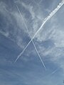 Vapour trails in the sky - geograph.org.uk - 5338117.jpg 768 × 1,024; 83 KB
-
 View from the Bronte Way towards Haworth (3647430981).jpg 2,497 × 1,664; 2.77 MB
-
 View over Dimples Lane wall towards Haworth - geograph.org.uk - 5631859.jpg 1,024 × 684; 173 KB
-
 View over Worth Valley - geograph.org.uk - 5039983.jpg 1,600 × 1,200; 587 KB
-
 View to Pickles Hill from Cemetery Road, Haworth - geograph.org.uk - 5215555.jpg 1,024 × 768; 257 KB
-
 View towards Haworth (3660551272).jpg 2,560 × 1,384; 2.44 MB
-
 View towards Lower Laithe Reservoir (9361755010).jpg 4,000 × 2,248; 5.63 MB
-
 View towards Lumb Foot from Cemetery Road - geograph.org.uk - 5215100.jpg 1,024 × 768; 220 KB
-
 Walled path (2591051512).jpg 2,560 × 1,920; 5.52 MB
-
 Weavers Hill - Sun Street - geograph.org.uk - 1266097.jpg 640 × 480; 248 KB
-
 White Boar - panoramio.jpg 3,216 × 4,288; 4.81 MB
-
 White house (5916808986).jpg 2,641 × 4,079; 9.56 MB
-

-
 Withens window (5936433961).jpg 2,667 × 4,000; 10.83 MB
-
 Worth Valley (9359004511).jpg 4,000 × 3,000; 7.87 MB
-
 Bell Isle - Bridgehouse Lane - geograph.org.uk - 419409.jpg 640 × 601; 135 KB
-
 Cross Roads Park Crown Bowling Green - geograph.org.uk - 600216.jpg 640 × 387; 19 KB
-
 Cross Roads Park Playground - geograph.org.uk - 600219.jpg 640 × 480; 55 KB
-
 Cross Roads Park Skateboarding Area - geograph.org.uk - 600217.jpg 640 × 404; 23 KB
-
 Crossroads with Lees - geograph.org.uk - 59442.jpg 480 × 640; 88 KB
-
 Cullingworth Moor - geograph.org.uk - 59440.jpg 640 × 480; 102 KB
-
 Footpath above Haworth - geograph.org.uk - 364370.jpg 640 × 426; 186 KB
-
 Haworth Park - geograph.org.uk - 419398.jpg 640 × 361; 79 KB
-
 Haworth Park - geograph.org.uk - 419401.jpg 640 × 351; 65 KB
-
 Laveroc Hall Farm - geograph.org.uk - 539781.jpg 640 × 480; 113 KB
-
 Quarry on Brow Moor Edge. - geograph.org.uk - 397172.jpg 640 × 480; 91 KB
-
 Rough Nook - West Lane - geograph.org.uk - 419358.jpg 640 × 454; 94 KB
-
 The Flappit, Flappit Spring - geograph.org.uk - 635726.jpg 640 × 480; 63 KB
-
 Wind Turbine on Brow Moor near Quarry - geograph.org.uk - 419413.jpg 476 × 640; 53 KB


.jpg)


.jpg)

.jpg)


.jpg)
.jpg)
.jpg)
.jpg)
.jpg)
.jpg)


.jpg)
.jpg)
.jpg)
.jpg)


.jpg)


.jpg)
_(39304628504).jpg)
_(28235237619).jpg)
_(39304634864).jpg)
_(39325061874).jpg)
_(40002795692).jpg)
.jpg)
.jpg)
.jpg)

.jpg)
.jpg)
.jpg)
.jpg)


.jpg)
.jpg)
.jpg)


.jpg)


.jpg)


.jpg)


.jpg)
.jpg)


.jpg)

.jpg)


.jpg)

.jpg)
.jpg)
.jpg)


.jpg)
.jpg)


.jpg)

.jpg)


.jpg)
.jpg)

.jpg)


.jpg)

.jpg)
.jpg)


