Category:Hawley, Hampshire
Jump to navigation
Jump to search

village in the civil parish of Blackwater and Hawley in the Hart district of northeastern Hampshire, England  | |||||
| Upload media | |||||
| Instance of | |||||
|---|---|---|---|---|---|
| Location | Blackwater and Hawley, Hart, Hampshire, South East England, England | ||||
| official website | |||||
 | |||||
English: Hawley is a village located in the northeast corner of Hampshire, England. It lies in the parish of Blackwater and Hawley and is administered by Blackwater & Hawley Parish Council. The village adjoins the small town of Blackwater and is considered as one of its suburbs. It is situated 5 km (3 miles) north of the centre of Farnborough, Hampshire, 53 km (33 miles) west-southwest of London and less than 1 km south of Blackwater, on the westernmost edge of the Blackwater Valley conurbation. Hawley is adjacent to Cove, a suburban village of Farnborough.
Français : Hawley est un village situé dans le comté du Hampshire en Angleterre.
Subcategories
This category has the following 2 subcategories, out of 2 total.
G
- Guillemont Park (3 F)
Media in category "Hawley, Hampshire"
The following 32 files are in this category, out of 32 total.
-
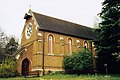
 All Saints, Hawley - geograph.org.uk - 1484747.jpg 640 × 328; 61 KB
-
 Cove Brook in Fox Lane - geograph.org.uk - 576874.jpg 640 × 480; 136 KB
-
 Cove Brook near Cove - geograph.org.uk - 576847.jpg 640 × 480; 112 KB
-
 Cove Brook under the M3 Motorway bridge - geograph.org.uk - 576859.jpg 640 × 480; 101 KB
-
 Crossroads in Hawley - geograph.org.uk - 3002359.jpg 800 × 600; 150 KB
-
 Flats off Mayfield Road - geograph.org.uk - 101565.jpg 640 × 480; 83 KB
-
 Hawley - geograph.org.uk - 3832.jpg 640 × 427; 227 KB
-
 Hawley Lake Sail Training Centre.jpeg 1,672 × 848; 1,006 KB
-
 Johnny English Cable car station steel structure.jpg 900 × 600; 161 KB
-

-

-

-

-
 All Saints Old Church, Hawley - geograph.org.uk - 1484736.jpg 640 × 426; 93 KB
-

-
 Bridleway on Hawley Common, Hampshire - geograph.org.uk - 115924.jpg 640 × 480; 146 KB
-
 Bridleway on Hawley Common, Hampshire - geograph.org.uk - 115927.jpg 640 × 480; 157 KB
-

-
 Fernhill Road, Hawley, Hampshire - geograph.org.uk - 112789.jpg 640 × 480; 181 KB
-
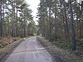
 Forestry track on Hawley Common - geograph.org.uk - 115932.jpg 640 × 480; 176 KB
-
 Greenbank Way - geograph.org.uk - 525783.jpg 640 × 532; 159 KB
-

-

-
 Houses along Watchetts Drive - geograph.org.uk - 637229.jpg 640 × 489; 117 KB
-
 Housing on Sand Hill, Hawley - geograph.org.uk - 101568.jpg 640 × 480; 118 KB
-
 Prince Charles Crescent - geograph.org.uk - 527516.jpg 640 × 458; 141 KB
-
 Station Road, northwest of the A325 - geograph.org.uk - 540838.jpg 640 × 592; 159 KB
-

-
 Track on Hawley Common - geograph.org.uk - 696170.jpg 640 × 480; 118 KB
-
 West Heath - geograph.org.uk - 3835.jpg 640 × 427; 199 KB
-
 Woodland on Hawley Common - geograph.org.uk - 115934.jpg 640 × 480; 188 KB
-
 Woodland on Hawley Common, Hampshire - geograph.org.uk - 115905.jpg 640 × 480; 155 KB


_in_snow_-_geograph.org.uk_-_664346.jpg)


