Category:Hawkshaw, Greater Manchester
Jump to navigation
Jump to search
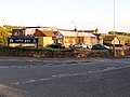
English: Hawkshaw is a small village of the Metropolitan Borough of Bury, in Greater Manchester, England. Historically part of Lancashire, it has a population of around 1,000 people. The village has a small shop and 2 pubs called The Red Lion and The Waggon and Horses.
village in Greater Manchester, England, UK  | |||||
| Upload media | |||||
| Instance of | |||||
|---|---|---|---|---|---|
| Location | Bury, Greater Manchester, North West England, England | ||||
 | |||||
Media in category "Hawkshaw, Greater Manchester"
The following 73 files are in this category, out of 73 total.
-
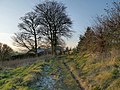
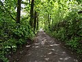
 A little-used path - geograph.org.uk - 1896527.jpg 3,751 × 2,489; 6.22 MB
-
 A little-used path - geograph.org.uk - 1896554.jpg 3,709 × 2,480; 4.87 MB
-
 A676 Bolton Road east of Hawkhaw - geograph.org.uk - 6305983.jpg 1,024 × 769; 214 KB
-

-
 Approaching Holcombe Hey Farm - geograph.org.uk - 3257596.jpg 640 × 480; 586 KB
-
 Bleaklow Mill or what remains of it - geograph.org.uk - 1224038.jpg 640 × 480; 87 KB
-
 Bleaklow Mill or what remains of it - geograph.org.uk - 1224040.jpg 640 × 480; 76 KB
-
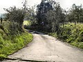
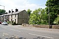
 Bolton Road (A676), Hawkshaw - geograph.org.uk - 2609407.jpg 640 × 480; 268 KB
-
 Bolton Road, Approaching Hawkshaw - geograph.org.uk - 2040369.jpg 800 × 600; 226 KB
-
 Bradshaw Road - geograph.org.uk - 1864457.jpg 1,600 × 1,200; 426 KB
-
 Bradshaw Road - geograph.org.uk - 5913904.jpg 3,648 × 2,736; 2.11 MB
-
 Buttercups fronting a view of Hawkshaw - geograph.org.uk - 1896638.jpg 3,872 × 2,480; 4.88 MB
-
 CC Walves Bridge - geograph.org.uk - 3437552.jpg 640 × 480; 110 KB
-
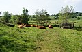 Cows lazing beside the footbridge - geograph.org.uk - 1897155.jpg 3,872 × 2,466; 4.89 MB
-
 Croichley Fold - geograph.org.uk - 2851102.jpg 640 × 480; 411 KB
-
 Elizabeth II postbox on Bradshaw Road - geograph.org.uk - 5913899.jpg 1,948 × 3,551; 1.22 MB
-
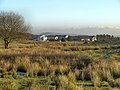
 Farmland above Hawkshaw - geograph.org.uk - 6665789.jpg 6,000 × 4,000; 5.78 MB
-
 Footpath at Finny Cote - geograph.org.uk - 3257420.jpg 640 × 480; 455 KB
-
 Former Bleaklow Mill now Hawkshaw Lodge - geograph.org.uk - 2722843.jpg 640 × 480; 117 KB
-
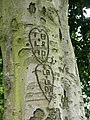 Has Love Survived^ - geograph.org.uk - 497194.jpg 480 × 640; 121 KB
-
 Hawkshaw Lane - geograph.org.uk - 2631250.jpg 1,280 × 960; 856 KB
-
 Hawkshaw Lane - geograph.org.uk - 2631256.jpg 1,280 × 960; 937 KB
-
 Hawkshaw Lane - geograph.org.uk - 3257475.jpg 640 × 480; 505 KB
-
 Hawkshaw Lane - geograph.org.uk - 4392311.jpg 640 × 295; 54 KB
-
 Hawkshaw Lane - geograph.org.uk - 6665577.jpg 6,000 × 4,000; 4.92 MB
-
 Hawkshaw Lane - geograph.org.uk - 6665728.jpg 5,728 × 3,818; 5.64 MB
-
 Hawkshaw Lane at Boardman's Farm - geograph.org.uk - 1751840.jpg 3,872 × 2,592; 5.24 MB
-
 Hawkshaw Lane, Boardman's Farm - geograph.org.uk - 3257767.jpg 640 × 480; 520 KB
-
 Hawkshaw Lane, Lower Grainings - geograph.org.uk - 2631248.jpg 1,280 × 960; 790 KB
-
 Hawkshaw Lodge - geograph.org.uk - 2851098.jpg 640 × 480; 380 KB
-
 Hawkshaw Methodist Church - geograph.org.uk - 1822674.jpg 2,816 × 2,112; 1.16 MB
-
 Hawkshaw Methodist Church - geograph.org.uk - 3543529.jpg 2,291 × 1,798; 2.18 MB
-
 Hawkshaw Methodist Church - geograph.org.uk - 453543.jpg 640 × 426; 136 KB
-
 Hawkshaw Rise - geograph.org.uk - 6653935.jpg 6,000 × 4,000; 4.71 MB
-
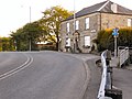
 Hawkshaw village - geograph.org.uk - 470338.jpg 640 × 480; 102 KB
-
 Holcombe Hill on misty morning - geograph.org.uk - 588756.jpg 640 × 480; 125 KB
-
 House on Bradshaw Road - geograph.org.uk - 5913162.jpg 640 × 435; 57 KB
-
 India Gate - geograph.org.uk - 1864470.jpg 1,600 × 1,200; 359 KB
-
 Lake at Hawkshaw - geograph.org.uk - 2945102.jpg 4,000 × 3,000; 6.04 MB
-
 Land Behind St Mary's Church - geograph.org.uk - 1822653.jpg 2,528 × 1,896; 870 KB
-
 Lea Bank Terrace, Hawkshaw - geograph.org.uk - 2945129.jpg 4,000 × 3,000; 5.6 MB
-
 Lifebelt , Simons Lodge, Redisher - geograph.org.uk - 394136.jpg 640 × 480; 197 KB
-
 Listed house at Hollingrove Farm 01.jpg 4,000 × 3,000; 6.3 MB
-
 Listed house at Hollingrove Farm 02.jpg 4,000 × 3,000; 6.07 MB
-
 Military Firing Range Sign - geograph.org.uk - 391613.jpg 480 × 640; 124 KB
-
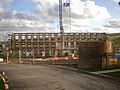
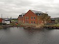
 Mill in Hawkshaw - geograph.org.uk - 119429.jpg 640 × 480; 111 KB
-
 Mill, Hawkshaw - geograph.org.uk - 470348.jpg 640 × 480; 151 KB
-
 New Hoyles, Hawkshaw - geograph.org.uk - 3257406.jpg 640 × 480; 508 KB
-

-
 Old Mill Chimney - geograph.org.uk - 2945112.jpg 4,000 × 3,000; 5.84 MB
-
 Ordnance Survey Cut Mark - geograph.org.uk - 3579837.jpg 4,000 × 3,000; 4.47 MB
-
 Path towards Turton Bottoms - geograph.org.uk - 3257414.jpg 640 × 480; 553 KB
-
 Pond by Hawkshaw Lane - geograph.org.uk - 6665733.jpg 6,000 × 4,000; 3.57 MB
-
 Remains of Bleaklow Mill Chimney - geograph.org.uk - 2722845.jpg 640 × 480; 158 KB
-
 Reservoir by Hawkshaw View - geograph.org.uk - 6653908.jpg 6,000 × 4,000; 4.44 MB
-

-
 Small reservoir above Walves Reservoir - geograph.org.uk - 6653865.jpg 6,000 × 4,000; 4.37 MB
-
 Stile without a Fence - geograph.org.uk - 3257419.jpg 640 × 480; 599 KB
-
 Telecommunications mast near Hawkshaw - geograph.org.uk - 3878064.jpg 1,024 × 768; 134 KB
-
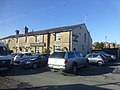
 Terraced houses in Hawkshaw - geograph.org.uk - 2505219.jpg 3,826 × 2,754; 3.99 MB
-
 The Red Lion - geograph.org.uk - 2609403.jpg 640 × 480; 215 KB
-
 The Red Lion - geograph.org.uk - 4399574.jpg 4,100 × 2,706; 7.16 MB
-
 The top of Hawkshaw Lane - geograph.org.uk - 6665742.jpg 6,000 × 4,000; 7.1 MB
-
 The Waggon and Horses at Hawkshaw - geograph.org.uk - 3878060.jpg 1,024 × 768; 158 KB
-
 Two Brooks Lane, Hawkshaw - geograph.org.uk - 2945120.jpg 4,000 × 3,000; 6.2 MB
-
 View from Hawkshaw Lane - geograph.org.uk - 3257427.jpg 640 × 480; 539 KB
-
 View over Hawkshaw Valley - geograph.org.uk - 470290.jpg 640 × 480; 87 KB
-
 Waggon and Horses - geograph.org.uk - 1822661.jpg 2,816 × 2,112; 889 KB
-
 Walves Bridge - geograph.org.uk - 1896614.jpg 3,671 × 2,480; 4.62 MB
-
 Walves Bridge, Hawkshaw - geograph.org.uk - 2609410.jpg 640 × 480; 281 KB
-
 Watling Street - geograph.org.uk - 1864485.jpg 1,600 × 1,200; 366 KB
-
 Watling Street near Bradshaw Head - geograph.org.uk - 6305965.jpg 1,024 × 768; 125 KB
-
 Woods, Top of Quarlton - geograph.org.uk - 585243.jpg 640 × 480; 85 KB


,_Hawkshaw_-_geograph.org.uk_-_2609407.jpg)


.jpg)


