Category:Hawkley
Jump to navigation
Jump to search
village and civil parish in Hampshire, UK _(May_2021)_(10).JPG) | |||||
| Upload media | |||||
| Instance of | |||||
|---|---|---|---|---|---|
| Location | East Hampshire, Hampshire, South East England, England | ||||
 | |||||
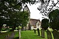
English: Hawkley is a village and civil parish in the East Hampshire district of Hampshire, England. It is 3.5 miles (5.7 km) north of Petersfield, to the east of the A3 road.
Subcategories
This category has the following 5 subcategories, out of 5 total.
Media in category "Hawkley"
The following 200 files are in this category, out of 338 total.
(previous page) (next page)-
 14 miles done, only 86 to go - geograph.org.uk - 1324324.jpg 640 × 480; 98 KB
-
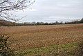
 A Bare field near Hawkley Hanger - geograph.org.uk - 1201978.jpg 640 × 430; 67 KB
-
 A Bare field near Hawkley Hanger - geograph.org.uk - 1201988.jpg 640 × 430; 67 KB
-
 A fallow field near Priors Dean - geograph.org.uk - 1201522.jpg 640 × 430; 81 KB
-
 A fallow field near Priors Dean - geograph.org.uk - 1201537.jpg 640 × 430; 68 KB
-
 A fallow field near Priors Dean - geograph.org.uk - 1201962.jpg 640 × 430; 65 KB
-

-
 A muddy Hangers Way, Hawkley Hanger - geograph.org.uk - 1202047.jpg 640 × 430; 120 KB
-
 A Quiet Hampshire byway near Priors Dean - geograph.org.uk - 1201450.jpg 640 × 430; 105 KB
-
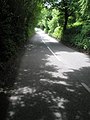 A shady Hawkley Road - geograph.org.uk - 1323146.jpg 480 × 640; 89 KB
-
 Ancient tree in Hawkley Churchyard - geograph.org.uk - 4999694.jpg 640 × 480; 118 KB
-
 Autumn on the green at Hawkley - geograph.org.uk - 3177623.jpg 640 × 480; 86 KB
-
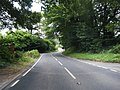
 B3006 - geograph.org.uk - 5212545.jpg 640 × 426; 68 KB
-
 B3006 - geograph.org.uk - 5212549.jpg 640 × 343; 58 KB
-
 B3006 - geograph.org.uk - 5212555.jpg 640 × 426; 78 KB
-
 B3006 - just south of Selborne - geograph.org.uk - 1980393.jpg 800 × 600; 158 KB
-
 B3006 - south of Selborne - geograph.org.uk - 1980391.jpg 480 × 640; 83 KB
-
 B3006 at Church Lane - geograph.org.uk - 3119286.jpg 640 × 480; 106 KB
-
 B3006 at Empshott - geograph.org.uk - 4711728.jpg 800 × 402; 68 KB
-
 B3006 at Empshott village boundary - geograph.org.uk - 3119257.jpg 640 × 480; 78 KB
-
 B3006 looking south - geograph.org.uk - 3119244.jpg 640 × 481; 68 KB
-
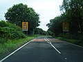
 B3006, A3 roundabout - geograph.org.uk - 2794675.jpg 640 × 337; 37 KB
-
 Barn by Crabtree Copse - geograph.org.uk - 2947369.jpg 4,288 × 3,216; 3.73 MB
-
 Barns on Upland Lane, Hawkley - geograph.org.uk - 6445343.jpg 1,824 × 1,114; 1,000 KB
-
 Beech House, Hawkley - geograph.org.uk - 1204400.jpg 640 × 430; 70 KB
-

-
 Burhunt Farm - geograph.org.uk - 2837596.jpg 4,288 × 3,216; 3.34 MB
-

-
 Bus stop at Warren Corner, Hampshire - geograph.org.uk - 578023.jpg 640 × 480; 96 KB
-
 By Ketcher's Farm - geograph.org.uk - 2837626.jpg 4,288 × 3,216; 3.41 MB
-
 Byway Above Mill Lane - geograph.org.uk - 2947256.jpg 4,288 × 3,216; 3.48 MB
-
 Cattle trough in Oakshott Hanger - geograph.org.uk - 1324332.jpg 640 × 480; 143 KB
-
 Cattle with a view - geograph.org.uk - 3754503.jpg 640 × 480; 76 KB
-
 Church at Empshott - geograph.org.uk - 6089380.jpg 1,024 × 768; 169 KB
-
 Church of the Holy Rood, Empshott - geograph.org.uk - 6430189.jpg 1,199 × 1,799; 497 KB
-
 Communications centre, Hawkley - geograph.org.uk - 1338213.jpg 640 × 480; 112 KB
-
 Communications hot spot at Hawkley - geograph.org.uk - 3178505.jpg 480 × 640; 84 KB
-

-
 Converted barn at Scotland Farm, Hawkley - geograph.org.uk - 6445342.jpg 1,812 × 1,090; 1.64 MB
-
 Cottages on The Green at Hawkley - geograph.org.uk - 1323402.jpg 640 × 480; 78 KB
-
 Country Road, South of Selborne - geograph.org.uk - 2837453.jpg 4,288 × 3,216; 3.42 MB
-

-
 CWGC grave in Hawkley Churchyard - geograph.org.uk - 4999699.jpg 480 × 640; 105 KB
-
 Dead badger in Lower Green Lane - geograph.org.uk - 3178476.jpg 640 × 480; 104 KB
-
 Dilapidated barn near Oakshott - geograph.org.uk - 2215590.jpg 800 × 600; 165 KB
-
 Distant tractor at Barefoots Farm - geograph.org.uk - 1321868.jpg 640 × 480; 77 KB
-
 Edge of the woodland, Hawkley Hanger - geograph.org.uk - 1201983.jpg 640 × 430; 125 KB
-
 Empshott Road End - geograph.org.uk - 2947088.jpg 4,288 × 3,216; 3.75 MB
-
 Empshott, Church Lane - geograph.org.uk - 6276450.jpg 6,472 × 4,315; 7.81 MB
-
 Empshott, Church Lane, Post box - geograph.org.uk - 6276455.jpg 6,618 × 4,413; 7.2 MB
-
 Empshott, Church of the Holy Rood - geograph.org.uk - 6276463.jpg 6,714 × 4,475; 6.63 MB
-

-
 Empshott, Church of the Holy Rood, Nave arches - geograph.org.uk - 6276480.jpg 7,836 × 5,223; 7.19 MB
-
 Empshott, Church of the Holy Rood, Nave capital - geograph.org.uk - 6276472.jpg 7,593 × 5,061; 6.98 MB
-
 Empshott, Church of the Holy Rood, North chancel window - geograph.org.uk - 6276492.jpg 7,687 × 5,125; 7.45 MB
-
 Empshott, Church of the Holy Rood, The altar - geograph.org.uk - 6276489.jpg 6,648 × 4,433; 5.84 MB
-
 Empshott, Church of the Holy Rood, The chancel - geograph.org.uk - 6276487.jpg 6,964 × 4,643; 5.35 MB
-
 Empshott, Church of the Holy Rood, The nave - geograph.org.uk - 6276466.jpg 6,947 × 4,631; 5.27 MB
-
 Empshott, Church of the Holy Rood, The nave - geograph.org.uk - 6276475.jpg 7,217 × 4,811; 6.08 MB
-
 Empshott, Church of the Holy Rood, The nave - geograph.org.uk - 6276482.jpg 7,382 × 4,921; 5.36 MB
-
 Empshott, Church of the Holy Rood, The nave roof - geograph.org.uk - 6276476.jpg 6,719 × 4,480; 5.6 MB
-
 Empshott, Church of the Holy Rood, The Norman font - geograph.org.uk - 6276468.jpg 6,481 × 4,321; 6.78 MB
-
 Empshott, Church of the Holy Rood, The Norman font - geograph.org.uk - 6276469.jpg 6,236 × 4,158; 6.54 MB
-

-

-
 Entrance to Hillclere - geograph.org.uk - 1323137.jpg 640 × 480; 110 KB
-
 Entrance to Tubbs Farm - geograph.org.uk - 2215600.jpg 800 × 600; 191 KB
-
 Fallen tree across the path - geograph.org.uk - 1204332.jpg 640 × 430; 93 KB
-

-
 Farmland near Hawkley - geograph.org.uk - 3177625.jpg 640 × 480; 63 KB
-

-
 Field by Inholms Copse - geograph.org.uk - 2948054.jpg 4,288 × 3,216; 3.56 MB
-
 Finger post at Lower Green - geograph.org.uk - 3178483.jpg 640 × 480; 78 KB
-
 Finger post just north of Hawkley - geograph.org.uk - 3178497.jpg 640 × 480; 141 KB
-
 Flint Barn, Standfast Lane - geograph.org.uk - 1204316.jpg 640 × 430; 80 KB
-
 Footpath arrives at Mill Lane - geograph.org.uk - 2199695.jpg 600 × 800; 178 KB
-

-
 Footpath towards Hawkley - geograph.org.uk - 357415.jpg 640 × 477; 116 KB
-
 Footpath, Empshott Green - geograph.org.uk - 2947212.jpg 4,288 × 3,216; 3.69 MB
-

-
 Fruit Field South of Selborne - geograph.org.uk - 2837664.jpg 4,288 × 3,216; 4 MB
-
 Game country - geograph.org.uk - 3754521.jpg 640 × 480; 158 KB
-
 Gateway to Lower Green Farm (a) - geograph.org.uk - 3178474.jpg 640 × 480; 52 KB
-
 Gateway to Lower Green Farm (b) - geograph.org.uk - 3178481.jpg 640 × 480; 109 KB
-
 Grassland adjoining the Hangers Way - geograph.org.uk - 1324241.jpg 640 × 480; 98 KB
-

-
 Hatchmoor Farm - geograph.org.uk - 2948090.jpg 4,288 × 3,216; 3.67 MB
-
 Hawkley - Church Tower - geograph.org.uk - 5259266.jpg 1,920 × 2,560; 1.8 MB
-
 Hawkley - geograph.org.uk - 5259471.jpg 2,560 × 1,920; 2.07 MB
-
 Hawkley Hanger (2) - geograph.org.uk - 1202105.jpg 640 × 430; 42 KB
-
 Hawkley Hanger - geograph.org.uk - 1202092.jpg 640 × 430; 40 KB
-
 Hawkley Hanger - geograph.org.uk - 3746899.jpg 640 × 480; 87 KB
-
 Hawkley Hanger - geograph.org.uk - 952.jpg 640 × 480; 72 KB
-
 Hawkley House - geograph.org.uk - 1204395.jpg 640 × 430; 54 KB
-
 Hawkley Inn - geograph.org.uk - 5259260.jpg 2,560 × 1,920; 1.92 MB
-
 Hawkley Inn - geograph.org.uk - 6089364.jpg 1,024 × 768; 163 KB
-
 Hawkley Place, Hawkley - geograph.org.uk - 1200172.jpg 640 × 430; 111 KB
-
 Hawkley Road - geograph.org.uk - 3754426.jpg 640 × 428; 90 KB
-
 Hawkley village green - geograph.org.uk - 40114.jpg 640 × 480; 75 KB
-
 Hawkley Village Notice Board - geograph.org.uk - 6328777.jpg 6,387 × 4,258; 4.42 MB
-
 Hawkley, Hampshire, St Peter ^ St Paul - geograph.org.uk - 5907430.jpg 4,608 × 3,456; 5.35 MB
-
 Hawkley, St. Peter and St. Paul Church - geograph.org.uk - 6328773.jpg 5,931 × 3,954; 5.72 MB
-

-
 Hawkley, St. Peter and St. Paul Church, Capital - geograph.org.uk - 6328913.jpg 6,839 × 4,559; 7.55 MB
-

-
 Hawkley, St. Peter and St. Paul Church, East window detail - geograph.org.uk - 6328901.jpg 4,011 × 6,017; 5.74 MB
-

-

-

-

-
 Hawkley, St. Peter and St. Paul Church, Millennium window 1 - geograph.org.uk - 6328880.jpg 4,823 × 7,235; 5.32 MB
-
 Hawkley, St. Peter and St. Paul Church, Millennium window 2 - geograph.org.uk - 6328881.jpg 2,844 × 4,266; 2.95 MB
-

-

-
 Hawkley, St. Peter and St. Paul Church, North western aspect - geograph.org.uk - 6328921.jpg 6,333 × 4,222; 5.97 MB
-
 Hawkley, St. Peter and St. Paul Church, Northern aspect - geograph.org.uk - 6328919.jpg 6,947 × 4,631; 6.8 MB
-

-

-
 Hawkley, St. Peter and St. Paul Church, Southern aspect - geograph.org.uk - 6328924.jpg 6,141 × 4,094; 6.2 MB
-
 Hawkley, St. Peter and St. Paul Church, Stained glass window - geograph.org.uk - 6328886.jpg 7,616 × 5,077; 5.08 MB
-
 Hawkley, St. Peter and St. Paul Church, Stained glass window - geograph.org.uk - 6328903.jpg 5,263 × 7,895; 6.22 MB
-

-

-

-

-

-
 Hawkley, St. Peter and St. Paul Church, The chancel - geograph.org.uk - 6328802.jpg 7,258 × 4,839; 7.08 MB
-

-

-
 Hawkley, St. Peter and St. Paul Church, The nave - geograph.org.uk - 6328933.jpg 4,054 × 2,702; 2.63 MB
-

-
 Hawkley, St. Peter and St. Paul Church, Tower - geograph.org.uk - 6328906.jpg 7,142 × 4,762; 6.16 MB
-

-

-

-

-

-

-

-
 Hawkley, Telephone and post boxes - geograph.org.uk - 6328783.jpg 7,324 × 4,883; 6.72 MB
-
 Hazard on Snailing Lane - geograph.org.uk - 3754461.jpg 640 × 480; 108 KB
-
 High Wood Hanger - geograph.org.uk - 1980315.jpg 640 × 480; 80 KB
-
 High Wood Hanger - geograph.org.uk - 1980384.jpg 640 × 480; 79 KB
-
 Hikers in Pococks Lane - geograph.org.uk - 1323262.jpg 640 × 480; 89 KB
-
 Hill Place (geograph 6587982).jpg 1,024 × 684; 257 KB
-
 Hillside at Hawkley Hurst - geograph.org.uk - 2947334.jpg 4,288 × 3,216; 3.46 MB
-
 Holy Rood, Empshott, family memorial - geograph.org.uk - 5114445.jpg 480 × 640; 52 KB
-

-

-

-
 Holy Rood, Empshott, memorial to a Major - geograph.org.uk - 5114535.jpg 640 × 480; 103 KB
-

-

-

-

-

-

-

-

-
 Holy Rood, Empshott, war memorial - geograph.org.uk - 5114485.jpg 640 × 480; 68 KB
-
 Horse and cottage along Mill Lane - geograph.org.uk - 2199699.jpg 800 × 600; 170 KB
-
 Horses grazing at Empshott Green - geograph.org.uk - 3178420.jpg 640 × 480; 61 KB
-
 House at Mabbotts - geograph.org.uk - 6089371.jpg 1,024 × 768; 242 KB
-
 House by footpath on Empshott Green - geograph.org.uk - 2199709.jpg 800 × 600; 136 KB
-

-
 Houses at the southern edge of Hawkley - geograph.org.uk - 2215604.jpg 800 × 600; 134 KB
-
 Houses with a View - geograph.org.uk - 2837648.jpg 4,288 × 3,216; 3.53 MB
-
 Hungry flock - geograph.org.uk - 2199693.jpg 800 × 600; 190 KB
-
 Hurst Farmhouse on Snailing Lane, Greatham - geograph.org.uk - 6445341.jpg 1,920 × 1,280; 1.16 MB
-
 In Field and Out Fields - geograph.org.uk - 2837533.jpg 4,288 × 3,216; 3.47 MB
-
 Inholms Copse - geograph.org.uk - 2948062.jpg 4,288 × 3,216; 3.63 MB
-
 Jolly Robins, Hawkley - geograph.org.uk - 3178508.jpg 640 × 480; 94 KB
-

-
 Junction of Lanes between Hawkley and Priors Dean (May 2021) (2).JPG 3,600 × 2,600; 1.82 MB
-

-

-

-
 Juniper Hanger - geograph.org.uk - 1622571.jpg 518 × 640; 181 KB
-
 Juniper Hanger - geograph.org.uk - 5259281.jpg 2,560 × 1,920; 1.89 MB
-
 Lane to Empshott - geograph.org.uk - 3746795.jpg 640 × 480; 172 KB
-
 Log Pile by Lane Copse - geograph.org.uk - 2947299.jpg 4,288 × 3,216; 3.96 MB
-

-

-
-

-

-

-
 Looking back towards Hurst Cottages - geograph.org.uk - 1321911.jpg 640 × 480; 86 KB
-

-
 Looking eastwards along Pococks Lane - geograph.org.uk - 1323198.jpg 640 × 480; 74 KB
-

-

-

-

-
 Lower Green - geograph.org.uk - 3746871.jpg 640 × 480; 91 KB
-
 Mabbotts Farmhouse (geograph 6580804).jpg 1,024 × 684; 224 KB
-
 Meadow, Empshott Green - geograph.org.uk - 2947205.jpg 4,288 × 3,216; 3.58 MB
-
 Meadows in the Upper Rother Valley - geograph.org.uk - 2947355.jpg 4,288 × 3,216; 3.54 MB
-
 Mill Lane - geograph.org.uk - 2947173.jpg 4,288 × 3,216; 3.45 MB
-
 Mill Lane - geograph.org.uk - 3746857.jpg 480 × 640; 149 KB


_-_geograph.org.uk_-_3178474.jpg)
_-_geograph.org.uk_-_3178481.jpg)


_-_geograph.org.uk_-_1202105.jpg)


_-_geograph.org.uk_-_6328877.jpg)
_-_geograph.org.uk_-_6328879.jpg)


_-_geograph.org.uk_-_6328872.jpg)


_-_geograph.org.uk_-_6328895.jpg)
_-_geograph.org.uk_-_6328897.jpg)


_-_geograph.org.uk_-_6328899.jpg)


.jpg)


_-_geograph.org.uk_-_5114501.jpg)
_-_geograph.org.uk_-_5114508.jpg)


_(2).JPG)


_-_geograph.org.uk_-_1324235.jpg)
_-_geograph.org.uk_-_1324239.jpg)
_-_geograph.org.uk_-_1324260.jpg)


.jpg)


