Category:Havenstraat 11, Oudewater
Jump to navigation
Jump to search
| Object location | | View all coordinates using: OpenStreetMap |
|---|
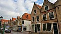
building in Oudewater, Netherlands  | |||||
| Upload media | |||||
| Instance of | |||||
|---|---|---|---|---|---|
| Location | Oudewater, Utrecht, Netherlands | ||||
| Street address |
| ||||
| Located on street |
| ||||
| Heritage designation |
| ||||
 | |||||
|
This is a category about rijksmonument number 32015
|
| Address |
|
Media in category "Havenstraat 11, Oudewater"
The following 9 files are in this category, out of 9 total.
-
 3421 Oudewater, Netherlands - panoramio (103).jpg 4,896 × 3,264; 2.53 MB
-
 3421 Oudewater, Netherlands - panoramio (106).jpg 4,896 × 3,264; 2.46 MB
-
 3421 Oudewater, Netherlands - panoramio (30).jpg 2,048 × 1,148; 535 KB
-
 Havenstraat 10-23, Oudewater, Netherlands - panoramio (21).jpg 2,048 × 1,148; 495 KB
-
 Overzicht - Oudewater - 20179851 - RCE.jpg 2,010 × 2,742; 1,009 KB
-
 Overzicht met kerktoren - Oudewater - 20375986 - RCE.jpg 2,362 × 2,910; 1.21 MB
-
 RM32015 Oudewater - Havenstraat 11.jpg 1,944 × 2,592; 1.27 MB
-
 Voorgevel - Oudewater - 20179860 - RCE.jpg 2,236 × 3,320; 1.4 MB
-
 Voorgevels - Oudewater - 20179859 - RCE.jpg 2,220 × 3,300; 1.53 MB
.jpg)
.jpg)
.jpg)
.jpg)


