Category:Haus Zum Olivenbaum (Steckborn)
Jump to navigation
Jump to search
| Object location | | View all coordinates using: OpenStreetMap |
|---|
 | |||||
| Upload media | |||||
| Instance of | |||||
|---|---|---|---|---|---|
| Part of | |||||
| Location |
| ||||
| Street address |
| ||||
| Heritage designation |
| ||||
 | |||||
|
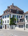
This is a category about a cultural property of regional significance in Switzerland with KGS number 5166
|
Media in category "Haus Zum Olivenbaum (Steckborn)"
This category contains only the following file.
-
 Haus zum Olivenbaum, Seestr. 68, Steckborn- MG 1151.jpg 2,048 × 2,560; 4.24 MB