Category:Haus Hauptstrasse 39, Brugg
Jump to navigation
Jump to search
| Object location | | View all coordinates using: OpenStreetMap |
|---|
alley house in Brugg in the canton of Aargau, Switzerland   | |||||
| Upload media | |||||
| Instance of |
| ||||
|---|---|---|---|---|---|
| Part of | |||||
| Location | Brugg, Brugg District, Aargau, Switzerland | ||||
| Street address |
| ||||
| Occupant |
| ||||
| Heritage designation | |||||
 | |||||
Media in category "Haus Hauptstrasse 39, Brugg"
The following 7 files are in this category, out of 7 total.
-
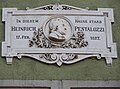
 Brugg AG Hauptstrasse 39 Pestalozzi-Sterbehaus Infotafel.jpg 5,472 × 3,648; 9.37 MB
-
 Brugg AG Hauptstrasse 39 Pestalozzi-Sterbehaus.jpg 4,542 × 3,561; 13.48 MB
-
 Brugg Hauptstr39.JPG 2,112 × 2,816; 1.2 MB
-
 Denkmal Heinrich Pestalozzi Brugg.jpg 2,977 × 2,214; 1.29 MB
-
 Hauptstr. 39 in Brugg AG.jpg 2,700 × 3,600; 4.96 MB
-
 Hauptstrasse39 - Sterbehaus Heinrich Pestalozzi.jpg 2,204 × 3,920; 1.66 MB
-
 Sterbehaus Pestalozzi.jpg 1,520 × 2,048; 755 KB


