Category:Hassall Green
Jump to navigation
Jump to search
village in Cheshire, United Kingdom  | |||||
| Upload media | |||||
| Instance of | |||||
|---|---|---|---|---|---|
| Location | Betchton, Cheshire East, Cheshire, North West England, England | ||||
 | |||||
English: Hassall Green is a village in the unitary authority of Cheshire East and the ceremonial county of Cheshire, England. It is in the civil parish of en:Betchton
Subcategories
This category has the following 6 subcategories, out of 6 total.
B
H
Media in category "Hassall Green"
The following 32 files are in this category, out of 32 total.
-
 Bank Farmhouse nr Hassall Green.jpg 1,800 × 1,350; 560 KB
-
 Betchton , Hassall Green - geograph.org.uk - 6361783.jpg 6,000 × 4,000; 5.73 MB
-
 Canal buildings at Hassall Green - geograph.org.uk - 4296260.jpg 1,024 × 768; 280 KB
-

-

-
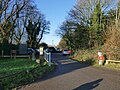 Car park for the Salt Line at Hassall Green - geograph.org.uk - 6358373.jpg 1,024 × 768; 345 KB
-
 Field path E of Betchton House near Hassall Green - geograph.org.uk - 5626424.jpg 5,184 × 2,920; 5.92 MB
-
 Field path E of Deanhill Farm near Hassall Green - geograph.org.uk - 5626416.jpg 5,184 × 2,920; 7.04 MB
-
 Field path E of Deanhill Farm near Hassall Green - geograph.org.uk - 5626419.jpg 5,184 × 2,920; 7.18 MB
-
 Field path NW of Betchton House near Hassall Green - geograph.org.uk - 5626422.jpg 5,184 × 2,920; 5.51 MB
-
 Former station house, Hassall Green - geograph.org.uk - 4296224.jpg 1,024 × 776; 174 KB
-
 Grazing near Hassall Green, Cheshire - geograph.org.uk - 2857046.jpg 800 × 600; 372 KB
-
 Hassall Green Ford - geograph.org.uk - 6008965.jpg 4,032 × 3,024; 7.29 MB
-

-
 Hassall Green station geograph-3614753-by-Ben-Brooksbank.jpg 2,360 × 1,594; 3.02 MB
-
 Hassall Green, footpath along field edge - geograph.org.uk - 4568174.jpg 3,008 × 2,000; 1.77 MB
-
 Hassall Green, public footpath - geograph.org.uk - 4568181.jpg 3,008 × 2,000; 2 MB
-
 Hassall Green, Stobie in motion! - geograph.org.uk - 4568222.jpg 3,008 × 2,000; 1.2 MB
-

-
 Pasture west of Hassall Green, Cheshire - geograph.org.uk - 2850723.jpg 1,024 × 648; 373 KB
-
 Pasture west of Hassall Green, Cheshire - geograph.org.uk - 2850735.jpg 800 × 600; 293 KB
-
 Pasture west of Hassall Green, Cheshire - geograph.org.uk - 2850740.jpg 1,024 × 653; 404 KB
-
 Public footpath from Salt Line to Hassall Green - geograph.org.uk - 4567448.jpg 3,008 × 2,000; 1.91 MB
-
 Rainy weather.jpg 2,048 × 1,365; 740 KB
-
 Salt Line trail, Station House from trail car park - geograph.org.uk - 4568274.jpg 3,008 × 2,000; 1.33 MB
-
 Snowy track leading S to Dean Hill near Hassall Green - geograph.org.uk - 5626412.jpg 5,184 × 2,920; 7.23 MB
-
 Snowy track leading S to Dean Hill near Hassall Green - geograph.org.uk - 5626414.jpg 5,184 × 2,920; 6.64 MB
-
 The former Romping Donkey at Hassall Green - geograph.org.uk - 4296252.jpg 1,024 × 768; 185 KB
-
 The Lock 57 Cafe, Hassall Green, Sandbach - geograph.org.uk - 1949343.jpg 2,048 × 1,536; 582 KB
-
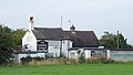 The Romping Donkey at Hassall Green, Cheshire - geograph.org.uk - 2854715.jpg 1,024 × 578; 331 KB
-
 The Romping Donkey at Hassall Green, Cheshire - geograph.org.uk - 2854740.jpg 1,024 × 578; 335 KB
-
 The Romping Donkey canalside pub - geograph.org.uk - 416974.jpg 640 × 504; 258 KB


