Category:Haslington
Jump to navigation
Jump to search
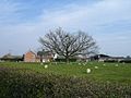
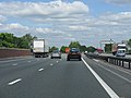
English: Haslington is a village and civil parish in the unitary authority of Cheshire East and the ceremonial county of Cheshire, England. It was originally situated on both sides of the section of the A534 road that links Crewe with Sandbach. However, this road has now been re-routed to bypass the village to the north-west. It is approximately two miles (three kilometres) east of Crewe, and four miles (six and a half kilometres) from Sandbach. The village is a close neighbour to a number of small towns and villages (including Alsager, Wheelock, Winterley), and is approximately six miles (nine kilometres) from the Elizabethan market town of Nantwich.
village and civil parish in Cheshire East, England, UK  | |||||
| Upload media | |||||
| Instance of | |||||
|---|---|---|---|---|---|
| Location | Cheshire East, Cheshire, North West England, England | ||||
| Population |
| ||||
| official website | |||||
 | |||||
Subcategories
This category has the following 5 subcategories, out of 5 total.
H
- Haslington War Memorial (1 F)
- Hawk Inn, Haslington (3 F)
O
- Oakhanger, Cheshire (2 F)
W
- Winterley and Wheelock Heath (2 F)
Media in category "Haslington"
The following 120 files are in this category, out of 120 total.
-
 A footbridge over the M6 - geograph.org.uk - 4615042.jpg 1,500 × 990; 119 KB
-
 A534 approaching the Wheelock bypass - geograph.org.uk - 2244969.jpg 640 × 480; 62 KB
-
 A534 at Bradeley Road overbridge - geograph.org.uk - 2244940.jpg 640 × 480; 61 KB
-
 A534 at Clay Lane junction - geograph.org.uk - 2244950.jpg 640 × 480; 56 KB
-
 A534 at Maw Lane overbridge - geograph.org.uk - 2244949.jpg 640 × 480; 61 KB
-
 A534 in cutting west of Haslington - geograph.org.uk - 2244944.jpg 640 × 480; 55 KB
-
 A534 junction with Clay Lane - geograph.org.uk - 254390.jpg 640 × 480; 71 KB
-
 A534 looking south with pylon - geograph.org.uk - 3101970.jpg 640 × 479; 49 KB
-
 A534 near Bradeley Hall - geograph.org.uk - 3101980.jpg 640 × 481; 55 KB
-
 A534 near Haslington House Farm - geograph.org.uk - 2244953.jpg 640 × 480; 57 KB
-
 Alsager Road, Winterley - geograph.org.uk - 2528272.jpg 640 × 480; 130 KB
-
 Bungalow, Oakhanger - geograph.org.uk - 3345974.jpg 2,848 × 2,136; 1.48 MB
-
 Butterton Lane heading east - geograph.org.uk - 3345969.jpg 640 × 480; 115 KB
-
 Butterton Lane, Oakhanger - geograph.org.uk - 3345979.jpg 2,848 × 2,136; 1.51 MB
-
 Care home in Haslington - geograph.org.uk - 5841402.jpg 1,024 × 768; 442 KB
-
 Cheshire East , Grassy Field ^ Pylon - geograph.org.uk - 3725146.jpg 2,255 × 3,395; 3.35 MB
-
 Cheshire East , The M6 Motorway - geograph.org.uk - 3725149.jpg 4,288 × 2,848; 5.11 MB
-
 Cheshire East , The M6 Motorway - geograph.org.uk - 4934139.jpg 6,000 × 4,000; 6.82 MB
-
 Cheshire East , The M6 Motorway - geograph.org.uk - 4934145.jpg 6,000 × 4,000; 5.18 MB
-
 Cheshire East , The M6 Motorway - geograph.org.uk - 4934147.jpg 6,000 × 4,000; 7.04 MB
-
 Chilled Out - panoramio.jpg 4,608 × 3,456; 3.54 MB
-
 Clay Lane - geograph.org.uk - 2244957.jpg 640 × 480; 77 KB
-
 Clay Lane - geograph.org.uk - 3346038.jpg 640 × 480; 55 KB
-
 Clay Lane - geograph.org.uk - 3346042.jpg 640 × 480; 56 KB
-
 Clearing waste ground near Crewe - geograph.org.uk - 3345907.jpg 1,024 × 492; 71 KB
-
 Close Lane Bridge, Northbound M6 - geograph.org.uk - 3506522.jpg 640 × 480; 361 KB
-
 Crewe Road, Haslington - geograph.org.uk - 2911340.jpg 800 × 600; 121 KB
-
 Crewe Road, Haslington - geograph.org.uk - 3346059.jpg 640 × 480; 82 KB
-
 Crewe Road, Winterly - geograph.org.uk - 2528273.jpg 640 × 480; 107 KB
-
 Elton Lane - geograph.org.uk - 4751917.jpg 5,500 × 3,667; 6.28 MB
-
 Elton Lane - geograph.org.uk - 4751920.jpg 5,500 × 3,667; 5.74 MB
-
 Elton Lane's eastern end - geograph.org.uk - 2244955.jpg 640 × 480; 86 KB
-
 Fallow field, Brook House Farm - geograph.org.uk - 3690965.jpg 640 × 430; 44 KB
-
 Farm building by the M6 - geograph.org.uk - 2643746.jpg 640 × 401; 45 KB
-
 Farm nameboard - geograph.org.uk - 4751925.jpg 5,500 × 3,667; 7.68 MB
-
 Farm track - geograph.org.uk - 4751941.jpg 3,333 × 5,000; 7.28 MB
-
 Farmhouse - geograph.org.uk - 4751944.jpg 4,896 × 3,672; 6.38 MB
-

-
 Farmland and pylon off Clay Lane - geograph.org.uk - 3346040.jpg 640 × 480; 34 KB
-
 Farmland and pylons - geograph.org.uk - 2814303.jpg 640 × 430; 51 KB
-
 Farmland near Haslington Hall - geograph.org.uk - 3346029.jpg 640 × 480; 66 KB
-
 Farmland near Winterley - geograph.org.uk - 3346035.jpg 640 × 480; 69 KB
-
 Farmland near Woodside Farm - geograph.org.uk - 3346027.jpg 640 × 480; 58 KB
-
 Farmland off Holmshaw Lane - geograph.org.uk - 3346022.jpg 640 × 480; 53 KB
-
 Farmland, Moss Farm - geograph.org.uk - 3346007.jpg 640 × 480; 53 KB
-
 Field - geograph.org.uk - 4751947.jpg 5,000 × 3,333; 7.24 MB
-
 Field north of Brook House Farm - geograph.org.uk - 2860799.jpg 2,000 × 1,493; 535 KB
-
 Flash near Clayhanger - geograph.org.uk - 3829914.jpg 640 × 430; 38 KB
-
 Footpath off Butterton Lane - geograph.org.uk - 3345965.jpg 640 × 480; 133 KB
-
 Footpath off Holmshaw Lane - geograph.org.uk - 3346031.jpg 640 × 480; 86 KB
-
 Footpath to Claylines - geograph.org.uk - 4751916.jpg 5,500 × 3,667; 6.75 MB
-
 Grazing, Pear Tree Farm - geograph.org.uk - 3346014.jpg 640 × 480; 74 KB
-
 Green Bank Farm Bridge crosses the M6 - geograph.org.uk - 4615044.jpg 1,500 × 999; 110 KB
-
 Green Bank Farm Bridge, M6 - geograph.org.uk - 2643738.jpg 640 × 531; 47 KB
-
 Hall o' the Heath Farm, Haslington - geograph.org.uk - 189792.jpg 640 × 480; 75 KB
-
 Haslington , Grassy Field - geograph.org.uk - 6361788.jpg 6,000 × 4,000; 5.58 MB
-
 Haslington , M6 Motorway - geograph.org.uk - 6292564.jpg 6,000 × 4,000; 5.41 MB
-
 Haslington , M6 Motorway - geograph.org.uk - 6292565.jpg 6,000 × 4,000; 5.22 MB
-
 Haslington , M6 Motorway - geograph.org.uk - 6361785.jpg 6,000 × 4,000; 4.46 MB
-
 Haslington , M6 Motorway - geograph.org.uk - 6361791.jpg 6,000 × 4,000; 4.34 MB
-
 Haslington - barley field - geograph.org.uk - 856362.jpg 640 × 480; 304 KB
-
 Haslington - Clayhanger Hall Farm.jpg 640 × 480; 39 KB
-
 Haslington Hall near Crewe - geograph.org.uk - 4668651.jpg 1,024 × 768; 278 KB
-
 Haslington Primary School - geograph.org.uk - 3346045.jpg 1,163 × 642; 142 KB
-
 Haslington School.jpg 1,032 × 768; 80 KB
-

-
 Haslington-CPSchool.jpg 613 × 288; 136 KB
-
 Haslington-MilleniumStone.jpg 640 × 480; 323 KB
-
 Haslington-OldHouse.jpg 640 × 480; 243 KB
-
 Hawk Inn - geograph.org.uk - 5514895.jpg 5,184 × 3,198; 1.93 MB
-
 Hedgerow - geograph.org.uk - 4751936.jpg 5,500 × 3,667; 6.72 MB
-
 Hedgerow trees - geograph.org.uk - 4751927.jpg 5,500 × 3,667; 6.44 MB
-
 Holly Bush Inn, Crewe Road, Winterley - geograph.org.uk - 2528271.jpg 640 × 480; 107 KB
-
 Holmshaw Lane - geograph.org.uk - 3346018.jpg 640 × 480; 56 KB
-
 Holmshaw Lane - geograph.org.uk - 3346024.jpg 640 × 480; 141 KB
-
 Holmshaw Lane - geograph.org.uk - 3346032.jpg 640 × 480; 102 KB
-
 Hooterhall farm - geograph.org.uk - 4751911.jpg 5,500 × 3,667; 6.36 MB
-
 House in Haslington - geograph.org.uk - 3346046.jpg 640 × 480; 98 KB
-
 Kents Green Lane - geograph.org.uk - 2528237.jpg 640 × 480; 204 KB
-
 Landfill site - geograph.org.uk - 5341829.jpg 640 × 426; 58 KB
-
 Large pond by the WCML - geograph.org.uk - 3690969.jpg 640 × 430; 37 KB
-
 M6 motorway - Green Bank Farm bridge - geograph.org.uk - 1918284.jpg 640 × 480; 153 KB
-
 M6 motorway - Moss Farm footbridge - geograph.org.uk - 1918283.jpg 640 × 480; 146 KB
-
 M6 Motorway at Radway Green - geograph.org.uk - 1918281.jpg 640 × 480; 147 KB
-
 M6 southbound near Moss Farm - geograph.org.uk - 2823659.jpg 640 × 480; 31 KB
-
 Haslington St Matthew.jpg 480 × 640; 286 KB
-
 Model village, Lakemore Country Park - geograph.org.uk - 1013138.jpg 640 × 427; 89 KB
-
 Moss Farm Footbridge, M6 - geograph.org.uk - 2643739.jpg 640 × 430; 44 KB
-
 New houses in Gutterscroft, Haslington - geograph.org.uk - 5841399.jpg 1,024 × 768; 252 KB
-
 Northbound M6 near Radway Green - geograph.org.uk - 4243221.jpg 640 × 427; 290 KB
-
 Northbound M6, Radway Green - geograph.org.uk - 3506516.jpg 640 × 480; 334 KB
-
 Nursery Rd bridge, M6 - geograph.org.uk - 2643741.jpg 640 × 381; 47 KB
-
 Nursery Road crosses the M6 - geograph.org.uk - 4615039.jpg 1,500 × 993; 111 KB
-
 Oakhanger Hall - geograph.org.uk - 2755783.jpg 2,304 × 1,728; 1.64 MB
-
 Oakhanger Moss - geograph.org.uk - 2755867.jpg 2,304 × 1,728; 1.93 MB
-
 Old House Haslington.jpg 5,184 × 3,456; 6.83 MB
-

-
 Pond by the railway line - geograph.org.uk - 2814315.jpg 640 × 430; 45 KB
-
 Pylon and farmland - geograph.org.uk - 3690973.jpg 640 × 430; 35 KB
-
 Pylon by the M6 - geograph.org.uk - 2689955.jpg 3,217 × 2,585; 2.62 MB
-
 Small pond - geograph.org.uk - 3690967.jpg 640 × 430; 39 KB
-

-
 Southbound M6, Bridge at Moss Farm - geograph.org.uk - 3506488.jpg 640 × 480; 404 KB
-
 Take away restaurant, Haslington - geograph.org.uk - 3346056.jpg 640 × 480; 58 KB
-
 The Broughton Arms pub, Haslington - geograph.org.uk - 3346053.jpg 640 × 466; 49 KB
-
 The Cosey Social Club, Haslington - geograph.org.uk - 2911331.jpg 800 × 600; 102 KB
-
 The Dingle, Haslington - geograph.org.uk - 3346048.jpg 640 × 480; 70 KB
-
 The Foresters Arms, Winterly - geograph.org.uk - 2528241.jpg 640 × 480; 107 KB
-

-
 Track to Moss Farm - geograph.org.uk - 3346009.jpg 640 × 480; 71 KB
-
 Two of three ponds - geograph.org.uk - 2814319.jpg 640 × 232; 38 KB
-
 United Reformed Church, Haslington - geograph.org.uk - 233530.jpg 640 × 480; 25 KB
-
 Waste ground north of Crewe - geograph.org.uk - 3345905.jpg 800 × 535; 58 KB
-
 Waymarks - geograph.org.uk - 4751934.jpg 3,667 × 5,500; 5.32 MB
-
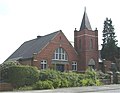 Wesleyan Methodist Church, Haslington - geograph.org.uk - 184343.jpg 640 × 497; 52 KB
-
 Wheelock Heath Farm - geograph.org.uk - 5516291.jpg 4,039 × 2,187; 2.04 MB
-
 White Moss Farm - geograph.org.uk - 2922312.jpg 2,530 × 1,744; 1.92 MB
-
 Winterley - geograph.org.uk - 5515059.jpg 5,184 × 3,002; 1.67 MB
-
 Claylanes Farm - geograph.org.uk - 236869.jpg 640 × 480; 36 KB
-
 Lakemore Country Park - geograph.org.uk - 236867.jpg 640 × 480; 38 KB


