Category:Hasenburg (Berg)
Jump to navigation
Jump to search
hill in Germany  | |||||
| Upload media | |||||
| Instance of | |||||
|---|---|---|---|---|---|
| Location | Thuringia, Germany | ||||
| Mountain range | |||||
 | |||||
Subcategories
This category has the following 4 subcategories, out of 4 total.
Media in category "Hasenburg (Berg)"
The following 28 files are in this category, out of 28 total.
-
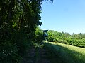
 Bischofferode 1986-07-08 13.jpg 2,922 × 1,914; 2.26 MB
-
 Blick auf Haynrode - panoramio (2).jpg 3,264 × 2,448; 1.41 MB
-
 Buhla Landschaft (1).jpg 4,320 × 3,240; 4.84 MB
-
 Hasenburg (21).jpg 2,432 × 4,320; 4.76 MB
-
 Hasenburg (22).jpg 4,320 × 3,240; 4.63 MB
-
 Hasenburg (23).jpg 3,240 × 4,320; 4.55 MB
-
 Hasenburg (25).jpg 4,320 × 3,240; 5.01 MB
-
 Hasenburg (31).jpg 3,288 × 2,414; 3.36 MB
-
 Hasenburg (32).jpg 4,320 × 3,240; 4.53 MB
-
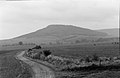
 Hasenburg 1986-10-20 03.jpg 4,360 × 2,900; 2.08 MB
-
 Hasenburg 1986-10-20 04.jpg 4,361 × 2,895; 1.94 MB
-
 Hasenburg 1986-10-20 05.jpg 4,356 × 2,896; 1.7 MB
-
 Hasenburg 1986-10-22.jpg 4,383 × 2,833; 1.28 MB
-
 Hasenburg 1993-08 01.jpg 4,275 × 2,776; 1.43 MB
-
 Hasenburg 2001-07-19.jpg 4,272 × 2,820; 2.65 MB
-
 Hasenburg 2007-03-02.jpg 3,024 × 2,016; 1.28 MB
-
 Hasenburg von N 2001-07-18.jpg 4,401 × 2,865; 2.27 MB
-
 Hasenburg von N 2001-07-19.jpg 4,351 × 2,823; 2.74 MB
-
 Haynrode 1986-10-22 01.jpg 4,280 × 2,779; 1.54 MB
-
 Haynrode 7 (1940) C.jpg 4,860 × 3,132; 3.06 MB
-
 Haynrode Ansicht.jpg 6,072 × 2,510; 5.06 MB
-
 Höhenschichten Karte des Harzgebirges, Kartenausschnitt (6).jpg 1,413 × 1,004; 679 KB
-
 Karte des Deutschen Reiches 386 (20).jpg 1,833 × 1,710; 1.61 MB
-
 Kreis Worbis 1840 (7).jpg 1,421 × 1,219; 716 KB
-
 OpenTopoMap Topographische Detailkarten 835.png 1,795 × 910; 1.84 MB
-
 Türkenkreuz Kraja (3).jpg 4,000 × 3,000; 4.04 MB
-
 Wallrode Hasenburg.JPG 4,320 × 3,240; 4.76 MB
-
 Wüstung Salmerode 1986-10-20 06.jpg 4,358 × 2,883; 1.75 MB

.jpg)
.jpg)
.jpg)
.jpg)
.jpg)
.jpg)
.jpg)
.jpg)


_C.jpg)

.jpg)
.jpg)
.jpg)

.jpg)

