Category:Haseborgsche Mühle
Jump to navigation
Jump to search
| Object location | | View all coordinates using: OpenStreetMap |
|---|
 | |||||
| Upload media | |||||
| Instance of | |||||
|---|---|---|---|---|---|
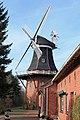
| Location | Möhlenwarf, Weener, Leer, Lower Saxony, Germany | ||||
| Heritage designation | |||||
| Source of energy |
| ||||
 | |||||
Media in category "Haseborgsche Mühle"
The following 10 files are in this category, out of 10 total.
-
 Weener - Zur Mühle - Haseborgsche Mühle 01 ies.jpg 3,744 × 5,616; 18.49 MB
-
 Weener - Zur Mühle - Haseborgsche Mühle 02 ies.jpg 3,744 × 5,616; 15.34 MB
-
 Weener - Zur Mühle - Haseborgsche Mühle 03 ies.jpg 3,743 × 5,616; 20.48 MB
-
 Weener - Zur Mühle - Haseborgsche Mühle 04 ies.jpg 3,744 × 5,616; 17.75 MB
-
 Weener - Zur Mühle - Haseborgsche Mühle 05 ies.jpg 3,744 × 5,616; 14.36 MB
-
 Weener - Zur Mühle - Haseborgsche Mühle 06 ies.jpg 3,744 × 5,616; 23.95 MB
-
 Weener - Zur Mühle - Haseborgsche Mühle 07 ies.jpg 3,744 × 5,616; 16.3 MB
-
 Weener - Zur Mühle - Haseborgsche Mühle 08 ies.jpg 5,616 × 3,744; 20.06 MB
-
 Windmühle Weener 01.jpg 4,000 × 3,000; 6 MB
-
 Windmühle Weener 02.jpg 4,000 × 3,000; 6.33 MB


