Category:Hascosay
Jump to navigation
Jump to search
English: Hascosay is an island in the council area of the Shetland Islands, Scotland.
island of the Shetland Islands, Scotland, UK  | |||||
| Upload media | |||||
| Instance of | |||||
|---|---|---|---|---|---|
| Part of | |||||
| Located in protected area |
| ||||
| Location | Shetland Islands, Scotland | ||||
| Located in or next to body of water |
| ||||
| Has part(s) |
| ||||
| Area |
| ||||
 | |||||
Media in category "Hascosay"
The following 33 files are in this category, out of 33 total.
-
 Ashore at Punds Geo, Hascosay - geograph.org.uk - 5806187.jpg 1,600 × 1,065; 846 KB
-
 Ba Taing, Hascosay, from the Ness of Vatsetter - geograph.org.uk - 5214129.jpg 1,024 × 682; 108 KB
-

-

-

-
 Crags, Punds Geo - geograph.org.uk - 3822599.jpg 640 × 245; 147 KB
-
 Evening sky over Hascosay from Brough, Fetlar - geograph.org.uk - 5937244.jpg 1,600 × 1,065; 445 KB
-
 Fulmar (Fulmarus glacialis), Punds Geo, Hascosay - geograph.org.uk - 5806744.jpg 1,600 × 1,067; 308 KB
-

-
 Gruna Taing and Djuba Wick, Hascosay - geograph.org.uk - 1935993.jpg 800 × 534; 133 KB
-
 Hascosay Sound from Hascosay - geograph.org.uk - 5806166.jpg 1,600 × 1,065; 697 KB
-
 Headland west of Djuba Wick, Hascosay - geograph.org.uk - 5207919.jpg 1,024 × 682; 98 KB
-

-
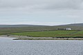
 House on Hascosay - geograph.org.uk - 1470084.jpg 640 × 426; 43 KB
-
 House on Hascosay - geograph.org.uk - 1935938.jpg 800 × 534; 124 KB
-

-
 Mire at Brough Lodge, Fetlar - geograph.org.uk - 1028577.jpg 640 × 422; 81 KB
-
 Moorland on the south end of Hascosay - geograph.org.uk - 5806170.jpg 1,600 × 1,065; 622 KB
-
 Natural arch, Punds Geo, Hascosay - geograph.org.uk - 5806191.jpg 1,600 × 1,065; 692 KB
-
 North end of the Bow of Hascosay - geograph.org.uk - 5207937.jpg 1,024 × 682; 76 KB
-
 Punds Geo, Hascosay - geograph.org.uk - 1936054.jpg 800 × 534; 134 KB
-
 Salmon barge, Djuba Wick, Hascosay - geograph.org.uk - 5207930.jpg 1,024 × 682; 126 KB
-
 Salmon farm in Djuba Wick, Hascosay - geograph.org.uk - 5207909.jpg 1,024 × 682; 111 KB
-
 Salmon farm in Djuba Wick, Hascosay - geograph.org.uk - 5207915.jpg 1,024 × 682; 135 KB
-
 Skulia Geo, Hascosay - geograph.org.uk - 5806179.jpg 1,600 × 1,065; 261 KB
-
 South-eastern coastline of Hascosay - geograph.org.uk - 5806949.jpg 1,600 × 1,065; 259 KB
-
 Sunset beyond Hascosay - geograph.org.uk - 5210283.jpg 1,024 × 682; 52 KB
-
 Taingar, Hascosay - geograph.org.uk - 1935956.jpg 800 × 533; 125 KB
-
 The Rett and Ba Taing, Hascosay - geograph.org.uk - 1935898.jpg 800 × 534; 116 KB
-
 Virdi Taing - geograph.org.uk - 2174689.jpg 3,456 × 2,304; 2.66 MB
-
 Virdi Taing, Hascosay - geograph.org.uk - 5207922.jpg 1,024 × 682; 109 KB
-
 Virdi Taing, Hascosay - geograph.org.uk - 5207926.jpg 1,024 × 682; 91 KB
-
 Virdi Taing, Hascosay - geograph.org.uk - 5806183.jpg 1,600 × 1,065; 322 KB


,_Djuba_Wick,_Hascosay_-_geograph.org.uk_-_5207906.jpg)

,_Djuba_Wick,_Hascosay_-_geograph.org.uk_-_5207927.jpg)

,_Punds_Geo,_Hascosay_-_geograph.org.uk_-_5806744.jpg)


,_Djuba_Wick,_Hascosay_-_geograph.org.uk_-_5211083.jpg)


