Category:Harwood Dale
Jump to navigation
Jump to search
village and civil parish in the Scarborough district of North Yorkshire, England  | |||||
| Upload media | |||||
| Instance of | |||||
|---|---|---|---|---|---|
| Location | Scarborough, North Yorkshire, Yorkshire and the Humber, England | ||||
| Population |
| ||||
 | |||||
Subcategories
This category has the following 2 subcategories, out of 2 total.
T
- Three Lords' Stones (1 F)
Media in category "Harwood Dale"
The following 200 files are in this category, out of 262 total.
(previous page) (next page)-
 4x4 Ruined Footpath, Pye Rigg - geograph.org.uk - 4955309.jpg 1,024 × 768; 453 KB
-
 A First World War Memorial - geograph.org.uk - 2327663.jpg 800 × 600; 328 KB
-

-
 A footpath heading to Linglands Farm - geograph.org.uk - 2327428.jpg 800 × 600; 338 KB
-
 A footpath to Jugger Howe Beck - geograph.org.uk - 2327756.jpg 800 × 600; 320 KB
-
 A footpath to Jugger Howe Beck - geograph.org.uk - 2327771.jpg 800 × 600; 292 KB
-
 A Forestry track in Harwood Dale Forest - geograph.org.uk - 2327777.jpg 800 × 600; 309 KB
-
 A pond at Hardwick Farm, Harwood Dale - geograph.org.uk - 2327721.jpg 800 × 600; 252 KB
-
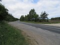 A171 - geograph.org.uk - 5842003.jpg 2,048 × 1,536; 1,005 KB
-
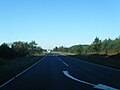 A171 in Harwood Dale Forest - geograph.org.uk - 4732778.jpg 640 × 480; 34 KB
-
 A171 near Teydale Farm - geograph.org.uk - 4732777.jpg 640 × 480; 42 KB
-
 A171 nears Helwath Road junction - geograph.org.uk - 4732779.jpg 640 × 480; 49 KB
-

-
 Access road from Kirkless Farm toward Lindhead Bridge (2) - geograph.org.uk - 4308076.jpg 4,608 × 3,456; 5.47 MB
-
 Are you sure this is the Way - geograph.org.uk - 2633089.jpg 3,264 × 2,448; 3.03 MB
-
 At the edge of the forest - geograph.org.uk - 5841977.jpg 2,048 × 1,536; 1.17 MB
-
 Aw cute^ - geograph.org.uk - 5722269.jpg 1,024 × 768; 321 KB
-
 Bottom of Ward Hill - geograph.org.uk - 3543103.jpg 1,200 × 1,600; 1.03 MB
-
 Boundary Stone - geograph.org.uk - 2925451.jpg 427 × 640; 251 KB
-
 Boundary stone on Pye Rigg End - geograph.org.uk - 4568177.jpg 1,536 × 2,048; 752 KB
-

-
 Breckenhurst Pond - geograph.org.uk - 5656452.jpg 4,608 × 3,456; 3.73 MB
-
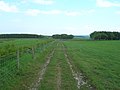
 Bridleway below Surgate Brow, North Yorkshire - geograph.org.uk - 4311071.jpg 1,600 × 1,062; 1,010 KB
-
 Bridleway below Surgate Brow, North Yorkshire - geograph.org.uk - 4311072.jpg 1,600 × 1,062; 520 KB
-
 Bridleway down Surgate Brow - geograph.org.uk - 3961744.jpg 2,814 × 2,010; 1.07 MB
-
 Bridleway in Harwood Dale Forest - geograph.org.uk - 3461292.jpg 1,600 × 1,200; 771 KB
-
 Bridleway in Harwood Dale Forest - geograph.org.uk - 5841996.jpg 2,048 × 1,536; 1.51 MB
-
 Bridleway leading to Lindhead Road - geograph.org.uk - 4311346.jpg 1,600 × 1,062; 568 KB
-
 Bridleway near Chapel Farm - geograph.org.uk - 2775561.jpg 1,024 × 768; 369 KB
-
 Bridleway near Harwood Dale - geograph.org.uk - 5841993.jpg 2,048 × 1,536; 1.13 MB
-
 Bridleway near Kirkless Farm - geograph.org.uk - 4311344.jpg 1,600 × 1,062; 599 KB
-
 Bridleway near Park Hill - geograph.org.uk - 2775566.jpg 1,024 × 768; 202 KB
-
 Bridleway towards Kirkless Farm - geograph.org.uk - 4311334.jpg 1,600 × 1,062; 628 KB
-
 Bridleway towards Lownorth Moor - geograph.org.uk - 1874586.jpg 640 × 480; 63 KB
-
 Brown Hill round cairn - geograph.org.uk - 5422207.jpg 3,840 × 2,880; 7.54 MB
-
 Brown Hill round cairn 2 - geograph.org.uk - 5422216.jpg 3,604 × 2,703; 5.07 MB
-
 Burgate Farm - geograph.org.uk - 2574600.jpg 640 × 427; 246 KB
-
 Burn Howe Moor from Harwood Dale Forest - geograph.org.uk - 3126447.jpg 1,600 × 1,064; 255 KB
-
 Castlebeck Farm - geograph.org.uk - 2632986.jpg 3,264 × 2,448; 1.67 MB
-
 Castlebeck Farm on Helwath Road - geograph.org.uk - 2327763.jpg 800 × 600; 203 KB
-
 Christmas Tree in May - geograph.org.uk - 6653535.jpg 480 × 640; 198 KB
-
 Cleared Forest, Standingstones Rigg - geograph.org.uk - 2327068.jpg 427 × 640; 275 KB
-
 Cleared section of Forest - geograph.org.uk - 2633062.jpg 3,264 × 2,448; 2.22 MB
-
 Cylindrical tank now for agricultural use on Pike Rigg - geograph.org.uk - 6198317.jpg 4,608 × 3,456; 6.11 MB
-
 Dry Stonewalling Field Corner - geograph.org.uk - 2633098.jpg 3,264 × 2,448; 1.79 MB
-
 Early morning sun on a snow-covered track - geograph.org.uk - 4377761.jpg 4,608 × 3,456; 5.55 MB
-
 East Syme looking west - geograph.org.uk - 1873827.jpg 640 × 480; 149 KB
-
 Edge of Harwood Dale Forest - geograph.org.uk - 1873869.jpg 640 × 480; 113 KB
-
 Ellis Close Farm, on Harwood Dale Road - geograph.org.uk - 2327422.jpg 800 × 600; 201 KB
-
 Entering Harwood Dale - geograph.org.uk - 2327613.jpg 800 × 600; 236 KB
-
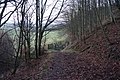
 Entrance to Pits Wood - geograph.org.uk - 1177473.jpg 640 × 480; 130 KB
-
 Farm buildings, Murk Head Farm - geograph.org.uk - 1874606.jpg 640 × 480; 64 KB
-
 Farm track off Waite Lane - geograph.org.uk - 1873834.jpg 640 × 480; 99 KB
-
 Farmland by the Falcon - geograph.org.uk - 3544695.jpg 2,974 × 2,071; 1.72 MB
-

-

-

-

-
 Farmland looking towards Scar Wood - geograph.org.uk - 1874595.jpg 640 × 480; 53 KB
-
 Farmland near Park Hill - geograph.org.uk - 1874598.jpg 640 × 480; 41 KB
-
 Farmland near Riverhead Farm - geograph.org.uk - 1874587.jpg 640 × 480; 42 KB
-
 Farmland near Riverhead Farm - geograph.org.uk - 1874594.jpg 640 × 480; 64 KB
-
 Farmland near Riverhead Farm - geograph.org.uk - 1874603.jpg 640 × 480; 31 KB
-
 Farmland near Thirley Cote Farm - geograph.org.uk - 1873817.jpg 640 × 480; 75 KB
-
 Farmland off Harwood Dale Road - geograph.org.uk - 1547207.jpg 640 × 480; 57 KB
-
 Farmland, Kirkless Farm - geograph.org.uk - 1547218.jpg 640 × 480; 65 KB
-
 Farmland, Pike Rigg - geograph.org.uk - 4955433.jpg 768 × 1,024; 210 KB
-
 Farmyard Keasbeck Farm Harwood Dale - geograph.org.uk - 1165971.jpg 640 × 480; 94 KB
-
 Felled Forest, Thorn Howe - geograph.org.uk - 2574503.jpg 640 × 427; 274 KB
-
 Felled Forest, Thorn Howe - geograph.org.uk - 2574508.jpg 427 × 640; 316 KB
-

-
 Field at Moor Cottage Farm - geograph.org.uk - 2574485.jpg 640 × 427; 237 KB
-
 Field boundary, Brown Hill - geograph.org.uk - 1874584.jpg 640 × 480; 50 KB
-
 Field in Harwood Dale Forest - geograph.org.uk - 220098.jpg 640 × 480; 73 KB
-
 Field near Moor Cottage Farm - geograph.org.uk - 2574497.jpg 640 × 427; 255 KB
-
 Fields Below Surgate Brow - geograph.org.uk - 2410955.jpg 640 × 427; 243 KB
-
 Fields on Lownorth Moor. Beef cattle and sheep country - geograph.org.uk - 6198297.jpg 4,456 × 3,244; 4.68 MB
-
 Fire Pond, Standingstones Rigg - geograph.org.uk - 2574606.jpg 427 × 640; 313 KB
-
 Flowers at Chapel Farm - geograph.org.uk - 6670986.jpg 1,600 × 1,200; 640 KB
-
 Foot Bridge over Lownorth Beck - geograph.org.uk - 4955452.jpg 1,024 × 768; 440 KB
-
 Footbridge over Broadlands Slack - geograph.org.uk - 1873983.jpg 640 × 480; 147 KB
-
 Footbridge over Harwood Dale Beck - geograph.org.uk - 4356550.jpg 4,608 × 3,456; 7.61 MB
-
 Footbridge over Helwath Beck - geograph.org.uk - 2632953.jpg 3,264 × 2,448; 3.1 MB
-
 Footbridge over the Derwent - geograph.org.uk - 4119245.jpg 4,320 × 3,240; 4.42 MB
-
 Footbridge over Thirley Beck - geograph.org.uk - 2574631.jpg 640 × 427; 315 KB
-
 Footpath off High Seat - geograph.org.uk - 5422264.jpg 3,840 × 2,880; 5.61 MB
-
 Ford at Harwood Dale - geograph.org.uk - 5506553.jpg 3,000 × 2,000; 7.38 MB
-
 Forest area cut and cleared - geograph.org.uk - 1165939.jpg 640 × 480; 82 KB
-
 Forest Road Harwood Dale Forest - geograph.org.uk - 1165923.jpg 640 × 480; 86 KB
-
 Forest track on northern edge of Broxa Forest - geograph.org.uk - 4377779.jpg 4,608 × 3,456; 4.55 MB
-
 Forest Track, Harwood Dale Forest - geograph.org.uk - 2574585.jpg 640 × 427; 275 KB
-
-

-
 Forestry Track, near Hardhurst Slack - geograph.org.uk - 2327061.jpg 427 × 640; 256 KB
-
 Forestry Track, Standingstones Rigg - geograph.org.uk - 2327064.jpg 640 × 427; 286 KB
-
 Forestry, Pye Rigg - geograph.org.uk - 2001178.jpg 640 × 427; 321 KB
-
 Former chapel, Harwood Dale - geograph.org.uk - 242972.jpg 640 × 480; 102 KB
-
 From Murk Head Farm to Barns Cliff - geograph.org.uk - 4379254.jpg 4,608 × 3,456; 4.01 MB
-
 From the end of the Forestry - geograph.org.uk - 2633013.jpg 3,264 × 2,448; 1.78 MB
-
 Gowland Lane joins Harwood Dale Road - geograph.org.uk - 2327409.jpg 800 × 600; 218 KB
-
 Grassland, Low North Moor - geograph.org.uk - 4955412.jpg 1,024 × 768; 272 KB
-
 Hardwick Farm - geograph.org.uk - 2574463.jpg 640 × 427; 276 KB
-
 Harvested Logs, Standingstones Rigg - geograph.org.uk - 2327073.jpg 640 × 427; 278 KB
-
 Harwood Dale - geograph.org.uk - 3854502.jpg 3,116 × 2,226; 2.29 MB
-
 Harwood Dale - geograph.org.uk - 5656006.jpg 4,608 × 3,456; 3.53 MB
-
 Harwood Dale - geograph.org.uk - 5841991.jpg 2,048 × 1,536; 1.12 MB
-
 Harwood Dale Forest - geograph.org.uk - 1874013.jpg 640 × 480; 122 KB
-
 Harwood Dale Forest - geograph.org.uk - 1874029.jpg 640 × 480; 96 KB
-
 Harwood Dale Forest - geograph.org.uk - 1874074.jpg 640 × 480; 100 KB
-
 Harwood Dale Forest - geograph.org.uk - 5842000.jpg 2,048 × 1,536; 1.4 MB
-

-
 Harwood Dale Road - geograph.org.uk - 1547206.jpg 640 × 480; 69 KB
-
 Harwood Dale Road - geograph.org.uk - 1547208.jpg 640 × 480; 118 KB
-
 Harwood Dale Road - geograph.org.uk - 2327413.jpg 800 × 600; 177 KB
-
 Harwood Dale Scarborough North Yorkshire England 2.jpg 5,000 × 1,121; 9.14 MB
-
 Harwood Dale UK parish locator map.svg 1,425 × 1,037; 4.3 MB
-
 Harwood Dale, Mill Inn - geograph.org.uk - 6895490.jpg 1,024 × 679; 304 KB
-
 Harwood Dale, Mill Inn - geograph.org.uk - 6895492.jpg 1,024 × 724; 210 KB
-
 Harwood Dale, North Yorkshire. By Thomas Tolkien (4925339440).jpg 5,000 × 1,488; 11.71 MB
-

-
 Helwath Beck - geograph.org.uk - 2632942.jpg 3,264 × 2,448; 3.39 MB
-
 Helwath Road - geograph.org.uk - 3549653.jpg 3,710 × 2,420; 2.45 MB
-
 Helwath Road, Harwood Dale Forest - geograph.org.uk - 3126452.jpg 1,600 × 1,064; 448 KB
-
 High Seat - geograph.org.uk - 5422267.jpg 3,840 × 2,880; 4.74 MB
-
 Joining the A171 south of the Falcon Inn - geograph.org.uk - 2327354.jpg 800 × 600; 199 KB
-
 Keldgate Slack - geograph.org.uk - 5841998.jpg 2,048 × 1,536; 1.46 MB
-
 Kirkless Farm - geograph.org.uk - 2411038.jpg 640 × 427; 269 KB
-
 Kirkless Farm - geograph.org.uk - 5841972.jpg 2,048 × 1,536; 1.11 MB
-
 Kirkless Farm. - geograph.org.uk - 1177653.jpg 640 × 480; 93 KB
-
 Kirkless Farmhouse - geograph.org.uk - 2233840.jpg 800 × 600; 235 KB
-
 Lane leading to Silpho Brow Farm - geograph.org.uk - 5248925.jpg 1,200 × 799; 265 KB
-
 Leat for Harwood Dale mill - geograph.org.uk - 5422276.jpg 2,880 × 3,840; 6.18 MB
-
 Lime Kiln near Grange Farm - geograph.org.uk - 5841986.jpg 2,048 × 1,536; 1.16 MB
-
 Looking down to the River Derwent - geograph.org.uk - 4356542.jpg 4,608 × 3,456; 6.15 MB
-
 Low North Road heading South - geograph.org.uk - 1874610.jpg 640 × 480; 85 KB
-
 Lownorth Bridge - geograph.org.uk - 3851038.jpg 640 × 457; 130 KB
-
 Lownorth Moor - geograph.org.uk - 5945802.jpg 2,048 × 1,536; 1.11 MB
-
 Lownorth Moor View - geograph.org.uk - 4955440.jpg 1,024 × 768; 299 KB
-
 Lownorth Park - geograph.org.uk - 218392.jpg 640 × 480; 84 KB
-
 Lownorth Road heading east - geograph.org.uk - 1874615.jpg 640 × 480; 74 KB
-
 Man made pond on Lownorth Moor - geograph.org.uk - 5422237.jpg 3,840 × 2,880; 5.21 MB
-
 Old St Margaret's Church, Harwood Dale - geograph.org.uk - 218402.jpg 640 × 480; 100 KB
-
 Milk Churn Stand at Castlebeck Farm - geograph.org.uk - 2632975.jpg 3,264 × 2,448; 2.14 MB
-
 Minor road to the Falcon - geograph.org.uk - 3544696.jpg 4,608 × 3,163; 4.74 MB
-
 Minor road towards Castlebeck - geograph.org.uk - 1874621.jpg 640 × 480; 138 KB
-
 Minor Road, Harwood Dale - geograph.org.uk - 1873948.jpg 640 × 480; 73 KB
-
 Moor Cottage Farm over the Field - geograph.org.uk - 2633072.jpg 3,264 × 2,448; 1.41 MB
-
 Moor End Road - geograph.org.uk - 2574592.jpg 427 × 640; 237 KB
-
 Moor End Road towards Harwood Dale - geograph.org.uk - 1873889.jpg 640 × 480; 60 KB
-
 Muddy Tracks - geograph.org.uk - 1177499.jpg 640 × 480; 121 KB
-
 Near Brown Hill - geograph.org.uk - 5945805.jpg 2,048 × 1,536; 1.04 MB
-
 New communications mast erected - geograph.org.uk - 6197725.jpg 4,552 × 3,380; 4.46 MB
-
 Newly Planted Forest - geograph.org.uk - 2925448.jpg 640 × 427; 254 KB
-
 North east from Ward Hill - geograph.org.uk - 4112679.jpg 4,320 × 3,240; 2.73 MB
-
 Old Bailey Bridge at Lownorth Bridge - geograph.org.uk - 3851040.jpg 3,199 × 2,285; 2.7 MB
-

-

-

-
 Old boundary south of Park Hill - geograph.org.uk - 5422257.jpg 2,880 × 3,840; 5.06 MB
-
 Old field boundary near Park Hill - geograph.org.uk - 3851057.jpg 3,123 × 2,231; 2.94 MB
-
 Old road east of the A171 - geograph.org.uk - 3546022.jpg 4,168 × 2,714; 3.17 MB
-
 Over fields to Langdale Rigg End - geograph.org.uk - 4379224.jpg 4,608 × 3,456; 4.2 MB
-
 Overgrown Firebreak - geograph.org.uk - 2633027.jpg 3,264 × 2,448; 2.2 MB
-
 Paddock near Brooklands Farm - geograph.org.uk - 2574563.jpg 640 × 427; 279 KB
-
 Park Hill - geograph.org.uk - 5422252.jpg 3,840 × 2,880; 6.07 MB
-
 Park Hill from the track - geograph.org.uk - 3850978.jpg 3,152 × 2,252; 2.87 MB
-
 Part of Harwood Dale mill - geograph.org.uk - 5422283.jpg 3,840 × 2,880; 5.83 MB
-
 Pasture near Kirkless Farm - geograph.org.uk - 2411050.jpg 640 × 427; 223 KB
-
 Path clearing in the forest - geograph.org.uk - 6653540.jpg 640 × 480; 197 KB
-
 Path down Silpho Brow - geograph.org.uk - 2410907.jpg 427 × 640; 309 KB
-
 Path in Harwood Dale Forest - geograph.org.uk - 1874003.jpg 640 × 480; 73 KB
-
 Path joins Sur Gate (road) near Surgate Brow Farm - geograph.org.uk - 4311328.jpg 1,600 × 1,062; 905 KB
-
 Path towards Harwood Dale - geograph.org.uk - 5841981.jpg 2,048 × 1,536; 1 MB
-
 Pile of cuttings - geograph.org.uk - 6653545.jpg 640 × 480; 219 KB
-
 Ponds and Highland cattle near Hardwick Farm - geograph.org.uk - 3854495.jpg 3,192 × 2,280; 3.01 MB
-
 Ponds near Hardwick Farm - geograph.org.uk - 3854490.jpg 3,117 × 2,227; 2.81 MB
-
 Pool in Harwood Dale Forest - geograph.org.uk - 6879201.jpg 1,600 × 1,200; 568 KB
-
 Possible double dyke - geograph.org.uk - 5422261.jpg 3,840 × 2,880; 7.04 MB
-
 Public Bridleway - geograph.org.uk - 2410943.jpg 427 × 640; 278 KB
-
 Public Bridleway to Silpho Brow - geograph.org.uk - 491182.jpg 640 × 480; 111 KB
-
 Public Bridleway, Pye Rigg - geograph.org.uk - 2001174.jpg 427 × 640; 295 KB
-
 Public Bridleway, Surgate Brow - geograph.org.uk - 2410958.jpg 640 × 427; 258 KB
-
 Public Footpath, Harwood Dale Forest - geograph.org.uk - 2574574.jpg 427 × 640; 290 KB
-
 Public Footpath, Harwood Dale Forest - geograph.org.uk - 2574579.jpg 427 × 640; 300 KB
-
 Reasty Hill Top track to Ward Hill - geograph.org.uk - 1104855.jpg 640 × 480; 84 KB
-
 Reasty Road towards Scarborough - geograph.org.uk - 1874626.jpg 640 × 480; 90 KB
-
 Road at Hardwick Farm - geograph.org.uk - 2574468.jpg 640 × 427; 275 KB
-
 Road junction near Teydale Farm - geograph.org.uk - 1963922.jpg 3,088 × 2,056; 3.84 MB
-

-
 Sheep at Lownorth - geograph.org.uk - 218397.jpg 640 × 480; 87 KB
-
 Sheep near Riverhead Farm - geograph.org.uk - 6655723.jpg 1,600 × 1,200; 352 KB
-
 Silpho Brow Farm - geograph.org.uk - 1262907.jpg 640 × 480; 58 KB
-
 Silpho Brow Farm - geograph.org.uk - 2410966.jpg 640 × 427; 255 KB
-
 Small woodland, Lownorth Moor - geograph.org.uk - 1874591.jpg 640 × 480; 69 KB
-
 St Mary's Church - geograph.org.uk - 3106821.jpg 3,072 × 1,728; 1.77 MB
-
 Stepping stones, River Derwent - geograph.org.uk - 5702178.jpg 640 × 480; 139 KB
-
 Surgate Brow Plantation - geograph.org.uk - 1177598.jpg 640 × 480; 48 KB
-
 Surgate Brow Plantation - geograph.org.uk - 2411053.jpg 427 × 640; 299 KB
-
 Surgate Brow Wood - geograph.org.uk - 491556.jpg 640 × 480; 104 KB
-
 Surgate road - geograph.org.uk - 5841975.jpg 2,048 × 1,536; 1.45 MB


_-_geograph.org.uk_-_4308076.jpg)


_near_Surgate_Brow_Farm_-_geograph.org.uk_-_4311328.jpg)


.jpg)