Category:Hartshill, Staffordshire
Jump to navigation
Jump to search
English: Hartshill is a township near the city of Stoke-on-Trent in the English county of Staffordshire.
area of Stoke-on-Trent, Staffordshire, United Kingdom | |||||
| Upload media | |||||
| Instance of |
| ||||
|---|---|---|---|---|---|
| Location | City of Stoke-on-Trent, Staffordshire, West Midlands, England | ||||
 | |||||
Subcategories
This category has the following 6 subcategories, out of 6 total.
Media in category "Hartshill, Staffordshire"
The following 131 files are in this category, out of 131 total.
-

-
 A500 - Shelton New Road bridge - geograph.org.uk - 2343654.jpg 640 × 480; 63 KB
-
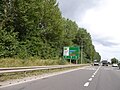
 A500 Queensway in Stoke-on-Trent - geograph.org.uk - 4569475.jpg 1,024 × 713; 218 KB
-
 Advance warning on A500 for junction with A5006 - geograph.org.uk - 5571033.jpg 1,600 × 1,200; 795 KB
-
 Allen Street, Hartshill - geograph.org.uk - 940915.jpg 457 × 640; 144 KB
-
 Allotments viewed from cemetery - geograph.org.uk - 5785603.jpg 4,032 × 3,024; 4.53 MB
-
 B5045 bridge over A500 - geograph.org.uk - 5571029.jpg 1,600 × 1,599; 956 KB
-
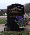 Bertram Clayton Brealey.JPG 2,376 × 2,750; 804 KB
-

-

-

-
 Bus stop on Hartshill Road - geograph.org.uk - 4991194.jpg 640 × 480; 81 KB
-
 Central Outpatients Department - geograph.org.uk - 1879748.jpg 2,048 × 1,536; 373 KB
-
 Claridge Road - geograph.org.uk - 4991228.jpg 640 × 480; 65 KB
-
 Coming in to land - geograph.org.uk - 1879771.jpg 2,048 × 1,536; 409 KB
-
 Crossroads outside Royal Stoke University Hospital - geograph.org.uk - 4313036.jpg 3,264 × 1,959; 2.32 MB
-
 Dell off Hilton Road - geograph.org.uk - 5778699.jpg 4,032 × 3,024; 4.03 MB
-
 Detached semi-detached, Hartshill - geograph.org.uk - 940909.jpg 640 × 457; 159 KB
-

-
 Footpath boundary behind Royal Stoke University Hospital - geograph.org.uk - 4328960.jpg 2,448 × 3,264; 4.91 MB
-
 Footpath boundary behind Royal Stoke University Hospital - geograph.org.uk - 4328968.jpg 3,264 × 2,448; 4.45 MB
-
 Footpath past pensioners' bungalows in Hartshill - geograph.org.uk - 5778784.jpg 4,032 × 3,024; 3.86 MB
-
 For Sale notice on Oliver Road - geograph.org.uk - 5779792.jpg 4,032 × 3,024; 3.98 MB
-
 Gate into Stoke (Hartshill) Cemetery - geograph.org.uk - 5778803.jpg 4,032 × 3,024; 4.4 MB
-
 Gitanas Public House, Hartshill - geograph.org.uk - 343827.jpg 640 × 480; 69 KB
-
 Grey day on Hartshill Road - geograph.org.uk - 4212925.jpg 1,600 × 1,200; 413 KB
-
 Harpfield Estate Ltd offices, Stoke-on-Trent.jpg 4,608 × 3,456; 3.57 MB
-
 Hartshill Road - geograph.org.uk - 5786683.jpg 2,986 × 2,300; 1.63 MB
-
 Hartshill Road - geograph.org.uk - 940920.jpg 640 × 457; 160 KB
-
 Hartshill Road looking east - geograph.org.uk - 4708710.jpg 3,264 × 2,448; 2.22 MB
-
 Hartshill Road, Hartshill - geograph.org.uk - 4994776.jpg 640 × 480; 66 KB
-
 Hartshill Road, Stoke-on-Trent (1).jpg 4,608 × 3,456; 3.51 MB
-
 Hartshill, Albany Road - geograph.org.uk - 4327911.jpg 3,264 × 2,448; 4.03 MB
-
 Hartshill, alley between Ashwell Road and Riseley Road - geograph.org.uk - 4327929.jpg 2,448 × 2,837; 2.56 MB
-
 Hartshill, Ashlands Grove - geograph.org.uk - 4457828.jpg 3,264 × 2,448; 2.39 MB
-
 Hartshill, Ashlands Road - geograph.org.uk - 4457824.jpg 3,264 × 2,448; 2.58 MB
-
 Hartshill, Balloon Street - geograph.org.uk - 4743530.jpg 2,906 × 2,141; 1.44 MB
-
 Hartshill, Bombay Club, with memorial to local roofer - geograph.org.uk - 4708673.jpg 3,264 × 2,448; 1.67 MB
-
 Hartshill, building on Stoke Old Road - geograph.org.uk - 4743579.jpg 3,264 × 2,448; 2 MB
-
 Hartshill, Cumming Street from Hartshill Road - geograph.org.uk - 4708091.jpg 3,264 × 2,448; 1.98 MB
-
 Hartshill, electricity substation on Thornburrow Drive - geograph.org.uk - 4457800.jpg 2,567 × 2,066; 2.23 MB
-
 Hartshill, footpath boundary - geograph.org.uk - 4327915.jpg 2,448 × 2,812; 3.15 MB
-
 Hartshill, Guy Hilton Research Centre (Keele University) - geograph.org.uk - 4708752.jpg 3,176 × 2,382; 1.82 MB
-
 Hartshill, Hilton House - geograph.org.uk - 4327907.jpg 3,264 × 1,965; 2.71 MB
-
 Hartshill, Hilton House Care Home - geograph.org.uk - 5128570.jpg 3,264 × 2,448; 2.08 MB
-
 Hartshill, hospital car park - geograph.org.uk - 5312926.jpg 4,032 × 3,024; 3.36 MB
-
 Hartshill, hospital car park - geograph.org.uk - 5312933.jpg 4,032 × 3,024; 4.2 MB
-
 Hartshill, houses on Hartshill Road - geograph.org.uk - 4708100.jpg 3,264 × 2,448; 2.17 MB
-
 Hartshill, junction of Albany Road and The Avenue - geograph.org.uk - 4327923.jpg 3,264 × 2,074; 2.76 MB
-
 Hartshill, lighting showroom - geograph.org.uk - 4708702.jpg 3,209 × 2,406; 1.56 MB
-
 Hartshill, lock-up garages behind Albany Grove - geograph.org.uk - 4370893.jpg 3,264 × 2,448; 3.67 MB
-
 Hartshill, Longfield Road from Albany Road - geograph.org.uk - 4328980.jpg 3,264 × 2,142; 2.83 MB
-
 Hartshill, Nelson Road - geograph.org.uk - 4708113.jpg 3,264 × 2,448; 1.83 MB
-
 Hartshill, Nirvana - geograph.org.uk - 4327934.jpg 3,100 × 1,874; 1.94 MB
-
 Hartshill, Noah's Ark - geograph.org.uk - 4708084.jpg 3,264 × 2,448; 1.61 MB
-

-
 Hartshill, Osborne Road - geograph.org.uk - 4708114.jpg 3,264 × 2,448; 2.24 MB
-
 Hartshill, Queen's Road - geograph.org.uk - 4457794.jpg 3,264 × 2,448; 2.95 MB
-
 Hartshill, road works outside the Red Lion - geograph.org.uk - 4743535.jpg 3,264 × 2,448; 1.63 MB
-
 Hartshill, Rosemary Ednam Close - geograph.org.uk - 4708110.jpg 3,206 × 2,126; 2.74 MB
-
 Hartshill, Sharman Close - geograph.org.uk - 4457888.jpg 3,260 × 2,240; 1.89 MB
-
 Hartshill, The Limes Allotments - geograph.org.uk - 4457819.jpg 3,264 × 2,448; 3.54 MB
-
 Hartshill, The Limes Allotments - geograph.org.uk - 4457833.jpg 3,264 × 2,448; 2.97 MB
-
 Hartshill, The Old House At Home - geograph.org.uk - 4370920.jpg 2,513 × 2,195; 1.51 MB
-
 Hartshill, war memorial - geograph.org.uk - 4708733.jpg 2,448 × 3,264; 2.17 MB
-
 Hilton Road - geograph.org.uk - 5779796.jpg 4,032 × 2,321; 2.8 MB
-
 Houses on Shelton New Road (B5045) - geograph.org.uk - 4991236.jpg 640 × 480; 49 KB
-
 Junction of Oliver Road and Lodge Road - geograph.org.uk - 5785610.jpg 3,596 × 2,685; 2.56 MB
-
 Junction of Wilfred Place and Queen's Road, Hartshill - geograph.org.uk - 5786656.jpg 4,032 × 3,024; 3.25 MB
-
 Junction of Yoxall Avenue and Queen's Road, Hartshill - geograph.org.uk - 5786666.jpg 4,032 × 3,024; 4.1 MB
-
 Maternity Unit, North Staffordshire Royal Infirmary - geograph.org.uk - 2464623.jpg 3,030 × 2,281; 1.81 MB
-
 Minton Cottages, Hartshill - geograph.org.uk - 940942.jpg 640 × 457; 174 KB
-
 Minton Cottages, Hartshill - geograph.org.uk - 940952.jpg 457 × 640; 183 KB
-
 Newcastle Players Theatre Workshop, Hartshill.jpg 3,456 × 4,608; 3.45 MB
-
 Newcastle-under-Lyme, Palmers Green - geograph.org.uk - 4380502.jpg 3,264 × 1,870; 2.65 MB
-
 Newcastle-under-Lyme, Palmers Green - geograph.org.uk - 4421078.jpg 2,448 × 2,481; 2.36 MB
-
 North Staffordshire Medical Institute - geograph.org.uk - 4135667.jpg 1,600 × 1,200; 334 KB
-
 North Staffordshire Royal Infirmary and car park - geograph.org.uk - 4258105.jpg 3,264 × 2,448; 3.57 MB
-
 North Staffordshire Royal Infirmary, car park - geograph.org.uk - 4457783.jpg 3,264 × 2,448; 2.13 MB
-
 North Staffordshire Royal Infirmary, Corporate Services - geograph.org.uk - 4457891.jpg 3,264 × 2,448; 2.88 MB
-
 North Staffordshire Royal Infirmary, pines and car park - geograph.org.uk - 4457773.jpg 3,264 × 2,448; 2.71 MB
-
 Occupational Therapy Department, Mosaic.JPG 3,676 × 3,049; 1.56 MB
-
 Oliver Road, Hartshill - geograph.org.uk - 5784689.jpg 4,032 × 3,024; 2.84 MB
-
 Oliver Road, Hartshill - geograph.org.uk - 5784690.jpg 3,024 × 2,706; 2.02 MB
-
 Path off Hilton Road - geograph.org.uk - 4313025.jpg 3,264 × 2,448; 4.74 MB
-
 Path Through Hartshill Park LNR - geograph.org.uk - 4155268.jpg 640 × 424; 81 KB
-
 Pond in Hartshill Park LNR - geograph.org.uk - 4155280.jpg 640 × 424; 108 KB
-
 Queen's Road, Hartshill - geograph.org.uk - 5785583.jpg 4,032 × 3,024; 3.02 MB
-
 Queen's Road, Hartshill - geograph.org.uk - 5785594.jpg 4,032 × 3,024; 4.16 MB
-
 Red Lion Public House - geograph.org.uk - 343828.jpg 640 × 480; 73 KB
-
 Royal Stoke University Hospital, cycle racks - geograph.org.uk - 4529757.jpg 3,264 × 2,448; 1.67 MB
-
 Seat in Hartshill Park - geograph.org.uk - 4155300.jpg 640 × 424; 72 KB
-

-
 Solicitors on Hartshill Road - geograph.org.uk - 4994767.jpg 640 × 480; 53 KB
-
 Stoke (Hartshill) Cemetery (10) - geograph.org.uk - 5778837.jpg 4,032 × 3,024; 4.08 MB
-
 Stoke (Hartshill) Cemetery (11) - geograph.org.uk - 5779763.jpg 4,032 × 3,024; 4.4 MB
-
 Stoke (Hartshill) Cemetery (12) - geograph.org.uk - 5779775.jpg 4,032 × 3,024; 4.93 MB
-
 Stoke (Hartshill) Cemetery (13) - geograph.org.uk - 5779779.jpg 4,032 × 3,024; 4.53 MB
-
 Stoke (Hartshill) Cemetery (14) - geograph.org.uk - 5779786.jpg 4,032 × 3,024; 4.51 MB
-
 Stoke (Hartshill) Cemetery (15) - geograph.org.uk - 5784691.jpg 4,032 × 3,024; 4.01 MB
-
 Stoke (Hartshill) Cemetery (16) - geograph.org.uk - 5784692.jpg 4,032 × 3,024; 4.54 MB
-
 Stoke (Hartshill) Cemetery (17) - geograph.org.uk - 5784693.jpg 4,032 × 3,024; 3.19 MB
-
 Stoke (Hartshill) Cemetery (2) - geograph.org.uk - 4457844.jpg 3,264 × 2,448; 3.9 MB
-
 Stoke (Hartshill) Cemetery (20) - geograph.org.uk - 5785568.jpg 4,032 × 3,024; 3.71 MB
-
 Stoke (Hartshill) Cemetery (21) - geograph.org.uk - 5785576.jpg 4,032 × 3,024; 3.86 MB
-
 Stoke (Hartshill) Cemetery (22) - geograph.org.uk - 5785598.jpg 4,032 × 3,024; 3.1 MB
-
 Stoke (Hartshill) Cemetery (23) - geograph.org.uk - 5786636.jpg 4,032 × 3,024; 4.16 MB
-
 Stoke (Hartshill) Cemetery (3) - geograph.org.uk - 4457849.jpg 3,264 × 2,448; 3.69 MB
-
 Stoke (Hartshill) Cemetery (4) - geograph.org.uk - 4457857.jpg 3,264 × 2,448; 3.69 MB
-
 Stoke (Hartshill) Cemetery (5) - geograph.org.uk - 4457881.jpg 3,264 × 2,448; 2.68 MB
-
 Stoke (Hartshill) Cemetery (6) - geograph.org.uk - 5778814.jpg 4,032 × 3,024; 4.92 MB
-
 Stoke (Hartshill) Cemetery (7) - geograph.org.uk - 5778823.jpg 4,032 × 3,024; 4.65 MB
-
 Stoke (Hartshill) Cemetery (8) - geograph.org.uk - 5778831.jpg 4,032 × 3,024; 4.87 MB
-
 Stoke (Hartshill) Cemetery (9) - geograph.org.uk - 5778833.jpg 4,032 × 3,024; 4.11 MB
-
 Stoke (Hartshill) Cemetery chapel - geograph.org.uk - 4457878.jpg 2,294 × 2,294; 1.96 MB
-
 Stoke (Hartshill) Cemetery chapels - geograph.org.uk - 4457865.jpg 3,264 × 2,448; 3.18 MB
-
 Stoke (Hartshill) Cemetery, flowerbed - geograph.org.uk - 4457871.jpg 3,264 × 2,448; 3.5 MB
-
 Stoke (Hartshill) Cemetery, Holly Lodge - geograph.org.uk - 4457839.jpg 3,123 × 2,202; 3.17 MB
-
 Stoke - Hartshill Cemetery Chapel - geograph.org.uk - 6534337.jpg 2,000 × 1,333; 2.61 MB
-
 Tesco Express - geograph.org.uk - 4991200.jpg 640 × 449; 71 KB
-
 The Former Victoria Theatre, Hartshill - geograph.org.uk - 6536947.jpg 2,000 × 1,333; 2.09 MB
-
 The Greyhound pub, George Street.jpg 4,608 × 3,456; 3.48 MB
-
 Tolkien Way sign, Stoke-on-Trent.jpg 4,608 × 3,456; 3.45 MB
-
 Tyre fitters on Hartshill Road (A52) - geograph.org.uk - 4991201.jpg 640 × 449; 51 KB
-
 Unnamed Alleyway - geograph.org.uk - 1879762.jpg 2,048 × 1,536; 1,010 KB
-
 Unnamed street - geograph.org.uk - 1879759.jpg 2,048 × 1,536; 738 KB
-
 Victoria Street - geograph.org.uk - 4991232.jpg 640 × 480; 59 KB
-

-
 Wilfred Place Drill Hall - geograph.org.uk - 3935102.jpg 1,600 × 1,064; 426 KB
-
 Wilfred Place Drill Hall - geograph.org.uk - 3935355.jpg 1,600 × 1,064; 412 KB
-
 Wilfred Place Drill Hall - geograph.org.uk - 3935359.jpg 1,600 × 1,064; 366 KB
_-_geograph.org.uk_-_2343647.jpg)


_-_geograph.org.uk_-_4991214.jpg)
_-_geograph.org.uk_-_4991216.jpg)
_-_geograph.org.uk_-_4991227.jpg)


_Cemetery_-_geograph.org.uk_-_5778803.jpg)


.jpg)


_-_geograph.org.uk_-_4708752.jpg)


_-_geograph.org.uk_-_4708765.jpg)


_-_geograph.org.uk_-_4991236.jpg)


_-_geograph.org.uk_-_4991198.jpg)

_Cemetery_(10)_-_geograph.org.uk_-_5778837.jpg)
_Cemetery_(11)_-_geograph.org.uk_-_5779763.jpg)
_Cemetery_(12)_-_geograph.org.uk_-_5779775.jpg)
_Cemetery_(13)_-_geograph.org.uk_-_5779779.jpg)
_Cemetery_(14)_-_geograph.org.uk_-_5779786.jpg)
_Cemetery_(15)_-_geograph.org.uk_-_5784691.jpg)
_Cemetery_(16)_-_geograph.org.uk_-_5784692.jpg)
_Cemetery_(17)_-_geograph.org.uk_-_5784693.jpg)
_Cemetery_(2)_-_geograph.org.uk_-_4457844.jpg)
_Cemetery_(20)_-_geograph.org.uk_-_5785568.jpg)
_Cemetery_(21)_-_geograph.org.uk_-_5785576.jpg)
_Cemetery_(22)_-_geograph.org.uk_-_5785598.jpg)
_Cemetery_(23)_-_geograph.org.uk_-_5786636.jpg)
_Cemetery_(3)_-_geograph.org.uk_-_4457849.jpg)
_Cemetery_(4)_-_geograph.org.uk_-_4457857.jpg)
_Cemetery_(5)_-_geograph.org.uk_-_4457881.jpg)
_Cemetery_(6)_-_geograph.org.uk_-_5778814.jpg)
_Cemetery_(7)_-_geograph.org.uk_-_5778823.jpg)
_Cemetery_(8)_-_geograph.org.uk_-_5778831.jpg)
_Cemetery_(9)_-_geograph.org.uk_-_5778833.jpg)
_Cemetery_chapel_-_geograph.org.uk_-_4457878.jpg)
_Cemetery_chapels_-_geograph.org.uk_-_4457865.jpg)
_Cemetery,_flowerbed_-_geograph.org.uk_-_4457871.jpg)
_Cemetery,_Holly_Lodge_-_geograph.org.uk_-_4457839.jpg)


_-_geograph.org.uk_-_4991201.jpg)


