Category:Hartley Wintney
Jump to navigation
Jump to search
village and civil parish in Hampshire, United Kingdom  | |||||
| Upload media | |||||
| Instance of | |||||
|---|---|---|---|---|---|
| Location | Hart, Hampshire, South East England, England | ||||
| Population |
| ||||
| Said to be the same as | Hartley Wintney (Wikimedia duplicated page, civil parish) | ||||
| official website | |||||
 | |||||
Subcategories
This category has the following 16 subcategories, out of 16 total.
Media in category "Hartley Wintney"
The following 200 files are in this category, out of 443 total.
(previous page) (next page)-
 A clear footpath to follow - geograph.org.uk - 3579478.jpg 640 × 425; 129 KB
-
 A dahlia in West Green House Gardens - geograph.org.uk - 4590104.jpg 1,392 × 1,500; 155 KB
-
 A path in West Green House Garden - geograph.org.uk - 4644976.jpg 1,500 × 999; 300 KB
-
 A sign of the times - geograph.org.uk - 2068690.jpg 800 × 514; 57 KB
-
 A small field of potatoes - geograph.org.uk - 2072202.jpg 640 × 480; 114 KB
-
 A swan on the lake - geograph.org.uk - 4646203.jpg 1,347 × 1,500; 74 KB
-
 A30 - Blackbushe Airport - geograph.org.uk - 2561216.jpg 640 × 435; 70 KB
-
 A30 - Phoenix Green - geograph.org.uk - 2848134.jpg 640 × 480; 71 KB
-
 A30 - Star Hill Plantation - geograph.org.uk - 2561209.jpg 640 × 403; 64 KB
-
 A30 at Phoenix Green - geograph.org.uk - 3566551.jpg 640 × 437; 117 KB
-
 A30 Hartford Bridge Flats - geograph.org.uk - 3816022.jpg 640 × 427; 84 KB
-
 A30 heading west - geograph.org.uk - 6577734.jpg 1,024 × 684; 280 KB
-
 A30 heading west - geograph.org.uk - 6577751.jpg 1,024 × 684; 346 KB
-
 A30 junction ahead near Yateley - geograph.org.uk - 3672746.jpg 800 × 658; 120 KB
-
 A30 London Road through Phoenix Green - geograph.org.uk - 4199267.jpg 640 × 427; 117 KB
-
 A30 meets the A323 from the left - geograph.org.uk - 622363.jpg 640 × 480; 89 KB
-
 A30 meets the A323 from the right - geograph.org.uk - 622357.jpg 640 × 480; 81 KB
-
 A30 southwest of Phoenix Green - geograph.org.uk - 1978800.jpg 640 × 480; 70 KB
-
 A327 heading north - geograph.org.uk - 6577760.jpg 1,024 × 684; 350 KB
-
 A327 heads north towards Eversley - geograph.org.uk - 3672799.jpg 800 × 653; 147 KB
-
 Access for cattle - River Whitewater - geograph.org.uk - 3580691.jpg 640 × 425; 188 KB
-
 Access to Blackbushe car auctions - geograph.org.uk - 2561548.jpg 640 × 385; 38 KB
-
 An allium in West Green House Garden - geograph.org.uk - 4644992.jpg 1,252 × 1,500; 237 KB
-
 An inviting cool pool - geograph.org.uk - 4233124.jpg 1,600 × 1,061; 467 KB
-
 Antique shop - Phoenix Green - geograph.org.uk - 2848139.jpg 640 × 480; 63 KB
-
 Antique shop on the A30 near Hartfordbridge - geograph.org.uk - 3699496.jpg 4,320 × 3,240; 3.33 MB
-

-
 Apples in West Green House Garden - geograph.org.uk - 4589798.jpg 999 × 1,500; 152 KB
-
 Apples in West Green House Garden - geograph.org.uk - 4644995.jpg 1,500 × 999; 135 KB
-
 Approaching harvest time - geograph.org.uk - 3580711.jpg 640 × 425; 162 KB
-
 Arrow Lane, Hartley Wintney - geograph.org.uk - 5512506.jpg 640 × 480; 190 KB
-
 Assorted cabins in a former pit - geograph.org.uk - 3579482.jpg 640 × 425; 147 KB
-
 B3013 bridge crosses the M5 - geograph.org.uk - 3813968.jpg 1,600 × 1,128; 242 KB
-
 Bakers Bridge - geograph.org.uk - 2654662.jpg 2,272 × 1,704; 3.3 MB
-
 Bakers Bridge seen from the north - geograph.org.uk - 4114416.jpg 800 × 600; 128 KB
-
 Bank, Hartley Wintney - geograph.org.uk - 4217546.jpg 569 × 640; 223 KB
-
 Banks of the River Whitewater - geograph.org.uk - 3580768.jpg 640 × 425; 193 KB
-
 Baptist Church, Hartley Wintney - geograph.org.uk - 3428132.jpg 2,287 × 1,517; 596 KB
-
 Barn with slit windows - geograph.org.uk - 2654664.jpg 2,272 × 1,704; 2.48 MB
-
 Bent farm gate - geograph.org.uk - 2072284.jpg 640 × 480; 112 KB
-
 Blackbushe Airport - geograph.org.uk - 4630799.jpg 2,560 × 1,920; 1.33 MB
-
 Blackbushes Road - geograph.org.uk - 6345353.jpg 800 × 450; 121 KB
-
 Blackbushes Road near Fleet - geograph.org.uk - 4217511.jpg 430 × 640; 312 KB
-
 Blue Chair in a Water Garden - geograph.org.uk - 6209420.jpg 1,600 × 1,039; 665 KB
-
 Borough Court Road - geograph.org.uk - 3580794.jpg 640 × 425; 187 KB
-
 Borough Court Road - geograph.org.uk - 3580796.jpg 640 × 425; 177 KB
-
 Borough Court Road at the end of Murrell Green Rd - geograph.org.uk - 4395647.jpg 2,560 × 1,920; 1.92 MB
-
 Borough Court Road at the end of Murrell Green Rd - geograph.org.uk - 4395679.jpg 2,560 × 1,920; 2.2 MB
-
 Bracknell Lane, Hartley Wintney - geograph.org.uk - 4881955.jpg 2,048 × 1,536; 1.41 MB
-
 Bracknell Lane, Hartley Wintney - geograph.org.uk - 4881961.jpg 2,048 × 1,536; 1.53 MB
-
 Bridge (Taplins Farm Lane) over the M3 - geograph.org.uk - 4158696.jpg 640 × 427; 253 KB
-
 Bridge and island pavilion - geograph.org.uk - 2515807.jpg 3,072 × 2,048; 2.33 MB
-

-
 Bridge over a drainage ditch - geograph.org.uk - 3563963.jpg 640 × 424; 117 KB
-
 Bridge over a drainage ditch - geograph.org.uk - 3563966.jpg 640 × 424; 154 KB
-
 Brightly coloured waste - geograph.org.uk - 3580719.jpg 640 × 425; 183 KB
-
 British Car Auctions, Blackbushe - geograph.org.uk - 3672692.jpg 800 × 564; 131 KB
-
 Brook by public footpath - geograph.org.uk - 5512257.jpg 640 × 480; 208 KB
-
 Bus stops on the A323 - geograph.org.uk - 4113147.jpg 800 × 600; 166 KB
-
 Callbox on Dilly Lane - geograph.org.uk - 2848147.jpg 640 × 480; 100 KB
-

-
 Cartshed at Lodge Farm, Hartley Wintney.JPG 5,428 × 3,436; 10.29 MB
-
 Cereal crop by Demale's Farm - geograph.org.uk - 3580799.jpg 640 × 425; 139 KB
-
 Cereal crop by the footpath - geograph.org.uk - 3579484.jpg 640 × 425; 158 KB
-
 Checking out Hartley Witney - geograph.org.uk - 6496560.jpg 640 × 522; 137 KB
-
 Chinese Chickens - geograph.org.uk - 6209410.jpg 5,152 × 3,864; 3.48 MB
-
 Church on Mount Pleasant - geograph.org.uk - 4113758.jpg 800 × 600; 161 KB
-
 Clear footpath through the crop - geograph.org.uk - 3580125.jpg 640 × 425; 144 KB
-
 Concrete slide - geograph.org.uk - 1814571.jpg 1,704 × 2,272; 2.94 MB
-
 Corner of a Strawberry field - geograph.org.uk - 3563960.jpg 640 × 424; 138 KB
-
 Corner of the Churchyard - geograph.org.uk - 4296137.jpg 4,000 × 3,000; 4.27 MB
-
 Cricket Pavilion - geograph.org.uk - 1814583.jpg 2,272 × 1,704; 2.34 MB
-
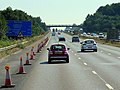
 Crossing Hartford Bridge (A30) - geograph.org.uk - 2561534.jpg 640 × 442; 51 KB
-
 Delightful spot by the Whitewater - geograph.org.uk - 3580704.jpg 640 × 425; 185 KB
-

-
 Dilly Lane - Taplin's Farm Lane - geograph.org.uk - 2831282.jpg 640 × 454; 57 KB
-
 Dilly Lane closed due roadworks - geograph.org.uk - 2514409.jpg 3,645 × 2,463; 2.05 MB
-
 Dipley Mill - geograph.org.uk - 3875411.jpg 640 × 428; 160 KB
-
 Dipley, Hampshire - geograph.org.uk - 2317301.jpg 1,800 × 1,200; 989 KB
-
 Doghouse Bridge - geograph.org.uk - 2654665.jpg 2,272 × 1,704; 3.05 MB
-
 Driving up Star Hill (A30) - geograph.org.uk - 2561526.jpg 640 × 415; 51 KB
-
 Duck pond at Hartley Wintney - geograph.org.uk - 3291982.jpg 640 × 427; 96 KB
-
 Duck pond with scarecrow. - geograph.org.uk - 1814577.jpg 2,272 × 1,704; 2.25 MB
-
 Duck Pond, Hartley Wintney - geograph.org.uk - 3428121.jpg 5,083 × 1,990; 1.74 MB
-
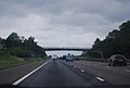
 Eastbound M3 - geograph.org.uk - 4158701.jpg 640 × 480; 265 KB
-
 Elvetham - geograph.org.uk - 846.jpg 640 × 437; 40 KB
-
 Elvetham Estate Buildings - geograph.org.uk - 4085419.jpg 4,320 × 3,240; 3.58 MB
-
 Elvetham Park, River Hart - geograph.org.uk - 4296190.jpg 4,000 × 3,000; 3.37 MB
-
 Elvetham, Hampshire - geograph.org.uk - 2922720.jpg 3,024 × 2,016; 1.17 MB
-
 Elvetham, Hants - geograph.org.uk - 2212122.jpg 3,504 × 2,336; 472 KB
-
 Elvetham, Hants - geograph.org.uk - 2212125.jpg 3,504 × 2,336; 421 KB
-
 Elvetham, Hants - geograph.org.uk - 2212129.jpg 3,504 × 2,336; 487 KB
-
 Entrance to Hartley Wintney Golf Club - geograph.org.uk - 2514418.jpg 3,643 × 2,370; 1.22 MB
-
 Entrance to the Elvetham Hotel, Hartley Wintney - geograph.org.uk - 2855396.jpg 1,600 × 1,200; 546 KB
-
 Evidence of a former weir - geograph.org.uk - 3580791.jpg 640 × 425; 187 KB
-
 Farm access Bridge, Bushy Hill, M3 - geograph.org.uk - 3032190.jpg 640 × 430; 34 KB
-
 Farm access bridge, M3 - geograph.org.uk - 2814605.jpg 640 × 344; 28 KB
-
 Farm access Bridge, M3 - geograph.org.uk - 4790575.jpg 640 × 290; 30 KB
-
 Farm track, not the footpath - geograph.org.uk - 3580109.jpg 640 × 425; 115 KB
-
 Farmer at work - adjacent to St. Mary's Churchyard - geograph.org.uk - 2749109.jpg 3,072 × 2,304; 1.67 MB
-
 Farmland in the high summer - geograph.org.uk - 3580138.jpg 640 × 425; 167 KB
-
 Farmland near St. Mary's Churchyard - geograph.org.uk - 2749066.jpg 4,000 × 3,000; 3.36 MB
-
 Field behind Damale's Farm - geograph.org.uk - 4237251.jpg 1,600 × 1,061; 627 KB
-
 Field by Fleet Road, Hartley Wintney - geograph.org.uk - 2855397.jpg 1,600 × 1,200; 567 KB
-
 Field corner - geograph.org.uk - 3580141.jpg 640 × 425; 174 KB
-
 Field near Taplin's Farm Lane - geograph.org.uk - 1927073.jpg 3,648 × 2,736; 4.59 MB
-
 Fields near Damale's Farm - geograph.org.uk - 3580792.jpg 640 × 425; 128 KB
-
 Fire Station, Hartley Wintney - geograph.org.uk - 1204593.jpg 640 × 480; 75 KB
-
 Fleet Road, Hartley Wintney - geograph.org.uk - 2855398.jpg 1,600 × 1,200; 633 KB
-
 Flowers and rhubarb in West Green House Gardens - geograph.org.uk - 4590101.jpg 1,500 × 999; 339 KB
-
 Footbridge at Dipley Mill - geograph.org.uk - 2269983.jpg 2,272 × 1,704; 2.81 MB
-
 Footbridge over River Whitewater - geograph.org.uk - 3580753.jpg 640 × 425; 189 KB
-

-

-
 Footbridge over the M3 - geograph.org.uk - 4785016.jpg 640 × 387; 37 KB
-
 Footbridge over the M3 - geograph.org.uk - 5268826.jpg 640 × 456; 47 KB
-
 Footbridge over the River Hart - geograph.org.uk - 1814559.jpg 2,272 × 1,704; 3.36 MB
-
 Footbridge over the River Hart - geograph.org.uk - 2654660.jpg 2,272 × 1,704; 2.81 MB
-
 Footpath and farm track - geograph.org.uk - 3580724.jpg 640 × 425; 154 KB
-
 Footpath approaching a former pit - geograph.org.uk - 3580722.jpg 640 × 425; 180 KB
-
 Footpath entrance at Phoenix Green - geograph.org.uk - 4199265.jpg 640 × 427; 131 KB
-
 Footpath going east from Home Farm Road - geograph.org.uk - 4114418.jpg 800 × 600; 156 KB
-
 Footpath junction on Arrow Lane - geograph.org.uk - 4112280.jpg 800 × 800; 240 KB
-
 Footpath towards River Whitewater - geograph.org.uk - 3580781.jpg 640 × 425; 207 KB
-
 Footpath turns right - geograph.org.uk - 3579486.jpg 640 × 425; 122 KB
-
 Former Methodist Chapel, Hartley Wintney - geograph.org.uk - 1993511.jpg 1,199 × 1,614; 336 KB
-
 Former Methodist Chapel, Phoenix Green - geograph.org.uk - 1993518.jpg 1,341 × 970; 286 KB
-
 Former pub, Hartfordbridge - geograph.org.uk - 6392573.jpg 1,024 × 739; 338 KB
-
 Fountains in the Paradise Garden - geograph.org.uk - 4589805.jpg 1,500 × 999; 264 KB
-
 Frosty Morning at Elvetham - geograph.org.uk - 4295998.jpg 3,736 × 2,084; 1.74 MB
-
 Glen Ample raspberry canes - geograph.org.uk - 1978810.jpg 480 × 640; 102 KB
-
 Glen Ample raspberry canes - geograph.org.uk - 2072200.jpg 640 × 480; 137 KB
-
 Golf course - geograph.org.uk - 1814574.jpg 2,272 × 1,704; 2.36 MB
-
 Gooseberry bushes - geograph.org.uk - 2072213.jpg 480 × 640; 124 KB
-
 Grass maze - geograph.org.uk - 3563968.jpg 640 × 436; 130 KB
-
 Graveyard, All Souls, Hartford Bridge - geograph.org.uk - 3428139.jpg 7,071 × 1,822; 3.31 MB
-
 Grazing field by the river - geograph.org.uk - 3580764.jpg 640 × 425; 159 KB
-
 Grazing field by the river - geograph.org.uk - 3580765.jpg 640 × 425; 139 KB
-
 Grazing land by the River Whitewater - geograph.org.uk - 3580143.jpg 640 × 425; 151 KB
-
 Great Butt hill - geograph.org.uk - 2654674.jpg 2,272 × 1,704; 3.05 MB
-
 Hampshire hedgerow - geograph.org.uk - 2072208.jpg 640 × 480; 129 KB
-
 Hart , M3 Motorway - geograph.org.uk - 6115567.jpg 6,000 × 4,000; 7.28 MB
-
 Hart , M3 Motorway - geograph.org.uk - 6115568.jpg 6,000 × 4,000; 2.95 MB
-
 Hart , M3 Motorway - geograph.org.uk - 6115569.jpg 6,000 × 4,000; 3.05 MB
-
 Hartford Automotive, Phoenix Green - geograph.org.uk - 5126617.jpg 2,048 × 1,536; 1.49 MB
-
 Hartford Bridge Flats - geograph.org.uk - 305.jpg 640 × 427; 33 KB
-
 Hartford Bridge, Hampshire - geograph.org.uk - 3428143.jpg 7,255 × 2,013; 2.12 MB
-
 Hartfordbridge, Eastbound A30 - geograph.org.uk - 5939479.jpg 1,024 × 734; 187 KB
-
 Hartley Antiques - High Street - geograph.org.uk - 6725303.jpg 1,024 × 768; 238 KB
-
 Hartley Wintney , Fleet Services - geograph.org.uk - 6624877.jpg 4,608 × 3,456; 7.46 MB
-
 Hartley Wintney , M3 Motorway - geograph.org.uk - 6624880.jpg 4,608 × 3,456; 6.74 MB
-
 Hartley Wintney , Road - geograph.org.uk - 6624875.jpg 4,608 × 3,456; 7.21 MB
-
 Hartley Wintney , Road - geograph.org.uk - 6624879.jpg 4,608 × 3,456; 7.62 MB
-
 Hartley Wintney - Ancient Milestone - geograph.org.uk - 2067221.jpg 864 × 648; 196 KB
-
 Hartley Wintney Baptist Church - geograph.org.uk - 3142854.jpg 1,716 × 1,160; 292 KB
-
 Hartley Wintney Cemetery - St Mary's - geograph.org.uk - 2749058.jpg 4,000 × 3,000; 3.61 MB
-
 Hartley Wintney Common - geograph.org.uk - 5359635.jpg 640 × 417; 139 KB
-
 Hartley Wintney fire station - geograph.org.uk - 279891.jpg 640 × 426; 188 KB
-
 Hartley Wintney Fire Station - geograph.org.uk - 5141908.jpg 2,048 × 1,536; 1.56 MB
-
 Hartley Wintney Green - geograph.org.uk - 4396518.jpg 2,560 × 1,920; 1.95 MB
-
 Hartley Wintney Green - geograph.org.uk - 5141962.jpg 2,048 × 1,536; 1.45 MB
-
 Hartley Wintney High Street - geograph.org.uk - 2514828.jpg 3,648 × 2,736; 1.83 MB
-
 Hartley Wintney pond - geograph.org.uk - 2859869.jpg 1,920 × 1,080; 969 KB
-
 Hartley Wintney Post Office - geograph.org.uk - 4395744.jpg 2,560 × 1,920; 2.07 MB
-
 Hartley Wintney Village Pond - geograph.org.uk - 621151.jpg 640 × 485; 133 KB
-

-
 Hartley Wintney, Hampshire - geograph.org.uk - 2317409.jpg 1,800 × 1,200; 975 KB
-
 Hartley Wintney, Hampshire - geograph.org.uk - 2323724.jpg 3,504 × 2,336; 888 KB
-
 Hartley Wintney, Hampshire - geograph.org.uk - 2323728.jpg 1,800 × 1,200; 962 KB
-
 Hartley Wintney, Hampshire - geograph.org.uk - 2323734.jpg 3,504 × 2,336; 739 KB
-
 Hartley Wintney, Hampshire - geograph.org.uk - 2323749.jpg 1,800 × 1,200; 989 KB
-
 Hartley Wintney, Hampshire - geograph.org.uk - 2323757.jpg 1,800 × 1,200; 953 KB
-
 Hartley Wintney, Hampshire - geograph.org.uk - 2323771.jpg 3,504 × 2,336; 970 KB
-
 Hartley Wintney, Hampshire - geograph.org.uk - 2922727.jpg 3,160 × 2,107; 929 KB
-

-
 Hartley Wintney, The Baptist Church - geograph.org.uk - 4818456.jpg 640 × 474; 62 KB
-
 Hartley Wintney, The Common - geograph.org.uk - 4818429.jpg 640 × 480; 119 KB
-

-
 Hartley Wintney.JPG 1,600 × 1,200; 425 KB
-
 Harvest time - Whitewater river valley - geograph.org.uk - 4236761.jpg 1,600 × 1,061; 441 KB
-
 Harvested oilseed rape - geograph.org.uk - 4086096.jpg 2,448 × 1,624; 3.47 MB
-
 Harvested oilseed rape - geograph.org.uk - 4086098.jpg 2,448 × 1,624; 3.16 MB
-
 Harvested oilseed rape field - geograph.org.uk - 4236760.jpg 1,600 × 1,061; 537 KB
-
 Heather on Hazeley Heath - geograph.org.uk - 5512526.jpg 640 × 480; 152 KB
-
 High Street - Hartley Wintney - geograph.org.uk - 2561539.jpg 640 × 410; 51 KB
-
 High Street at Hartley Wintney - geograph.org.uk - 3597364.jpg 1,024 × 789; 822 KB
-
 High Street Hartley Wintney - geograph.org.uk - 2855299.jpg 1,600 × 1,200; 623 KB
-
 High Street shops - geograph.org.uk - 2561204.jpg 640 × 469; 73 KB
-

-
 Houses on the green at Phoenix Green - geograph.org.uk - 4199263.jpg 640 × 427; 100 KB
-
 Ivyhole Hill - geograph.org.uk - 5512303.jpg 640 × 480; 187 KB
-
 Ivyhole Hill near Hartfordbridge - geograph.org.uk - 4217514.jpg 533 × 640; 216 KB
-
 Junction of Arrow and Bracknell Lanes - geograph.org.uk - 4113092.jpg 800 × 600; 215 KB
-
 Junction of London Road and Bracknell Lane - geograph.org.uk - 2854759.jpg 1,600 × 1,200; 540 KB
-
 Junction of London Road and Thackham's Lane - geograph.org.uk - 2856797.jpg 1,600 × 1,200; 551 KB
-
 Junction on the A323 - geograph.org.uk - 4113135.jpg 800 × 600; 157 KB
-
 Keeping everything tidy - geograph.org.uk - 3580716.jpg 640 × 425; 185 KB
-
 Kenward House, Hartley Wintney - geograph.org.uk - 4217525.jpg 640 × 599; 151 KB
-
 Lake at West Green House - geograph.org.uk - 6209422.jpg 3,769 × 2,232; 1.5 MB
-
 Lane around West Green - geograph.org.uk - 3566542.jpg 640 × 413; 140 KB


_over_the_M3_-_geograph.org.uk_-_4158696.jpg)


_-_geograph.org.uk_-_2561534.jpg)


_-_geograph.org.uk_-_2561526.jpg)


