Category:Hartington Upper Quarter
Jump to navigation
Jump to search
English: Hartington Upper Quarter is a civil parish in the High Peak district of Derbyshire, England, originating from the division of the ancient parish of Hartington into four. The parish had a population of 451 according to the 2001 census.
civil parish in Derbyshire, UK | |||||
| Upload media | |||||
| Instance of | |||||
|---|---|---|---|---|---|
| Location | High Peak, Derbyshire, East Midlands, England | ||||
 | |||||
Subcategories
This category has the following 17 subcategories, out of 17 total.
A
B
- Burbage Tunnel (7 F)
C
E
- Errwood Reservoir (112 F)
F
- Fernilee Reservoir (45 F)
G
- Goyt's Bridge (9 F)
H
- Hillhead Quarry (14 F)
- Hindlow Quarry (34 F)
- Hindlow Tunnel (2 F)
S
- Shining Tor (58 F)
- Sterndale Moor (5 F)
T
W
- Washgate Bridge (7 F)
- Windgather Rocks (27 F)
Media in category "Hartington Upper Quarter"
The following 200 files are in this category, out of 729 total.
(previous page) (next page)-
 "Here's looking at you, kid" - geograph.org.uk - 2861280.jpg 4,094 × 3,070; 3.2 MB
-
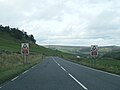
 A 54 outside Buxton - geograph.org.uk - 2389059.jpg 2,379 × 1,727; 2.09 MB
-

-
 A lane called The Street - geograph.org.uk - 2544023.jpg 640 × 480; 82 KB
-
 A new stile - geograph.org.uk - 5824362.jpg 4,896 × 3,672; 6.41 MB
-
 A patch of moorland, Goyt Valley - geograph.org.uk - 2173134.jpg 640 × 480; 70 KB
-

-
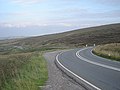
 A Sharp Road Bend on Long Hill - geograph.org.uk - 2864816.jpg 3,148 × 2,260; 1.39 MB
-
 A Track off Goyt's Lane - geograph.org.uk - 1985570.jpg 640 × 480; 70 KB
-
 A tributary of Berry Clough - geograph.org.uk - 3124409.jpg 3,872 × 2,592; 6.23 MB
-
 A tributary of the River Dane - geograph.org.uk - 3029949.jpg 640 × 427; 251 KB
-
 A5004 - geograph.org.uk - 4723487.jpg 5,184 × 3,456; 1.78 MB
-
 A515 south east passing Greatlow Farm - geograph.org.uk - 2569338.jpg 3,648 × 2,736; 2.14 MB
-
 A53 above Stanley Moor - geograph.org.uk - 6296734.jpg 1,024 × 769; 103 KB
-
 A53 at Axe Edge End - geograph.org.uk - 6296725.jpg 1,024 × 768; 112 KB
-
 A53 junction on Axe Edge - geograph.org.uk - 6296731.jpg 1,024 × 769; 80 KB
-
 A53 looking south across Stanley Moor - geograph.org.uk - 5568134.jpg 1,600 × 962; 526 KB
-
 A53 nears Brandside turn - geograph.org.uk - 6296727.jpg 1,024 × 769; 97 KB
-
 A53 on Axe Edge, with farm fields below the road - geograph.org.uk - 5568175.jpg 1,600 × 1,200; 662 KB
-
 A537 South-West of Buxton - geograph.org.uk - 5867339.jpg 1,024 × 768; 245 KB
-
 A54 at Terret Plantation - geograph.org.uk - 3514889.jpg 640 × 434; 188 KB
-
 A54 descent to Buxton - geograph.org.uk - 2858990.jpg 5,184 × 3,456; 3.67 MB
-
 A54 west of Buxton.jpg 640 × 480; 76 KB
-
 Above Thirkelow Farm - geograph.org.uk - 335853.jpg 640 × 426; 79 KB
-
 Across Burlow near Harpur Hill - geograph.org.uk - 2526135.jpg 640 × 480; 134 KB
-
 Across Shooter's Clough - geograph.org.uk - 1704039.jpg 2,272 × 1,712; 957 KB
-
 Across the fields to Harley Grange - geograph.org.uk - 2861304.jpg 3,809 × 2,857; 2.33 MB
-
 Across the moor - geograph.org.uk - 2858935.jpg 5,184 × 3,456; 2.93 MB
-
 Across the valley to Leycote. - geograph.org.uk - 6248387.jpg 1,024 × 683; 178 KB
-
 Advertising Blimp - geograph.org.uk - 5823068.jpg 4,896 × 3,672; 5.66 MB
-
 Along the Goyt Valley - geograph.org.uk - 5598070.jpg 5,152 × 3,864; 7.51 MB
-
 Along the ridge approaching Oldgate Nick - geograph.org.uk - 3511745.jpg 4,000 × 2,248; 4.98 MB
-
 Along the Ridge to Wainstones - geograph.org.uk - 4246495.jpg 427 × 640; 258 KB
-
 Ancient Track - geograph.org.uk - 4071170.jpg 2,560 × 1,920; 3.21 MB
-
 Animal feeder on Hind Low - geograph.org.uk - 3349069.jpg 3,872 × 2,592; 3.73 MB
-
 Another path, another stile - geograph.org.uk - 3511774.jpg 4,000 × 2,248; 5.12 MB
-
 Approaching Derbyshire Bridge - geograph.org.uk - 3507398.jpg 533 × 800; 139 KB
-
 Approaching the railway bridge - geograph.org.uk - 5857856.jpg 1,469 × 1,102; 401 KB
-
 Approaching Thirkelow from the south - geograph.org.uk - 5804994.jpg 5,184 × 3,675; 3.86 MB
-
 At the entrance to Buxton Raceway - geograph.org.uk - 5805041.jpg 3,649 × 4,925; 2.8 MB
-

-
 Autumn morning sunbeams in the Goyt valley - geograph.org.uk - 2240399.jpg 1,875 × 2,500; 4.21 MB
-
 Autumnal Colours near Fernilee Reservoir - geograph.org.uk - 3727771.jpg 3,808 × 2,724; 3.58 MB
-
 Back road to Buxton Raceway - geograph.org.uk - 2106243.jpg 1,024 × 768; 279 KB
-
 Bargain books at Brierlow Bar - geograph.org.uk - 2302739.jpg 1,794 × 1,052; 328 KB
-
 Barn Farm - geograph.org.uk - 4077739.jpg 4,896 × 3,672; 6.43 MB
-
 Barrier on Track to Old Workings - geograph.org.uk - 3029961.jpg 640 × 427; 268 KB
-
 Behind Errwood Hall - geograph.org.uk - 5598024.jpg 5,152 × 3,864; 7.56 MB
-
 Bend in the A5004 above the Goyt Valley - geograph.org.uk - 5539480.jpg 800 × 600; 127 KB
-
 Bend in the A54 approaching Burbage - geograph.org.uk - 5431009.jpg 1,600 × 1,200; 222 KB
-
 Bend in the concession path - geograph.org.uk - 5835822.jpg 5,184 × 3,888; 7.01 MB
-
 Bend in the road - geograph.org.uk - 1949965.jpg 640 × 480; 54 KB
-
 Bend on the A54 - geograph.org.uk - 2946907.jpg 1,280 × 853; 285 KB
-
 Berry Clough - geograph.org.uk - 1951603.jpg 640 × 480; 78 KB
-
 Berry Clough - geograph.org.uk - 3124391.jpg 3,872 × 2,592; 5.99 MB
-
 Berry Clough - geograph.org.uk - 3124445.jpg 3,872 × 2,592; 5.37 MB
-
 Berry Clough - geograph.org.uk - 3507425.jpg 800 × 533; 72 KB
-
 Berry Clough - geograph.org.uk - 4246426.jpg 640 × 480; 53 KB
-
 Bird on the wire - geograph.org.uk - 3114585.jpg 4,000 × 3,000; 2.54 MB
-
 Blackclough Farm - geograph.org.uk - 3753191.jpg 640 × 480; 75 KB
-
 Blinder House - geograph.org.uk - 2560910.jpg 1,024 × 768; 190 KB
-
 Blue sky, colourful machines - geograph.org.uk - 5823038.jpg 4,896 × 3,672; 6.79 MB
-
 Bobcats - geograph.org.uk - 5823076.jpg 4,896 × 3,672; 6.59 MB
-
 Booth Farm - geograph.org.uk - 335966.jpg 640 × 426; 66 KB
-
 Booth Farm - geograph.org.uk - 3360018.jpg 3,872 × 2,592; 3.46 MB
-
 Booth Farm - geograph.org.uk - 3887067.jpg 4,912 × 3,264; 5.68 MB
-
 Booth Farm - geograph.org.uk - 5155308.jpg 5,018 × 2,898; 1.54 MB
-
 Booth Farm and Hollin Hill - geograph.org.uk - 335970.jpg 640 × 426; 55 KB
-
 Boundary wall on Axe Edge Moor - geograph.org.uk - 5483220.jpg 1,024 × 768; 219 KB
-
 Boundary Wall, Goytsclough - geograph.org.uk - 1223040.jpg 640 × 480; 143 KB
-
 Bracken and walls - geograph.org.uk - 2173175.jpg 1,600 × 1,132; 600 KB
-
 Brand End from Thirkelow - geograph.org.uk - 335876.jpg 640 × 426; 94 KB
-
 Brand Top - geograph.org.uk - 5352057.jpg 4,286 × 3,129; 3.34 MB
-
 Brand Top Village Hall - geograph.org.uk - 2927544.jpg 640 × 427; 233 KB
-
 Bridge on Wild Moor - geograph.org.uk - 3515007.jpg 640 × 427; 241 KB
-
 Bridge over stream. - geograph.org.uk - 1740928.jpg 480 × 640; 115 KB
-
 Bridleway onto Hind Low - geograph.org.uk - 3348231.jpg 3,872 × 2,592; 3.21 MB
-
 Bridleway view of Lafarge site - geograph.org.uk - 1230389.jpg 640 × 480; 102 KB
-

-
 Brierlow Grange milestone in its setting - geograph.org.uk - 1870973.jpg 819 × 614; 187 KB
-
 Broken Wall at Cats Tor - geograph.org.uk - 3727711.jpg 4,000 × 3,000; 1.93 MB
-
 Brook at the bottom of Rake End - geograph.org.uk - 1475605.jpg 640 × 480; 118 KB
-
 Bunsal Cob - geograph.org.uk - 5674620.jpg 6,032 × 4,014; 7.5 MB
-
 Bunsall Incline - geograph.org.uk - 1256153.jpg 640 × 480; 73 KB
-
 Butterfly on cornflower - geograph.org.uk - 4082841.jpg 2,858 × 2,310; 1.08 MB
-
 Buxton , closed off railway tunnel, Wild Moor - geograph.org.uk - 6222725.jpg 1,024 × 678; 698 KB
-
 Buxton , Wild Moor - geograph.org.uk - 6222709.jpg 1,024 × 678; 633 KB
-
 Buxton , Wild Moor - geograph.org.uk - 6224130.jpg 1,024 × 678; 634 KB
-
 Buxton bus on The Cat and Fiddle Road - geograph.org.uk - 5077415.jpg 4,657 × 3,856; 4.53 MB
-
 Buxton Raceway - geograph.org.uk - 335902.jpg 640 × 426; 76 KB
-
 Buxton Raceway - geograph.org.uk - 335934.jpg 640 × 426; 81 KB
-
 Buxton Raceway seen from the perimeter fence - geograph.org.uk - 5805861.jpg 5,184 × 3,888; 5.67 MB
-
 Buxton Rugby Union Club - geograph.org.uk - 3294700.jpg 4,000 × 3,000; 2.16 MB
-
 Cairn above Berry Clough - geograph.org.uk - 2449884.jpg 1,600 × 1,062; 566 KB
-
 Calfhey Wood - geograph.org.uk - 4723490.jpg 5,184 × 3,251; 1.88 MB
-
 Cascade over orange rocks - geograph.org.uk - 3451110.jpg 1,536 × 2,048; 563 KB
-
 Cat and Fiddle Road A537 - geograph.org.uk - 5430911.jpg 3,795 × 1,813; 1.82 MB
-
 Cat and Fiddle Road looking towards The Terret - geograph.org.uk - 3513375.jpg 4,000 × 2,248; 5.07 MB
-
 Cat and Fiddle Road looking towards The Terret - geograph.org.uk - 3513378.jpg 4,000 × 2,248; 5.26 MB
-
 Cats Tor - geograph.org.uk - 3840021.jpg 4,286 × 2,806; 2.6 MB
-
 Cats Tor summit - geograph.org.uk - 5724595.jpg 1,500 × 1,000; 1.36 MB
-
 Cattle at rest near Hurdlow Town - geograph.org.uk - 5204534.jpg 3,888 × 5,184; 3.87 MB
-
 Cattle at Sterndale Hollow - geograph.org.uk - 3515139.jpg 640 × 431; 196 KB
-
 Cattle Grid - geograph.org.uk - 5823175.jpg 4,896 × 3,672; 6.34 MB
-
 Cattle Grid and gate - geograph.org.uk - 5824368.jpg 4,896 × 3,672; 6.67 MB
-
 Cattle grid near Stoop Farm - geograph.org.uk - 5835829.jpg 5,184 × 3,888; 6.53 MB
-
 Cattle on Hind Low - geograph.org.uk - 5835853.jpg 5,184 × 3,888; 6.89 MB
-
 Cheeks Hill - geograph.org.uk - 3323849.jpg 1,600 × 1,200; 918 KB
-
 Cistern's Clough - geograph.org.uk - 3036260.jpg 3,296 × 2,472; 1.36 MB
-
 Cistern's Clough - geograph.org.uk - 3364605.jpg 3,872 × 2,592; 4.6 MB
-
 Cisterns Clough - geograph.org.uk - 1571782.jpg 640 × 480; 149 KB
-
 Cisterns Clough - geograph.org.uk - 2927453.jpg 640 × 427; 252 KB
-
 Cisterns Clough and the Dove Valley - geograph.org.uk - 2927451.jpg 640 × 427; 278 KB
-
 Closed for a while - geograph.org.uk - 1951608.jpg 640 × 480; 62 KB
-
 Clover Fields Touring Caravan Park - geograph.org.uk - 1671908.jpg 640 × 480; 60 KB
-
 Coal pit on Goyt's Moss - geograph.org.uk - 1518808.jpg 640 × 479; 131 KB
-
 Cold fields near Booth Farm - geograph.org.uk - 3358602.jpg 3,872 × 2,592; 4.2 MB
-
 Combs Head - geograph.org.uk - 4070571.jpg 2,560 × 1,920; 3.92 MB
-
 Coming to a roadworks near you, soon - geograph.org.uk - 5027880.jpg 800 × 524; 171 KB
-
 Common Newt - geograph.org.uk - 4573792.jpg 640 × 480; 83 KB
-
 Concession path towards Tor Rock - geograph.org.uk - 5835818.jpg 5,184 × 3,888; 7.43 MB
-
 Conifer forest beside The Street - geograph.org.uk - 3507336.jpg 533 × 800; 177 KB
-
 Conifer plantation in the Goyt Forest - geograph.org.uk - 1780728.jpg 3,072 × 2,304; 1.34 MB
-
 Copse at Pomeroy - geograph.org.uk - 3515171.jpg 640 × 427; 250 KB
-
 Copse next to Upper Blindlow Lane - geograph.org.uk - 5447381.jpg 640 × 427; 54 KB
-
 Copse on Long Lane - geograph.org.uk - 5539477.jpg 800 × 600; 168 KB
-
 Cottage near Colshaw - geograph.org.uk - 3360064.jpg 3,872 × 2,592; 4.24 MB
-
 Cotton grass above Stake Clough - geograph.org.uk - 1951625.jpg 640 × 480; 105 KB
-
 Cotton grass on Hoo Moor - geograph.org.uk - 3507343.jpg 800 × 533; 135 KB
-
 Cow on the path to Sterndale Moor - geograph.org.uk - 3665083.jpg 3,577 × 2,555; 2.03 MB
-
 Crags on Cat's Tor - geograph.org.uk - 696104.jpg 640 × 426; 79 KB
-
 Crowhill farm - geograph.org.uk - 3476499.jpg 2,048 × 1,536; 547 KB
-
 Crumbling wall above Errwood Reservoir - geograph.org.uk - 3124524.jpg 3,872 × 2,592; 5.92 MB
-
 Crushing roller - geograph.org.uk - 5823072.jpg 4,896 × 3,672; 6.84 MB
-
 Customer support truck - geograph.org.uk - 3827156.jpg 800 × 600; 154 KB
-

-
 Dam above Errwood Reservoir - geograph.org.uk - 2967471.jpg 640 × 480; 74 KB
-
 Dane Head - geograph.org.uk - 3029946.jpg 640 × 427; 225 KB
-
 Dane Head - geograph.org.uk - 3036223.jpg 3,242 × 2,400; 1.23 MB
-
 Dane Valley Way - geograph.org.uk - 2946912.jpg 1,280 × 853; 338 KB
-
 Dane Valley Way - geograph.org.uk - 2970670.jpg 640 × 480; 76 KB
-
 Dane Valley Way near Reeve-edge Quarries - geograph.org.uk - 1571729.jpg 640 × 480; 148 KB
-
 Dane valley. - geograph.org.uk - 5455087.jpg 640 × 427; 73 KB
-
 Danger No Swimming - geograph.org.uk - 4333717.jpg 1,024 × 768; 454 KB
-
 Dark Peak landscape from near Windgather rocks - geograph.org.uk - 2267287.jpg 1,969 × 938; 1.52 MB
-
 Deep Clough - geograph.org.uk - 2923950.jpg 4,608 × 3,072; 3.22 MB
-
 Deep Clough - geograph.org.uk - 3579148.jpg 2,736 × 3,648; 4.6 MB
-
 Deep Clough - geograph.org.uk - 4180157.jpg 480 × 640; 100 KB
-
 Deep Clough Footbridge - geograph.org.uk - 1412256.jpg 480 × 640; 127 KB
-
 Deep Clough Footbridge-Signpost - geograph.org.uk - 733843.jpg 640 × 479; 153 KB
-
 Derbyshire Bridge - geograph.org.uk - 3728140.jpg 4,000 × 3,000; 2.92 MB
-
 Derbyshire Bridge over the infant River Goyt - geograph.org.uk - 5077451.jpg 4,738 × 3,732; 5.75 MB
-
 Derbyshire county boundary on A54 - geograph.org.uk - 6314844.jpg 3,060 × 2,289; 2.54 MB
-
 Derbyshire Dales in January - geograph.org.uk - 135850.jpg 640 × 483; 59 KB
-
 Derbyshire Landscape 109 365 (41525500932).jpg 3,648 × 2,430; 5.06 MB
-
 Derbyshire UK parish map highlighting Hartington Upper Quarter.svg 888 × 1,308; 2.34 MB
-
 Derelict building at the site of Buxton Quarry - geograph.org.uk - 5835637.jpg 5,184 × 3,888; 6.62 MB
-
 Descending Cats Tor on the path to Shining Tor - geograph.org.uk - 2923783.jpg 3,072 × 4,608; 3.47 MB
-
 Descending the path to Stake's Clough - geograph.org.uk - 2923947.jpg 2,903 × 4,354; 2.78 MB
-
 Descent from Staker Hill to Harpur Hill - geograph.org.uk - 3351316.jpg 3,872 × 2,592; 3.81 MB
-
 Descent to Brand Side - geograph.org.uk - 3364596.jpg 3,872 × 2,592; 4.29 MB
-
 Dismantled railway now walkway below Hillhead Quarry - geograph.org.uk - 6421795.jpg 5,184 × 2,920; 4.54 MB
-
 Distant Buxton - geograph.org.uk - 3513391.jpg 4,000 × 2,248; 4.98 MB
-
 Distant Laboratory - geograph.org.uk - 5823133.jpg 4,896 × 3,672; 6.26 MB
-
 Distant quarry face - geograph.org.uk - 5823128.jpg 4,896 × 3,672; 6.71 MB
-

-
 Disused reservoir, Staker Hill - geograph.org.uk - 1868679.jpg 794 × 595; 205 KB
-
 Dove Dale near Washgate Bridge - geograph.org.uk - 3360043.jpg 3,872 × 2,592; 3.78 MB
-
 Dove Head farm - geograph.org.uk - 5568179.jpg 1,600 × 961; 489 KB
-
 Dove Valley - geograph.org.uk - 3985204.jpg 1,350 × 1,013; 246 KB
-
 Drain outflow - geograph.org.uk - 1592545.jpg 640 × 480; 148 KB
-
 Dry Stone Wall - geograph.org.uk - 4180143.jpg 480 × 640; 80 KB
-
 Dry stone wall, Goyt Valley - geograph.org.uk - 2173164.jpg 640 × 480; 98 KB
-
 Dry stone walls on Taxal Moor - geograph.org.uk - 2441607.jpg 3,648 × 2,736; 5.44 MB
-
 Duckboards above the Goyt Valley - geograph.org.uk - 3124519.jpg 3,872 × 2,592; 6.42 MB
-

-
 Embankment on old Cromford and High Peak Railway - geograph.org.uk - 3513413.jpg 4,000 × 2,248; 5.9 MB
-
 Emerging from the woods - geograph.org.uk - 3684786.jpg 2,448 × 3,264; 3.21 MB
-
 Employee parking - geograph.org.uk - 5823103.jpg 4,896 × 3,672; 7.02 MB
-
 End of the road - geograph.org.uk - 2858975.jpg 5,184 × 3,456; 4.56 MB
-
 Entering access land - geograph.org.uk - 3709094.jpg 3,872 × 2,592; 1.94 MB
-
 Entrance kiosk at Buxton Raceway - geograph.org.uk - 5805045.jpg 4,536 × 3,488; 3.5 MB
-
 Entrance to Buxton Raceway - geograph.org.uk - 5805035.jpg 3,763 × 5,049; 3.81 MB
-

-
 Errwood footpath - geograph.org.uk - 4473267.jpg 3,648 × 2,736; 4.47 MB
-
 Ewe and lambs on Stalker Hill - geograph.org.uk - 5805067.jpg 4,861 × 3,607; 3.35 MB
-
 Excavator and sheep above Thirkelow - geograph.org.uk - 5805021.jpg 5,010 × 3,735; 4.78 MB
-
 Explosive truck - geograph.org.uk - 3827150.jpg 800 × 600; 158 KB
-
 Fairthorn - geograph.org.uk - 3364897.jpg 3,872 × 2,592; 4.53 MB
-
 Farm ruins and spaniel south of The Street - geograph.org.uk - 2923734.jpg 3,921 × 2,941; 2.73 MB
-
 Fence and Knoll - geograph.org.uk - 4185525.jpg 640 × 480; 69 KB
-
 Fence and stile, near Fough - geograph.org.uk - 2252483.jpg 3,648 × 2,736; 5.85 MB
-
 Fenceline in Cistern's Clough - geograph.org.uk - 3985045.jpg 402 × 660; 53 KB
-
 Fernilee Reservoir is out of sight - geograph.org.uk - 5541778.jpg 5,376 × 3,024; 3.52 MB
-
 Field of cows near Brierlow Bar - geograph.org.uk - 5835625.jpg 5,182 × 2,915; 4.48 MB
-
 Fields between Hind Low and Brier Low - geograph.org.uk - 3348223.jpg 3,872 × 2,592; 3.96 MB
-
 Fields Near Greatlow - geograph.org.uk - 5452921.jpg 640 × 427; 65 KB
-
 Fields near Greensides - geograph.org.uk - 5835840.jpg 5,184 × 3,888; 6.02 MB
-
 Fields near Greensides - geograph.org.uk - 5835841.jpg 5,184 × 3,888; 5.71 MB
-
 Fields near Hindlow Quarry - geograph.org.uk - 4185920.jpg 3,830 × 2,723; 2.51 MB


.jpg)


