Category:Hart Station
Jump to navigation
Jump to search
English: Hart Station is a place in County Durham, in England. It is situated to the north west of Hartlepool, near West View.
suburb of Hartlepool, County Durham, England, UK  | |||||
| Upload media | |||||
| Instance of | |||||
|---|---|---|---|---|---|
| Location | Hartlepool, County Durham, North East England, England | ||||
 | |||||
Media in category "Hart Station"
The following 70 files are in this category, out of 70 total.
-
 A playing field off Easington Road - geograph.org.uk - 3330480.jpg 800 × 517; 68 KB
-
 A1049 heading west - geograph.org.uk - 2820908.jpg 640 × 480; 59 KB
-
 Beach and dunes at North Sands - geograph.org.uk - 5663855.jpg 800 × 516; 76 KB
-
 Club house at Hartlepool Golf Club - geograph.org.uk - 5663856.jpg 800 × 535; 124 KB
-
 Club House, Hartlepool Golf Club - geograph.org.uk - 4744882.jpg 640 × 480; 454 KB
-
 Coastline near Black Halls - geograph.org.uk - 488092.jpg 640 × 480; 107 KB
-
 Crimdon Beck and Hart Warren Dunes - geograph.org.uk - 4744890.jpg 640 × 480; 386 KB
-
 Davison Drive heading south - geograph.org.uk - 2820916.jpg 640 × 480; 49 KB
-
 Developing site, Hartlepool - geograph.org.uk - 3000463.jpg 640 × 441; 116 KB
-
 Dunes and beach south of Crimdon Park - geograph.org.uk - 4687570.jpg 640 × 480; 103 KB
-
 Dunes and North Sands - geograph.org.uk - 4687569.jpg 640 × 480; 81 KB
-
 Dunes by Hart Warren - geograph.org.uk - 4686766.jpg 640 × 480; 69 KB
-
 Durham Coast Line Hart Station 04 03 2016.jpg 640 × 480; 209 KB
-
 England Coast Path at Hart Warren - geograph.org.uk - 5663844.jpg 800 × 600; 136 KB
-
 Entrance to West View Cemetery in Hartlepool - geograph.org.uk - 3556919.jpg 3,648 × 2,736; 2.76 MB
-
 Footbridge at Hart Station - geograph.org.uk - 4744867.jpg 480 × 640; 438 KB
-

-
 Footbridge in the Hart Warren Dunes - geograph.org.uk - 4744892.jpg 640 × 480; 419 KB
-

-
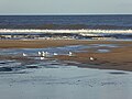 Gulls on North Sands - geograph.org.uk - 4744872.jpg 640 × 480; 375 KB
-
 Hart road - geograph.org.uk - 215282.jpg 640 × 479; 42 KB
-
 Hart station site geograph-3614176-by-Ben-Brooksbank.jpg 2,419 × 1,401; 3.76 MB
-
 Hart Warren Dunes - geograph.org.uk - 4744886.jpg 640 × 480; 391 KB
-
 Hartlepool Golf Club at Hart Warren - geograph.org.uk - 5663836.jpg 800 × 501; 122 KB
-
 Hartlepool Rugby Club - geograph.org.uk - 2822276.jpg 640 × 411; 59 KB
-
 Hartlepool to Newcastle railway line - geograph.org.uk - 3028930.jpg 2,848 × 2,144; 2.47 MB
-
 Holy Trinity Church - geograph.org.uk - 2820914.jpg 640 × 480; 66 KB
-
 Horse rider at North Sands, Hartlepool - geograph.org.uk - 5517724.jpg 800 × 743; 124 KB
-
 Houses on Formby Close - geograph.org.uk - 2821004.jpg 640 × 480; 59 KB
-
 Houses on West View Road - geograph.org.uk - 2820899.jpg 640 × 480; 83 KB
-
 John Howe Gardens, Hartlepool - geograph.org.uk - 2097991.jpg 640 × 480; 63 KB
-
 Jones Road and Lightfoot Crescent - geograph.org.uk - 1919049.jpg 3,648 × 2,736; 2.77 MB
-
 Land beside Hart Road - geograph.org.uk - 2820996.jpg 640 × 480; 93 KB
-
 New build housing - geograph.org.uk - 2820998.jpg 640 × 480; 59 KB
-
 New Development, Hartlepool - geograph.org.uk - 2097871.jpg 640 × 480; 51 KB
-
 North Sands (2) - geograph.org.uk - 4687575.jpg 640 × 480; 66 KB
-
 North Sands - geograph.org.uk - 4687571.jpg 640 × 480; 78 KB
-

-
 North Sands by Hart Warren (2) - geograph.org.uk - 4686748.jpg 640 × 480; 58 KB
-
 North Sands by Hart Warren (3) - geograph.org.uk - 4686756.jpg 640 × 480; 59 KB
-
 North Sands by Hart Warren - geograph.org.uk - 4686746.jpg 640 × 480; 48 KB
-
 Path through the dunes - geograph.org.uk - 5663845.jpg 800 × 600; 131 KB
-

-
 Pipeline on the beach at North Sands - geograph.org.uk - 5663748.jpg 794 × 800; 160 KB
-
 Pool on North Sands - geograph.org.uk - 4744901.jpg 640 × 480; 466 KB
-
 Pool on North Sands - geograph.org.uk - 4744905.jpg 640 × 480; 361 KB
-
 Railway footbridge - geograph.org.uk - 1298441.jpg 640 × 480; 67 KB
-
 Ridlington Way, West View - geograph.org.uk - 2728590.jpg 640 × 480; 98 KB
-
 Road junction near West View (TS24) - geograph.org.uk - 1877906.jpg 3,088 × 2,056; 3.36 MB
-
 Roundabout in Hart Station geograph-1877883-by-Philip-Barker.jpg 3,088 × 2,056; 3.08 MB
-
 Sainsbury's on Bishop Cuthbert Estate, Hartlepool - geograph.org.uk - 1887541.jpg 2,048 × 1,536; 628 KB
-
 Stream and Hart Warren Dunes - geograph.org.uk - 4744896.jpg 640 × 480; 419 KB
-
 Stream and pool on North Sands - geograph.org.uk - 4744894.jpg 640 × 480; 422 KB
-
 The A179 eastbound towards Hartlepool - geograph.org.uk - 3556903.jpg 3,648 × 2,736; 1.81 MB
-

-
 The Saxon on Easington Road - geograph.org.uk - 3330478.jpg 800 × 600; 95 KB
-
 Tracks on North Sands - geograph.org.uk - 4744909.jpg 480 × 640; 384 KB
-
 Blue House Gill - geograph.org.uk - 488110.jpg 480 × 640; 127 KB
-
 Blue House Gill - geograph.org.uk - 604917.jpg 640 × 480; 64 KB
-
 Cliffs near Blackhall Rocks - geograph.org.uk - 1424355.jpg 640 × 480; 91 KB
-

-
 Crimdon Beach - geograph.org.uk - 361529.jpg 480 × 640; 76 KB
-
 Crimdon Beck Mouth - geograph.org.uk - 1407541.jpg 640 × 480; 45 KB
-
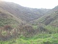
 Crimdon Dene - geograph.org.uk - 260770.jpg 640 × 366; 42 KB
-
 Dunes at Crimdon - geograph.org.uk - 260761.jpg 640 × 405; 57 KB
-
 Fungus growing on the dunes - geograph.org.uk - 260773.jpg 414 × 414; 38 KB
-
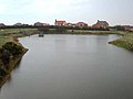 Hart Reservoir, looking east - geograph.org.uk - 279220.jpg 640 × 480; 42 KB
-
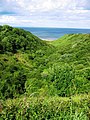
 Hart Warren Dunes Nature Reserve - geograph.org.uk - 482876.jpg 640 × 480; 94 KB
-
 Looking across Hart Road - geograph.org.uk - 215280.jpg 640 × 479; 37 KB
-
 Oystercatchers feeding,Durham coast - geograph.org.uk - 604924.jpg 640 × 480; 62 KB


_-_geograph.org.uk_-_4687575.jpg)


_-_geograph.org.uk_-_4686748.jpg)
_-_geograph.org.uk_-_4686756.jpg)


_-_geograph.org.uk_-_1877906.jpg)


