Category:Harrisville Rural District
Jump to navigation
Jump to search
historic district in Harrisville, New Hampshire  | |||||
| Upload media | |||||
| Instance of | |||||
|---|---|---|---|---|---|
| Location | Harrisville, Cheshire County, New Hampshire | ||||
| Heritage designation | |||||
 | |||||
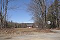
Harrisville Rural District, Harrisville, New Hampshire, extends from Mason Road in the west to Bonds Corner Rd and Lampman Rd in the east, bounded on the south by the town line with Dublin and to the north by properties on the north side of Mason and Venable Rds.
Media in category "Harrisville Rural District"
The following 2 files are in this category, out of 2 total.
-
 Harrisville RuralDistrict 1.jpg 1,024 × 680; 199 KB
-
 Harrisville RuralDistrict 2.jpg 1,024 × 680; 212 KB
