Category:Harpham
Jump to navigation
Jump to search
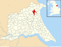
English: Harpham is a small village and civil parish in the East Riding of Yorkshire, England. It is located just south of the A614 road, approximately 5 miles (8 km) north east of Driffield and 7 miles (11 km) south west of Bridlington.
village in East Riding of Yorkshire, England, UK  | |||||
| Upload media | |||||
| Instance of | |||||
|---|---|---|---|---|---|
| Location | East Riding of Yorkshire, Yorkshire and the Humber, England | ||||
| Population |
| ||||
| Said to be the same as | Harpham (Wikimedia duplicated page, civil parish) | ||||
 | |||||
Subcategories
This category has the following 3 subcategories, out of 3 total.
Media in category "Harpham"
The following 200 files are in this category, out of 419 total.
(previous page) (next page)-
 A bend in the A614 - geograph.org.uk - 4356853.jpg 640 × 480; 71 KB
-
 A bridleway towards Woodside Farm - geograph.org.uk - 2748087.jpg 800 × 600; 163 KB
-
 A building to the north of Harpham.jpg 640 × 469; 488 KB
-
 A distant view of Burton Agnes Hall - geograph.org.uk - 5552048.jpg 800 × 600; 108 KB
-
 A field in Gransmoor Wood - geograph.org.uk - 4795943.jpg 4,608 × 3,456; 4.03 MB
-
 A footpath to Lowthorpe - geograph.org.uk - 2748252.jpg 800 × 600; 210 KB
-
 A green lane^ - geograph.org.uk - 2096041.jpg 1,024 × 768; 223 KB
-
 A narrow Moor Lane with passing places - geograph.org.uk - 4497692.jpg 1,024 × 697; 123 KB
-
 A path from Station Road to Harpham - geograph.org.uk - 2748271.jpg 800 × 600; 74 KB
-
 A road junction on Moor Lane - geograph.org.uk - 2748077.jpg 800 × 565; 69 KB
-
 A rural signpost - geograph.org.uk - 4795923.jpg 4,608 × 3,456; 4.96 MB
-
 A thin Plantation across the field - geograph.org.uk - 3369658.jpg 4,000 × 3,000; 2.76 MB
-
 A614 - geograph.org.uk - 5429771.jpg 640 × 426; 48 KB
-
 A614 heading south west - geograph.org.uk - 4356779.jpg 640 × 480; 75 KB
-
 A614 heading south west - geograph.org.uk - 4362348.jpg 640 × 480; 68 KB
-

-
 A614 south of Ruston Parva - geograph.org.uk - 4591280.jpg 1,600 × 1,067; 1.07 MB
-
 A614 to the east of Bracey Bridge - geograph.org.uk - 2165080.jpg 800 × 600; 187 KB
-
 A614 towards Driffield - geograph.org.uk - 4356788.jpg 640 × 480; 67 KB
-
 A614 towards Driffield - geograph.org.uk - 4356901.jpg 640 × 480; 101 KB
-
 A614 towards Driffield - geograph.org.uk - 4357039.jpg 640 × 480; 72 KB
-
 A614 towards Driffield - geograph.org.uk - 4361749.jpg 640 × 480; 67 KB
-
 A614 towards Driffield - geograph.org.uk - 4362344.jpg 640 × 480; 86 KB
-
 A614 towards Driffield - geograph.org.uk - 4362370.jpg 640 × 480; 81 KB
-
 A614 towards Driffield - geograph.org.uk - 4365984.jpg 640 × 480; 48 KB
-
 A614 towards Driffield - geograph.org.uk - 4368024.jpg 640 × 480; 84 KB
-

-
 A614, Bracey Bridge - geograph.org.uk - 5429769.jpg 640 × 394; 67 KB
-
 Agricultural buildings - geograph.org.uk - 2096131.jpg 1,024 × 768; 124 KB
-
 Allotment or garden^ - geograph.org.uk - 5427693.jpg 640 × 426; 65 KB
-
 An empty house on Out Gates (road) - geograph.org.uk - 2562509.jpg 800 × 600; 298 KB
-
 Approaching bends on the A614 - geograph.org.uk - 4356847.jpg 640 × 480; 63 KB
-
 Approaching Harpham Crossing - geograph.org.uk - 4257052.jpg 1,024 × 768; 274 KB
-
 Approaching the turn off for Harpham - geograph.org.uk - 4356768.jpg 640 × 480; 63 KB
-
 Autumn in Lowthorpe churchyard - geograph.org.uk - 4257036.jpg 1,024 × 768; 274 KB
-
 Bare field off Harpham Lane - geograph.org.uk - 2096118.jpg 1,024 × 768; 173 KB
-
 Barn conversion on Main Street, Harpham - geograph.org.uk - 6450096.jpg 5,184 × 3,888; 6.88 MB
-

-
 Bathclose Farm, Lowthorpe - geograph.org.uk - 4259570.jpg 1,024 × 768; 122 KB
-
 Bracey Bridge Mill - geograph.org.uk - 6285579.jpg 1,024 × 768; 154 KB
-
 Bracey Bridge Mill, East Yorkshire - geograph.org.uk - 720136.jpg 640 × 445; 193 KB
-
 Bracey Garth Plantation - geograph.org.uk - 4356797.jpg 640 × 480; 103 KB
-
 Bridge over a drain near Millingdale Farm - geograph.org.uk - 4256715.jpg 1,024 × 768; 162 KB
-
 Bridge over White Dike - geograph.org.uk - 4284790.jpg 640 × 480; 78 KB
-
 Bridleway to Burton Agnes - geograph.org.uk - 5945877.jpg 1,024 × 768; 239 KB
-
 Bridleway to Burton Agnes - geograph.org.uk - 5945884.jpg 1,024 × 752; 209 KB
-
 Bridleway to Lowthorpe Beck - geograph.org.uk - 2096038.jpg 1,024 × 768; 100 KB
-
 Buildings at Millingdale Farm - geograph.org.uk - 2562385.jpg 800 × 600; 320 KB
-
 Burntmill Bridge (Footbridge) - geograph.org.uk - 3369691.jpg 4,000 × 3,000; 4.11 MB
-
 Bus stop on the A614 - geograph.org.uk - 4362375.jpg 640 × 480; 87 KB
-
 Butt Balk the lane from Harpham to the A164 - geograph.org.uk - 3368011.jpg 4,000 × 3,000; 2.14 MB
-
 Chalkstone cottage - geograph.org.uk - 4259759.jpg 1,024 × 768; 176 KB
-
 Chalky field entrance - geograph.org.uk - 2096060.jpg 1,024 × 768; 137 KB
-
 Church of St. Martin, Chancel East Wall interior - geograph.org.uk - 4258310.jpg 1,024 × 768; 262 KB
-

-

-
 Church of St. Martin, Lowthorpe - geograph.org.uk - 4259561.jpg 1,024 × 768; 177 KB
-
 Church of St. Nicholas, Ruston Parva - geograph.org.uk - 5730234.jpg 1,024 × 768; 204 KB
-

-
 Church of St.Martin - geograph.org.uk - 6285581.jpg 1,024 × 768; 234 KB
-
 Churchyard trees, Harpham - geograph.org.uk - 2094917.jpg 1,024 × 768; 121 KB
-
 Cottage and path, Ruston Parva - geograph.org.uk - 5728034.jpg 1,024 × 768; 259 KB
-
 Cottages on East End - geograph.org.uk - 4360152.jpg 640 × 480; 99 KB
-
 Cottages on Station Road, Harpham - geograph.org.uk - 6453431.jpg 800 × 600; 93 KB
-
 Crop field and hedgerow - geograph.org.uk - 4362345.jpg 640 × 480; 59 KB
-
 Crop field and hedgerow, Hall Flats - geograph.org.uk - 4356755.jpg 640 × 480; 84 KB
-

-
 Crop field east of White Dike - geograph.org.uk - 4284864.jpg 640 × 480; 102 KB
-
 Crop field near White Dike - geograph.org.uk - 4284756.jpg 640 × 480; 55 KB
-
 Crop field off the A614 - geograph.org.uk - 4356905.jpg 640 × 480; 54 KB
-
 Crop field, Bardales - geograph.org.uk - 4368023.jpg 640 × 366; 33 KB
-
 Crop field, Bracey Bridge - geograph.org.uk - 4356827.jpg 640 × 480; 76 KB
-
 Crop field, Nafferton Carrs - geograph.org.uk - 4284771.jpg 640 × 480; 84 KB
-
 Crop field, Nafferton Carrs - geograph.org.uk - 4284774.jpg 640 × 480; 86 KB
-
 Crop field, Nafferton Carrs - geograph.org.uk - 4284970.jpg 640 × 480; 105 KB
-
 Crops, Holderness - geograph.org.uk - 5416092.jpg 640 × 426; 42 KB
-
 Crops, Holderness - geograph.org.uk - 5416864.jpg 640 × 426; 30 KB
-
 Crossing East of Harpham - geograph.org.uk - 142930.jpg 640 × 480; 151 KB
-
 Crossroads near Harpham - geograph.org.uk - 2096051.jpg 1,024 × 768; 100 KB
-
 Dagett Lane, Harpham, East Riding - geograph.org.uk - 2116387.jpg 1,600 × 1,200; 459 KB
-
 Daggett Lane, Harpham - geograph.org.uk - 2094900.jpg 1,024 × 768; 121 KB
-
 Daggett Lane, Harpham - geograph.org.uk - 462877.jpg 640 × 442; 101 KB
-
 Ditch, Holderness - geograph.org.uk - 5416106.jpg 640 × 426; 42 KB
-
 Downhill stretch of the A614 - geograph.org.uk - 4356881.jpg 640 × 480; 75 KB
-
 Drain into White Dike - geograph.org.uk - 4284786.jpg 640 × 480; 73 KB
-
 Drain near Millingdale Farm - geograph.org.uk - 4260411.jpg 1,024 × 768; 147 KB
-
 Drain near Millingdale Farm - geograph.org.uk - 5726417.jpg 1,024 × 768; 161 KB
-
 Drummer's Well - geograph.org.uk - 4257050.jpg 1,024 × 768; 207 KB
-
 East End Farm Harpham.jpg 640 × 459; 79 KB
-
 East End Farm, Harpham - geograph.org.uk - 4259949.jpg 1,024 × 705; 95 KB
-
 East End, Harpham - geograph.org.uk - 5431905.jpg 640 × 468; 86 KB
-
 Elizabeth II postbox, Lowthorpe - geograph.org.uk - 6450131.jpg 450 × 800; 136 KB
-
 Elizabeth II postbox, Ruston Parva - geograph.org.uk - 6449264.jpg 305 × 640; 43 KB
-
 End of the road, Cattlehomes - geograph.org.uk - 4284815.jpg 640 × 480; 62 KB
-
 Entering Ruston Parva - geograph.org.uk - 3369561.jpg 4,000 × 3,000; 2.65 MB
-

-
 Entrance to St Martin's church Lowthorpe - geograph.org.uk - 4497915.jpg 1,024 × 768; 320 KB
-
 Estate cottages, Lowthorpe - geograph.org.uk - 4258272.jpg 1,024 × 768; 209 KB
-
 Exercising the animals - geograph.org.uk - 4260395.jpg 1,024 × 768; 135 KB
-
 Fallow field - geograph.org.uk - 5416114.jpg 640 × 426; 31 KB
-

-
 Farm road to Thornholme Moor Farm - geograph.org.uk - 4795910.jpg 4,608 × 3,456; 3.68 MB
-
 Farm track crossing - geograph.org.uk - 5427699.jpg 640 × 426; 48 KB
-
 Farm Track near the Elms - geograph.org.uk - 1256758.jpg 640 × 480; 111 KB
-
 Farmland - geograph.org.uk - 5416758.jpg 640 × 426; 33 KB
-
 Farmland and hedgerow - geograph.org.uk - 4356783.jpg 640 × 480; 56 KB
-
 Farmland and manure heap - geograph.org.uk - 4356774.jpg 640 × 480; 85 KB
-
 Farmland near Airy Hill Farm - geograph.org.uk - 4356898.jpg 640 × 480; 71 KB
-
 Farmland near Harpham - geograph.org.uk - 1256971.jpg 640 × 480; 100 KB
-
 Farmland near Harpman Crossing - geograph.org.uk - 5427680.jpg 640 × 296; 16 KB
-

-
 Farmland off Sandy Lane - geograph.org.uk - 1256986.jpg 640 × 480; 89 KB
-
 Farmland, Cattleholmes - geograph.org.uk - 4284805.jpg 640 × 480; 42 KB
-
 Farmland, Hall Flats - geograph.org.uk - 4362342.jpg 640 × 480; 84 KB
-
 Farmland, Hall Flats - geograph.org.uk - 4365983.jpg 640 × 480; 77 KB
-
 Farmland, Sykes - geograph.org.uk - 4356784.jpg 640 × 480; 70 KB
-
 Field boundary, Harpham Moor - geograph.org.uk - 4257062.jpg 1,024 × 768; 145 KB
-
 Field edge and beacon near Ruston Parva - geograph.org.uk - 5728044.jpg 1,024 × 768; 177 KB
-
 Field entrance ff the A614 - geograph.org.uk - 4362372.jpg 640 × 480; 110 KB
-
 Field entrance off the A614 - geograph.org.uk - 4356841.jpg 640 × 399; 49 KB
-
 Field entrance off the A614 - geograph.org.uk - 4356921.jpg 640 × 480; 75 KB
-
 Field footpath to Kilham - geograph.org.uk - 3368045.jpg 4,000 × 3,000; 3.14 MB
-
 Field in the centre of the village, Ruston Parva - geograph.org.uk - 5730344.jpg 1,024 × 768; 249 KB
-
 Field on Harpham Moor - geograph.org.uk - 4257060.jpg 1,024 × 768; 142 KB
-
 Field, Sleights Farm - geograph.org.uk - 5367689.jpg 640 × 426; 51 KB
-
 Fields and hedgerow - geograph.org.uk - 4361224.jpg 640 × 480; 91 KB
-
 Flat farmland - geograph.org.uk - 5365043.jpg 640 × 426; 34 KB
-
 Flat farmland, Bardales - geograph.org.uk - 4356775.jpg 640 × 480; 76 KB
-
 Flat farmland, Nafferton Carrs - geograph.org.uk - 4284791.jpg 640 × 480; 58 KB
-
 Flat scenery - geograph.org.uk - 5416756.jpg 640 × 426; 29 KB
-
 Footpath across the village - geograph.org.uk - 2094883.jpg 1,024 × 768; 203 KB
-
 Footpath alongside Church Wood - geograph.org.uk - 3369635.jpg 4,000 × 3,000; 2.98 MB
-
 Footpath and shadow over High Field - geograph.org.uk - 3368036.jpg 4,000 × 3,000; 2.92 MB
-

-
 Footpath over Middle Field to Kilham - geograph.org.uk - 3368024.jpg 4,000 × 3,000; 3.54 MB
-
 Footpath to Harpham - geograph.org.uk - 4259566.jpg 1,024 × 768; 184 KB
-
 Footpath to Harpham - geograph.org.uk - 4259575.jpg 1,024 × 768; 195 KB
-
 Footpath to Harpham and Kilham - geograph.org.uk - 4258277.jpg 768 × 1,024; 119 KB
-
 Footpath to Lowthorpe - geograph.org.uk - 3369666.jpg 4,000 × 3,000; 2.69 MB
-
 Footpath to Sandy Lane - geograph.org.uk - 5945861.jpg 1,024 × 768; 293 KB
-
 Footpath to Station Road - geograph.org.uk - 3369675.jpg 4,000 × 3,000; 3.15 MB
-
 Former Chapel, Harpham - geograph.org.uk - 6341858.jpg 5,456 × 3,632; 7.6 MB
-
 Foston Beck from Lowthorpe Bridge - geograph.org.uk - 3058577.jpg 3,264 × 2,448; 2.32 MB
-
 Gate across Out Gates - geograph.org.uk - 4259961.jpg 1,024 × 768; 190 KB
-
 Gated field entrance - geograph.org.uk - 2096048.jpg 1,024 × 768; 138 KB
-

-
 George VI postbox, Main Street, Harpham - geograph.org.uk - 6341863.jpg 3,632 × 5,456; 6.02 MB
-

-
 Grazing near Outgate Farm - geograph.org.uk - 6453526.jpg 800 × 535; 85 KB
-
 Grazing, North Cattleholmes - geograph.org.uk - 4284824.jpg 640 × 480; 65 KB
-
 Grazing, Ruston Parva - geograph.org.uk - 6449266.jpg 5,184 × 3,888; 5.67 MB
-
 Green Lane - geograph.org.uk - 1240843.jpg 640 × 480; 57 KB
-
 Green Lane - geograph.org.uk - 142899.jpg 640 × 480; 96 KB
-
 Green Lane - geograph.org.uk - 5945864.jpg 1,024 × 768; 255 KB
-
 Hall Garth Farm, Harpham - geograph.org.uk - 4259769.jpg 1,024 × 768; 202 KB
-

-
 Harpham Crossing - geograph.org.uk - 4259970.jpg 1,024 × 768; 230 KB
-
 Harpham Crossing - geograph.org.uk - 462827.jpg 471 × 640; 114 KB
-
 Harpham Crossing - geograph.org.uk - 462833.jpg 473 × 640; 163 KB
-
 Harpham Field - geograph.org.uk - 1240853.jpg 640 × 480; 72 KB
-
 Harpham Field - geograph.org.uk - 142901.jpg 640 × 480; 110 KB
-
 Harpham Grange - geograph.org.uk - 142914.jpg 640 × 480; 101 KB
-
 Harpham Grange - geograph.org.uk - 4356751.jpg 640 × 367; 62 KB
-
 Harpham Grange - geograph.org.uk - 463162.jpg 640 × 443; 92 KB
-
 Harpham Grange - geograph.org.uk - 720208.jpg 640 × 298; 116 KB
-
 Harpham Lane - geograph.org.uk - 1240848.jpg 640 × 480; 44 KB
-
 Harpham Lane - geograph.org.uk - 2096069.jpg 1,024 × 768; 126 KB
-
 Harpham Lane - geograph.org.uk - 2096115.jpg 1,024 × 768; 156 KB
-
 Harpham Lane into Kilham - geograph.org.uk - 3368052.jpg 4,000 × 3,000; 3 MB
-
 Harpham Plump - geograph.org.uk - 6285565.jpg 1,024 × 768; 118 KB
-
 Harpham Plump from Green Lane - geograph.org.uk - 142956.jpg 640 × 480; 98 KB
-
 Harpham Pump - geograph.org.uk - 5945869.jpg 1,024 × 768; 153 KB
-
 Harpham UK parish locator map.svg 1,425 × 1,107; 1.68 MB
-
 Harpham village entrance sign - geograph.org.uk - 2271264.jpg 640 × 480; 37 KB
-
 Harpham village notice board - geograph.org.uk - 2748244.jpg 800 × 600; 141 KB
-
 Harpham(StephenHorncastle)Mar2006.jpg 640 × 480; 107 KB
-
 Harpman level crossing - geograph.org.uk - 5552045.jpg 1,024 × 768; 741 KB
-
 Heading for Lowthorpe from Nafferton - geograph.org.uk - 3370172.jpg 4,000 × 3,000; 2.72 MB
-
 Heading for the summit - geograph.org.uk - 2096058.jpg 1,024 × 768; 124 KB
-
 Hedge near Sleights Farm - geograph.org.uk - 5427701.jpg 640 × 426; 56 KB
-
 Hedge overwhelmed by Old Man's Beard - geograph.org.uk - 4260417.jpg 1,024 × 768; 174 KB
-
 Hedgerow on Sykes Balk - geograph.org.uk - 1256929.jpg 640 × 480; 104 KB
-
 Hedgerow tree - geograph.org.uk - 2096055.jpg 1,024 × 768; 140 KB
-
 Hedgerow tree - geograph.org.uk - 2096072.jpg 1,024 × 768; 135 KB
-
 Hedgerow trees - geograph.org.uk - 2096056.jpg 1,024 × 768; 112 KB
-
 High Field (Harpham Field) - geograph.org.uk - 2096063.jpg 1,024 × 768; 108 KB
-
 Holderness farmland - geograph.org.uk - 5367683.jpg 640 × 426; 41 KB
-
 Holderness farmland near Kelk Beck - geograph.org.uk - 5367660.jpg 640 × 426; 51 KB
-
 House in Ruston Parva - geograph.org.uk - 6449265.jpg 5,184 × 3,888; 6.23 MB
-
 House on End End, Harpham - geograph.org.uk - 6341861.jpg 5,456 × 3,632; 6.07 MB
-
 House on Out Gates - geograph.org.uk - 6453532.jpg 800 × 551; 101 KB
-
 Houses on Main Street, Harpham - geograph.org.uk - 6342122.jpg 5,456 × 3,632; 4 MB
-
 Houses, Lowthorpe - geograph.org.uk - 6450134.jpg 640 × 458; 74 KB
-
 Into the sun on Harpham Lane - geograph.org.uk - 6285568.jpg 1,024 × 768; 244 KB
-
 Jerry Plantation - geograph.org.uk - 4257030.jpg 1,024 × 768; 171 KB
-
 Jerry Plantation - geograph.org.uk - 5367682.jpg 640 × 426; 42 KB
-
 Jerry Plantation - geograph.org.uk - 5427696.jpg 640 × 426; 45 KB
-
 Junction ahead on Moor Lane - geograph.org.uk - 4497691.jpg 1,024 × 698; 102 KB
-
 Junction of paths - geograph.org.uk - 4257040.jpg 1,024 × 768; 192 KB
-
 Kelk Beck - geograph.org.uk - 1325382.jpg 640 × 481; 81 KB


_-_geograph.org.uk_-_3369691.jpg)


Mar2006.jpg)


_-_geograph.org.uk_-_2096063.jpg)


_-_geograph.org.uk_-_2562509.jpg)