Category:Harlaxton
Jump to navigation
Jump to search
English: Harlaxton is a civil parish and small village of around 300 houses in the county of Lincolnshire, in England. It has a church, post office, village shop, pub and a primary school and lies on the A607 road 2 miles from Grantham.
Nederlands: Harlaxton is een klein dorp in het graafschap Lincolnshire, Engeland. Het dorp heeft een kerk, postkantoor, dorpswinkel en een lagere school.
village in Lincolnshire, UK   | |||||
| Upload media | |||||
| Instance of | |||||
|---|---|---|---|---|---|
| Location | Harlaxton, Vale of Belvoir, Lincolnshire, East Midlands, England | ||||
 | |||||
Subcategories
This category has the following 18 subcategories, out of 18 total.
A
B
F
G
- The Gregory Arms, Harlaxton (4 F)
H
- Harlaxton Bridge (11 F)
- Harlaxton Ironstone Railway (12 F)
- Harlaxton Village Cross (7 F)
- Hedges in Harlaxton (5 F)
M
S
V
- Harlaxton Village Hall (2 F)
Media in category "Harlaxton"
The following 200 files are in this category, out of 253 total.
(previous page) (next page)-
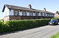
 10 ^ 12 Church Street - geograph.org.uk - 3646333.jpg 1,280 × 960; 360 KB
-
 2 Pond Street (aka Wyggeston Farm) - geograph.org.uk - 3646123.jpg 1,280 × 1,007; 322 KB
-
 A Restricted Byway - geograph.org.uk - 3921201.jpg 1,600 × 1,067; 637 KB
-
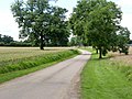
 A607 towards Grantham - geograph.org.uk - 2966499.jpg 640 × 480; 64 KB
-
 A607 towards Grantham - geograph.org.uk - 2966507.jpg 640 × 480; 56 KB
-
 A607 towards Grantham - geograph.org.uk - 2966532.jpg 640 × 480; 82 KB
-
 A607 towards Grantham - geograph.org.uk - 5056783.jpg 3,696 × 2,448; 2.28 MB
-
 A607 towards Grantham, Harlaxton - geograph.org.uk - 2966517.jpg 640 × 480; 88 KB
-
 A607 towards Harlaxton - geograph.org.uk - 155371.jpg 640 × 380; 43 KB
-
 A607 towards Melton Mowbray - geograph.org.uk - 4329896.jpg 2,816 × 2,112; 1.21 MB
-
 An unusual notice - geograph.org.uk - 3647036.jpg 1,280 × 960; 207 KB
-

-
 Benchmark on base of electricity pylon - geograph.org.uk - 6402141.jpg 1,024 × 683; 408 KB
-
 Benchmark on Church of St Mary ^ St Peter - geograph.org.uk - 6279742.jpg 1,024 × 683; 355 KB
-
 Benchmark on house at Echo Farm - geograph.org.uk - 6288415.jpg 644 × 1,024; 212 KB
-
 Benchmark on wall at entrance to ^43 High Street - geograph.org.uk - 6426567.jpg 1,024 × 683; 329 KB
-
 Benchmark on ^1 The Drift - geograph.org.uk - 6426338.jpg 1,024 × 761; 260 KB
-
 Benchmark on ^11 The Drift - geograph.org.uk - 6426209.jpg 1,024 × 683; 296 KB
-

-

-
 Bridge over the weir - geograph.org.uk - 1129200.jpg 640 × 427; 120 KB
-
 Bridge parapet - geograph.org.uk - 3601979.jpg 1,280 × 960; 405 KB
-
 Canal reservoir feeder - geograph.org.uk - 3602160.jpg 1,280 × 960; 462 KB
-
 Church gargoyle - geograph.org.uk - 6034336.jpg 640 × 480; 88 KB
-
 Church of St Mary ^ St Peter - geograph.org.uk - 6279013.jpg 1,024 × 683; 167 KB
-
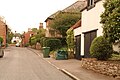 Church Street, Harlaxton - geograph.org.uk - 6260255.jpg 1,024 × 683; 179 KB
-
 Cows Grazing near Harlaxton Church - geograph.org.uk - 3652934.jpg 640 × 481; 340 KB
-
 Crop field near Warren Farm - geograph.org.uk - 3016332.jpg 640 × 480; 62 KB
-
 Cupola through the cedar tree - geograph.org.uk - 3595775.jpg 1,280 × 960; 395 KB
-
 Cycling along the Grantham Canal - geograph.org.uk - 269347.jpg 640 × 427; 123 KB
-
 Datestone, 77 High Street - geograph.org.uk - 3647078.jpg 1,280 × 960; 287 KB
-
 Delivery station platform - geograph.org.uk - 2005442.jpg 640 × 426; 141 KB
-
 Denton Reservoir - geograph.org.uk - 6034067.jpg 640 × 480; 44 KB
-
 Drive to the village - geograph.org.uk - 3595841.jpg 1,280 × 960; 423 KB
-
 Driveway to Harlaxton Manor - geograph.org.uk - 5583378.jpg 800 × 675; 120 KB
-
 Dutch Canal - geograph.org.uk - 4609305.jpg 1,024 × 683; 307 KB
-
 Electricity pylon in field off Gorse Lane - geograph.org.uk - 6402150.jpg 683 × 1,024; 169 KB
-
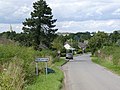
 Entering Harlaxton from Swine Hill - geograph.org.uk - 5300110.jpg 3,648 × 2,736; 3.43 MB
-
 Entrance to farmhouse at Echo Farm - geograph.org.uk - 6288429.jpg 1,024 × 665; 240 KB
-
 Entrance to North Lodge Farm - geograph.org.uk - 3653602.jpg 640 × 481; 315 KB
-
 Entrance to North Lodge Farm - geograph.org.uk - 3921133.jpg 1,600 × 1,067; 490 KB
-
 Entrance to ^43 High Street - geograph.org.uk - 6426600.jpg 1,024 × 683; 276 KB
-
 Entry to Harlaxton - geograph.org.uk - 3601420.jpg 1,280 × 960; 368 KB
-
 Farm track near North Lodge - geograph.org.uk - 6295283.jpg 1,024 × 768; 207 KB
-
 Farm track near North Lodge - geograph.org.uk - 6295289.jpg 1,024 × 768; 171 KB
-
 Farmland And The Grantham Canal - geograph.org.uk - 4246342.jpg 4,000 × 3,000; 2.33 MB
-

-
 Farmland Between Harlaxton and Barrowby - geograph.org.uk - 3654391.jpg 640 × 480; 291 KB
-
 Farmland near Harlaxton - geograph.org.uk - 2966497.jpg 640 × 480; 113 KB
-
 Farmland near Sproxton Lodge - geograph.org.uk - 5254407.jpg 800 × 612; 172 KB
-
 Farmland near Stroxton Lodge - geograph.org.uk - 3016353.jpg 640 × 480; 62 KB
-
 Farmland near Warren Farm - geograph.org.uk - 5254397.jpg 800 × 600; 169 KB
-
 Farmland near Wealdmore Lodge Farm - geograph.org.uk - 3016361.jpg 640 × 480; 47 KB
-
 Farmland next to Denton Reservoir - geograph.org.uk - 5583194.jpg 800 × 551; 165 KB
-
 Farmland next to Wealdmore Lodge Farm - geograph.org.uk - 5255462.jpg 800 × 587; 165 KB
-
 Farmland north of Harlaxton, aerial 2018 - geograph.org.uk - 5846337.jpg 800 × 533; 103 KB
-
 Farmland south of Barrowby - geograph.org.uk - 3610585.jpg 640 × 480; 61 KB
-

-
 Farmland towards Harlaxton Manor - geograph.org.uk - 4329911.jpg 2,816 × 2,112; 1.1 MB
-
 Farmland towards the Grantham Canal - geograph.org.uk - 2966530.jpg 640 × 480; 92 KB
-
 Farmland towards woodland - geograph.org.uk - 3016364.jpg 640 × 480; 42 KB
-
 Farmland west of Harlaxton - geograph.org.uk - 3023714.jpg 3,648 × 2,736; 3.51 MB
-
 Field boundary near Wealdmore Lodge Farm - geograph.org.uk - 6295646.jpg 1,024 × 768; 164 KB
-
 Field next to Harlaxton Wood - geograph.org.uk - 5254399.jpg 800 × 600; 148 KB
-
 Fields next to the Grantham Canal - geograph.org.uk - 5583341.jpg 800 × 591; 107 KB
-

-
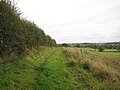
 Footpath - geograph.org.uk - 6034063.jpg 640 × 480; 55 KB
-
 Footpath - geograph.org.uk - 6034073.jpg 640 × 480; 67 KB
-
 Footpath - geograph.org.uk - 6034334.jpg 640 × 480; 45 KB
-
 Footpath and Finger Post - geograph.org.uk - 6034060.jpg 640 × 480; 99 KB
-
 Footpath ladder exit from field - geograph.org.uk - 5299331.jpg 3,648 × 2,736; 4.12 MB
-
 Footpath north to Harlaxton - geograph.org.uk - 5299303.jpg 3,648 × 2,736; 3.85 MB
-
 Footpath over fields - geograph.org.uk - 2966495.jpg 640 × 480; 120 KB
-
 Footpath steps - geograph.org.uk - 3601896.jpg 1,280 × 960; 477 KB
-
 Footpath to Harlaxton - geograph.org.uk - 2966503.jpg 640 × 480; 76 KB
-
 Footpath to Harlaxton - geograph.org.uk - 3601880.jpg 960 × 1,280; 471 KB
-
 Footpath to Harlaxton - geograph.org.uk - 3601941.jpg 1,280 × 960; 337 KB
-
 Footpath to Harlaxton - geograph.org.uk - 3602136.jpg 1,280 × 960; 457 KB
-
 Footpath to Harlaxton Wharf - geograph.org.uk - 6295287.jpg 1,024 × 768; 174 KB
-
 Footpath to Rectory Lane - geograph.org.uk - 3023652.jpg 3,648 × 2,736; 4.32 MB
-
 Former Ironstone Quarry - geograph.org.uk - 3601903.jpg 1,280 × 960; 317 KB
-
 Former silos in Harlaxton Park - geograph.org.uk - 3595840.jpg 1,280 × 960; 214 KB
-
 Gateway to Coneygree, Harlaxton (geograph 6329827).jpg 1,024 × 768; 332 KB
-
 Gorse Lane towards Hungerton, part of the Salt Way - geograph.org.uk - 5299364.jpg 3,648 × 2,736; 3.37 MB
-
 Grantham Canal - geograph.org.uk - 3602944.jpg 1,280 × 960; 375 KB
-
 Grantham Canal - geograph.org.uk - 792325.jpg 640 × 427; 97 KB
-
 Grantham Canal at Harlaxton Wharf - geograph.org.uk - 2741007.jpg 3,525 × 2,638; 3.53 MB
-
 Grantham Canal east of Vincent Bridge - geograph.org.uk - 3602935.jpg 1,280 × 960; 396 KB
-
 Grantham Canal milepost - geograph.org.uk - 3602939.jpg 1,280 × 960; 404 KB
-
 Grantham Canal near Denton Reservoir - 2 - geograph.org.uk - 2741013.jpg 3,648 × 2,736; 3.77 MB
-
 Grantham Canal near Denton Reservoir - geograph.org.uk - 2741011.jpg 3,529 × 2,643; 3.47 MB
-
 Grantham Canal near Harlaxton - geograph.org.uk - 104615.jpg 640 × 427; 225 KB
-
 Grantham Canal near Harlaxton - geograph.org.uk - 3958478.jpg 3,088 × 2,056; 4.97 MB
-
 Grantham Canal overgrown with weed - geograph.org.uk - 2164093.jpg 1,024 × 768; 258 KB
-
 Grantham Canal towards Grantham - geograph.org.uk - 4329914.jpg 2,816 × 2,112; 1.96 MB
-
 Grantham Canal towpath - geograph.org.uk - 3602930.jpg 1,280 × 960; 394 KB
-
 Grantham Canal Towpath at Harlaxton - geograph.org.uk - 3653537.jpg 480 × 640; 403 KB
-
 Grantham Canal west of Harlaxton Wharf - geograph.org.uk - 2164085.jpg 1,024 × 768; 243 KB
-
 Grantham Canal west of Harlaxton Wharf - geograph.org.uk - 2741016.jpg 3,648 × 2,736; 3.58 MB
-
 Grantham Canal, Harlaxton - geograph.org.uk - 3653256.jpg 640 × 481; 365 KB
-
 Grantham Canal, Harlaxton - geograph.org.uk - 3653582.jpg 640 × 481; 374 KB
-
 Grantham Canal, Harlaxton Cutting - geograph.org.uk - 3653573.jpg 640 × 480; 326 KB
-
 Grantham Canal, Harlaxton Cutting - geograph.org.uk - 3654389.jpg 640 × 481; 379 KB
-
 Grantham Canal, Harlaxton Wharf - geograph.org.uk - 3653501.jpg 640 × 481; 365 KB
-
 Gregory Close - geograph.org.uk - 6034354.jpg 640 × 480; 79 KB
-
 Harlaxton Clays - geograph.org.uk - 6295399.jpg 1,024 × 768; 156 KB
-
 Harlaxton Cutting - geograph.org.uk - 2741021.jpg 3,648 × 2,736; 3.88 MB
-
 Harlaxton Drift - geograph.org.uk - 3653597.jpg 640 × 481; 235 KB
-
 Harlaxton Drift.JPG 2,048 × 1,536; 464 KB
-
 Harlaxton Lower Lodge - geograph.org.uk - 5253689.jpg 800 × 604; 237 KB
-
 Harlaxton Manor, aerial 2018 - geograph.org.uk - 5846286.jpg 1,024 × 683; 143 KB
-
 Harlaxton Post Office, near Grantham - geograph.org.uk - 94602.jpg 640 × 480; 102 KB
-
 Harlaxton Quarries railway trackbed - geograph.org.uk - 3602133.jpg 1,280 × 960; 474 KB
-
 Harlaxton Quarries railway trackbed - geograph.org.uk - 3602142.jpg 1,280 × 960; 401 KB
-
 Harlaxton Sign.JPG 2,524 × 2,376; 2.53 MB
-
 Harlaxton Spire - geograph.org.uk - 1470007.jpg 640 × 480; 85 KB
-
 Harlaxton Sports and Social Club - geograph.org.uk - 3647075.jpg 1,280 × 948; 201 KB
-
 Harlaxton Three Shires Mooring.JPG 3,872 × 2,592; 4.23 MB
-
 Harlaxton Three Shires Narrowboat.JPG 3,216 × 2,300; 3.41 MB
-
 Harlaxton Village Pump.JPG 2,472 × 3,728; 3.7 MB
-
 Harlaxton Village Store.JPG 3,784 × 2,480; 3.94 MB
-
 Harlaxton, Lincolnshire, England - a road through the village 1904.jpg 1,115 × 642; 440 KB
-
 Harlaxton, near Grantham - geograph.org.uk - 30249.jpg 640 × 480; 98 KB
-
 Harlaxton, Village Store and Post Office - geograph.org.uk - 3653240.jpg 640 × 481; 268 KB
-

-
 Horses and paddocks at Harlaxton - geograph.org.uk - 5583360.jpg 800 × 500; 89 KB
-
-

-
 Junction of Peashill Lane from A607 - geograph.org.uk - 6279000.jpg 1,024 × 683; 199 KB
-
 Junction of Rectory Lane and West End, Harlaxton - geograph.org.uk - 5299290.jpg 3,282 × 2,488; 2.44 MB
-
 Lane leading to the A607 - geograph.org.uk - 5253668.jpg 800 × 603; 205 KB
-
 Lesser Celandine - geograph.org.uk - 792252.jpg 640 × 427; 115 KB
-
 Line of Trees - geograph.org.uk - 4356360.jpg 2,816 × 2,112; 2.76 MB
-
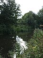
 Lone Fisherman Greets the Sun - geograph.org.uk - 2036125.jpg 5,616 × 3,744; 797 KB
-
 Looking across fields to Wealdmore Lodge Farm - geograph.org.uk - 5299335.jpg 3,648 × 2,736; 3.16 MB
-
 Main reception - geograph.org.uk - 3595830.jpg 960 × 1,280; 357 KB
-
 Medusa - geograph.org.uk - 3604289.jpg 640 × 628; 153 KB
-
 Minor road towards Hungerton - geograph.org.uk - 3016350.jpg 640 × 480; 41 KB
-
 Minor road towards Hungerton - geograph.org.uk - 3016359.jpg 640 × 480; 38 KB
-
 Minor road towards Hungerton - geograph.org.uk - 3016363.jpg 640 × 480; 51 KB
-
 Minor road towards Hungerton - geograph.org.uk - 3016365.jpg 640 × 480; 49 KB
-
 Misty Denton Morning - geograph.org.uk - 2119020.jpg 6,144 × 4,096; 859 KB
-
 More woodland near Denton Reservoir^ - geograph.org.uk - 30241.jpg 640 × 480; 161 KB
-
 Nether Lane - geograph.org.uk - 3602150.jpg 1,280 × 960; 364 KB
-
 No sign of the footpath - geograph.org.uk - 3647032.jpg 1,280 × 960; 324 KB
-
 No. 1 The Drift - geograph.org.uk - 6426351.jpg 1,024 × 683; 180 KB
-
 Oak Farm, Harlaxton - geograph.org.uk - 3646149.jpg 1,280 × 960; 346 KB
-
 Old Beck at Denton Reservoir - geograph.org.uk - 1129028.jpg 450 × 640; 132 KB
-
 Old School - geograph.org.uk - 792259.jpg 640 × 427; 79 KB
-
 Old School House - geograph.org.uk - 3646153.jpg 1,280 × 960; 252 KB
-

-
 Parking on the lawn - geograph.org.uk - 3595764.jpg 1,280 × 960; 376 KB
-

-
 Path beside the Grantham Canal - geograph.org.uk - 3610578.jpg 640 × 480; 93 KB
-
 Path beside the Grantham Canal - geograph.org.uk - 3610582.jpg 640 × 480; 111 KB
-
 Path Leading Off The Grantham Canal - geograph.org.uk - 4246319.jpg 4,000 × 3,000; 4.13 MB
-
 Path next to the Grantham Canal - geograph.org.uk - 5583355.jpg 800 × 600; 205 KB
-
 Path to the Grantham Canal - geograph.org.uk - 3654374.jpg 640 × 481; 357 KB
-
 Peashill Lane - geograph.org.uk - 1835129.jpg 640 × 480; 248 KB
-
 Pegasus courtyard - geograph.org.uk - 3595754.jpg 1,280 × 960; 271 KB
-
 Pegasus Memorial - geograph.org.uk - 4601432.jpg 1,024 × 683; 341 KB
-
 Picnic table at Denton Reservoir - geograph.org.uk - 1129006.jpg 640 × 427; 122 KB
-
 Ploughed field - geograph.org.uk - 6034329.jpg 640 × 480; 57 KB
-
 Power lines near Harlaxton Wharf - geograph.org.uk - 2737620.jpg 3,648 × 2,736; 1.98 MB
-
 Prepared field and the edge of Barrowby - geograph.org.uk - 6294953.jpg 1,024 × 768; 151 KB
-
 Prepared field near Harlaxton Lower Lodge - geograph.org.uk - 6294969.jpg 1,024 × 768; 161 KB
-
 Public footpath at Denton Reservoir - geograph.org.uk - 1129055.jpg 427 × 640; 117 KB
-
 Public Footpath from West End, Harlaxton - geograph.org.uk - 5056763.jpg 3,696 × 2,448; 2.3 MB
-
 Public footpath or public mudbath^ - geograph.org.uk - 1129087.jpg 640 × 427; 114 KB
-
 Public footpath to Harlaxton Wharf - geograph.org.uk - 1129066.jpg 640 × 427; 94 KB
-
 Raising the dust - geograph.org.uk - 3601965.jpg 1,280 × 960; 224 KB
-
 Restricted byway near Barrowby - geograph.org.uk - 6294951.jpg 1,024 × 768; 196 KB
-
 Restricted byway near Barrowby - geograph.org.uk - 6294954.jpg 1,024 × 768; 157 KB
-
 Restricted byway near Barrowby - geograph.org.uk - 6294957.jpg 1,024 × 768; 170 KB
-
 Restricted byway near Barrowby - geograph.org.uk - 6294965.jpg 1,024 × 768; 192 KB
-
 Road heading south near Tudor Lodge - geograph.org.uk - 3016341.jpg 640 × 480; 43 KB
-
 Road junction - geograph.org.uk - 6034027.jpg 640 × 480; 61 KB
-
 Road past Harlaxton Manor - geograph.org.uk - 3956339.jpg 3,088 × 2,056; 3.31 MB
-
 Road towards Hungerton - geograph.org.uk - 3956360.jpg 3,088 × 2,056; 3.32 MB
-
 Semi-detached houses on west side of The Drift - geograph.org.uk - 6426240.jpg 1,024 × 662; 188 KB
-
 Steps leading down to farmland - geograph.org.uk - 5254424.jpg 636 × 800; 174 KB
-
 Strood Close - geograph.org.uk - 6034031.jpg 640 × 480; 49 KB
-
 Stubble field near Harlaxton - geograph.org.uk - 6295654.jpg 1,024 × 768; 138 KB
-
 Swinehill junction - geograph.org.uk - 3956353.jpg 3,088 × 2,056; 3.05 MB
-
 The churchyard and adjacent buildings, Harlaxton - geograph.org.uk - 6329640.jpg 1,024 × 768; 235 KB
-
 The Drift (road) - geograph.org.uk - 3921136.jpg 4,272 × 2,848; 5.54 MB
-
 The Drift - geograph.org.uk - 3653593.jpg 640 × 481; 305 KB
-
 The Drift - geograph.org.uk - 3653612.jpg 640 × 481; 302 KB
-
 The Drift heading north - geograph.org.uk - 3610689.jpg 640 × 480; 57 KB
-
 The Drift, Harlaxton - geograph.org.uk - 3654366.jpg 640 × 481; 286 KB
-
 The Drift, Towards Barrowby - geograph.org.uk - 3653614.jpg 640 × 481; 317 KB
-
 The Dutch Canal - geograph.org.uk - 3595817.jpg 1,280 × 960; 337 KB
-
 The Dutch Canal - geograph.org.uk - 4609297.jpg 1,024 × 683; 292 KB
-
 The Grantham Canal - geograph.org.uk - 3610576.jpg 640 × 480; 112 KB
-
 The Grantham Canal - geograph.org.uk - 3610579.jpg 480 × 640; 89 KB
-
 The Grantham Canal looking West - geograph.org.uk - 104618.jpg 640 × 427; 231 KB
-
 The Grantham Canal near Harlaxton - geograph.org.uk - 6295539.jpg 1,024 × 768; 252 KB
-
 The Grantham Canal near Harlaxton - geograph.org.uk - 6295542.jpg 1,024 × 768; 252 KB
-
 The Grantham Canal near Harlaxton - geograph.org.uk - 6295640.jpg 1,024 × 768; 268 KB
-
 The Grantham Canal near Harlaxton Lower Lodge - geograph.org.uk - 6329636.jpg 1,024 × 768; 224 KB

_-_geograph.org.uk_-_3646123.jpg)


.jpg)


_-_geograph.org.uk_-_3921136.jpg)


