Category:Harehope Farm, Eglingham
Jump to navigation
Jump to search
Media in category "Harehope Farm, Eglingham"
The following 19 files are in this category, out of 19 total.
-
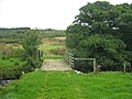 Bridge and bridleway over the Crane Burn - geograph.org.uk - 1501697.jpg 600 × 450; 109 KB
-
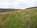 Bridleway above Harehope Farm - geograph.org.uk - 1501672.jpg 600 × 450; 92 KB
-
 Crane Burn near Harehope Farm - geograph.org.uk - 1501684.jpg 600 × 450; 163 KB
-
 Disused sluice near Harehope - geograph.org.uk - 1123211.jpg 640 × 480; 64 KB
-
 Drystone wall near Harehope - geograph.org.uk - 1123240.jpg 640 × 480; 76 KB
-
 Gateway to Harehope - geograph.org.uk - 1123222.jpg 640 × 480; 75 KB
-
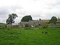
 Harehope Farm - geograph.org.uk - 1501717.jpg 600 × 450; 81 KB
-
 Harehope Farm - geograph.org.uk - 1506372.jpg 600 × 450; 71 KB
-

-
 Harehope Farm Cottage's Allotments - geograph.org.uk - 1506396.jpg 600 × 450; 97 KB
-
 Harehope Farm Cottages - geograph.org.uk - 1501757.jpg 600 × 450; 80 KB
-
 Harehope Farm Cottages - geograph.org.uk - 1506377.jpg 600 × 450; 87 KB
-

-

-
 Remains of a boundary wall - geograph.org.uk - 1501737.jpg 600 × 450; 83 KB
-
 Road from Harehope Farm - geograph.org.uk - 1506399.jpg 600 × 450; 104 KB
-
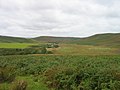 View of Stock Brook Valley - geograph.org.uk - 1498797.jpg 600 × 450; 80 KB
-

-
 Wetland pond next to Harehope Farm - geograph.org.uk - 1501749.jpg 600 × 450; 85 KB


