Category:Hardingham
Jump to navigation
Jump to search

village in Norfolk, England, UK  | |||||
| Upload media | |||||
| Instance of | |||||
|---|---|---|---|---|---|
| Location | Breckland, Norfolk, East of England, England | ||||
| Population |
| ||||
| Area |
| ||||
| Said to be the same as | Hardingham (Wikimedia duplicated page, civil parish) | ||||
| official website | |||||
 | |||||
Subcategories
This category has the following 5 subcategories, out of 5 total.
Media in category "Hardingham"
The following 122 files are in this category, out of 122 total.
-
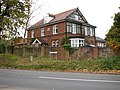 A fine house in Low Street - geograph.org.uk - 2144890.jpg 640 × 480; 132 KB
-

-
 Arable field with a tree, near Low Street - geograph.org.uk - 5823040.jpg 1,024 × 576; 88 KB
-
 At Hardingham Station - geograph.org.uk - 5470720.jpg 640 × 455; 114 KB
-
 Batemans Lane, Low Street - geograph.org.uk - 2282563.jpg 640 × 480; 65 KB
-
 Boundary House - geograph.org.uk - 2114361.jpg 1,280 × 960; 254 KB
-
 BR 14021 at Hardingham.jpg 2,592 × 1,952; 847 KB
-
 Capt. William Augustus Portman Foster, 1887-1914 - geograph.org.uk - 6582631.jpg 3,456 × 2,592; 3.59 MB
-
 Danemoor bridges - geograph.org.uk - 1435426.jpg 640 × 480; 79 KB
-
 Diesel on the front not steam - geograph.org.uk - 2630812.jpg 640 × 410; 74 KB
-
 Direction Sign – Signpost - geograph.org.uk - 6530046.jpg 1,458 × 1,944; 760 KB
-
 Electricity sub-station - geograph.org.uk - 670055.jpg 480 × 640; 127 KB
-
 Entrance to Old Hall Farm, Hardingham - geograph.org.uk - 5365742.jpg 3,456 × 2,592; 2.9 MB
-
 Farmland Near Hardingham - geograph.org.uk - 5470725.jpg 640 × 403; 103 KB
-
 Farmland Near Thuxton - geograph.org.uk - 5471176.jpg 640 × 432; 101 KB
-
 Field by the River Yare, Low Street - geograph.org.uk - 6550083.jpg 1,858 × 1,180; 1.07 MB
-
 Football ground - geograph.org.uk - 846708.jpg 640 × 480; 135 KB
-
 Footpath to Low Street - geograph.org.uk - 5365764.jpg 3,456 × 2,592; 3.91 MB
-
 Grain silos - geograph.org.uk - 846692.jpg 480 × 640; 170 KB
-
 Hall Farm - geograph.org.uk - 846713.jpg 626 × 431; 144 KB
-
 Hardingham electricity substation - geograph.org.uk - 6071754.jpg 3,264 × 2,448; 1.74 MB
-
 Hardingham Fete 29-6-05 at High Common - geograph.org.uk - 23067.jpg 457 × 640; 114 KB
-
 Hardingham St George's church - geograph.org.uk - 2253712.jpg 640 × 480; 78 KB
-
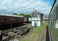
 Hardingham station - geograph.org.uk - 4623423.jpg 4,000 × 3,000; 3.97 MB
-
 Hardingham Village Sign - geograph.org.uk - 5585369.jpg 480 × 640; 81 KB
-
 Hardingham Village Sign - geograph.org.uk - 5585372.jpg 640 × 480; 73 KB
-
 Hardingham village sign at the junction with Beech Lane - geograph.org.uk - 5365761.jpg 3,456 × 2,592; 3.88 MB
-
 Hardingham War Memorial - geograph.org.uk - 5365750.jpg 3,456 × 2,592; 3.81 MB
-
 Hardingham War Memorial Hall - geograph.org.uk - 846706.jpg 640 × 462; 121 KB
-
 Houses by Hardingham Road - geograph.org.uk - 846683.jpg 640 × 473; 126 KB
-
 Houses in Beeches Lane - geograph.org.uk - 846711.jpg 640 × 458; 119 KB
-
 Houses on Low Street, Hardingham - geograph.org.uk - 5823046.jpg 1,024 × 767; 128 KB
-
 Large array of Solar panels at Hardingham - geograph.org.uk - 6071763.jpg 3,264 × 2,448; 1.71 MB
-
 Large new building at Reymerston - geograph.org.uk - 6071748.jpg 1,565 × 1,174; 564 KB
-
 Large storage shed and silos - geograph.org.uk - 846688.jpg 640 × 480; 186 KB
-
 Lieutenant Geoffrey Stephen Walley, 1892- 1916 - geograph.org.uk - 6582623.jpg 2,531 × 1,853; 1.6 MB
-
 Long straight track - geograph.org.uk - 846697.jpg 640 × 480; 159 KB
-
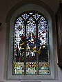 Memorial window in Hardingham St. George church - geograph.org.uk - 5366168.jpg 2,592 × 3,456; 3.1 MB
-
 Minor road at Hardingham - geograph.org.uk - 6071759.jpg 3,264 × 2,448; 1.83 MB
-
 New Ballast - geograph.org.uk - 1435435.jpg 640 × 480; 95 KB
-
 New engine shed by Hardingham Station - geograph.org.uk - 2144885.jpg 640 × 480; 145 KB
-
 Number 72, at Reymerston crossroads - geograph.org.uk - 6071738.jpg 3,264 × 2,448; 1.8 MB
-
 Oak tree beside Church Road, Hardingham - geograph.org.uk - 5365771.jpg 3,456 × 2,592; 3.85 MB
-

-
 On the road to Hardingham - geograph.org.uk - 846687.jpg 640 × 480; 154 KB
-

-
 Railway line, Hardingham - geograph.org.uk - 1053067.jpg 640 × 473; 106 KB
-

-
 Sapling plantation, south of Hardingham Station - geograph.org.uk - 5818772.jpg 1,024 × 768; 178 KB
-
 Single Signal - geograph.org.uk - 1435394.jpg 640 × 480; 58 KB
-
 Single Signal - geograph.org.uk - 1435398.jpg 640 × 480; 75 KB
-

-
 Solar Farm View - geograph.org.uk - 5470728.jpg 640 × 383; 83 KB
-
 St George, Hardingham, churchyard - geograph.org.uk - 5552393.jpg 640 × 480; 86 KB
-

-
 St George, Hardingham, south door - geograph.org.uk - 5552396.jpg 480 × 640; 55 KB
-
 Straw bales by the River Yare, Low Street - geograph.org.uk - 6550087.jpg 1,862 × 1,192; 1.63 MB
-
 Sugar Beet At White Cross - geograph.org.uk - 295674.jpg 640 × 480; 100 KB
-
 The bridge over a small road - geograph.org.uk - 1435414.jpg 640 × 480; 130 KB
-
 The Cutting South of Thuxton - geograph.org.uk - 1766691.jpg 800 × 531; 145 KB
-
 The CWGC headstone of LAC S.C. Warnes - geograph.org.uk - 5365756.jpg 2,488 × 3,195; 3.12 MB
-
 The Driveway To Old Hall - geograph.org.uk - 276674.jpg 640 × 481; 98 KB
-

-
 The Old Coach House - geograph.org.uk - 846700.jpg 640 × 562; 168 KB
-
 Thuxton passing loop.jpg 2,133 × 1,299; 513 KB
-
 Track maintenance near Danemoor Bridge, Garvestone - geograph.org.uk - 6030486.jpg 3,264 × 2,448; 1.74 MB
-
 View across railway tracks - geograph.org.uk - 670069.jpg 480 × 640; 107 KB
-
 View east along Middle Road - geograph.org.uk - 670036.jpg 480 × 640; 124 KB
-
 View north along Station Road - geograph.org.uk - 846714.jpg 480 × 640; 179 KB
-

-
 View southeast across new crop - geograph.org.uk - 668235.jpg 480 × 640; 161 KB
-
 View west along Hackford Road - geograph.org.uk - 846695.jpg 640 × 480; 189 KB
-
 Village sign - geograph.org.uk - 1411810.jpg 428 × 639; 59 KB
-
 Village sign - geograph.org.uk - 846717.jpg 480 × 640; 133 KB
-
 Waiting by the gate - geograph.org.uk - 846704.jpg 640 × 480; 167 KB
-

-
 White Barn cottage - geograph.org.uk - 2114379.jpg 1,280 × 960; 268 KB
-
 White Barn farm road - geograph.org.uk - 2114391.jpg 1,280 × 960; 490 KB
-
 Whitecross Farm, Hardingham - geograph.org.uk - 536593.jpg 640 × 480; 135 KB
-
 Y-junction near Vine Lodge, Hardingham - geograph.org.uk - 537954.jpg 640 × 480; 183 KB
-
 A Concreted Lane - geograph.org.uk - 277377.jpg 640 × 480; 98 KB
-
 A Drain On Banham Hill - geograph.org.uk - 295689.jpg 480 × 640; 107 KB
-
 A Green Bridleway - geograph.org.uk - 295773.jpg 640 × 480; 84 KB
-
 Almost at the end - geograph.org.uk - 670052.jpg 480 × 640; 123 KB
-
 Approaching Hardingham from the east - geograph.org.uk - 846681.jpg 640 × 465; 114 KB
-
 Banham Hill - geograph.org.uk - 276858.jpg 640 × 480; 95 KB
-
 Buildings At Wood Farm - geograph.org.uk - 276862.jpg 640 × 480; 98 KB
-
 Church Road - geograph.org.uk - 669995.jpg 640 × 480; 126 KB
-
 Competing Barns - geograph.org.uk - 295772.jpg 640 × 480; 88 KB
-
 Coston Lane - geograph.org.uk - 295724.jpg 640 × 480; 84 KB
-
 Country Cottage - geograph.org.uk - 295769.jpg 640 × 480; 82 KB
-
 Danemoor farm access bridge - geograph.org.uk - 1435440.jpg 640 × 480; 90 KB
-
 Danemoor Lane - geograph.org.uk - 670046.jpg 480 × 640; 139 KB
-
 Dereham Road past Danemore Green - geograph.org.uk - 668103.jpg 480 × 640; 134 KB
-
 Farm track across railway bridge - geograph.org.uk - 668207.jpg 480 × 640; 183 KB
-

-
 Field Track - geograph.org.uk - 277379.jpg 640 × 480; 100 KB
-
 Fields on the other side - geograph.org.uk - 668214.jpg 640 × 480; 123 KB
-
 Green And Grey - geograph.org.uk - 276678.jpg 640 × 480; 91 KB
-
 Hardingham Road - geograph.org.uk - 295776.jpg 640 × 480; 96 KB
-
 Junction of Middle Road with Station Road - geograph.org.uk - 670030.jpg 640 × 480; 125 KB
-
 Junction of Station Road with the B1135 - geograph.org.uk - 670076.jpg 480 × 640; 117 KB
-
 Loading Sugar Beet - geograph.org.uk - 276863.jpg 640 × 480; 96 KB
-
 Looking east along a hedge - geograph.org.uk - 668276.jpg 480 × 640; 178 KB
-
 Looking east along White Cross - geograph.org.uk - 670005.jpg 640 × 480; 124 KB
-

-
 Ploughed field on bleak January day - geograph.org.uk - 668320.jpg 640 × 480; 175 KB
-
 Railway bridge - geograph.org.uk - 668097.jpg 640 × 480; 149 KB
-
 Railway bridge across Mill Road - geograph.org.uk - 671877.jpg 480 × 640; 156 KB
-
 Sandy Lane - geograph.org.uk - 276683.jpg 640 × 480; 98 KB
-
 Southburgh Road - geograph.org.uk - 276676.jpg 640 × 480; 97 KB
-
 Station Farm - geograph.org.uk - 671882.jpg 640 × 480; 131 KB
-
 Teasels beside track - geograph.org.uk - 668224.jpg 480 × 640; 188 KB
-
 The B1135 across railway bridge - geograph.org.uk - 670062.jpg 640 × 480; 107 KB
-
 The Lake At Coston - geograph.org.uk - 295701.jpg 640 × 480; 93 KB
-
 The Lane To Kimberley Farms - geograph.org.uk - 295705.jpg 640 × 480; 99 KB
-
 The Road To Coston - geograph.org.uk - 276867.jpg 640 × 480; 98 KB
-
 The Road To Danemoor Green - geograph.org.uk - 295670.jpg 640 × 480; 107 KB
-
 The Road To Hardingham - geograph.org.uk - 277376.jpg 640 × 480; 99 KB
-
 The Road To Hardingham - geograph.org.uk - 295687.jpg 640 × 480; 77 KB
-
 This way to Nordelph Corner - geograph.org.uk - 670022.jpg 480 × 640; 123 KB
-
 This year's crop - geograph.org.uk - 668281.jpg 640 × 480; 144 KB


_-_geograph.org.uk_-_5522038.jpg)


