Category:Hardiness zone maps of the United States
Jump to navigation
Jump to search
Media in category "Hardiness zone maps of the United States"
The following 18 files are in this category, out of 18 total.
-
 2012 USDA Plant Hardiness Zone Map (USA).jpg 10,800 × 7,200; 26.3 MB
-
 New York plant hardiness zone map 2012.jpg 2,996 × 2,247; 2.3 MB
-
 USDA Hardiness zone map.jpg 4,014 × 4,002; 5.92 MB
-
 USDAplanthardiness.jpg 620 × 603; 165 KB
-
 USDA Hardiness zone map detail for northeast US.jpg 313 × 250; 48 KB
-
 2023 USDA Plant Hardiness Zone Map (USA).jpg 10,800 × 7,200; 36.59 MB
-
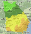 Georgia-plantmaps-hardiness-zones.png 243 × 264; 161 KB
-
 Mdusdamap.jpg 610 × 410; 31 KB
-
 MichiganHardinessZones in Celsius.svg 535 × 606; 78 KB
-
 MichiganHardinessZones.svg 535 × 606; 79 KB
-
 Plant hardiness zones, Ohio LOC 95681997.jpg 3,427 × 2,665; 838 KB
-
 Plant hardiness zones, Ohio LOC 95681997.tif 3,427 × 2,665; 26.13 MB
-
 USDA Plant Hardiness Zone Map - North Central US.jpg 2,550 × 3,300; 2.15 MB
-
 USDA Plant Hardiness Zone Map - North East US.jpg 3,300 × 2,550; 2.88 MB
-
 USDA Plant Hardiness Zone Map - North West US.jpg 3,300 × 2,550; 3.26 MB
-
 USDA Plant Hardiness Zone Map - South Central US.jpg 3,300 × 2,550; 1.83 MB
-
 USDA Plant Hardiness Zone Map - South East US.jpg 3,300 × 2,550; 2.08 MB
-
 USDA Plant Hardiness Zone Map - South West US.jpg 3,300 × 2,550; 3.21 MB
.jpg)


.jpg)


