Category:Hardewikerstraat 5-7-9 (Groningen)
Jump to navigation
Jump to search
| Object location | | View all coordinates using: OpenStreetMap |
|---|
 | |||||
| Upload media | |||||
| Instance of | |||||
|---|---|---|---|---|---|
| Location | Groningen, Netherlands | ||||
| Heritage designation |
| ||||
 | |||||
|
This is a category about rijksmonument number 18486
|
| Address |
|
Media in category "Hardewikerstraat 5-7-9 (Groningen)"
The following 7 files are in this category, out of 7 total.
-
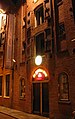
 Goldenarm-groningen-deur.jpg 1,600 × 1,200; 1.95 MB
-
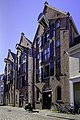 Groningen - Hardewikerstraat 5-7-9.jpg 2,906 × 4,359; 10.05 MB
-
 Groningen-goldenarm.jpg 750 × 1,190; 560 KB
-
 Hardewikerstraat 5-7-9.jpg 1,882 × 2,275; 1.17 MB
-
 Voorgevels - Groningen - 20093874 - RCE.jpg 812 × 1,200; 231 KB
-
 Voorgevels - Groningen - 20093875 - RCE.jpg 965 × 1,200; 250 KB
-
 Voorgevels - Groningen - 20093876 - RCE.jpg 949 × 1,200; 268 KB


