Category:Happisburgh
Jump to navigation
Jump to search
village and civil parish in Norfolk, England  | |||||
| Upload media | |||||
| Instance of | |||||
|---|---|---|---|---|---|
| Location | North Norfolk, Norfolk, East of England, England | ||||
| Population |
| ||||
| Area |
| ||||
| Said to be the same as | Happisburgh (Wikimedia duplicated page, civil parish) | ||||
| official website | |||||
 | |||||
Subcategories
This category has the following 11 subcategories, out of 11 total.
B
- Benches in Happisburgh (2 F)
C
F
- Footpaths in Happisburgh (9 F)
M
- Maps of Happisburgh (2 F)
- Meriones (ship, 1922) (1 F)
N
S
T
Media in category "Happisburgh"
The following 200 files are in this category, out of 339 total.
(previous page) (next page)-
 A rusty anchor - geograph.org.uk - 799617.jpg 480 × 640; 176 KB
-
 HM Trawler Agate-Postcard.jpg 6,936 × 3,864; 4.41 MB
-
 All Saints Lessingham - geograph.org.uk - 3607492.jpg 4,320 × 3,240; 4.8 MB
-
 Baffling remains near Happisburgh - geograph.org.uk - 5552943.jpg 1,600 × 1,200; 199 KB
-
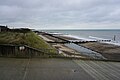
 Beach access ramp, Happisburgh - geograph.org.uk - 5884395.jpg 1,024 × 768; 267 KB
-
 Beach and cliff, Happisburgh - geograph.org.uk - 5884219.jpg 1,024 × 768; 265 KB
-
 Beach and cliff, Happisburgh, 2013 - geograph.org.uk - 5884818.jpg 1,024 × 768; 240 KB
-
 Beach between Happisburgh and Eccles - geograph.org.uk - 5877762.jpg 1,024 × 768; 243 KB
-
 Beach car park, Happisburgh - geograph.org.uk - 5884296.jpg 1,024 × 768; 329 KB
-
 Beach Road is presently closed - geograph.org.uk - 3774341.jpg 640 × 480; 140 KB
-
 Beach Road, Happisburgh - geograph.org.uk - 3793995.jpg 640 × 480; 80 KB
-
 Beach Road, Happisburgh - geograph.org.uk - 5552828.jpg 1,600 × 1,197; 513 KB
-
 Beach Road, northern arm, Happisburgh - geograph.org.uk - 5878012.jpg 1,024 × 768; 325 KB
-
 Beach Road, southern arm, Happisburgh - geograph.org.uk - 5883567.jpg 1,024 × 768; 285 KB
-
 Beach south of Happisburgh - geograph.org.uk - 5552854.jpg 1,600 × 1,200; 261 KB
-
 Beach south of Happisburgh - geograph.org.uk - 6292390.jpg 1,600 × 1,067; 374 KB
-
 Beach, Happisburgh - geograph.org.uk - 5884205.jpg 1,024 × 768; 254 KB
-
 Beach, Happisburgh - geograph.org.uk - 5884273.jpg 1,024 × 768; 245 KB
-
 Bend in Happisburgh Road - geograph.org.uk - 4962563.jpg 640 × 480; 85 KB
-
 Blue plaque on The Hill House Inn, Happisburgh - geograph.org.uk - 5330013.jpg 3,456 × 2,592; 3.42 MB
-
 Boulders for Sea defence - geograph.org.uk - 6775009.jpg 1,024 × 768; 169 KB
-
 Bridleway to East Ruston - geograph.org.uk - 812061.jpg 640 × 480; 197 KB
-
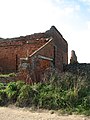
 Broken shutters - geograph.org.uk - 812074.jpg 480 × 640; 194 KB
-
 Buildings on Bush Drive - geograph.org.uk - 3607474.jpg 4,320 × 3,240; 4.75 MB
-
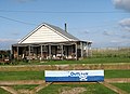
 Bungalow on Cart Gap Road - geograph.org.uk - 978263.jpg 640 × 451; 87 KB
-
 Bush Drive - geograph.org.uk - 6781051.jpg 1,024 × 768; 138 KB
-
 Bush Drive towards Cart Gap - geograph.org.uk - 6292298.jpg 1,600 × 1,067; 291 KB
-
 Camberley Cottage and Thrums (geograph 7556674).jpg 1,024 × 683; 627 KB
-
 Car body workshop at Whimpwell Green - geograph.org.uk - 5853833.jpg 3,456 × 2,312; 2.23 MB
-
 Chalet by Doggett's Lane - geograph.org.uk - 6292330.jpg 1,600 × 1,067; 433 KB
-

-
 Church Farmhouse - geograph.org.uk - 3956245.jpg 640 × 480; 132 KB
-
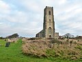
 Church in Happisburgh - geograph.org.uk - 6488346.jpg 1,024 × 768; 111 KB
-
 Cliff and beach access ramp, Happisburgh - geograph.org.uk - 5884239.jpg 1,024 × 768; 299 KB
-
 Cliff and beach south of Happisburgh - geograph.org.uk - 5884083.jpg 1,024 × 768; 291 KB
-
 Cliff House Hotel, Beach Road, Happisburgh - geograph.org.uk - 3590080.jpg 2,592 × 1,944; 1.27 MB
-
 Cliff, Happisburgh, 2013 - geograph.org.uk - 5885004.jpg 1,024 × 768; 360 KB
-
 Cliff, Happisburgh, 2013 - geograph.org.uk - 5885011.jpg 1,024 × 768; 368 KB
-
 Cliff, Happisburgh, 2013 - geograph.org.uk - 5885043.jpg 1,024 × 768; 278 KB
-
 Cliffs at Happisburgh - geograph.org.uk - 5552813.jpg 1,600 × 1,189; 219 KB
-
 Cliffs at Happisburgh - geograph.org.uk - 5888071.jpg 640 × 480; 77 KB
-
 Cliffs near Happisburgh - geograph.org.uk - 5552938.jpg 1,600 × 1,200; 266 KB
-

-

-
 Coast at Happisburgh - geograph.org.uk - 5552819.jpg 1,600 × 1,200; 304 KB
-
 Coast path towards Happisburgh - geograph.org.uk - 5883886.jpg 1,024 × 768; 277 KB
-
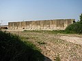
 Coastal defence remains - geograph.org.uk - 5552674.jpg 1,600 × 1,200; 325 KB
-
 Coastal defence remains near Happisburgh - geograph.org.uk - 5553583.jpg 1,600 × 1,200; 317 KB
-
 Coastal defences - geograph.org.uk - 6292344.jpg 1,600 × 1,067; 304 KB
-
 Coastal erosion near Happisburgh - geograph.org.uk - 6292312.jpg 1,600 × 1,067; 403 KB
-
 Coastal path towards Eccles-on-Sea - geograph.org.uk - 5883408.jpg 1,024 × 768; 342 KB
-
 Coastal remains, Happisburgh, 2013 - geograph.org.uk - 5885037.jpg 1,024 × 768; 256 KB
-

-
 Condemned houses - geograph.org.uk - 2092919.jpg 1,280 × 960; 282 KB
-
 Condemned Houses, Beach Road, Happisburgh, Norfolk - geograph.org.uk - 2895722.jpg 2,272 × 1,704; 1.28 MB
-
 Cottages by Church Farm - geograph.org.uk - 3956251.jpg 640 × 469; 213 KB
-
 Country Lane - geograph.org.uk - 522019.jpg 640 × 480; 114 KB
-
 Crinoid Fossils - geograph.org.uk - 2079125.jpg 800 × 531; 101 KB
-
 Crop boundary - geograph.org.uk - 6292326.jpg 1,600 × 1,067; 514 KB
-
 Crop field east of Whimpwell Street - geograph.org.uk - 4962553.jpg 640 × 480; 75 KB
-
 Defiant shrub in Beach Road - geograph.org.uk - 3774369.jpg 640 × 518; 256 KB
-
 Digger on the cliffs at Happisburgh - geograph.org.uk - 3002189.jpg 4,320 × 3,240; 5.46 MB
-
 Dilapidated sea defences - geograph.org.uk - 5552907.jpg 1,600 × 1,165; 426 KB
-
 Doing a King Canute with the Happisburgh coastal defences - geograph.org.uk - 2372922.jpg 3,072 × 2,048; 2.75 MB
-
 Dwindling caravan park, Happisburgh - geograph.org.uk - 5885054.jpg 1,024 × 768; 264 KB
-

-

-
En-Happisburgh.ogg 5.2 s; 68 KB
-
 End of Beach Road (southern part), 2013 - geograph.org.uk - 5885000.jpg 1,024 × 768; 251 KB
-
 England Coast Path towards Happisburgh - geograph.org.uk - 6292388.jpg 1,600 × 1,067; 408 KB
-
 Entering Happisburgh - geograph.org.uk - 4958011.jpg 640 × 480; 76 KB
-
 Entrance to Happisburgh Hall - geograph.org.uk - 812062.jpg 640 × 480; 189 KB
-
 Environment Agency 110809 131537.jpg 4,288 × 2,848; 4.73 MB
-
 Environment Agency 110809 131544.jpg 4,288 × 2,848; 5.51 MB
-
 Environment Agency 110809 131551.jpg 4,288 × 2,848; 4.81 MB
-
 Environment Agency 110809 131555.jpg 4,288 × 2,848; 4.72 MB
-
 Environment Agency 110809 131559.jpg 4,288 × 2,848; 4.89 MB
-
 Environment Agency 110809 131604.jpg 4,288 × 2,848; 5.1 MB
-
 Environment Agency 110809 131609.jpg 4,288 × 2,848; 5.1 MB
-
 Environment Agency 110809 131618.jpg 4,288 × 2,848; 4.72 MB
-
 Eroded cliff, Happisburgh, 2013 - geograph.org.uk - 5884796.jpg 1,024 × 768; 261 KB
-
 Eroded coastline south of Happisburgh - geograph.org.uk - 6292321.jpg 1,600 × 1,067; 378 KB
-
 Eroded road at Happisburgh - geograph.org.uk - 6488347.jpg 1,024 × 768; 192 KB
-
 Eroding Cliff - geograph.org.uk - 6762639.jpg 1,024 × 768; 186 KB
-
 Eroding cliff, Happisburgh, 2013 - geograph.org.uk - 5884838.jpg 1,024 × 768; 271 KB
-
 Eroding clifftop at Happisburgh - geograph.org.uk - 5889204.jpg 640 × 438; 72 KB
-

-
 Farm buildings - geograph.org.uk - 798498.jpg 640 × 480; 143 KB
-
 Farmland near Manor Farm - geograph.org.uk - 1690510.jpg 640 × 427; 37 KB
-
 Farmland near Mill Farm - geograph.org.uk - 4962560.jpg 640 × 480; 80 KB
-
 Farmland, Happisburgh - geograph.org.uk - 4958004.jpg 640 × 480; 70 KB
-
 Farmland, south of Happisburgh - geograph.org.uk - 1690507.jpg 640 × 427; 38 KB
-
 Farmland, south of Happisburgh - geograph.org.uk - 1690508.jpg 640 × 427; 34 KB
-
 Flood defences at Happisburgh beach - geograph.org.uk - 3774218.jpg 640 × 480; 130 KB
-
 Footpath from Happisburgh to Walcott - geograph.org.uk - 3956252.jpg 640 × 480; 173 KB
-
 Footpath to Happisburgh - geograph.org.uk - 3774346.jpg 640 × 480; 158 KB
-
 Footpath to Whimpwell Green - geograph.org.uk - 798483.jpg 640 × 480; 200 KB
-
 Fossil Bi - Valve - geograph.org.uk - 2079128.jpg 800 × 531; 88 KB
-
 Fossils at Happisburgh - geograph.org.uk - 2079143.jpg 800 × 531; 153 KB
-
 Fossils in the Defences - geograph.org.uk - 2079132.jpg 800 × 531; 113 KB
-
 Groyne near Happiburgh - geograph.org.uk - 5552681.jpg 1,600 × 1,200; 423 KB
-
 Groyne on the beach near Happisburgh - geograph.org.uk - 5888028.jpg 640 × 477; 79 KB
-
 Grub Street, Happisburgh - geograph.org.uk - 4958006.jpg 640 × 480; 73 KB
-
 Grubb Street past brick and flint barn - geograph.org.uk - 812081.jpg 480 × 640; 198 KB
-
 Happisburgh - 2013 - geograph.org.uk - 4079977.jpg 3,648 × 2,736; 1.49 MB
-
 Happisburgh - 2013 - geograph.org.uk - 4080005.jpg 3,648 × 2,736; 3.86 MB
-
 Happisburgh - 2013 - geograph.org.uk - 4080021.jpg 3,648 × 2,736; 3.5 MB
-
 Happisburgh - 2013 - geograph.org.uk - 4080022.jpg 3,648 × 2,736; 1.13 MB
-
 Happisburgh - 2013 - geograph.org.uk - 4080024.jpg 3,648 × 2,736; 1.56 MB
-
 Happisburgh - 2013 - geograph.org.uk - 4080026.jpg 3,648 × 2,736; 1.27 MB
-
 Happisburgh - 2013 - geograph.org.uk - 4080030.jpg 3,648 × 2,736; 1.34 MB
-
 Happisburgh - geograph.org.uk - 2078897.jpg 800 × 531; 86 KB
-
 Happisburgh Beach.jpg 1,728 × 3,072; 1.07 MB
-
 Happisburgh Cafe - geograph.org.uk - 2316896.jpg 600 × 800; 363 KB
-
 Happisburgh church - geograph.org.uk - 5884481.jpg 768 × 1,024; 394 KB
-
 Happisburgh church - geograph.org.uk - 5884513.jpg 1,024 × 768; 221 KB
-

-

-
 Happisburgh cliff and beach. 2013 - geograph.org.uk - 5884851.jpg 1,024 × 768; 181 KB
-
 Happisburgh Cliffs - geograph.org.uk - 2079050.jpg 800 × 531; 118 KB
-
 Happisburgh cliffs and beach - geograph.org.uk - 3101895.jpg 3,648 × 2,255; 2.11 MB
-
 Happisburgh Cliffs in Northerly direction - geograph.org.uk - 6762505.jpg 1,024 × 768; 153 KB
-
 Happisburgh Cliffs with Church in background - geograph.org.uk - 6762631.jpg 1,024 × 768; 213 KB
-

-
 Happisburgh Lighthouse - geograph.org.uk - 5501405.jpg 1,067 × 1,600; 491 KB
-
 Happisburgh Lighthouse - geograph.org.uk - 5853654.jpg 2,592 × 3,456; 2.88 MB
-
 Happisburgh lighthouse - geograph.org.uk - 5877967.jpg 1,024 × 768; 200 KB
-
 Happisburgh Lighthouse - geograph.org.uk - 5884104.jpg 1,024 × 768; 238 KB
-
 Happisburgh Lighthouse - geograph.org.uk - 5968407.jpg 1,064 × 1,600; 335 KB
-
 Happisburgh lighthouse - geograph.org.uk - 6488349.jpg 768 × 1,024; 75 KB
-
 Happisburgh Lighthouse from top of Ramp to Beach - geograph.org.uk - 6762084.jpg 1,024 × 768; 190 KB
-
 Happisburgh Lighthouse from Whimpwell Street - geograph.org.uk - 6425818.jpg 1,800 × 1,199; 385 KB
-
 Happisburgh lighthouse seen from beach - geograph.org.uk - 6762635.jpg 1,024 × 768; 185 KB
-
 Happisburgh Manor - geograph.org.uk - 2686454.jpg 2,848 × 2,144; 1.51 MB
-
 Happisburgh Manor - geograph.org.uk - 5883590.jpg 1,024 × 768; 321 KB
-
 Happisburgh Manor - geograph.org.uk - 5885059.jpg 1,024 × 768; 285 KB
-
 Happisburgh Manor - geograph.org.uk - 799594.jpg 640 × 480; 206 KB
-
 Happisburgh new Community Carpark - geograph.org.uk - 6774993.jpg 1,024 × 768; 196 KB
-
 Happisburgh Sea Defences - geograph.org.uk - 2079138.jpg 800 × 531; 141 KB
-
 Happisburgh St. Mary's church - geograph.org.uk - 2199796.jpg 640 × 480; 101 KB
-
 Happisburgh stone tools.jpg 768 × 1,280; 274 KB
-
 Happisburgh village sign - geograph.org.uk - 4295979.jpg 480 × 640; 120 KB
-
 Happisburgh Village, Norfolk - geograph.org.uk - 2142547.jpg 1,600 × 1,061; 315 KB
-

-
 Happisburgh, Scene from St. Mary's church - geograph.org.uk - 4879465.jpg 4,804 × 3,196; 6.85 MB
-
 Hardstand by Hall Farm - geograph.org.uk - 812079.jpg 640 × 480; 125 KB
-
 Hedgerow trees - geograph.org.uk - 3794521.jpg 640 × 480; 91 KB
-
 Hill Farm - geograph.org.uk - 3794067.jpg 640 × 480; 83 KB
-
-
 Holly Farm, Whimpwell Green - geograph.org.uk - 4962555.jpg 640 × 480; 66 KB
-
 House for sale, Cart Gap - geograph.org.uk - 6292380.jpg 1,600 × 1,067; 319 KB
-

-

-
 House on The Street, Happisburgh - geograph.org.uk - 4958028.jpg 640 × 480; 59 KB
-
 House on The Street, Happisburgh - geograph.org.uk - 4970781.jpg 640 × 458; 78 KB
-
 House with compulsory purchase order - geograph.org.uk - 3590068.jpg 2,592 × 1,944; 1.28 MB
-
 Houses at the end of Beach Road - geograph.org.uk - 799553.jpg 640 × 480; 158 KB
-
 Houses on School Common Road - geograph.org.uk - 798492.jpg 640 × 480; 156 KB
-
 Housing near Happisburgh Common - geograph.org.uk - 4558231.jpg 1,024 × 768; 490 KB
-
 Huge clay outcrop on Happisburgh beach - geograph.org.uk - 3774308.jpg 640 × 480; 137 KB
-
-
 Indistinct Path through Marrams - geograph.org.uk - 6781010.jpg 1,024 × 768; 158 KB
-
 Information on Cart Gap - geograph.org.uk - 6781098.jpg 1,024 × 768; 236 KB
-
 Inside the Pillbox - geograph.org.uk - 2079017.jpg 800 × 531; 132 KB
-
 IRB ramp and beachcombers at Cart Gap - geograph.org.uk - 2136889.jpg 1,050 × 787; 185 KB
-
 John Sell Cotman - Font at Happisburgh Church, Norfolk - Google Art Project.jpg 3,357 × 2,585; 2.03 MB
-
 Junction of Grubb Street with Short Lane - geograph.org.uk - 812054.jpg 640 × 442; 160 KB
-
 Kiln Cottage near Happisburgh - geograph.org.uk - 5891416.jpg 640 × 468; 123 KB
-
 Launching a jet ski at Cart Gap - geograph.org.uk - 6292374.jpg 1,600 × 1,045; 236 KB
-

-
 Lighthouse Close, Happisburgh - geograph.org.uk - 4962550.jpg 640 × 480; 69 KB
-
 Locked gate on footpath - geograph.org.uk - 3774184.jpg 640 × 480; 173 KB
-

-
 Looking down Ramp to Beach - geograph.org.uk - 6762086.jpg 1,024 × 768; 241 KB
-
 Looking east from the Marrams - geograph.org.uk - 6780997.jpg 1,024 × 768; 158 KB
-
 Looking north from Cart Gap - geograph.org.uk - 5968909.jpg 1,600 × 1,064; 461 KB
-
 Looking out to sea from Happisburgh - geograph.org.uk - 1746441.jpg 800 × 490; 79 KB
-
 Looking through the hole - geograph.org.uk - 799687.jpg 640 × 480; 183 KB
-
 Lost to the sea at Happisburgh - geograph.org.uk - 3001626.jpg 4,320 × 3,240; 5.22 MB
-
 Major Cliff erosion - geograph.org.uk - 6762513.jpg 1,024 × 768; 250 KB
-
 Manor Farm - geograph.org.uk - 3794088.jpg 640 × 480; 82 KB
-
 Moat Farm - geograph.org.uk - 798494.jpg 640 × 480; 155 KB
-
 Moat Farm and Barns - geograph.org.uk - 798487.jpg 640 × 480; 193 KB
-
 Morgan 4-4, Cart Gap Road - geograph.org.uk - 6292365.jpg 1,600 × 1,067; 433 KB
-
-

-
 New Barn - geograph.org.uk - 978245.jpg 640 × 480; 160 KB
-
 Norfolk Coast Path at Happisburgh - geograph.org.uk - 5851117.jpg 640 × 480; 90 KB
-
 Norfolk Coast Path from Happisburgh - geograph.org.uk - 5552676.jpg 1,600 × 1,200; 472 KB
-
 Norfolk Coast Path to Walcott - geograph.org.uk - 5552660.jpg 1,600 × 1,200; 491 KB
-

-
 Norfolk Coast Path towards Ostend - geograph.org.uk - 5889268.jpg 640 × 480; 103 KB
-
 North Norfolk's open landscape - geograph.org.uk - 1690511.jpg 640 × 427; 36 KB
-
 North Walsham Road - geograph.org.uk - 4958002.jpg 640 × 480; 61 KB
-
 North Walsham Road - geograph.org.uk - 4958008.jpg 640 × 480; 65 KB
-

-
 Northerly view from Cliff top - geograph.org.uk - 6761999.jpg 1,024 × 768; 191 KB
-

-
 Northwest from Marrams - geograph.org.uk - 6781001.jpg 1,024 × 768; 195 KB
-
 Norwegian boulders on Happisburgh beach - geograph.org.uk - 3774220.jpg 640 × 480; 121 KB


.jpg)


,_2013_-_geograph.org.uk_-_5885000.jpg)


