Category:Hannah cum Hagnaby
Jump to navigation
Jump to search
civil parish in Lincolnshire, United Kingdom  | |||||
| Upload media | |||||
| Instance of | |||||
|---|---|---|---|---|---|
| Location | East Lindsey, Lincolnshire, East Midlands, England | ||||
| Population |
| ||||
 | |||||
Hannah cum Hagnaby is a small civil parish in the East Lindsey district of Lincolnshire, England. It includes the depopulated area, apart from Abbey Farm, of Hagnaby, in the southwest of the parish.
Subcategories
This category has the following 3 subcategories, out of 3 total.
H
- Hagnaby, Hannah cum Hagnaby (5 F)
- Hannah, Lincolnshire (6 F)
Media in category "Hannah cum Hagnaby"
The following 42 files are in this category, out of 42 total.
-
-
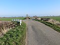
 Bend in the A1111 near Grange Farm - geograph.org.uk - 4682530.jpg 640 × 480; 81 KB
-
 Centre of Hagnaby - geograph.org.uk - 3948948.jpg 640 × 427; 82 KB
-
 Crawcroft Lane, Hannah - geograph.org.uk - 6075645.jpg 4,000 × 3,000; 3.4 MB
-
 Crop field, Stone Bridge - geograph.org.uk - 4657799.jpg 640 × 480; 97 KB
-
-
 Farm track near Hagnaby - geograph.org.uk - 3756929.jpg 3,000 × 2,000; 5.17 MB
-
 Field edge near Hagnaby - geograph.org.uk - 3759619.jpg 1,600 × 962; 485 KB
-
 Field with distant Wind Farm - geograph.org.uk - 3758096.jpg 3,500 × 2,333; 5.99 MB
-
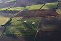
 Flat farmland near Hannah - geograph.org.uk - 4682536.jpg 640 × 480; 52 KB
-
 Gated farm track near Hagnaby - geograph.org.uk - 4682548.jpg 640 × 480; 74 KB
-
 Heading west near Stone Bridge - geograph.org.uk - 4682540.jpg 640 × 480; 80 KB
-
 Junction of lanes at Stone Bridge - geograph.org.uk - 6075636.jpg 4,000 × 3,000; 3.62 MB
-
 Lane at Hagnaby - geograph.org.uk - 6075622.jpg 4,000 × 3,000; 4.08 MB
-
 Lane crossing Washdyke Bridge - geograph.org.uk - 6075042.jpg 4,000 × 3,000; 3.44 MB
-
 Lane Junction with Rossa Road - geograph.org.uk - 1498913.jpg 640 × 480; 48 KB
-

-
 Mill Hill - Private Land - geograph.org.uk - 1498917.jpg 640 × 480; 61 KB
-
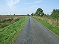
 Minor road towards Hagnaby - geograph.org.uk - 4682535.jpg 640 × 480; 66 KB
-
 Minor road towards Hagnaby - geograph.org.uk - 4682538.jpg 640 × 480; 85 KB
-
 Minor road towards Hagnaby - geograph.org.uk - 4682541.jpg 640 × 480; 77 KB
-
 Minor road towards Hagnaby - geograph.org.uk - 4682546.jpg 640 × 480; 81 KB
-
 Ordnance Survey Cut Mark - geograph.org.uk - 6087854.jpg 4,000 × 3,000; 4.14 MB
-

-

-
-

-

-

-

-
 Stubble field near Mill Hill - geograph.org.uk - 4682544.jpg 640 × 480; 78 KB
-

-
 Thorpe Hannah Drain - geograph.org.uk - 6340416.jpg 5,456 × 3,632; 5.01 MB
-
 Track to Abbey Farm at Hagnaby - geograph.org.uk - 6075628.jpg 4,000 × 3,000; 3.83 MB
-
 Track towards Mill Hill - geograph.org.uk - 3948649.jpg 640 × 427; 64 KB
-
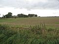 View across farmland towards Hannah - geograph.org.uk - 1498912.jpg 640 × 480; 75 KB
-

-
 Wold Grift Drain from Washdyke Bridge - geograph.org.uk - 6340563.jpg 5,456 × 3,632; 5.8 MB
-
 Wold Grift Drain towards Washdyke Bridge - geograph.org.uk - 6340417.jpg 5,456 × 3,632; 4.93 MB
-
 Wold Grift Drain towards Washdyke Bridge - geograph.org.uk - 6340418.jpg 5,456 × 3,632; 4.29 MB
-
 Wold Grift Drain towards Washdyke Bridge - geograph.org.uk - 6340420.jpg 5,456 × 3,632; 4.29 MB
-
 Young plantation by Mill Hill - geograph.org.uk - 3948642.jpg 640 × 427; 73 KB


_-_geograph.org.uk_-_4683969.jpg)


