Category:Hanham Abbots
Jump to navigation
Jump to search
English: Hanham Abbots is a civil parish in the South Gloucestershire district, in the county of Gloucestershire, England.
civil parish in South Gloucestershire, Gloucestershire, England | |||||
| Upload media | |||||
| Instance of | |||||
|---|---|---|---|---|---|
| Location | South Gloucestershire, Gloucestershire, South West England, England | ||||
| Population |
| ||||
 | |||||
Subcategories
This category has the following 6 subcategories, out of 6 total.
Media in category "Hanham Abbots"
The following 200 files are in this category, out of 214 total.
(previous page) (next page)-

-
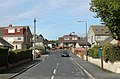
 2010 , Abbots Road looking west - geograph.org.uk - 2111859.jpg 1,024 × 777; 218 KB
-
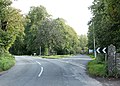
 2010 , Avon Ring Road looking north - geograph.org.uk - 2111865.jpg 1,600 × 1,176; 491 KB
-
 2010 , Court Farm Road, Longwell Green - geograph.org.uk - 2110666.jpg 1,600 × 1,025; 383 KB
-
 2010 , Court Farm Road, Longwell Green, Bristol - geograph.org.uk - 2110658.jpg 1,600 × 1,173; 421 KB
-
 2010 , Footpath and fields, Bristol's green belt - geograph.org.uk - 2111808.jpg 1,024 × 683; 248 KB
-
-
 2010 , Stratton Place, Longwell Green - geograph.org.uk - 2110902.jpg 1,024 × 683; 197 KB
-
 2010 , The house on the hill, Longwell Green - geograph.org.uk - 2111819.jpg 1,024 × 719; 130 KB
-
 2010 , Windsor Road, Longwell Green - geograph.org.uk - 2089464.jpg 800 × 530; 130 KB
-
 2011 , A431 passing the Butchers Arms - geograph.org.uk - 2277119.jpg 1,600 × 1,259; 451 KB
-
 2011 , At the end of Iles Close, Hanham - geograph.org.uk - 2277172.jpg 3,840 × 2,418; 2.76 MB
-
 2011 , Dynorod men on an errand of mercy - geograph.org.uk - 2270640.jpg 1,600 × 1,249; 722 KB
-
 A different landscape and a different flavour - geograph.org.uk - 6440226.jpg 3,296 × 2,472; 1.95 MB
-
 A Georgian postbox on Gays Road - geograph.org.uk - 6556497.jpg 2,472 × 3,296; 1.79 MB
-
 A high lift of the legs - geograph.org.uk - 6761192.jpg 3,296 × 2,472; 3.34 MB
-
 A large and woody mushroom - geograph.org.uk - 5686201.jpg 2,304 × 1,704; 1.68 MB
-
 A line of wood and flowers - geograph.org.uk - 5286514.jpg 2,304 × 1,704; 1.68 MB
-
 A lockdown scenario - geograph.org.uk - 6763271.jpg 3,296 × 2,472; 3.49 MB
-
 A monarch and horses along the Avon - geograph.org.uk - 5286556.jpg 1,704 × 2,304; 1.77 MB
-
 A nasty niff - geograph.org.uk - 5686212.jpg 1,704 × 2,304; 2.37 MB
-
 A new gate^ - geograph.org.uk - 6761220.jpg 3,296 × 2,472; 3.4 MB
-
 A pound on the common - geograph.org.uk - 6764239.jpg 3,296 × 2,472; 3.65 MB
-
 A risky step - geograph.org.uk - 5328517.jpg 2,304 × 1,704; 1.82 MB
-
 A seat by the Avon - geograph.org.uk - 5686789.jpg 2,304 × 1,704; 1.61 MB
-
 A short cliff face - geograph.org.uk - 5686205.jpg 2,304 × 1,704; 1.73 MB
-
 A sign awaiting Spring - geograph.org.uk - 5686841.jpg 1,704 × 2,304; 1.9 MB
-
 A small car park in front of the houses - geograph.org.uk - 6556462.jpg 3,296 × 2,472; 1.89 MB
-
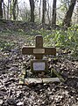 A small cross for a life lost - geograph.org.uk - 5686190.jpg 1,704 × 2,304; 2.33 MB
-
 A stile to enter Hanham Recreation Ground - geograph.org.uk - 6556475.jpg 2,472 × 3,296; 1.81 MB
-
 A stile with a mixture of styles - geograph.org.uk - 5287459.jpg 2,304 × 1,704; 1.98 MB
-
 A walk to the River Avon - geograph.org.uk - 6764258.jpg 3,296 × 2,472; 3.6 MB
-
 A4174 near Hanham Green - geograph.org.uk - 3565304.jpg 515 × 640; 68 KB
-
 A4174 near Hanham Green - geograph.org.uk - 3565325.jpg 557 × 640; 81 KB
-
 Abbots Avenue, Hanham - geograph.org.uk - 3385410.jpg 1,024 × 768; 137 KB
-
 Across the Hams - geograph.org.uk - 6440223.jpg 3,296 × 2,472; 1.88 MB
-
 Across to Castle Inn Farm - geograph.org.uk - 5287474.jpg 2,304 × 1,704; 1.72 MB
-
 An early luncheon - geograph.org.uk - 5286731.jpg 2,304 × 1,704; 1.16 MB
-
 An opening for little doggies^ - geograph.org.uk - 5287470.jpg 2,304 × 1,704; 1.7 MB
-
 An unconvincing camouflage - geograph.org.uk - 6761202.jpg 3,296 × 2,472; 3.43 MB
-
 Approaching the foot of Hanham hills via footpath PHA22 - geograph.org.uk - 5375453.jpg 2,592 × 1,936; 2.07 MB
-
 Avon flood plain below Hencliff Wood - geograph.org.uk - 3563568.jpg 640 × 458; 92 KB
-
 Avon Valley Path - geograph.org.uk - 5562121.jpg 2,592 × 1,944; 1.3 MB
-
 Avon Walkway below Cleeve Wood, Hanham - geograph.org.uk - 5637290.jpg 5,184 × 2,920; 5.63 MB
-
 Back lane, Hanham - geograph.org.uk - 3385445.jpg 1,024 × 614; 97 KB
-
 Bags full - geograph.org.uk - 5286743.jpg 2,304 × 1,704; 1.18 MB
-
 Barn east of Hanham Green - geograph.org.uk - 3565032.jpg 640 × 480; 81 KB
-
 Barn east of Hanham Green - geograph.org.uk - 3565084.jpg 480 × 640; 78 KB
-
 Barred gate at The Batch - geograph.org.uk - 5685868.jpg 2,304 × 1,704; 1.79 MB
-
 Bath Road at its junction with Long Beach Road - geograph.org.uk - 5577576.jpg 6,000 × 4,000; 4.87 MB
-
 Bath Road in Longwell Green - geograph.org.uk - 5577570.jpg 6,000 × 4,000; 5.21 MB
-
 Benchmark in Crossleaze Road - geograph.org.uk - 6556289.jpg 2,472 × 3,296; 1.82 MB
-
 Benchmark on Abbots Road - geograph.org.uk - 6761157.jpg 3,296 × 2,472; 3.37 MB
-
 Bickley Farm - geograph.org.uk - 3564240.jpg 640 × 450; 91 KB
-
 Big bobbins - geograph.org.uk - 5686861.jpg 2,304 × 1,704; 1.69 MB
-
 Boats and weir, Hanham Mills - geograph.org.uk - 3563994.jpg 640 × 453; 75 KB
-
 Bridge over Siston Brook - geograph.org.uk - 5577504.jpg 6,000 × 4,000; 7.36 MB
-
 Bypassed stile - geograph.org.uk - 6440206.jpg 3,296 × 2,472; 1.87 MB
-
 Castle Hill Farm, outbuilding - geograph.org.uk - 2903279.jpg 640 × 480; 92 KB
-
 Clearing stone and wood - geograph.org.uk - 5287534.jpg 1,704 × 2,304; 2.12 MB
-
 Cleeve Wood - geograph.org.uk - 4484421.jpg 1,024 × 768; 139 KB
-
 Close to the mouth - geograph.org.uk - 5328565.jpg 1,704 × 2,304; 2.24 MB
-
 Concrete column for art's sake - geograph.org.uk - 5286564.jpg 1,704 × 2,304; 1.74 MB
-
 Cottages at Hanham Mills - geograph.org.uk - 3564198.jpg 480 × 640; 69 KB
-
 Cottages at Hanham Mills - geograph.org.uk - 5637293.jpg 5,184 × 2,920; 5.61 MB
-
 Cottages on Stonehill - geograph.org.uk - 5578361.jpg 6,000 × 4,000; 4.93 MB
-
 Cottages, Hanham - geograph.org.uk - 2794320.jpg 2,848 × 2,136; 1.35 MB
-
 Couch's Rank - geograph.org.uk - 5686802.jpg 2,304 × 1,704; 1.65 MB
-
 Court Farm Road - geograph.org.uk - 3564829.jpg 640 × 468; 102 KB
-
 Court Farm Road - geograph.org.uk - 3564920.jpg 640 × 435; 64 KB
-
 Crossing Abbots Road - geograph.org.uk - 5287511.jpg 1,704 × 2,304; 1.45 MB
-
 Crumbling building near the Avon - geograph.org.uk - 5686794.jpg 2,304 × 1,704; 1.7 MB
-
 Cut Mark, Hanham Green, Castle Inn Farm - geograph.org.uk - 2903299.jpg 480 × 640; 122 KB
-

-
 Derelict barn on Longwell Green - geograph.org.uk - 6761190.jpg 3,296 × 2,472; 3.63 MB
-
 Don't stop or get too close^ - geograph.org.uk - 6556496.jpg 2,472 × 3,296; 1.8 MB
-
 Electric fence in horse-speak - geograph.org.uk - 5286580.jpg 2,304 × 1,704; 1.38 MB
-
 Entrance to a small copse crowning Hanham hills - geograph.org.uk - 5375477.jpg 2,592 × 1,936; 2.05 MB
-

-
 Ferry Road, Hanham - geograph.org.uk - 3564206.jpg 640 × 494; 105 KB
-
 Ferry Road, Hanham - geograph.org.uk - 3564257.jpg 640 × 445; 75 KB
-
 Field at Court Farm - geograph.org.uk - 3564901.jpg 640 × 443; 67 KB
-
 Field by Court Farm Road - geograph.org.uk - 3564815.jpg 640 × 441; 64 KB
-
 Field east of Hanham Green - geograph.org.uk - 3565288.jpg 640 × 444; 70 KB
-
 Field near Longwell Green - geograph.org.uk - 3564937.jpg 640 × 445; 74 KB
-
 Footbridge over A4174 - geograph.org.uk - 3565293.jpg 450 × 640; 50 KB
-
 Footpath junction in Avon Valley Woodlands - geograph.org.uk - 3386147.jpg 1,024 × 768; 234 KB
-
 Footpath junction in Bickley Wood - geograph.org.uk - 5686745.jpg 2,304 × 1,704; 1.77 MB
-
 Footpath near Hanham Green - geograph.org.uk - 3565006.jpg 640 × 493; 89 KB
-
 Footpath over grazing land - geograph.org.uk - 5577562.jpg 6,000 × 4,000; 6.03 MB
-
 Forest Edge, Hanham - geograph.org.uk - 3385419.jpg 1,024 × 768; 136 KB
-
 Former chapel on Shellards Road - geograph.org.uk - 5578318.jpg 6,000 × 4,000; 5.03 MB
-
 Former quarry, Avon Valley Woodlands - geograph.org.uk - 3386141.jpg 1,024 × 768; 241 KB
-
 Gate with map showing footpaths over Hanham hills - geograph.org.uk - 5226899.jpg 2,592 × 1,936; 1.75 MB
-
 Gatehouse, Hanham Court. - panoramio.jpg 2,816 × 2,112; 1.49 MB
-
 Gates to Hanham Court - geograph.org.uk - 3564747.jpg 640 × 480; 92 KB
-
 Gateway off Abbots road - geograph.org.uk - 5426803.jpg 2,592 × 1,936; 2.22 MB
-
 Getting plastered in a pub - geograph.org.uk - 5325898.jpg 1,704 × 2,304; 1.35 MB
-
 Green rows - geograph.org.uk - 5686775.jpg 2,304 × 1,704; 1.65 MB
-
 Greenbank Road - geograph.org.uk - 5578381.jpg 6,000 × 4,000; 4.1 MB
-
 Half a building at The Batch - geograph.org.uk - 5685865.jpg 2,304 × 1,704; 2.06 MB
-
 Hanham Abbotts Church (St. George) & Tithe Barn (14990010213).jpg 4,592 × 3,056; 3.74 MB
-
 Hanham Avon valley - geograph.org.uk - 5556645.jpg 3,968 × 2,976; 2.12 MB
-
 Hanham Avon Valley - geograph.org.uk - 5556652.jpg 3,407 × 2,556; 2.66 MB
-
 Hanham C.C. pavilion - geograph.org.uk - 6556448.jpg 3,296 × 2,472; 1.8 MB
-
 Hanham Cricket ground - geograph.org.uk - 6556438.jpg 3,296 × 2,472; 1.82 MB
-
 Hanham Green, a public open space - geograph.org.uk - 6556435.jpg 3,296 × 2,472; 1.92 MB
-
 Hanham Hall - geograph.org.uk - 3565369.jpg 640 × 444; 50 KB
-
 Hanham Hall from the north-west - geograph.org.uk - 3385443.jpg 1,024 × 768; 105 KB
-
 Hanham Lock from the big bridge (geograph 6439516).jpg 3,296 × 2,472; 1.86 MB
-
 Hanham Mills - geograph.org.uk - 3563947.jpg 640 × 476; 74 KB
-
 Hanham Tithe Barn (15607463671).jpg 4,592 × 3,056; 3.81 MB
-
 Hanham weir through a pergola - geograph.org.uk - 5286550.jpg 1,704 × 2,304; 2 MB
-
 Heading Close - geograph.org.uk - 3385449.jpg 1,024 × 768; 122 KB
-
 Heath Road - geograph.org.uk - 3386126.jpg 1,024 × 614; 113 KB
-
 Horses and motorcyclists are...^ - geograph.org.uk - 5286235.jpg 1,704 × 2,304; 2.22 MB
-
 House on River Avon once owned by J.Couch - geograph.org.uk - 1773216.jpg 1,006 × 1,024; 397 KB
-
 Houses on Samuel White Road - geograph.org.uk - 3385447.jpg 1,024 × 768; 121 KB
-
 Iron machinery by the Avon - geograph.org.uk - 5686783.jpg 2,304 × 1,704; 1.7 MB
-
 Junction on Castle Farm Road - geograph.org.uk - 5685873.jpg 2,304 × 1,704; 1.76 MB
-
 Kennet ^ Avon Canal Walk - geograph.org.uk - 6051805.jpg 640 × 480; 99 KB
-
 Kennet ^ Avon Canal Walk - geograph.org.uk - 6051816.jpg 640 × 480; 98 KB
-
 Kennet ^ Avon Canal Walk - geograph.org.uk - 6051846.jpg 640 × 480; 133 KB
-
 Kissing gate at the top of Hanham hills on footpath PHA15 - geograph.org.uk - 5375436.jpg 2,592 × 1,936; 2.34 MB
-
 Kissing gate on top of Hanham hills - geograph.org.uk - 5328434.jpg 2,592 × 1,936; 2.73 MB
-
 Landing stages on the north bank of the Avon - geograph.org.uk - 4486448.jpg 1,024 × 768; 140 KB
-
 Last orders for the Queen - geograph.org.uk - 4807498.jpg 2,304 × 1,704; 1.55 MB
-
 Leaving Abbots Road - geograph.org.uk - 5287524.jpg 2,304 × 1,704; 1.75 MB
-
 Little joy on Stonehill - geograph.org.uk - 6763278.jpg 3,296 × 2,472; 3.27 MB
-
 Londonderry Farm Hanham - geograph.org.uk - 5561001.jpg 1,248 × 960; 457 KB
-
 Londonderry Wharf Bridge, over Siston Brook - geograph.org.uk - 4484395.jpg 1,024 × 768; 222 KB
-
 Longwell Green from the air - geograph.org.uk - 4784460.jpg 3,264 × 2,448; 4.57 MB
-
 Longwell Green trig flush bracket - geograph.org.uk - 6761215.jpg 2,472 × 3,296; 3.31 MB
-
 Losing the flavour - geograph.org.uk - 5328485.jpg 1,704 × 2,304; 1.74 MB
-
 Meadow, Hanham Green - geograph.org.uk - 3565342.jpg 640 × 460; 82 KB
-

-
 Mi-space, Longwell Green - geograph.org.uk - 5578336.jpg 6,000 × 4,000; 4.05 MB
-
 Mill Cottages, Hanham - geograph.org.uk - 1773240.jpg 1,600 × 1,328; 841 KB
-
 Modern information for walkers - geograph.org.uk - 6763265.jpg 2,472 × 3,296; 3.26 MB
-
 Mooring post on the Avon towpath - geograph.org.uk - 5686849.jpg 1,704 × 2,304; 1.98 MB
-
 Moorings beside the pub - geograph.org.uk - 5286524.jpg 2,304 × 1,704; 1.69 MB
-
 Mother Nature's restaurant is open - geograph.org.uk - 5286738.jpg 2,304 × 1,704; 1.15 MB
-
 My Local - geograph.org.uk - 5577582.jpg 6,000 × 4,000; 4.76 MB
-
 Nature's bridge - geograph.org.uk - 5328504.jpg 2,304 × 1,704; 1.67 MB
-
 Nibbled away - geograph.org.uk - 6440209.jpg 2,472 × 3,296; 1.7 MB
-
 No footpath along this farm track - geograph.org.uk - 5392084.jpg 2,592 × 1,936; 2.61 MB
-
 No household waste - geograph.org.uk - 5286001.jpg 1,704 × 2,304; 1.4 MB
-
 No Motorcycles or guns^ - geograph.org.uk - 5685881.jpg 1,704 × 2,304; 2.33 MB
-
 No-one wants to kiss^ - geograph.org.uk - 5328559.jpg 1,704 × 2,304; 1.66 MB
-
 No. 44 bus on Memorial Road - geograph.org.uk - 3386124.jpg 1,024 × 614; 102 KB
-
-
 North bank of the River Avon, below Cleeve Wood - geograph.org.uk - 4484411.jpg 1,024 × 768; 190 KB
-
 Open Access - geograph.org.uk - 5328528.jpg 2,304 × 1,704; 1.67 MB
-
 Open for a meal - geograph.org.uk - 5286734.jpg 2,304 × 1,704; 1.12 MB
-
 Open to the elements - geograph.org.uk - 5686771.jpg 2,304 × 1,704; 1.69 MB
-
 Path east of Hanham Green - geograph.org.uk - 3565291.jpg 480 × 640; 93 KB
-
 Path to Hanham Green - geograph.org.uk - 3565337.jpg 640 × 449; 73 KB
-
 Planting for the future - geograph.org.uk - 5328533.jpg 2,304 × 1,704; 1.63 MB
-
 Please do not feed us^ - geograph.org.uk - 6554283.jpg 3,296 × 2,472; 1.91 MB
-
 Please do not feed us^ - geograph.org.uk - 6764249.jpg 2,472 × 3,296; 3.09 MB
-
 Pond at the end of Crossleaze Road - geograph.org.uk - 6764245.jpg 3,296 × 2,472; 3.34 MB
-
 Power lines crossing the River Avon - geograph.org.uk - 4484426.jpg 1,024 × 768; 100 KB
-
 Power over the brook - geograph.org.uk - 4807273.jpg 2,304 × 1,704; 1.72 MB
-
 Private landing stage, north bank, River Avon - geograph.org.uk - 4486454.jpg 1,024 × 768; 138 KB
-
 Public footpath through former quarry - geograph.org.uk - 3386142.jpg 1,024 × 768; 209 KB
-
 Reclaiming the stone - geograph.org.uk - 5686755.jpg 2,304 × 1,704; 1.7 MB
-
 Rickety stile - geograph.org.uk - 5328495.jpg 2,304 × 1,704; 1.65 MB
-
 Riding shotgun^ - geograph.org.uk - 5685871.jpg 1,704 × 2,304; 2.55 MB
-
 River Avon - geograph.org.uk - 5322775.jpg 640 × 426; 59 KB
-
 River Avon Trail - geograph.org.uk - 1855627.jpg 640 × 480; 122 KB
-
 River Avon, Hanham, - geograph.org.uk - 3644127.jpg 1,200 × 1,600; 608 KB
-
 Riverside Cottages, Hanham Mills - geograph.org.uk - 3563584.jpg 640 × 437; 56 KB
-
 Riveting road - geograph.org.uk - 5686869.jpg 1,704 × 2,304; 1.82 MB
-
 Rugged footwear should be worn - geograph.org.uk - 5686846.jpg 1,704 × 2,304; 1.98 MB
-
 Samuel White Road, Hanham - geograph.org.uk - 3385429.jpg 1,024 × 768; 108 KB
-
 Sign informing that there is no footpath - geograph.org.uk - 5392068.jpg 2,592 × 1,936; 2.17 MB
-
 Signs of a wet winter - geograph.org.uk - 5286552.jpg 2,304 × 1,704; 1.8 MB
-
 Silver birch on Whittucks Close - geograph.org.uk - 3385325.jpg 1,024 × 768; 141 KB
-
 South Gloucestershire , Bristol Scenery - geograph.org.uk - 4155542.jpg 4,288 × 2,848; 7.19 MB
-
 South over the Avon - geograph.org.uk - 5287486.jpg 1,704 × 2,304; 1.74 MB
-
 Standing 92.607 metres high - geograph.org.uk - 6761211.jpg 2,472 × 3,296; 3.25 MB
-
 Stile east of Hanham Green - geograph.org.uk - 3565047.jpg 480 × 640; 116 KB
-
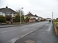
 Stone Hill, ring road - geograph.org.uk - 2104402.jpg 1,024 × 768; 144 KB
-
 Stone posts and a wooden gate on Abbots Road - geograph.org.uk - 6761162.jpg 3,296 × 2,472; 3.3 MB
-
 Stone stile on Abbots Road - geograph.org.uk - 6556408.jpg 3,296 × 2,472; 1.88 MB
-
 Sub-station in Crossleaze Road - geograph.org.uk - 6556283.jpg 3,296 × 2,472; 1.9 MB
-
 The Avon valley at Kingswood - geograph.org.uk - 4784423.jpg 3,264 × 2,448; 4.6 MB
-
 The Barton - geograph.org.uk - 3385451.jpg 1,024 × 614; 107 KB
-
 The Chapel Coffee Shop - geograph.org.uk - 5578313.jpg 6,000 × 4,000; 5.06 MB
-
 The Elm Tree, Hanham - geograph.org.uk - 6556426.jpg 3,296 × 2,472; 1.84 MB
-
 The Longwell Green trig point - geograph.org.uk - 6761205.jpg 3,296 × 2,472; 3.52 MB
-
 The Old Lock and Weir Inn - geograph.org.uk - 5286541.jpg 2,304 × 1,704; 1.22 MB
-
 The Old Locked Up^ - geograph.org.uk - 6440213.jpg 3,296 × 2,472; 2.53 MB
-
 The Queen's Head - a 350 year story - geograph.org.uk - 4807666.jpg 2,304 × 1,704; 1.61 MB
-
 The R Avon at The Chequers PH, Hanham Mills - geograph.org.uk - 5637292.jpg 5,184 × 2,920; 5.73 MB
-
 The ring road near Hanham - geograph.org.uk - 5287518.jpg 2,304 × 1,704; 1.31 MB
-
 The scaffolding removed - geograph.org.uk - 5325887.jpg 2,304 × 1,704; 1.55 MB
-
 The whites of Roman Way - geograph.org.uk - 6765646.jpg 3,296 × 2,472; 3.3 MB
-
 To Mount Pleasant - geograph.org.uk - 5287538.jpg 2,304 × 1,704; 1.75 MB
-
 Towards Gover Road - geograph.org.uk - 3565352.jpg 524 × 640; 88 KB


_%26_Tithe_Barn_(14990010213).jpg)


.jpg)

.jpg)


