Category:Hanbury, Staffordshire
Jump to navigation
Jump to search
village and civil parish in Staffordshire, UK  | |||||
| Upload media | |||||
| Instance of | |||||
|---|---|---|---|---|---|
| Location | East Staffordshire, Staffordshire, West Midlands, England | ||||
 | |||||
Subcategories
This category has the following 4 subcategories, out of 4 total.
R
W
- St Werburgh's Church, Hanbury (10 F)
Media in category "Hanbury, Staffordshire"
The following 200 files are in this category, out of 255 total.
(previous page) (next page)-
 131 metre spot height on Knightsfield Road - geograph.org.uk - 3182809.jpg 1,024 × 768; 128 KB
-
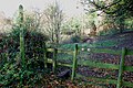
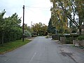
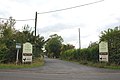
 A choice of three ways - Hanbury, Staffordshire - geograph.org.uk - 3620586.jpg 3,072 × 2,304; 2.63 MB
-
 A corner of Hanbury - Staffordshire - geograph.org.uk - 3842546.jpg 3,072 × 2,304; 4.36 MB
-
 A narrow country lane - geograph.org.uk - 5868402.jpg 2,000 × 1,333; 2.9 MB
-
 A track off Greaves Lane - geograph.org.uk - 5868410.jpg 2,000 × 1,333; 2.95 MB
-
 An agricultural store - geograph.org.uk - 5868351.jpg 2,000 × 1,333; 2.29 MB
-
 Anslow Road towards Blackbrook - geograph.org.uk - 5842829.jpg 1,469 × 1,102; 553 KB
-
 Anslow Road, Woodend - geograph.org.uk - 5565639.jpg 640 × 480; 76 KB
-
 Approach to Coton in the Clay - geograph.org.uk - 2685263.jpg 640 × 428; 81 KB
-
 Approaching Hanbury 1 - Staffordshire - geograph.org.uk - 3843088.jpg 3,072 × 2,304; 2.17 MB
-
 Approaching Hanbury 2 - Staffordshire - geograph.org.uk - 3843097.jpg 3,072 × 2,304; 2.1 MB
-
 Approaching Hanbury 3 - Staffordshire - geograph.org.uk - 3843100.jpg 3,072 × 2,304; 2.2 MB
-
 Approaching Hanbury 4 - Staffordshire - geograph.org.uk - 3843109.jpg 3,072 × 2,304; 2.65 MB
-
 Approaching Hare Holes Farm - geograph.org.uk - 1626763.jpg 640 × 480; 92 KB
-
 Approaching Lower Castle Hayes Farm - geograph.org.uk - 5583586.jpg 1,600 × 1,200; 461 KB
-
 Arriving at Hanbury - geograph.org.uk - 5583565.jpg 1,600 × 1,200; 354 KB
-
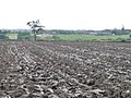
 As far as the plough has got - geograph.org.uk - 3182771.jpg 1,024 × 768; 134 KB
-

-
 B5017 towards Needwood - geograph.org.uk - 5564688.jpg 640 × 480; 57 KB
-
 B5017 towards Needwood - geograph.org.uk - 5564693.jpg 640 × 480; 74 KB
-
 B5234 heading east - geograph.org.uk - 3422831.jpg 640 × 480; 73 KB
-
 B5234 heading east - geograph.org.uk - 3422839.jpg 640 × 480; 88 KB
-
 B5234 heading east - geograph.org.uk - 3422851.jpg 640 × 480; 59 KB
-
 Back Entrance to a Farm at Woodend - geograph.org.uk - 2612141.jpg 640 × 428; 86 KB
-
 Barn at Fauld Hall - geograph.org.uk - 5592339.jpg 1,280 × 977; 291 KB
-
 Barn at Fauld Hall, detail - geograph.org.uk - 5592355.jpg 1,280 × 838; 455 KB
-
 Bend in Coton Lane - geograph.org.uk - 5097761.jpg 640 × 480; 59 KB
-
 Bends in Fauld Lane - geograph.org.uk - 5097765.jpg 640 × 480; 56 KB
-
 Big Staffordshire sky - geograph.org.uk - 4457733.jpg 4,320 × 3,240; 3.79 MB
-
 Blackbrook Spinney - geograph.org.uk - 3182863.jpg 1,024 × 768; 165 KB
-
 Bus shelter in Anslow Road, Hanbury - Staffordshire - geograph.org.uk - 3845507.jpg 3,072 × 2,304; 2.36 MB
-
 By Fauld Hall - geograph.org.uk - 5868346.jpg 2,000 × 1,333; 2.09 MB
-
 Car Park at Hanbury Common - geograph.org.uk - 5565021.jpg 1,280 × 960; 656 KB
-
 Cattle grazing by a small patch of trees - geograph.org.uk - 3182877.jpg 1,024 × 768; 167 KB
-
 Chapel Lane, Hanbury Woodend - geograph.org.uk - 3182788.jpg 1,024 × 768; 127 KB
-
 Church Lane, Hanbury 1 - Staffordshire - geograph.org.uk - 3845268.jpg 3,072 × 2,304; 2.4 MB
-
 Church Lane, Hanbury 2 - Staffordshire - geograph.org.uk - 3845279.jpg 3,072 × 2,304; 2.67 MB
-
 Church Lane, Hanbury 3 - Staffordshire - geograph.org.uk - 3845285.jpg 3,072 × 2,304; 2.99 MB
-
 Church Lane, Hanbury 4 - Staffordshire - geograph.org.uk - 3845292.jpg 3,072 × 2,304; 2.34 MB
-
 Coming into Coton in the Clay - geograph.org.uk - 5843262.jpg 1,469 × 1,102; 574 KB
-
 Contrasting trees along the B5017 - geograph.org.uk - 3182760.jpg 1,024 × 768; 161 KB
-
 Contrasting trees in field and spinney - geograph.org.uk - 3182868.jpg 1,024 × 768; 111 KB
-
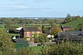
 Coton Hall - geograph.org.uk - 5592321.jpg 1,280 × 960; 340 KB
-
 Coton in the Clay - geograph.org.uk - 5868367.jpg 2,000 × 1,333; 3.32 MB
-
 Coton Lane, Coton in the Clay - geograph.org.uk - 5098277.jpg 640 × 426; 52 KB
-
 Coulter's Hill Farm - geograph.org.uk - 3182500.jpg 1,024 × 768; 228 KB
-
 Coulters Hill Cottage - geograph.org.uk - 2683722.jpg 640 × 428; 125 KB
-
 Coulters Hill Cottage, from the west - geograph.org.uk - 3182465.jpg 1,024 × 768; 188 KB
-
 Croft Farm - geograph.org.uk - 1914163.jpg 2,000 × 1,500; 665 KB
-
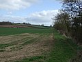
 Crop field towards Greaves Wood - geograph.org.uk - 5564686.jpg 640 × 480; 62 KB
-
-
 Crossplain Poultry Farm - geograph.org.uk - 3422836.jpg 1,024 × 605; 146 KB
-
 Crossroads at the 136 metre spot height - geograph.org.uk - 3182753.jpg 1,024 × 768; 147 KB
-
 Cyclist heading east on Anslow Road - geograph.org.uk - 3182815.jpg 1,024 × 768; 129 KB
-
 Decorative plasterwork, Croft Farm, Hanbury - geograph.org.uk - 1914155.jpg 2,000 × 1,448; 430 KB
-
 Dozens of gulls over a stubble field - geograph.org.uk - 3182472.jpg 1,024 × 768; 162 KB
-
 Draycott and Hanbury Cricket Club - geograph.org.uk - 198906.jpg 640 × 480; 81 KB
-
 Driveway to Hanbury Preparatory School - geograph.org.uk - 198909.jpg 640 × 480; 105 KB
-
 Dry grassland - geograph.org.uk - 5868424.jpg 2,000 × 1,333; 2.48 MB
-
 Elizabeth II postbox on Martin's Lane, Hanbury - geograph.org.uk - 5565757.jpg 2,592 × 1,944; 1.08 MB
-
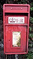 Elizabeth II postbox, Coton Lane, Coton in the Clay - geograph.org.uk - 5098276.jpg 1,450 × 2,565; 545 KB
-
 Entering Coton Lane in the Clay - geograph.org.uk - 5097758.jpg 640 × 480; 73 KB
-
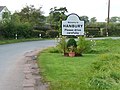
 Entering Hanbury - geograph.org.uk - 5564705.jpg 640 × 480; 71 KB
-
 Entrance to Saltbrook Meadow Farm - geograph.org.uk - 2685246.jpg 640 × 428; 84 KB
-
 Factory Units on Lancaster Park - geograph.org.uk - 2618701.jpg 640 × 428; 105 KB
-
 Farmland near Hare Holes Farm - geograph.org.uk - 6423697.jpg 1,024 × 768; 250 KB
-
 Farmland north of Bishop's Hill - geograph.org.uk - 3182496.jpg 1,024 × 768; 161 KB
-
 Farmland north of Brickyard Cottages - geograph.org.uk - 3182805.jpg 1,024 × 768; 105 KB
-
 Farmland on the north side of Hanbury Hill - geograph.org.uk - 5842846.jpg 1,306 × 979; 585 KB
-
 Farmland, Middle Linbrook - geograph.org.uk - 3422848.jpg 640 × 480; 55 KB
-
 Farmland, Vicar's Hill - geograph.org.uk - 3422827.jpg 640 × 480; 55 KB
-
 Fauld crater memorial - geograph.org.uk - 5177589.jpg 800 × 533; 609 KB
-
 Fauld Lane - geograph.org.uk - 3933061.jpg 4,000 × 3,000; 2.41 MB
-
 Fauld Lane - geograph.org.uk - 5097764.jpg 640 × 480; 54 KB
-
 Fauld Lane - geograph.org.uk - 5097772.jpg 640 × 480; 92 KB
-
 Fauld Lane - geograph.org.uk - 5097779.jpg 640 × 480; 53 KB
-
 Fauld Lane - geograph.org.uk - 5097785.jpg 640 × 480; 54 KB
-
 Fauld woodland in sunshine - Hanbury, Staffordshire - geograph.org.uk - 3844285.jpg 3,072 × 2,304; 4.08 MB
-
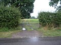
 Field gate on the south side of Pipey Lane - geograph.org.uk - 3182489.jpg 1,024 × 768; 209 KB
-
 Field north of Pipey Lane - geograph.org.uk - 3182481.jpg 1,024 × 768; 150 KB
-
 Field off the B5017 - geograph.org.uk - 5564690.jpg 640 × 460; 69 KB
-
 Field track near Fauld - geograph.org.uk - 5592336.jpg 1,280 × 960; 355 KB
-
 Fields looking to Rough Hays - geograph.org.uk - 401186.jpg 640 × 421; 40 KB
-
 Flood plain of the River Dove near Fauld - geograph.org.uk - 5592360.jpg 1,280 × 960; 265 KB
-
 Footpath across a Field of Cows - geograph.org.uk - 2612172.jpg 640 × 428; 74 KB
-
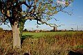
 Footpath and Big Tree - geograph.org.uk - 197548.jpg 640 × 480; 81 KB
-
 Footpath and Field near Fauld Industrial Park - geograph.org.uk - 6424076.jpg 1,024 × 768; 273 KB
-
 Footpath and Stile to Woodend - geograph.org.uk - 2612180.jpg 428 × 640; 93 KB
-
 Footpath between Draycott in the Clay and Hanbury - geograph.org.uk - 5583562.jpg 1,600 × 1,200; 416 KB
-
 Footpath in Brown's Coppice - geograph.org.uk - 6424058.jpg 2,901 × 3,869; 5.14 MB
-
 Footpath Near Fauld Crater - geograph.org.uk - 1626784.jpg 640 × 480; 129 KB
-
 Footpath on Greaves Lane - geograph.org.uk - 2683734.jpg 640 × 428; 120 KB
-
 Footpath through a stream - geograph.org.uk - 3182856.jpg 1,024 × 768; 236 KB
-
 Footpath through the corn on Hanbury Hill - geograph.org.uk - 5565009.jpg 1,280 × 960; 609 KB
-
 Footpath to Coulters Hill - geograph.org.uk - 3422823.jpg 640 × 480; 75 KB
-
 Footpath to Farm - geograph.org.uk - 197544.jpg 640 × 480; 120 KB
-
 Footpath to Foxholes - geograph.org.uk - 5564702.jpg 640 × 480; 125 KB
-
 Footpath To Hanbury Church - geograph.org.uk - 1971453.jpg 1,496 × 1,122; 840 KB
-

-
 Former tramway at the gypsum works - geograph.org.uk - 5565053.jpg 1,280 × 960; 557 KB
-
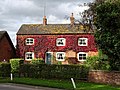
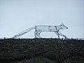 Fox on Thatched Roof, Hanbury - geograph.org.uk - 1975250.jpg 1,496 × 1,122; 498 KB
-
 Fresh Growth in the Fields - geograph.org.uk - 2682635.jpg 640 × 428; 135 KB
-
 From Fauld Lane looking to Row Hill - geograph.org.uk - 2685256.jpg 640 × 428; 103 KB
-
 Gated farm track off Fauld Lane - geograph.org.uk - 5097768.jpg 640 × 480; 89 KB
-
 Gated track off Pipey Lane - geograph.org.uk - 5564694.jpg 640 × 480; 115 KB
-
 Gated track to farm buildings - geograph.org.uk - 3182779.jpg 1,024 × 768; 184 KB
-
 Glebe House, Hanbury.jpg 4,320 × 3,240; 4.67 MB
-
 Grazing and hedgerow, Hanbury Park - geograph.org.uk - 5565641.jpg 640 × 480; 56 KB
-
 Grazing near the River Dove - geograph.org.uk - 5097775.jpg 640 × 480; 43 KB
-
 Grazing near the River Dove - geograph.org.uk - 5097784.jpg 640 × 480; 58 KB
-
 Grazing north of Fauld Lane - geograph.org.uk - 5097763.jpg 640 × 480; 49 KB
-
 Grazing towards Blackbrook Spinney - geograph.org.uk - 5565643.jpg 640 × 480; 76 KB
-
 Grazing, Fauld - geograph.org.uk - 5097767.jpg 640 × 480; 48 KB
-
 Grazing, Hanbury Woodend - geograph.org.uk - 5564699.jpg 640 × 480; 80 KB
-
 Grazing, Row Hill - geograph.org.uk - 5097760.jpg 640 × 480; 58 KB
-
 Grazing, Woodend - geograph.org.uk - 5565635.jpg 640 × 480; 70 KB
-
 Greaves Cottage, Greaves Lane - geograph.org.uk - 2683779.jpg 640 × 428; 84 KB
-
 Greaves Cottages - geograph.org.uk - 5868408.jpg 2,000 × 1,333; 2.5 MB
-
 Greaves Lane - geograph.org.uk - 2683755.jpg 640 × 428; 138 KB
-
 Hanbury Common - geograph.org.uk - 5583571.jpg 1,600 × 1,200; 342 KB
-
 Hanbury Woodend Cottage - geograph.org.uk - 5842836.jpg 1,469 × 1,102; 683 KB
-
 Hanbury Woodend Farm - geograph.org.uk - 2612150.jpg 640 × 428; 105 KB
-
 Hanbury Woodend farmland - geograph.org.uk - 3182799.jpg 1,024 × 768; 101 KB
-
 Hanbury Woodend postbox - geograph.org.uk - 3182792.jpg 1,024 × 768; 147 KB
-
 Hare Holes Farm - geograph.org.uk - 1223993.jpg 640 × 480; 44 KB
-
 Heading east on Fauld Lane - geograph.org.uk - 5097777.jpg 640 × 480; 63 KB
-
 House in Hanbury - geograph.org.uk - 5564706.jpg 640 × 480; 66 KB
-
 House on Martin's Lane, Hanbury - geograph.org.uk - 5565760.jpg 640 × 480; 88 KB
-
 House on the bend of Anslow Road - geograph.org.uk - 3182817.jpg 1,024 × 768; 135 KB
-
 Incomplete field boundary, north of Pipey Lane - geograph.org.uk - 3182477.jpg 1,024 × 768; 136 KB
-
 Isolated building south of Fauld Crater - geograph.org.uk - 5583580.jpg 1,600 × 1,200; 335 KB
-
-
 Knightsfield Road, Hanbury - geograph.org.uk - 3182757.jpg 962 × 722; 144 KB
-
 Knightsfield Road, Hanbury Woodend - geograph.org.uk - 5564700.jpg 640 × 480; 94 KB
-

-
 Lane to Hare Holes Farm - geograph.org.uk - 5583583.jpg 1,600 × 1,200; 349 KB
-
 Logs for sale, house for sale, Anslow Road - geograph.org.uk - 3182891.jpg 1,024 × 768; 128 KB
-

-
 Looking south east on the B5017 - geograph.org.uk - 5564698.jpg 640 × 480; 70 KB
-
 Looking to Finger Post on greaves Lane - geograph.org.uk - 2683747.jpg 640 × 428; 116 KB
-
 Looking Towards a Road Junction - geograph.org.uk - 2612188.jpg 640 × 416; 64 KB
-
 Looking towards Coton Farm - geograph.org.uk - 5868353.jpg 2,000 × 1,333; 2.23 MB
-
 Looking towards the Dove - geograph.org.uk - 5868323.jpg 2,000 × 1,333; 1.88 MB
-
 Looking up the hill - geograph.org.uk - 5868335.jpg 2,000 × 1,333; 2.09 MB
-
 Martin's Lane on Hanbury Hill - geograph.org.uk - 5842842.jpg 1,306 × 979; 708 KB
-
 Martin's Lane, Hanbury - geograph.org.uk - 5564707.jpg 640 × 480; 83 KB
-
 Martins Lane, Hanbury - Staffordshire - geograph.org.uk - 3845517.jpg 3,072 × 2,304; 2.21 MB
-
 Converted Chapel near Hanbury - geograph.org.uk - 198917.jpg 640 × 480; 103 KB
-
 Milepost at SK 15042733.jpg 640 × 480; 258 KB
-
 Milepost at SK 163 257.jpg 768 × 1,024; 440 KB
-
 Milepost at SK 174 246.jpg 492 × 701; 47 KB
-
 Milepost near Eland Brook.jpg 492 × 701; 62 KB
-
 Minor road towards Blackbrook - geograph.org.uk - 5565645.jpg 640 × 480; 67 KB
-
 Minor road towards Woodend - geograph.org.uk - 5565633.jpg 640 × 480; 75 KB
-
 Natural Viewpoint in the Stonepit Hills - geograph.org.uk - 6424069.jpg 3,686 × 2,762; 2.66 MB
-
 Near Blackbrook Farm - geograph.org.uk - 4455999.jpg 4,320 × 3,240; 4.32 MB
-
 New House Rises from Demolition Site - geograph.org.uk - 2612132.jpg 640 × 428; 78 KB
-
 Newly ploughed field, north of King's Standing - geograph.org.uk - 3182768.jpg 1,024 × 768; 163 KB
-

-
 Old air shaft - geograph.org.uk - 5565081.jpg 1,280 × 960; 249 KB
-
 Old Hall Farmhouse, Coton in the Clay.jpg 1,280 × 856; 357 KB
-
 On the edge of Hanbury - geograph.org.uk - 4456159.jpg 4,320 × 3,240; 5.18 MB
-
 Over a hedge to an Electric Sub Station - geograph.org.uk - 2685019.jpg 640 × 428; 113 KB
-
-
 Parson's Brake - geograph.org.uk - 400308.jpg 640 × 426; 99 KB
-
 Pipey Lane - geograph.org.uk - 3182463.jpg 1,024 × 768; 159 KB
-
 Pipey Lane - geograph.org.uk - 3182507.jpg 1,024 × 768; 154 KB
-
 Pipey Lane - geograph.org.uk - 3931141.jpg 4,317 × 2,933; 5.18 MB
-
 Pipey Lane - geograph.org.uk - 5564696.jpg 640 × 480; 60 KB
-
 Proud of Hanbury - geograph.org.uk - 3182828.jpg 1,024 × 768; 151 KB
-
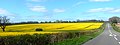
 Rape Seed Field - geograph.org.uk - 3931149.jpg 4,030 × 2,573; 4.68 MB
-
 Rape seed field - geograph.org.uk - 401177.jpg 640 × 421; 74 KB
-
 Rape Seed Landscape - Needwood Forest - geograph.org.uk - 3931158.jpg 4,488 × 1,665; 2.71 MB
-
 Rebuilt and still going - Hanbury, Staffordshire - geograph.org.uk - 3620608.jpg 3,072 × 2,304; 1.79 MB
-
 Red Brick Barn on Fauld Lane - geograph.org.uk - 2683889.jpg 640 × 428; 60 KB
-
 Return from Fauld crater - Hanbury, Staffordshire - geograph.org.uk - 3844236.jpg 3,072 × 2,304; 2.92 MB
-
 Riddings Lane - geograph.org.uk - 5565092.jpg 1,280 × 960; 567 KB
-
 Riddings Lane near Coton - geograph.org.uk - 5565074.jpg 1,280 × 960; 620 KB
-
 River Dove at Scropton - geograph.org.uk - 5573404.jpg 1,280 × 960; 559 KB
-
 Road (B5234) at Vicarshill Farm - geograph.org.uk - 5053325.jpg 4,000 × 3,000; 2.87 MB
-
 Road leaving Coton in the Clay - geograph.org.uk - 5843287.jpg 1,469 × 1,102; 522 KB
-
 Sign at the Cock Inn, Hanbury - geograph.org.uk - 1914178.jpg 1,346 × 2,000; 393 KB
-
 Small flock of sheep, Hanbury Woodend - geograph.org.uk - 3182823.jpg 1,024 × 768; 129 KB
-
 Springtime in Hanbury - Staffordshire - geograph.org.uk - 3845493.jpg 3,072 × 2,304; 2.95 MB
-
 St Werburgh's Church, Hanbury - geograph.org.uk - 5583567.jpg 1,600 × 1,200; 440 KB
-
 Staffordshire's green fields - geograph.org.uk - 3182845.jpg 1,024 × 768; 129 KB
-
 Stripes in the fields - geograph.org.uk - 4456004.jpg 4,320 × 3,240; 4.88 MB
-
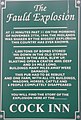
 Tale of tragedy - Hanbury, Staffordshire - geograph.org.uk - 3843211.jpg 3,072 × 2,304; 2.04 MB
-

-

-
 The Cock Inn - geograph.org.uk - 5868416.jpg 2,000 × 1,333; 1.73 MB
-

-
 The Cock Inn and a water tower, Hanbury - geograph.org.uk - 1914174.jpg 2,000 × 1,500; 607 KB
-

-
 The Cock Inn, Hanbury - geograph.org.uk - 582294.jpg 640 × 480; 37 KB
-
 The driveway to Hanbury Park - geograph.org.uk - 402971.jpg 640 × 480; 93 KB
-
 The Laurels and Coton Farmhouse - geograph.org.uk - 5592314.jpg 1,280 × 960; 536 KB
-
 The Laurels, Coton in the Clay.jpg 1,280 × 960; 473 KB
-
 The Thatched Cottage, Coton in the Clay - geograph.org.uk - 5592311.jpg 1,280 × 960; 369 KB
-
 The Thatched Cottage, Coton in the Clay.jpg 3,784 × 2,686; 1.58 MB


_at_Vicarshill_Farm_-_geograph.org.uk_-_5053325.jpg)


_-_geograph.org.uk_-_3422841.jpg)


