Category:Hamstead, West Midlands
Jump to navigation
Jump to search
English: Hamstead, West Midlands, England, straddling the border of Birmingham and Sandwell. Formerly in Staffordshire.
area straddling the border of Birmingham and Sandwell, West Midlands, England  | |||||
| Upload media | |||||
| Instance of | |||||
|---|---|---|---|---|---|
| Location |
| ||||
 | |||||
Subcategories
This category has the following 5 subcategories, out of 5 total.
Media in category "Hamstead, West Midlands"
The following 17 files are in this category, out of 17 total.
-
 A Lane at Hamstead, Staffordshire.jpg 2,974 × 2,335; 4.37 MB
-
 A Lane at Hamstead, Staffordshire.tiff 2,974 × 2,335; 20.68 MB
-
 Hamstead - Coleraine Road - geograph.org.uk - 986733.jpg 640 × 480; 88 KB
-
 Hamstead - Rocky Lane - geograph.org.uk - 986722.jpg 640 × 480; 83 KB
-
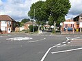
 Hamstead - Rocky Lane junction - geograph.org.uk - 986716.jpg 640 × 480; 68 KB
-
 Hamstead Park - geograph.org.uk - 986751.jpg 640 × 480; 74 KB
-
 Hamstead Road sign - 2014-09-27 - Andy Mabbett.JPG 3,008 × 2,000; 2.65 MB
-
 Lines family sketchbook - Floodgate, Perry Mill 008.jpg 2,152 × 2,658; 1.3 MB
-
 NXWM ADL Enviro 200 Mini 752 on 54.jpg 5,184 × 3,456; 4.93 MB
-
 Old Walsall Road - geograph.org.uk - 1374677.jpg 640 × 425; 107 KB
-

-
 Ordnance Survey - Staffordshire Sheet LXVIII.NE - 1886.png 9,332 × 7,075; 88.02 MB
-
 Ordnance Survey - Staffordshire Sheet LXVIII.SE - 1890.png 9,260 × 7,055; 88.84 MB
-
 Ordnance Survey Drawings - Sutton Coldfield (OSD 257).jpg 4,000 × 2,666; 3.52 MB
-
 Street Atlas of Birmingham - 1939 - Sheet 03 - Hamstead area.jpg 758 × 1,000; 448 KB
-
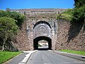 Tame Valley Canal Spouthouse Lane Aqueduct.jpg 2,592 × 1,944; 1.66 MB
-
 The River Tame at Hamstead.png 1,765 × 1,052; 2.25 MB


.png)


.jpg)


