Category:Hametoun
Jump to navigation
Jump to search
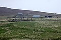
English: Hametoun, also Da Hametoon or Hametun is a settlement in the south of the island of Foula, in the council area of the Shetland Islands, Scotland. More info
Media in category "Hametoun"
The following 23 files are in this category, out of 23 total.
-
 Braidfit from Hametoun Burn, Foula (geograph 6990052).jpg 1,600 × 1,067; 630 KB
-
 Da Hametoon - geograph.org.uk - 3804312.jpg 640 × 480; 252 KB
-
 Da Hametoon, Foula - geograph.org.uk - 3715479.jpg 1,600 × 1,023; 1.05 MB
-
 Hametoun and Hamnafield, Foula, from the air (geograph 7099545).jpg 1,600 × 1,067; 514 KB
-
 Hametoun and the Daal, Foula, from the air - geograph.org.uk - 6321461.jpg 1,600 × 1,067; 359 KB
-

-

-
 Hametoun and the Noup, Foula, from the air (geograph 7099543).jpg 1,600 × 1,067; 604 KB
-
 Hametoun and the Noup, Foula, from the air - geograph.org.uk - 5894020.jpg 1,600 × 1,065; 428 KB
-
 Hametoun and the Noup, Foula, from the air - geograph.org.uk - 6321458.jpg 1,600 × 1,069; 398 KB
-
 Hametoun Burn, Foula (geograph 7049540).jpg 1,600 × 720; 265 KB
-
 Hametoun, Foula (geograph 7297636).jpg 1,600 × 720; 270 KB
-
 Hametoun, Foula - geograph.org.uk - 5763326.jpg 1,024 × 683; 156 KB
-
 Hametoun, Foula - geograph.org.uk - 5776108.jpg 1,024 × 683; 159 KB
-
 Road at Hametoun, Foula - geograph.org.uk - 5898176.jpg 1,600 × 1,065; 753 KB
-
 Ruin, Da Hametoon - geograph.org.uk - 3804320.jpg 640 × 480; 283 KB
-
 Ruined buildings, Hametoun, Foula (geograph 7805763).jpg 1,600 × 739; 188 KB
-

-
 The Hametoun Burn, Foula - geograph.org.uk - 5776102.jpg 1,024 × 683; 184 KB
-
 The Noup from Hametoun, Foula - geograph.org.uk - 5790056.jpg 1,600 × 900; 497 KB
-
 The Noup from the Hametoun Burn, Foula - geograph.org.uk - 5790044.jpg 1,600 × 900; 789 KB
-
 Wet pasture, Da Hametoon - geograph.org.uk - 3804335.jpg 640 × 480; 263 KB
-
 Yard at Hametoun, Foula - geograph.org.uk - 5790053.jpg 1,600 × 900; 836 KB
.jpg)


.jpg)

.jpg)
.jpg)
.jpg)


.jpg)
.jpg)


.jpg)


