Category:Hamdijk 49, Bad Nieuweschans
Jump to navigation
Jump to search
| Object location | | View all coordinates using: OpenStreetMap |
|---|
 | |||||
| Upload media | |||||
| Instance of | |||||
|---|---|---|---|---|---|
| Part of | |||||
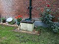
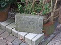
| Location | Bad Nieuweschans, Oldambt, Groningen, Netherlands | ||||
| Heritage designation |
| ||||
 | |||||
Nederlands: Boerderij Hamdijk
|
This is a category about rijksmonumentcomplex number 522548
|
Boerderij
|
This is a category about rijksmonument number 522549
|
Schuur
|
This is a category about rijksmonument number 522550
|
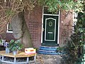
Stookhok
|
This is a category about rijksmonument number 522551
|
| Address |
|
Media in category "Hamdijk 49, Bad Nieuweschans"
The following 13 files are in this category, out of 13 total.
-
 Bijschuur Hamdijk 1.jpg 3,648 × 2,736; 2.22 MB
-
 Bijschuur Hamdijk 2.jpg 3,648 × 2,736; 2.22 MB
-
 Boerderij Hamdijk 1.jpg 3,648 × 2,736; 2.34 MB
-
 Boerderij Hamdijk 2.jpg 3,648 × 2,736; 2.24 MB
-
 Boerderij Hamdijk 3.jpg 2,736 × 3,648; 2.28 MB
-
 Boerderij Hamdijk 4.jpg 3,648 × 2,736; 2.26 MB
-
 Boerderij Hamdijk 5.jpg 3,648 × 2,736; 2.25 MB
-
 Boerderij Hamdijk 6.jpg 2,736 × 3,648; 2.36 MB
-
 Boerderij Hamdijk 7.jpg 2,736 × 3,648; 2.22 MB
-
 Boerderij Hamdijk 8.jpg 3,648 × 2,736; 2.31 MB
-
 Stookhut Hamdijk 1.jpg 3,648 × 2,736; 2.29 MB
-
 Stookhut Hamdijk 2.jpg 3,648 × 2,736; 2.21 MB
-
 Stookhut Hamdijk 3.jpg 2,736 × 3,648; 2.21 MB


