Category:Hambleton, Selby
Jump to navigation
Jump to search
village and civil parish in Selby, North Yorkshire, UK  | |||||
| Upload media | |||||
| Instance of | |||||
|---|---|---|---|---|---|
| Location | Selby, North Yorkshire, Yorkshire and the Humber, England | ||||
| Population |
| ||||
 | |||||
English: Hambleton is (a small village) and civil parish near to Selby in North Yorkshire, England. It is in the district of Selby and should not be confused with the district of Hambleton, another district of North Yorkshire.
Subcategories
This category has the following 3 subcategories, out of 3 total.
Media in category "Hambleton, Selby"
The following 199 files are in this category, out of 199 total.
-
 'Nessie on holiday^' - geograph.org.uk - 6344755.jpg 1,280 × 803; 377 KB
-
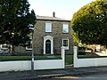
 22 Main Road, Hambleton - geograph.org.uk - 6342387.jpg 1,280 × 960; 327 KB
-
 A lane leading to Philip Lane - geograph.org.uk - 3644896.jpg 800 × 600; 92 KB
-
 A New Wood - geograph.org.uk - 112477.jpg 640 × 480; 99 KB
-
 A road leading to Owlett Hall - geograph.org.uk - 3644902.jpg 800 × 600; 111 KB
-
 A63 at Fox Lane, Hambleton - geograph.org.uk - 6344710.jpg 1,280 × 960; 285 KB
-
 A63 at Thorpe Willoughby, from the railway - geograph.org.uk - 4695606.jpg 1,600 × 685; 118 KB
-
 A63 Selby by-pass - geograph.org.uk - 2397294.jpg 1,600 × 1,200; 336 KB
-
 At Fox Bridge - geograph.org.uk - 6344713.jpg 1,280 × 775; 444 KB
-
 Atop Hambleton Hough - geograph.org.uk - 5638439.jpg 640 × 480; 83 KB
-
 Back Lane, Hambleton - geograph.org.uk - 3644878.jpg 800 × 600; 123 KB
-
 Barn, Hambleton - geograph.org.uk - 2627143.jpg 1,600 × 1,200; 496 KB
-
 Bayle Dike, Hambleton - geograph.org.uk - 3595744.jpg 640 × 480; 80 KB
-

-
 Brook Rein - geograph.org.uk - 4333071.jpg 1,024 × 768; 230 KB
-
 By Mill Lane, Hambleton - geograph.org.uk - 6538041.jpg 5,067 × 3,801; 4.12 MB
-
 Care Home on Station Road, Hambleton - geograph.org.uk - 6382630.jpg 800 × 501; 94 KB
-
 Care Home on Station Road, Hambleton - geograph.org.uk - 6383894.jpg 4,890 × 3,526; 3.87 MB
-
 Cemetery, Gateforth Lane, Hambleton - geograph.org.uk - 4333339.jpg 1,024 × 768; 163 KB
-
 Church Lodge, Gateforth Hall - geograph.org.uk - 6344034.jpg 1,280 × 878; 553 KB
-
 Church Lodge, Hambleton Hough - geograph.org.uk - 1419702.jpg 640 × 480; 109 KB
-
 Common Lane - geograph.org.uk - 2627211.jpg 1,600 × 1,200; 335 KB
-
 Common Lane at Hagg Bush Farm - geograph.org.uk - 3644906.jpg 800 × 600; 104 KB
-
 Common Lane towards the A63 - geograph.org.uk - 3644910.jpg 800 × 600; 135 KB
-
 Common Lane, Hambleton - geograph.org.uk - 3644889.jpg 800 × 600; 123 KB
-
 Common Lane, Hambleton - geograph.org.uk - 6344707.jpg 1,280 × 901; 275 KB
-
 Common Lane, Hambleton - geograph.org.uk - 6344716.jpg 1,280 × 960; 373 KB
-
 Cottages on Station Road, Hambleton - geograph.org.uk - 6382632.jpg 800 × 465; 78 KB
-
 Cross Country Train - geograph.org.uk - 6343539.jpg 1,280 × 960; 336 KB
-
 Crossroads on the south side of Hambleton - geograph.org.uk - 4333334.jpg 1,024 × 768; 132 KB
-
 Defibrillator on Village Hall, Hambleton - geograph.org.uk - 6382637.jpg 800 × 583; 145 KB
-
 Detached houses, Westcroft Lane, Hambleton - geograph.org.uk - 4333428.jpg 1,024 × 768; 104 KB
-
 Dike - geograph.org.uk - 702381.jpg 600 × 400; 122 KB
-
 Disappearing drain, east of Fox Lane - geograph.org.uk - 4333530.jpg 1,024 × 768; 161 KB
-
 Drain alongside Fox Lane, looking south - geograph.org.uk - 4333508.jpg 1,024 × 768; 148 KB
-
 Drain on the north side of Old Lane - geograph.org.uk - 4333464.jpg 1,024 × 768; 152 KB
-
 East Coast Main Line near Hambleton - geograph.org.uk - 6344199.jpg 1,280 × 960; 299 KB
-
 East Coast Main Line near Hambleton - geograph.org.uk - 6344213.jpg 1,280 × 822; 336 KB
-

-
 ECML Northbound - geograph.org.uk - 5774113.jpg 640 × 427; 228 KB
-

-
 Entering Hambleton - geograph.org.uk - 6382620.jpg 800 × 489; 89 KB
-
 Entering Hambleton on Gateforth Lane - geograph.org.uk - 2153618.jpg 800 × 600; 268 KB
-
 Farm buildings and pylon - geograph.org.uk - 4610984.jpg 640 × 426; 42 KB
-
 Farm buildings on Main Road, Hambleton - geograph.org.uk - 6382621.jpg 800 × 505; 107 KB
-

-
 Farm land to the north of the railway line - geograph.org.uk - 3550372.jpg 1,024 × 768; 142 KB
-
 Farm track off the A1238 - geograph.org.uk - 2397298.jpg 1,600 × 1,200; 613 KB
-
 Farmland - geograph.org.uk - 4610979.jpg 640 × 426; 40 KB
-
 Farmland - geograph.org.uk - 4610988.jpg 640 × 426; 32 KB
-
 Farmland beside the A63 - geograph.org.uk - 2397297.jpg 1,600 × 1,200; 241 KB
-
 Farmland east of Morton Lane - geograph.org.uk - 4333313.jpg 1,024 × 768; 189 KB
-
 Farmland near Common Lane - geograph.org.uk - 4611124.jpg 640 × 426; 32 KB
-
 Farmland near Low Rest Park Farm - geograph.org.uk - 2627189.jpg 1,600 × 1,200; 325 KB
-
 Farmland near Owlett Hall - geograph.org.uk - 2627199.jpg 1,600 × 1,200; 490 KB
-
 Farmland off Common Lane - geograph.org.uk - 2627176.jpg 1,600 × 1,200; 381 KB
-
 Farmland off Scalm Lane - geograph.org.uk - 2627161.jpg 1,600 × 1,200; 459 KB
-
 Farmland south of Old Lane - geograph.org.uk - 4333458.jpg 1,024 × 768; 142 KB
-
 Farmland west of Morton Lane - geograph.org.uk - 4333303.jpg 1,024 × 768; 178 KB
-
 Farmland, Bayle Dike-Hambleton - geograph.org.uk - 3595753.jpg 640 × 480; 72 KB
-
-

-
 Field and Farm Buildings, Owlett Hall - geograph.org.uk - 6604944.jpg 1,024 × 644; 137 KB
-
 Field boundary, north of Old Lane - geograph.org.uk - 4333497.jpg 1,024 × 768; 154 KB
-
 Field Lane ends - geograph.org.uk - 1419717.jpg 640 × 480; 60 KB
-
 Field Lane railway bridge, Hambleton - geograph.org.uk - 6344197.jpg 1,280 × 960; 286 KB
-
 Field Lane, Hambleton - geograph.org.uk - 6344193.jpg 1,280 × 960; 352 KB
-
 Field Lane, Thorpe Willoughby - geograph.org.uk - 6343528.jpg 1,280 × 960; 346 KB
-
 Flat farmland - geograph.org.uk - 4610976.jpg 640 × 426; 30 KB
-
 Flat farmland - geograph.org.uk - 4611131.jpg 640 × 426; 30 KB
-

-
 Footbridge towards golf course - geograph.org.uk - 702386.jpg 600 × 400; 86 KB
-
 Footpath from Hambleton towards Fox Lane - geograph.org.uk - 5314781.jpg 1,600 × 1,200; 652 KB
-
 Footpath off Fox Lane - geograph.org.uk - 6344279.jpg 1,280 × 960; 429 KB
-
 Former A63 near Hambleton - geograph.org.uk - 6343531.jpg 1,280 × 960; 501 KB
-
 Fox Lane, Maspin Moor - geograph.org.uk - 6344277.jpg 1,280 × 960; 440 KB
-
 Garth Farm, Hambleton - geograph.org.uk - 6383108.jpg 800 × 600; 111 KB
-
 Garth House, Hambleton - geograph.org.uk - 6342382.jpg 1,280 × 948; 315 KB
-
 Garth Lane, Hambleton - geograph.org.uk - 6383873.jpg 4,779 × 3,041; 2.56 MB
-
 Garth Lane, Hambleton - geograph.org.uk - 6383874.jpg 4,580 × 3,081; 2.51 MB
-
 Gated level crossing, Philip Lane - geograph.org.uk - 2627183.jpg 1,600 × 1,200; 425 KB
-
 Gateforth Farm - geograph.org.uk - 2343573.jpg 640 × 430; 27 KB
-
 Gateforth Farm - geograph.org.uk - 2409685.jpg 640 × 399; 33 KB
-
 Gateforth Mushroom Farm - geograph.org.uk - 1419741.jpg 640 × 480; 57 KB
-
 Hagg Bush Farm - geograph.org.uk - 2627208.jpg 1,600 × 1,200; 262 KB
-
 Hagg Bush Farm, Nr Hambleton - geograph.org.uk - 250950.jpg 640 × 480; 75 KB
-
 Hambleton - geograph.org.uk - 4315.jpg 640 × 480; 54 KB
-
 Hambleton from the east end of Mill Lane - geograph.org.uk - 4333341.jpg 1,024 × 768; 156 KB
-
 Hambleton Hough - geograph.org.uk - 4316.jpg 640 × 480; 123 KB
-
 Hambleton Methodist Church - geograph.org.uk - 250936.jpg 640 × 480; 86 KB
-
 Hambleton Methodist Church - geograph.org.uk - 6383104.jpg 800 × 550; 82 KB
-
 Hambleton Recreation Area and playing fields - geograph.org.uk - 6344752.jpg 1,280 × 960; 273 KB
-
 Hambleton South Junction - geograph.org.uk - 6343535.jpg 1,280 × 960; 378 KB
-
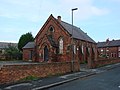
 Hambleton Sunday School - geograph.org.uk - 250938.jpg 640 × 480; 108 KB
-
 Hambleton Sunday School - geograph.org.uk - 6383105.jpg 640 × 470; 67 KB
-

-
 Hambleton village from The Hough - geograph.org.uk - 6343552.jpg 1,280 × 960; 274 KB
-
 High Mill Farmhouse - outskirts of Crake Hall.jpg 4,032 × 2,268; 3.6 MB
-
 House on Garth Lane, Hambleton - geograph.org.uk - 6383872.jpg 565 × 800; 139 KB
-
 Looking towards Hambleton Hough - geograph.org.uk - 6343546.jpg 1,280 × 960; 253 KB
-
 Main Road (A63) Hambleton - geograph.org.uk - 2627172.jpg 1,600 × 1,200; 572 KB
-
 Main Road (A63), Hambleton - geograph.org.uk - 6383102.jpg 640 × 429; 55 KB
-
 Main Road, Hambleton (A63) - geograph.org.uk - 2627145.jpg 1,600 × 1,200; 442 KB
-
 Main Road, Hambleton - geograph.org.uk - 3644876.jpg 800 × 600; 95 KB
-
 Mill Lane, Hambleton, looking westwards - geograph.org.uk - 4333322.jpg 1,024 × 768; 121 KB
-
 Morton Lane, looking north - geograph.org.uk - 4333300.jpg 1,024 × 768; 142 KB
-
 Museum of Badges and Battledress 50356432901 o.jpg 4,032 × 2,268; 3.18 MB
-
 New building at Angel Riding and Livery Centre - geograph.org.uk - 4333076.jpg 1,024 × 768; 150 KB
-
 On Hambleton Hough - geograph.org.uk - 6343559.jpg 960 × 1,280; 383 KB
-
 On the Hough at Hambleton - geograph.org.uk - 6343548.jpg 960 × 1,280; 667 KB
-
 Orchard Drive, Hambleton - geograph.org.uk - 2153636.jpg 800 × 600; 246 KB
-
 Owlet Hall, Hambleton - geograph.org.uk - 250953.jpg 640 × 480; 61 KB
-
 Owlett Hall Farm - geograph.org.uk - 4611133.jpg 640 × 426; 31 KB
-
 Partly cultivated field, east of Morton Lane - geograph.org.uk - 4333298.jpg 1,024 × 768; 151 KB
-
 Patch of snow, north side of Brook Rein - geograph.org.uk - 4333065.jpg 1,024 × 768; 145 KB
-
 Philip Lane heading north - geograph.org.uk - 2627180.jpg 1,600 × 1,200; 392 KB
-
 Philip Lane Level Crossing - geograph.org.uk - 6344717.jpg 1,280 × 833; 252 KB
-
 Philip Lane Level Crossing - geograph.org.uk - 6344720.jpg 960 × 1,280; 241 KB
-
-
 Ploughed field - geograph.org.uk - 5305065.jpg 640 × 353; 19 KB
-
 Postbox YO8 80 - Station Road Hambleton - geograph.org.uk - 6082949.jpg 768 × 1,024; 235 KB
-

-
 Public footpath heading to Westcroft Lane - geograph.org.uk - 4333434.jpg 1,024 × 768; 125 KB
-
 Pybus Warren Scout Camp - geograph.org.uk - 711971.jpg 640 × 427; 93 KB
-
 Pylon by the East Coast Main Line - geograph.org.uk - 4252314.jpg 640 × 430; 28 KB
-
 Pylon near Hambleton - geograph.org.uk - 4610985.jpg 640 × 426; 32 KB
-
 Pylon near Hambleton - geograph.org.uk - 4610986.jpg 640 × 426; 32 KB
-
 Pylons by the East Coast Main Line - geograph.org.uk - 2343567.jpg 640 × 430; 25 KB
-
 Railway towards Selby - geograph.org.uk - 2627186.jpg 1,600 × 1,200; 290 KB
-
 Road Over Boy Hill - geograph.org.uk - 711688.jpg 640 × 427; 48 KB
-
 Roadside tree, Old Lane - geograph.org.uk - 4333451.jpg 1,024 × 768; 123 KB
-
 Scalm Lane Access Point – information board - geograph.org.uk - 6344736.jpg 1,280 × 960; 449 KB
-
 Scalm Lane Allotments, Hambleton - geograph.org.uk - 6344739.jpg 1,280 × 960; 374 KB
-
 Scalm Lane level crossing - geograph.org.uk - 6344732.jpg 1,280 × 960; 378 KB
-
 Scalm Lane level crossing - geograph.org.uk - 6344734.jpg 1,280 × 885; 403 KB
-
 Scalm Lane level crossing, Hambleton - geograph.org.uk - 5314803.jpg 1,600 × 1,200; 344 KB
-
 Scalm Park Golf Course - geograph.org.uk - 2409702.jpg 640 × 430; 32 KB
-

-
 Sewage Works - geograph.org.uk - 112738.jpg 640 × 480; 46 KB
-
 Sewage Works - geograph.org.uk - 4610978.jpg 640 × 391; 45 KB
-
 Shelter on The Hough - geograph.org.uk - 6343549.jpg 1,280 × 838; 535 KB
-
 Sign for the Red Lion, Hambleton - geograph.org.uk - 6382646.jpg 670 × 800; 72 KB
-
 South of the railway line - geograph.org.uk - 4611126.jpg 640 × 426; 37 KB
-
 Southbound LNER train - geograph.org.uk - 6343545.jpg 1,280 × 960; 300 KB
-
 Spur off the East Coast Main Line - geograph.org.uk - 4610983.jpg 640 × 426; 63 KB
-
 St Mary's Church Hambleton - geograph.org.uk - 6081752.jpg 1,024 × 768; 264 KB
-
 St Mary's Church, Hambleton - geograph.org.uk - 5314783.jpg 1,600 × 1,200; 725 KB
-
 St Mary's Church, Hambleton - geograph.org.uk - 6342384.jpg 1,280 × 960; 557 KB
-
 St Mary's Church, Hambleton - geograph.org.uk - 6382626.jpg 800 × 631; 184 KB
-
 Station Road, Hambleton - geograph.org.uk - 2153624.jpg 800 × 600; 224 KB
-
 Station Road, Hambleton - geograph.org.uk - 2627163.jpg 1,600 × 1,200; 543 KB
-
 Station Road, Hambleton - geograph.org.uk - 6383896.jpg 640 × 510; 78 KB
-
 Stile and bridge towards Hambleton - geograph.org.uk - 702371.jpg 600 × 400; 123 KB
-
 Stubble field on the southern edge of Hambleton - geograph.org.uk - 4333328.jpg 1,024 × 768; 227 KB
-
 Telecommunication mast - geograph.org.uk - 4610977.jpg 606 × 640; 45 KB
-

-

-
 The East Coast Main Line - geograph.org.uk - 4610980.jpg 640 × 426; 31 KB
-
 The East Coast Main Line - geograph.org.uk - 4610982.jpg 640 × 426; 55 KB
-
 The lane to Owlett Hall - geograph.org.uk - 6344714.jpg 1,280 × 960; 349 KB
-
 The Old Police House, Hambleton - geograph.org.uk - 2153630.jpg 800 × 600; 299 KB
-
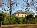 The Old Vicarage, Hambleton - geograph.org.uk - 6344745.jpg 1,280 × 960; 656 KB
-
-
 The Owl Hotel, Hambleton - geograph.org.uk - 250946.jpg 640 × 480; 100 KB
-
 The Owl, Hambleton - geograph.org.uk - 2627168.jpg 1,600 × 1,200; 431 KB
-
 The Red Lion public house at Hambleton - geograph.org.uk - 3644810.jpg 800 × 600; 105 KB
-

-
 The Red Lion, Hambleton - geograph.org.uk - 2627149.jpg 1,600 × 989; 238 KB
-
 The Red Lion, Hambleton - geograph.org.uk - 6342385.jpg 1,280 × 960; 287 KB
-
 The Red Lion, Hambleton - geograph.org.uk - 6382643.jpg 800 × 523; 72 KB
-
 The site of Gateforth Farm - geograph.org.uk - 6344211.jpg 1,280 × 866; 304 KB
-
 The southern edge of Hambleton - Westcroft Lane - geograph.org.uk - 4333446.jpg 1,024 × 768; 126 KB
-
 Three trees along a drain, east of Fox Lane - geograph.org.uk - 4333514.jpg 1,024 × 768; 153 KB
-
 Town Dike - geograph.org.uk - 2397300.jpg 1,600 × 1,200; 724 KB
-
 Town Dike - geograph.org.uk - 6343541.jpg 1,280 × 960; 354 KB
-
 Track to Manor Farm - geograph.org.uk - 1419696.jpg 640 × 480; 75 KB
-
 Track to Owlett Hall - geograph.org.uk - 2627201.jpg 1,600 × 1,200; 425 KB
-
 Track towards Low Rest Park Farm (footpath) - geograph.org.uk - 2627193.jpg 1,600 × 1,200; 525 KB
-
 Track towards Main Drain southwest of Hambleton - geograph.org.uk - 5314769.jpg 1,600 × 1,200; 472 KB
-

-
 Trans-Pennine Express - geograph.org.uk - 6343543.jpg 1,280 × 960; 354 KB
-
 Tree alongside Fox Lane - geograph.org.uk - 4333501.jpg 1,024 × 768; 141 KB
-

-
 Two in one at Hambleton - geograph.org.uk - 6344726.jpg 1,280 × 960; 347 KB
-
 Two trees and farmland - geograph.org.uk - 4611132.jpg 640 × 426; 30 KB
-
 View from Hambleton Hough - geograph.org.uk - 6343555.jpg 1,280 × 902; 312 KB
-
 View from Hambleton Hough - geograph.org.uk - 6343556.jpg 1,280 × 869; 295 KB
-
 Village Hall on Station Road, Hambleton - geograph.org.uk - 6383895.jpg 4,824 × 2,959; 2.48 MB
-
 Village Hall, Hambleton - geograph.org.uk - 6382635.jpg 640 × 480; 58 KB
-
 Walmsley House, Hambleton - geograph.org.uk - 6344742.jpg 1,280 × 960; 425 KB
-
 Waterlogged farmland, southern edge of Hambleton - geograph.org.uk - 4333352.jpg 1,024 × 768; 144 KB
-

-
 Waterlogged field, east of Brecks Farm - geograph.org.uk - 4333537.jpg 1,024 × 768; 168 KB
-
 Waterlogged field, south side of Old Lane - geograph.org.uk - 4333456.jpg 1,024 × 768; 183 KB
-
 Waterlogged field, south-east of Breckswood - geograph.org.uk - 4333535.jpg 1,024 × 768; 165 KB
-
 Westcroft Lane, Hambleton - geograph.org.uk - 6538035.jpg 4,739 × 3,520; 3.87 MB
-
 Whinny Hagg Lane, Hambleton - geograph.org.uk - 6343533.jpg 1,280 × 920; 228 KB
-
 Whinny Hagg Lane, Hambleton - geograph.org.uk - 6343537.jpg 1,280 × 960; 351 KB
-
 York Minster seen from Hambleton Hough - geograph.org.uk - 6343553.jpg 1,280 × 960; 300 KB


_Hambleton_-_geograph.org.uk_-_2627172.jpg)
,_Hambleton_-_geograph.org.uk_-_6383102.jpg)
_-_geograph.org.uk_-_2627145.jpg)


_-_geograph.org.uk_-_2627193.jpg)


