Category:Halling, Kent
Jump to navigation
Jump to search
village and civil parish in Kent, United Kingdom .jpg) | |||||
| Upload media | |||||
| Instance of | |||||
|---|---|---|---|---|---|
| Location | Medway, Kent, South East England, England | ||||
| Said to be the same as | Halling (Wikimedia duplicated page, civil parish) | ||||
 | |||||
Subcategories
This category has the following 8 subcategories, out of 8 total.
B
- Bishop's palace at Halling (9 F)
F
- The Five Bells, Halling (4 F)
H
- Halling railway station (10 F)
- Halling War Memorial, Kent (1 F)
- The Homeward Bound, Halling (4 F)
O
- Oasts in Halling (3 F)
U
Media in category "Halling, Kent"
The following 200 files are in this category, out of 305 total.
(previous page) (next page)-
 A small clearing in Halling Wood - geograph.org.uk - 5075695.jpg 4,608 × 3,456; 3.39 MB
-
 A small outcrop of chalk - geograph.org.uk - 3225952.jpg 640 × 430; 132 KB
-
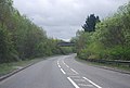
 A228 - geograph.org.uk - 3493620.jpg 640 × 405; 66 KB
-
 A228 - geograph.org.uk - 3548561.jpg 640 × 430; 59 KB
-
 A228 - road liable to flooding - geograph.org.uk - 2991553.jpg 640 × 480; 95 KB
-
 A228 leaving Medway - geograph.org.uk - 3254499.jpg 640 × 430; 41 KB
-
 A228 Rochester Road, Cuxton - geograph.org.uk - 1958771.jpg 3,139 × 2,354; 2.36 MB
-
 A228 Rochester Road, North Halling - geograph.org.uk - 1958868.jpg 3,488 × 2,616; 1.92 MB
-
 A228, entering Medway - geograph.org.uk - 3493489.jpg 640 × 430; 50 KB
-
 A228, Halling bypass - geograph.org.uk - 3493491.jpg 640 × 430; 65 KB
-
 A228, Halling bypass - geograph.org.uk - 3548564.jpg 640 × 430; 63 KB
-
 A228, Halling bypass - geograph.org.uk - 3548565.jpg 640 × 430; 67 KB
-
 A228, Halling bypass - geograph.org.uk - 3548567.jpg 640 × 430; 49 KB
-
 A228, Halling turning - geograph.org.uk - 3548568.jpg 640 × 430; 55 KB
-
 A228, North Halling - geograph.org.uk - 3493618.jpg 640 × 430; 82 KB
-
 A228, southbound - geograph.org.uk - 3548558.jpg 640 × 430; 49 KB
-
 Abandoned boat on the banks of the River Medway - geograph.org.uk - 4469249.jpg 2,272 × 1,704; 814 KB
-
 Allotments at Halling - geograph.org.uk - 2405307.jpg 1,280 × 842; 269 KB
-
 Allotments with Halling concrete works in the background - geograph.org.uk - 1960218.jpg 3,488 × 2,616; 2.24 MB
-
 An old chalk quarry - geograph.org.uk - 3252630.jpg 640 × 430; 74 KB
-

-
 Banks of the River Medway, Halling - geograph.org.uk - 1467267.jpg 640 × 480; 104 KB
-
 Barn Meadow - geograph.org.uk - 3157463.jpg 640 × 430; 82 KB
-
 Barn Meadow, Upper Halling - geograph.org.uk - 5086987.jpg 2,099 × 2,043; 1.09 MB
-
 Barrier near Court Farm - geograph.org.uk - 3225931.jpg 640 × 430; 141 KB
-
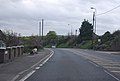
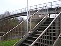
 Bridge over the A228 (Vicarage Rd) - geograph.org.uk - 3223321.jpg 640 × 430; 115 KB
-
 Bridge over the A228 - geograph.org.uk - 3493496.jpg 640 × 430; 77 KB
-
 Bridleway, May's Wood - geograph.org.uk - 3229576.jpg 640 × 430; 125 KB
-
 Bridleway, Wingate Wood - geograph.org.uk - 3229575.jpg 640 × 430; 137 KB
-
 Browndens Rd - geograph.org.uk - 3151736.jpg 640 × 430; 119 KB
-
 Browndens Rd - geograph.org.uk - 3157378.jpg 640 × 430; 83 KB
-
 Browndens Rd - geograph.org.uk - 3157405.jpg 640 × 430; 61 KB
-
 Browndens Road, Upper Halling - geograph.org.uk - 5087000.jpg 3,264 × 2,448; 2.27 MB
-
 Byway junction - geograph.org.uk - 3133719.jpg 640 × 430; 118 KB
-
 Byway leading from Chapel Lane to Court Farm, Upper Halling - geograph.org.uk - 1961424.jpg 3,488 × 2,616; 2.17 MB
-
 Byway mud wallow 2, Greatpark Wood - geograph.org.uk - 2748176.jpg 3,648 × 2,056; 2.21 MB
-
 Byway, Gag Plantation - geograph.org.uk - 3137172.jpg 640 × 430; 125 KB
-
 Byway, Rochester Forest - geograph.org.uk - 3133699.jpg 640 × 430; 118 KB
-
 Cart Shed, Whorn Place - geograph.org.uk - 3247708.jpg 640 × 430; 94 KB
-
 Cemetery Road, Halling - geograph.org.uk - 3634480.jpg 640 × 480; 123 KB
-
 Cemetery Road, Halling - geograph.org.uk - 3634481.jpg 640 × 480; 66 KB
-
 Chalk Quarry Lake near Halling - geograph.org.uk - 2209594.jpg 1,171 × 777; 388 KB
-
 Chapel Houses (geograph 7101183).jpg 1,024 × 683; 902 KB
-
 Chapel Lane - geograph.org.uk - 3618066.jpg 4,000 × 3,000; 3.89 MB
-
 Chapel Lane, Upper Halling - geograph.org.uk - 1960947.jpg 3,488 × 2,616; 2.17 MB
-
 Chapel Lane, Upper Halling - geograph.org.uk - 1960951.jpg 3,488 × 2,616; 2.23 MB
-
 Chapel Lane, Upper Halling - geograph.org.uk - 5086960.jpg 3,264 × 2,448; 2.56 MB
-
 Chapel Lane, Upper Halling - geograph.org.uk - 5086961.jpg 3,264 × 2,448; 2.39 MB
-
 Cherry blossom on Meadow Crescent - geograph.org.uk - 2331600.jpg 640 × 480; 126 KB
-
 Chillingdon Close - geograph.org.uk - 3151744.jpg 640 × 430; 75 KB
-
 Climbing the scarp slope - geograph.org.uk - 3225945.jpg 640 × 430; 144 KB
-
 Climbing the scarp slope - geograph.org.uk - 3225950.jpg 640 × 430; 148 KB
-
 Close-up of Halling Village Sign - geograph.org.uk - 2099029.jpg 2,304 × 3,072; 1.52 MB
-
 Conveyor over the A228 - geograph.org.uk - 3493505.jpg 640 × 430; 64 KB
-
 Coppicing by the North Downs Way - geograph.org.uk - 3225979.jpg 640 × 430; 125 KB
-
 Coppicing in Wingate Wood - geograph.org.uk - 1227972.jpg 640 × 480; 184 KB
-
 Cottage next to Pilgrims Road - geograph.org.uk - 3617961.jpg 4,000 × 3,000; 4.06 MB
-
 Countryside near Upper Halling - geograph.org.uk - 3157483.jpg 640 × 430; 60 KB
-
 Countryside near Upper Halling - geograph.org.uk - 3157494.jpg 640 × 430; 47 KB
-
 Disused Chalk Quarry - geograph.org.uk - 3151702.jpg 640 × 430; 66 KB
-
 Disused chalk quarry - geograph.org.uk - 3160312.jpg 640 × 430; 86 KB
-
 Disused quarry seen from Pilgrims Road - geograph.org.uk - 3617378.jpg 4,000 × 3,000; 4.05 MB
-
 Dry valley near Cuxton - geograph.org.uk - 1227954.jpg 640 × 384; 75 KB
-
 Entering Halling - geograph.org.uk - 3222444.jpg 640 × 430; 101 KB
-
 Entering Halling, A228 - geograph.org.uk - 3548557.jpg 640 × 430; 61 KB
-
 Entrance to an old quarry, Upper Halling - geograph.org.uk - 1960954.jpg 3,488 × 2,616; 2.16 MB
-
 Essex Road, Halling - geograph.org.uk - 3634464.jpg 640 × 480; 57 KB
-
 Essex Road, Halling - geograph.org.uk - 3634468.jpg 640 × 480; 65 KB
-
 Essex Road, Halling - geograph.org.uk - 5088548.jpg 3,264 × 2,448; 1.82 MB
-
 Exit from Wingate Wood - geograph.org.uk - 1227966.jpg 480 × 640; 200 KB
-
 Farmland near Whittings Farm - geograph.org.uk - 3157514.jpg 640 × 430; 47 KB
-
 Fenced Footpath - geograph.org.uk - 1084220.jpg 640 × 481; 78 KB
-
 Fields at North Halling - geograph.org.uk - 2524037.jpg 640 × 480; 149 KB
-
 Footbridge over A228 Halling By-Pass - geograph.org.uk - 1083604.jpg 640 × 481; 79 KB
-
 Footbridge, A228 - geograph.org.uk - 3493495.jpg 640 × 430; 78 KB
-
 Footpath by disused chalk quarry - geograph.org.uk - 3160300.jpg 640 × 430; 93 KB
-
 Footpath by The Warren - geograph.org.uk - 3250178.jpg 640 × 430; 149 KB
-
 Footpath from Chapel Lane - geograph.org.uk - 3618016.jpg 4,000 × 3,000; 4.14 MB
-
 Footpath from Upper Halling - geograph.org.uk - 3157469.jpg 640 × 430; 124 KB
-
 Footpath in Rochester Forest - geograph.org.uk - 3225965.jpg 640 × 430; 132 KB
-
 Footpath junction - geograph.org.uk - 3225938.jpg 640 × 430; 136 KB
-
 Footpath off Pilgrims Rd - geograph.org.uk - 3250166.jpg 640 × 430; 115 KB
-
 Footpath off Pilgrims Rd - geograph.org.uk - 3250175.jpg 640 × 430; 104 KB
-
 Footpath off Pilgrims Rd - geograph.org.uk - 3252664.jpg 640 × 430; 158 KB
-
 Footpath onto the North Downs - geograph.org.uk - 3618058.jpg 4,000 × 3,000; 4.38 MB
-
 Footpath past an old quarry - geograph.org.uk - 3157497.jpg 640 × 430; 62 KB
-
 Footpath signpost, Barn Meadow - geograph.org.uk - 3157466.jpg 640 × 430; 137 KB
-
 Footpath to Holborough - geograph.org.uk - 3157468.jpg 640 × 430; 129 KB
-
 Footpath to Holborough - geograph.org.uk - 3157479.jpg 640 × 430; 129 KB
-
 Footpath to Whittings Farm - geograph.org.uk - 3157503.jpg 640 × 430; 58 KB
-

-
 Footpath, Court Farm - geograph.org.uk - 3223328.jpg 640 × 430; 80 KB
-
 Formby Terrace - geograph.org.uk - 2405311.jpg 1,280 × 843; 229 KB
-
 Formby Terrace, Halling - geograph.org.uk - 1961315.jpg 3,488 × 2,616; 2.11 MB
-
 Formby Terrace, Halling - geograph.org.uk - 5087042.jpg 3,264 × 2,448; 3.16 MB
-
 Former Quarry now farmers field - geograph.org.uk - 1084214.jpg 640 × 481; 49 KB
-
 Former Rochester Cement Works offices - geograph.org.uk - 2405310.jpg 1,280 × 836; 179 KB
-
 Frozen Weed in Dean Farm Valley - geograph.org.uk - 1082782.jpg 640 × 481; 88 KB
-
 Gateway at Whorn's Place - geograph.org.uk - 5513335.jpg 714 × 1,024; 265 KB
-
 Gateway to Whorn Place - geograph.org.uk - 3247709.jpg 640 × 430; 104 KB
-
 Grassland south of Dean Hill - geograph.org.uk - 3157473.jpg 640 × 430; 42 KB
-
 Grassy field - geograph.org.uk - 3157492.jpg 640 × 430; 51 KB
-
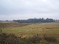
 Grazing marsh and pylons, Halling - geograph.org.uk - 2991535.jpg 640 × 480; 107 KB
-
 Greatpark Wood - geograph.org.uk - 3133654.jpg 640 × 430; 108 KB
-
 Greatpark Wood - geograph.org.uk - 3133666.jpg 640 × 430; 132 KB
-
 Greatpark Wood at end of Chapel Lane - geograph.org.uk - 1160538.jpg 640 × 481; 131 KB
-
 Halling Baptist Chapel - geograph.org.uk - 1083609.jpg 640 × 481; 110 KB
-
 Halling bypass - geograph.org.uk - 3493493.jpg 640 × 430; 68 KB
-
 Halling fire station - geograph.org.uk - 588027.jpg 640 × 427; 196 KB
-
 Halling Fresh Marsh - geograph.org.uk - 3634473.jpg 3,488 × 2,616; 2.17 MB
-
 Halling from Wouldham - geograph.org.uk - 3917022.jpg 2,560 × 1,598; 2 MB
-
 Halling Jubilee Hall - geograph.org.uk - 3151746.jpg 640 × 422; 59 KB
-
 Halling Medical Centre (geograph 3254447).jpg 640 × 430; 86 KB
-

-
 Halling Village Sign near Halling Community Centre - geograph.org.uk - 2099007.jpg 2,304 × 3,072; 1.71 MB
-
 Halling waterside - geograph.org.uk - 3917158.jpg 2,560 × 1,920; 2.24 MB
-
 Halling Wood - geograph.org.uk - 5075690.jpg 4,608 × 3,456; 3.48 MB
-
 Hay bales by the footpath - geograph.org.uk - 3225933.jpg 640 × 430; 70 KB
-
 High St - geograph.org.uk - 3254497.jpg 640 × 410; 48 KB
-
 High St, Halling (geograph 3223318).jpg 640 × 430; 73 KB
-
 High St, Halling - geograph.org.uk - 3252724.jpg 640 × 430; 63 KB
-
 High St, Halling - geograph.org.uk - 3254498.jpg 640 × 392; 49 KB
-
 High Street road bridge over the Railway - geograph.org.uk - 2098932.jpg 3,072 × 2,304; 1.82 MB
-
 High Street, Halling - geograph.org.uk - 3634482.jpg 640 × 480; 64 KB
-
 Holly Hill Lane, Holly Hill - geograph.org.uk - 5086737.jpg 3,264 × 2,448; 2.73 MB
-
 Horseholder Wood - geograph.org.uk - 3133690.jpg 640 × 430; 63 KB
-
 House in Upper Halling - geograph.org.uk - 3618136.jpg 4,000 × 3,000; 3.96 MB
-
 House in Upper Halling - geograph.org.uk - 3618138.jpg 4,000 × 3,000; 4.04 MB
-
 House on Chapel Rd - geograph.org.uk - 3151722.jpg 640 × 430; 92 KB
-
 House on Chapel Road - geograph.org.uk - 2530671.jpg 640 × 480; 142 KB
-
 House on Pilgrims Rd - geograph.org.uk - 3250168.jpg 640 × 430; 91 KB
-
 Houses on Pilgrims Road - geograph.org.uk - 2530667.jpg 640 × 480; 137 KB
-
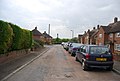
 Houses, The Street - geograph.org.uk - 3151734.jpg 640 × 430; 80 KB
-
 Howlsmere Close, Halling - geograph.org.uk - 3223309.jpg 640 × 430; 74 KB
-
 In a dry valley - geograph.org.uk - 3229612.jpg 640 × 430; 44 KB
-
 In Rochester Forest - geograph.org.uk - 3225963.jpg 640 × 430; 133 KB
-
 Kent Rd - geograph.org.uk - 3252719.jpg 640 × 430; 78 KB
-
 Kent Rd, Halling - geograph.org.uk - 3252715.jpg 640 × 430; 71 KB
-
 Kent Road, Halling - geograph.org.uk - 1958841.jpg 3,488 × 2,616; 2.18 MB
-
 Kent Road, Halling - geograph.org.uk - 3634470.jpg 640 × 480; 56 KB
-
 Kent Road, Halling - geograph.org.uk - 5087038.jpg 3,264 × 2,448; 1.79 MB
-
 Kissing gate, Upper Halling - geograph.org.uk - 3157471.jpg 640 × 430; 133 KB
-
 Lafarge Land - geograph.org.uk - 1906143.jpg 3,648 × 2,736; 4.2 MB
-
 Looking along Pilgrims Road - geograph.org.uk - 3617362.jpg 4,000 × 3,000; 4.29 MB
-
 Low Meadow, Halling - geograph.org.uk - 1542366.jpg 640 × 480; 62 KB
-
 Marsh Road, Halling - geograph.org.uk - 3634471.jpg 640 × 480; 88 KB
-
 Marsh Road, Halling - geograph.org.uk - 3634472.jpg 640 × 480; 84 KB
-
 Marsh Road, Halling - geograph.org.uk - 3634474.jpg 640 × 480; 57 KB
-
 May's Wood - geograph.org.uk - 3617344.jpg 4,000 × 3,000; 4.4 MB
-
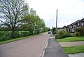
 Meadow Close - geograph.org.uk - 3157409.jpg 640 × 387; 55 KB
-
 Meadow Close, Upper Halling - geograph.org.uk - 5086994.jpg 2,731 × 2,049; 1.35 MB
-
 Meadow Crescent - geograph.org.uk - 3151729.jpg 640 × 430; 60 KB
-
 Meadow Crescent, Upper Halling - geograph.org.uk - 1958813.jpg 3,488 × 2,616; 2.05 MB
-
 Meadow Crescent, Upper Halling - geograph.org.uk - 5086983.jpg 3,264 × 2,448; 2.2 MB
-
 Meadow Crescent, Upper Halling - geograph.org.uk - 5086990.jpg 3,264 × 2,448; 1.87 MB
-
 Medway Valley Railway to Snodland - geograph.org.uk - 2098942.jpg 3,072 × 2,304; 2.53 MB
-
 Yellow Morris Minor on Vicarage Road - geograph.org.uk - 1314845.jpg 640 × 480; 112 KB
-
 Muddy byway - geograph.org.uk - 3137166.jpg 640 × 430; 125 KB
-
 NashendenValley5504.JPG 2,048 × 1,536; 744 KB
-
 NashendenValley5508.JPG 2,048 × 1,536; 746 KB
-
 Near the top - geograph.org.uk - 3225955.jpg 640 × 430; 119 KB
-

-
 New bridge over the River Medway - geograph.org.uk - 4924330.jpg 640 × 480; 77 KB
-
 North Downs scarp slope - geograph.org.uk - 3225948.jpg 640 × 430; 145 KB
-
 North Downs Way - geograph.org.uk - 3133671.jpg 640 × 430; 135 KB
-
 North Downs Way - geograph.org.uk - 3225956.jpg 640 × 430; 137 KB
-
 North Downs Way - geograph.org.uk - 3225973.jpg 640 × 430; 133 KB
-
 North Downs Way - geograph.org.uk - 3229578.jpg 640 × 430; 126 KB
-
 North Downs Way - geograph.org.uk - 3229611.jpg 640 × 430; 73 KB
-

-
 North Downs Way through Ten Acre Wood - geograph.org.uk - 1118336.jpg 640 × 481; 149 KB
-
 North Downs Way, Greatpark Wood - geograph.org.uk - 3129580.jpg 640 × 430; 151 KB
-
 North Downs Way, Wingate Wood - geograph.org.uk - 3225985.jpg 640 × 430; 119 KB
-
 North Downs Way, Wingate Wood - geograph.org.uk - 3229567.jpg 640 × 430; 121 KB
-
 North Downs Way, Wingate Wood - geograph.org.uk - 3229569.jpg 640 × 430; 113 KB
-
 North Downs Way, Wingate Wood - geograph.org.uk - 3229571.jpg 640 × 430; 105 KB
-
 North Downs Way, Wingate Wood - geograph.org.uk - 3229574.jpg 640 × 430; 133 KB
-
 North Halling - geograph.org.uk - 3250170.jpg 640 × 430; 98 KB
-
 North Halling Marina - geograph.org.uk - 1062190.jpg 640 × 481; 58 KB
-
 North Halling, old cement works, new housing - geograph.org.uk - 5512674.jpg 1,024 × 786; 267 KB
-
 Oil Seed Rape Field near Court Farm - geograph.org.uk - 1314868.jpg 640 × 427; 81 KB
-

-
 Old tramway embankment- Halling (geograph 3917186).jpg 2,560 × 1,814; 2.19 MB
-

-
 Overhead gantry crossing Formby Road, Halling - geograph.org.uk - 1960226.jpg 3,488 × 2,616; 2.27 MB
-

-
 Path in Rochester Forest - geograph.org.uk - 3225962.jpg 640 × 430; 122 KB
-
 Peter's Bridge Road - geograph.org.uk - 5360017.jpg 3,264 × 2,448; 2.25 MB
-
 Peter's Bridge Road - geograph.org.uk - 5360019.jpg 3,264 × 2,448; 2.22 MB
-
 Peters Village - a work in progress - geograph.org.uk - 5799083.jpg 1,600 × 1,200; 353 KB
-
 Petrol Station, Halling High Street - geograph.org.uk - 1467735.jpg 640 × 480; 68 KB
-
 Pilgrims Rd - geograph.org.uk - 3250162.jpg 640 × 430; 97 KB
-
 Pilgrims Rd - geograph.org.uk - 3250163.jpg 640 × 430; 94 KB
-
 Pilgrims Rd - geograph.org.uk - 3250177.jpg 640 × 430; 100 KB
-
 Pilgrims Rd - geograph.org.uk - 3250180.jpg 640 × 430; 88 KB
-
 Pilgrims Rd - geograph.org.uk - 3250181.jpg 640 × 430; 122 KB
-
 Pilgrims Rd - geograph.org.uk - 3250183.jpg 640 × 430; 123 KB
-
 Pilgrims Rd - geograph.org.uk - 3250184.jpg 640 × 430; 78 KB
-
 Pilgrims Rd - geograph.org.uk - 3252624.jpg 640 × 430; 103 KB
-
 Pilgrims Rd - geograph.org.uk - 3252627.jpg 640 × 430; 87 KB


_-_geograph.org.uk_-_3223321.jpg)


.jpg)


.jpg)


.jpg)


