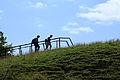
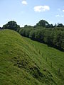
Category:Haithabu semicircular rampart
Jump to navigation
Jump to search

| Object location | | View all coordinates using: OpenStreetMap |
|---|
Dansk: Den halvcirkelformede vold omkring Hedeby.
Deutsch: Halbkreiswall des Danewerks um Haithabu
Subcategories
This category has only the following subcategory.
V
Media in category "Haithabu semicircular rampart"
The following 23 files are in this category, out of 23 total.
-
 Busdorf - Am Haddebyer Noor - Haddebyer Noor+Halbkreiswall 01 ies.jpg 5,616 × 3,744; 10.06 MB
-
 Busdorf - Am Haddebyer Noor - Haddebyer Noor+Halbkreiswall 02 ies.jpg 5,616 × 3,744; 10.95 MB
-
 Busdorf - Am Haddebyer Noor - Halbkreiswall 01 ies.jpg 5,616 × 3,744; 14.05 MB
-
 Busdorf - Am Haddebyer Noor - Halbkreiswall 02 ies.jpg 5,616 × 3,744; 7.8 MB
-
 Busdorf - Am Haddebyer Noor - Halbkreiswall 03 ies.jpg 5,616 × 3,744; 8.46 MB
-
 Busdorf - Am Haddebyer Noor - Halbkreiswall 04 ies.jpg 5,616 × 3,744; 7.4 MB
-
 Busdorf - Am Haddebyer Noor - Halbkreiswall 05 ies.jpg 5,616 × 3,744; 8.68 MB
-
 Busdorf - Am Haddebyer Noor - Halbkreiswall 06 ies.jpg 5,616 × 3,744; 11.89 MB
-
 Haithabu Wall WT2005.jpg 1,761 × 1,063; 849 KB
-
 Haithabu Wallanlage WT2005.jpg 1,739 × 977; 708 KB
-
 Haithabu Wallprofil.jpg 1,200 × 1,600; 581 KB
-
 Hedeby 34.JPG 1,280 × 960; 346 KB
-
 Hedeby 37.JPG 1,280 × 960; 338 KB
-
 Hedeby 38.JPG 1,280 × 960; 358 KB
-
 Hedeby 39.JPG 1,280 × 960; 348 KB
-
 Hedeby 41.JPG 1,280 × 960; 319 KB
-
 Nördlicher Wall Haddebyer Noor.jpg 1,600 × 1,200; 600 KB
-
 Ringwall haithabu 2023-09-01 1.jpg 3,648 × 1,744; 2.19 MB
-
 Ringwall haithabu 2023-09-01 2.jpg 3,648 × 1,744; 2.49 MB
-
 Ringwall haithabu 2023-09-01 3.jpg 5,120 × 2,448; 3.32 MB
-
 Ringwall haithabu 2023-09-01 4.jpg 5,120 × 2,448; 4.74 MB
-
 Ringwall haithabu 2023-09-01 5.jpg 3,648 × 1,744; 2.54 MB
-
 Schleswig - Am Hafen 03 ies.jpg 5,616 × 3,744; 11.86 MB


