Category:Haisthorpe
Jump to navigation
Jump to search
English: Haisthorpe is a village in the East Riding of Yorkshire, England. It is situated approximately 4 miles (6.4 km) south west of Bridlington town centre. It lies on the A614 road.
village in United Kingdom  | |||||
| Upload media | |||||
| Instance of | |||||
|---|---|---|---|---|---|
| Location | Carnaby, East Riding of Yorkshire, Yorkshire and the Humber, England | ||||
 | |||||
Media in category "Haisthorpe"
The following 10 files are in this category, out of 10 total.
-
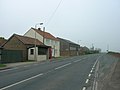 A614 Through Haisthorpe.jpg 640 × 480; 42 KB
-
 Farm buildings - geograph.org.uk - 820474.jpg 640 × 427; 83 KB
-

-
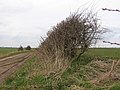 Haisthorpe Field - geograph.org.uk - 143287.jpg 640 × 480; 103 KB
-
 Lane North of Haisthorpe - geograph.org.uk - 1241028.jpg 640 × 480; 111 KB
-
 Pumping Station - geograph.org.uk - 72568.jpg 640 × 480; 44 KB
-
 Stable Block Haisthorpe.jpg 640 × 254; 43 KB
-
 Unmanned Level Crossing Haisthorpe.jpg 640 × 480; 76 KB
-
 Woldgate Methodist Church - geograph.org.uk - 1241015.jpg 640 × 480; 94 KB
-
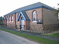 Woldgate Methodist Church Haisthorpe.jpg 640 × 480; 109 KB


