Category:Haigh Cote Dam
Jump to navigation
Jump to search
Media in category "Haigh Cote Dam"
The following 15 files are in this category, out of 15 total.
-
 Bridleway towards Plane Trees - geograph.org.uk - 3949929.jpg 1,600 × 1,106; 369 KB
-
 Driveway and landfill site near Haigh Cote Dam - geograph.org.uk - 3488498.jpg 2,000 × 1,500; 899 KB
-
 Footpath alongside Haigh Cote Dam - geograph.org.uk - 3487387.jpg 2,000 × 1,500; 878 KB
-
 Footpath alongside Haigh Cote Dam - geograph.org.uk - 3488469.jpg 2,000 × 1,500; 974 KB
-
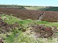
 Footpath descending from Haigh Cote Dam - geograph.org.uk - 3487443.jpg 2,000 × 1,500; 1.05 MB
-
 Footpath through heather at Cold Edge Dams - geograph.org.uk - 3488463.jpg 2,000 × 1,500; 1.16 MB
-

-
 Haigh Cote Dam - geograph.org.uk - 1106798.jpg 640 × 480; 96 KB
-
 Haigh Cote Dam - geograph.org.uk - 1358721.jpg 640 × 480; 80 KB
-

-
 Iron bollard nexr to Halifax Bridleway 113 - geograph.org.uk - 3495824.jpg 2,000 × 1,500; 1.19 MB
-
 Land fill at Haigh Cote Dam - geograph.org.uk - 3488484.jpg 2,000 × 1,500; 1.01 MB
-
 Landing stage on Haigh Cote Dam - geograph.org.uk - 3487392.jpg 2,000 × 1,472; 928 KB
-

-
 Withens Head Farm, Warley - geograph.org.uk - 1279525.jpg 640 × 478; 133 KB


