Category:Haggerston
Jump to navigation
Jump to search
district in the East End of London, England  | |||||
| Upload media | |||||
| Instance of | |||||
|---|---|---|---|---|---|
| Location | London Borough of Hackney, Greater London, London, England | ||||
| Different from | |||||
 | |||||
English: Haggerston is a place in the London Borough of Hackney.It is bounded by Hackney Road on the south, Kingsland Road on the west, Middleton Road on the north with London Fields and Broadway Market on the east. In the 1990s a number of the area's more rundown housing estates were refurbished and some disused public buildings were privately converted as gated communities.
Norsk bokmål: Haggerston er et område sentralt i London, i bydelen Hackney. Vanligvis defineres Hagerston som området mellom Hackney Road, Kingsland Road og Middleton Road. I øst grenser Hagerston til London Fields og Broadway Market.
Subcategories
This category has the following 20 subcategories, out of 20 total.
A
- Acton's Lock (20 F)
C
- Cremer Street, London (10 F)
D
H
- Pubs in Haggerston (21 F)
- Haggerston Baths (12 F)
- Haggerston Library (6 F)
- Haggerston railway bridge (14 F)
K
L
- Lee Street (5 F)
Q
- Queensbridge Road, London (20 F)
S
- St Mary's Church, Haggerston (2 F)
- Suleymaniye Mosque (London) (17 F)
T
- The Bridge Academy (7 F)
W
- Whiston Road (4 F)
Media in category "Haggerston"
The following 59 files are in this category, out of 59 total.
-
-
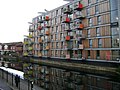
 Adelaide Wharf, Haggerston - geograph.org.uk - 5563327.jpg 1,578 × 1,600; 790 KB
-
 Albion Drive, Haggerston - geograph.org.uk - 4325685.jpg 2,272 × 1,704; 834 KB
-
 Albion Square, Haggerston - geograph.org.uk - 4325686.jpg 2,272 × 1,704; 800 KB
-
 Albion Terrace, Haggerston - geograph.org.uk - 4325694.jpg 2,272 × 1,704; 816 KB
-
 Boris bikes with Santander branding, Haggerston - geograph.org.uk - 4533218.jpg 3,648 × 2,736; 3.45 MB
-
 Brownlow Road, Haggerston - geograph.org.uk - 4325683.jpg 2,272 × 1,704; 818 KB
-
 Bryant Court, Haggerston - geograph.org.uk - 5967329.jpg 1,024 × 768; 243 KB
-

-
 Clarissa Street E8 (4285924390).jpg 1,960 × 1,940; 1.71 MB
-
 Gas Works Basin - geograph.org.uk - 129233.jpg 640 × 429; 114 KB
-
 Gates, Laburnum Street, Haggerston, E2 - geograph.org.uk - 1386586.jpg 640 × 480; 450 KB
-
 Gloucester Square Residents' Garden, Haggerston - geograph.org.uk - 4533248.jpg 2,673 × 3,565; 1.82 MB
-
 Hackney Seventh-Day Adventist Church - geograph.org.uk - 395694.jpg 640 × 480; 133 KB
-
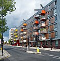
 Haggerson aparment block new development 1.jpg 2,848 × 2,136; 1.46 MB
-
 Haggerston - Don't Eat Me! Street Graffiti.jpg 3,504 × 2,336; 4.51 MB
-
 Haggerston Bridge - geograph.org.uk - 2904252.jpg 640 × 430; 90 KB
-
 Haggerston Bridge - geograph.org.uk - 4747143.jpg 640 × 480; 134 KB
-
 Haggerston council block 1.jpg 2,848 × 2,136; 1.52 MB
-
 Haggerston from the air - geograph.org.uk - 4104406.jpg 640 × 480; 222 KB
-
 Haggerston from the air - geograph.org.uk - 4604467.jpg 640 × 508; 196 KB
-
 Haggerston iron church 1.jpg 544 × 640; 107 KB
-
 Haggerston shops - geograph.org.uk - 1091896.jpg 640 × 480; 89 KB
-
 Haggerston, Corner of Hackney Road and Tuilerie Street - geograph.org.uk - 1716527.jpg 2,755 × 2,051; 3.88 MB
-
 Haggerston, Dunston Road - geograph.org.uk - 1728774.jpg 3,264 × 2,448; 4.56 MB
-
 Haggerston, Samuel House, Dunston Road - geograph.org.uk - 1728707.jpg 3,264 × 2,448; 7.54 MB
-
 Haggerston, Stonebridge Gardens - geograph.org.uk - 1938442.jpg 3,456 × 2,304; 1.58 MB
-
 Iron church, Haggerston - Flickr - Fin Fahey.jpg 802 × 1,024; 995 KB
-
 Jeger Avenue, Haggerston - geograph.org.uk - 5967335.jpg 1,024 × 768; 249 KB
-
 Laburnum Street, Haggerston, London E2 - geograph.org.uk - 1386601.jpg 512 × 640; 389 KB
-
 Local shops, Haggerston - geograph.org.uk - 5964582.jpg 1,024 × 768; 222 KB
-
 Mansfield Court on Queensbridge Road, Haggerston - geograph.org.uk - 6280192.jpg 1,832 × 1,132; 1.27 MB
-
 Map of City of London and its Environs Sheet 027, Ordnance Survey, 1869-1880.png 11,280 × 7,551; 58.06 MB
-
 Mosaic Snake, Stonebridge Park, Haggerson.jpg 5,218 × 3,478; 10.83 MB
-
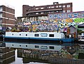
 Narrowboats on Regent's Canal, Haggerston - geograph.org.uk - 4533263.jpg 3,108 × 2,326; 2.52 MB
-
 Orme House, Haggerston.jpg 5,533 × 3,458; 9.27 MB
-
 Orwell House on Regent's Row, Haggerston - geograph.org.uk - 6381850.jpg 5,456 × 3,632; 2.98 MB
-
 Pearson Street, London E2 - geograph.org.uk - 499807.jpg 640 × 427; 101 KB
-

-

-
-
 Randal Cremer school, Haggerston - geograph.org.uk - 5964567.jpg 1,024 × 768; 209 KB
-
 Regent's Canal at Haggerston - geograph.org.uk - 6381851.jpg 5,456 × 3,632; 2.73 MB
-
 Regent's Canal at Haggerston - geograph.org.uk - 6381934.jpg 5,456 × 3,632; 2.42 MB
-
 Regent's Canal at Pritchard's Road, Haggerston - geograph.org.uk - 6381784.jpg 5,456 × 3,632; 2.27 MB
-
 Regent's Canal Haggerston.jpg 5,052 × 3,886; 12.99 MB
-
 Regent's Canal, Haggerston - geograph.org.uk - 129197.jpg 640 × 429; 80 KB
-
 Regent's Row, Haggerston - geograph.org.uk - 6381854.jpg 5,456 × 3,632; 2.22 MB
-

-

-
 Ron's Eel and Shell Fish.jpg 3,508 × 1,973; 2.83 MB
-
 Samuel House, Haggerston Estate - geograph.org.uk - 5832211.jpg 1,024 × 768; 323 KB
-
 Shrubland Road, Haggerston - geograph.org.uk - 4325684.jpg 2,272 × 1,704; 738 KB
-
 Song Que, Haggerston, London (2403677813).jpg 1,280 × 960; 245 KB
-
 St Saviour's Priory, Haggerston - geograph.org.uk - 5302521.jpg 1,000 × 747; 377 KB
-
 Vibrant ping pong tables Haggerston.jpg 3,264 × 2,448; 2.5 MB
-

-
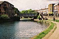
 View of Haggerston Lock from the Regent's Canal towpath - geograph.org.uk - 5514655.jpg 3,872 × 2,592; 2.24 MB
-


.jpg)


.jpg)
.jpg)


.jpg)


