Category:Haconby
Jump to navigation
Jump to search
village in South Kesteven, Lincolnshire, UK  | |||||
| Upload media | |||||
| Instance of | |||||
|---|---|---|---|---|---|
| Location | Haconby, South Kesteven, Lincolnshire, East Midlands, England | ||||
 | |||||
English: Haconby is a small village located on the western edge of the Lincolnshire Fens, three miles north of Bourne.
Subcategories
This category has the following 5 subcategories, out of 5 total.
Media in category "Haconby"
The following 139 files are in this category, out of 139 total.
-
 1950s houses - geograph.org.uk - 4102750.jpg 4,896 × 3,672; 6.89 MB
-
 60s Bungalows - geograph.org.uk - 4102706.jpg 4,896 × 3,672; 6.72 MB
-
 A secure boundary - geograph.org.uk - 4102711.jpg 4,896 × 3,672; 7 MB
-
 Across the Car Dyke - geograph.org.uk - 4103180.jpg 4,896 × 3,672; 7.18 MB
-
 Aesculus hippocastanum - geograph.org.uk - 4102725.jpg 4,896 × 3,672; 6.86 MB
-
 Along the Car Dyke - geograph.org.uk - 4103191.jpg 4,896 × 3,672; 7.18 MB
-
 Along the Car Dyke - geograph.org.uk - 4103418.jpg 4,896 × 3,672; 6.75 MB
-
 Araucaria araucana - geograph.org.uk - 4102764.jpg 4,896 × 3,672; 7.2 MB
-
 Barns at Spa Farm - geograph.org.uk - 3727443.jpg 4,896 × 3,672; 6.95 MB
-
 Base of trig pillar - geograph.org.uk - 4188229.jpg 3,672 × 4,896; 6.3 MB
-
 Black Hole Drove Pumping Station - geograph.org.uk - 3142073.jpg 2,256 × 1,504; 909 KB
-
 Black Hole Drove Pumping Station - geograph.org.uk - 4782410.jpg 640 × 480; 68 KB
-
 Borehole - geograph.org.uk - 4103213.jpg 4,896 × 3,672; 6.41 MB
-
 Bourne 3 - geograph.org.uk - 2868927.jpg 768 × 1,024; 348 KB
-
 Bridge over Car Dyke on Haconby Drove - geograph.org.uk - 3139286.jpg 2,256 × 1,504; 1.31 MB
-
 Car Dyke at Haconby - geograph.org.uk - 144745.jpg 640 × 427; 149 KB
-
 Centre of the village - geograph.org.uk - 4102732.jpg 4,896 × 3,672; 6.91 MB
-
 Church Lane Haconby - geograph.org.uk - 4102691.jpg 4,896 × 3,672; 6.77 MB
-
 Corvids on the drove - geograph.org.uk - 2467929.jpg 640 × 480; 76 KB
-
 Cottage in Church Street - geograph.org.uk - 4103452.jpg 4,896 × 3,672; 6.87 MB
-
 Crop field west of the A15 - geograph.org.uk - 3847122.jpg 640 × 480; 87 KB
-
 Derelict accommodation - geograph.org.uk - 3479614.jpg 4,320 × 3,240; 5.37 MB
-
 Derelict crew yard - geograph.org.uk - 3479654.jpg 4,320 × 3,240; 5.43 MB
-
 Derelict farm building - geograph.org.uk - 3479602.jpg 4,320 × 3,240; 5.47 MB
-
 Ditches and Fields on Hacconby Fen - geograph.org.uk - 4253700.jpg 1,024 × 768; 430 KB
-
 Drain along Haconby Drove - geograph.org.uk - 3135288.jpg 1,504 × 2,256; 957 KB
-
 Drain on Haconby Drove towards Middle Farm ^ Pinders Farm - geograph.org.uk - 3140926.jpg 2,256 × 1,504; 1.11 MB
-
 Dry Dyke - geograph.org.uk - 4103415.jpg 4,896 × 3,672; 6.66 MB
-
 Dry Dyke - geograph.org.uk - 4103420.jpg 4,896 × 3,672; 6.78 MB
-
 Electric pump at Haconby - geograph.org.uk - 3479795.jpg 4,320 × 3,240; 5.6 MB
-
 Engine Farm - geograph.org.uk - 3479687.jpg 4,320 × 3,240; 5.53 MB
-
 Farm Buildings and Hall - geograph.org.uk - 2853240.jpg 1,024 × 768; 238 KB
-
 Farm on Haconby Drove - geograph.org.uk - 144753.jpg 640 × 427; 103 KB
-
 Farm Track on Haconby Fen - geograph.org.uk - 144747.jpg 640 × 427; 121 KB
-
 Fenland scene - geograph.org.uk - 4103435.jpg 4,896 × 3,672; 6.47 MB
-
 Field - geograph.org.uk - 4103193.jpg 4,896 × 3,672; 6.23 MB
-
 Field behind the school - geograph.org.uk - 4103163.jpg 4,896 × 3,672; 6.88 MB
-
 Fields Near Haconby - geograph.org.uk - 2853219.jpg 1,024 × 768; 186 KB
-
 Folkingham Road (A15) - geograph.org.uk - 3847123.jpg 640 × 480; 92 KB
-
 Following the plough - geograph.org.uk - 4102774.jpg 4,896 × 3,672; 6.64 MB
-
 Footpath off Chapel Street, Haconby - geograph.org.uk - 3139255.jpg 2,256 × 1,504; 1.03 MB
-
 Footpath towards Morton - geograph.org.uk - 4251457.jpg 1,024 × 768; 463 KB
-
 Former school - geograph.org.uk - 4102759.jpg 4,896 × 3,672; 6.78 MB
-
 Former shop - geograph.org.uk - 4102755.jpg 4,896 × 3,672; 6.67 MB
-
 Front-end loader - geograph.org.uk - 4188247.jpg 4,896 × 3,672; 6.34 MB
-
 Giant machine - geograph.org.uk - 4188212.jpg 4,896 × 3,672; 6.74 MB
-
 Hacconby Drove - geograph.org.uk - 2632633.jpg 4,000 × 3,000; 4.28 MB
-
 Hacconby Drove - geograph.org.uk - 4253725.jpg 1,024 × 768; 399 KB
-
 Hacconby Drove - geograph.org.uk - 6307101.jpg 1,024 × 768; 228 KB
-
 Hacconby Drove leading out to Hacconby Fen - geograph.org.uk - 2632622.jpg 4,000 × 3,000; 4.14 MB
-
 Hacconby Drove on Hacconby Fen - geograph.org.uk - 2632675.jpg 4,000 × 3,000; 3.94 MB
-
 Hacconby Fen - geograph.org.uk - 2632668.jpg 4,000 × 3,000; 4.4 MB
-
 Hacconby Fen - geograph.org.uk - 6307003.jpg 1,024 × 768; 212 KB
-
 Hacconby Fen - geograph.org.uk - 6307087.jpg 1,024 × 768; 234 KB
-
 Haconby Drove in high summer - geograph.org.uk - 2467935.jpg 640 × 480; 99 KB
-
 Haconby Drove in high summer - geograph.org.uk - 2467951.jpg 640 × 480; 70 KB
-
 Haconby Fen - geograph.org.uk - 4188234.jpg 4,896 × 3,672; 6.33 MB
-
 Haconby Fen Pumping Station - geograph.org.uk - 3135286.jpg 2,256 × 1,504; 1.19 MB
-
 Haconby Fen Pumping Station - geograph.org.uk - 3135294.jpg 2,256 × 1,504; 877 KB
-
 Haconby fen pumping station - geograph.org.uk - 3479742.jpg 4,320 × 3,240; 5.25 MB
-
 Haconby Manor House - geograph.org.uk - 2606695.jpg 640 × 427; 106 KB
-
 Haconby pumping station outfall - geograph.org.uk - 3479712.jpg 4,320 × 3,240; 5.81 MB
-
 Hiding in plain sight - geograph.org.uk - 4103197.jpg 4,896 × 3,672; 6.65 MB
-
 House in Church Street - geograph.org.uk - 4102734.jpg 4,896 × 3,672; 6.95 MB
-
 House in church Street - geograph.org.uk - 4102735.jpg 4,896 × 3,672; 6.67 MB
-
 House in Church Street - geograph.org.uk - 4103447.jpg 4,896 × 3,672; 7.05 MB
-
 House in Haconby - geograph.org.uk - 4103171.jpg 4,896 × 3,672; 6.66 MB
-
 Houses in Church Street - geograph.org.uk - 4102740.jpg 4,896 × 3,672; 6.57 MB
-
 In the dust - geograph.org.uk - 4188243.jpg 4,896 × 3,672; 5.38 MB
-

-
 Inside the fen - geograph.org.uk - 4103439.jpg 4,896 × 3,672; 6.57 MB
-
 Interior of derelict building - geograph.org.uk - 3479638.jpg 4,320 × 3,240; 5.37 MB
-
 Late era barns - geograph.org.uk - 4103203.jpg 4,896 × 3,672; 6.7 MB
-
 Lay-by daffodils on the A15 near Bourne, Lincolnshire - geograph.org.uk - 4382432.jpg 1,771 × 1,190; 1.41 MB
-

-
 Loading straw on a Farm Track - geograph.org.uk - 3139106.jpg 2,256 × 1,504; 1.03 MB
-
 Looking along Stainfield Road - geograph.org.uk - 2693409.jpg 4,000 × 3,000; 3.9 MB
-
 Looking to the A15 crossroads - geograph.org.uk - 3861710.jpg 4,000 × 3,000; 3.91 MB
-
 Middle Farm and Pinders Farm, Haconby Fen - geograph.org.uk - 144751.jpg 640 × 427; 106 KB
-
 Milestone - geograph.org.uk - 2868929.jpg 1,024 × 768; 268 KB
-
 Nest boxes - geograph.org.uk - 3479807.jpg 4,320 × 3,240; 5.48 MB
-
 Notice at the borehole - geograph.org.uk - 4103215.jpg 4,896 × 3,672; 6.75 MB
-
 Old farm buildings - geograph.org.uk - 4154258.jpg 4,896 × 3,672; 6.36 MB
-
 Old farm cottages at Haconby, near Bourne, Lincolnshire - geograph.org.uk - 4663077.jpg 2,793 × 2,071; 1.48 MB
-
 Older building - geograph.org.uk - 4154264.jpg 4,896 × 3,672; 6.62 MB
-

-
 Picturesque - geograph.org.uk - 4102708.jpg 4,896 × 3,672; 6.4 MB
-
 Ploughed field near Haconby - geograph.org.uk - 6306958.jpg 1,024 × 768; 232 KB
-
 Ploughing and Rolling - geograph.org.uk - 4253686.jpg 1,024 × 768; 407 KB
-
 Pole transformer - geograph.org.uk - 3479839.jpg 4,320 × 3,240; 5.25 MB
-
 Power Lines along Hacconby Drove - geograph.org.uk - 4253716.jpg 768 × 1,024; 391 KB
-
 Private bridge - geograph.org.uk - 4188231.jpg 4,896 × 3,672; 6.89 MB
-
 Public Footpath to Stainfield Spa - geograph.org.uk - 3139124.jpg 1,504 × 2,256; 1.38 MB
-
 Pumping station at end of Haconby Drove - geograph.org.uk - 144772.jpg 640 × 427; 120 KB
-
 Pumping station nameplate - geograph.org.uk - 3479761.jpg 4,320 × 3,240; 5.37 MB
-
 Quality brickwork - geograph.org.uk - 4154261.jpg 4,896 × 3,672; 6.94 MB
-
 Red brick farm building - geograph.org.uk - 3479631.jpg 4,320 × 3,240; 5.71 MB
-

-
 Restored farmhouse - geograph.org.uk - 4102714.jpg 4,896 × 3,672; 6.83 MB
-
 Road Junction near Haconby - geograph.org.uk - 3139209.jpg 2,256 × 1,504; 1.24 MB
-
 Route of the railway - geograph.org.uk - 4103176.jpg 4,896 × 3,672; 7.04 MB
-

-
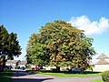 Royal conker tree at Haconby, near Bourne, Lincolnshire (2) - geograph.org.uk - 4668782.jpg 2,848 × 2,134; 1.36 MB
-

-
 Seed Drill - geograph.org.uk - 4189183.jpg 4,896 × 3,672; 6.66 MB
-
 South Forty Foot Drain - geograph.org.uk - 6307107.jpg 1,024 × 768; 154 KB
-
 Stainfield Spa - geograph.org.uk - 6579315.jpg 1,024 × 768; 207 KB
-
 Straw Bales - geograph.org.uk - 4253729.jpg 1,024 × 768; 428 KB
-
 Substation notices - geograph.org.uk - 4103218.jpg 4,896 × 3,672; 6.58 MB
-
 The Car Dyke near Haconby - geograph.org.uk - 6306983.jpg 1,024 × 768; 356 KB
-
 The compound - geograph.org.uk - 4103216.jpg 4,896 × 3,672; 7.01 MB
-
 The course of a former railway - geograph.org.uk - 6306965.jpg 1,024 × 768; 153 KB
-
 The landward side - geograph.org.uk - 4103460.jpg 4,896 × 3,672; 7.12 MB
-
 The microwave tower - geograph.org.uk - 4188241.jpg 4,896 × 3,672; 6.72 MB
-
 The Open Fen - geograph.org.uk - 4103456.jpg 4,896 × 3,672; 6.85 MB
-
 The picture that framed itself - geograph.org.uk - 3479569.jpg 4,320 × 3,240; 5.97 MB
-
 The road from Haconby to Stainfield - geograph.org.uk - 3639340.jpg 3,776 × 2,520; 4.07 MB
-
 The road to Stainby - geograph.org.uk - 3861715.jpg 4,000 × 3,000; 4.45 MB
-
 The South Forty Foot Drain - geograph.org.uk - 3142069.jpg 1,504 × 2,256; 787 KB
-
 The village green in Hacconby - geograph.org.uk - 2632715.jpg 4,000 × 3,000; 4.37 MB
-
 The village pub at Haconby, near Bourne, Lincolnshire - geograph.org.uk - 4457632.jpg 1,750 × 1,172; 696 KB
-
 The village school at Haconby, near Bourne, Lincolnshire - geograph.org.uk - 4442026.jpg 1,773 × 1,177; 835 KB
-

-
 Top of Trig Pillar - geograph.org.uk - 4188224.jpg 4,896 × 3,672; 6.16 MB
-
 Toward the Fen - geograph.org.uk - 4103453.jpg 4,896 × 3,672; 6.67 MB
-
 Toward the village - geograph.org.uk - 4103454.jpg 4,896 × 3,672; 6.69 MB
-
 Track by the South Forty Foot Drain - geograph.org.uk - 4253665.jpg 1,024 × 825; 410 KB
-
 Track off Hacconby Drove - geograph.org.uk - 6306998.jpg 1,024 × 768; 200 KB
-
 Track on Haconby Fen - geograph.org.uk - 3139302.jpg 2,256 × 1,504; 1.14 MB
-
 Track to old farm buildings, off Haconby Drove - geograph.org.uk - 3135264.jpg 2,256 × 1,504; 857 KB
-
 Trig pillar - geograph.org.uk - 4188223.jpg 4,896 × 3,672; 6.75 MB
-
 Under the road - geograph.org.uk - 4103187.jpg 4,896 × 3,672; 6.9 MB
-
 Under the Spreading Chestnut Tree - geograph.org.uk - 693620.jpg 640 × 427; 117 KB
-
 Victorian house at Haconby, near Bourne, Lincolnshire (geograph 4664675).jpg 1,764 × 1,183; 690 KB
-
 Victorian textures - geograph.org.uk - 4102720.jpg 4,896 × 3,672; 6.69 MB
-
 View toward Royce's Farm - geograph.org.uk - 4188216.jpg 4,896 × 3,672; 7.02 MB
-
 View toward Woodbine House - geograph.org.uk - 4188214.jpg 4,896 × 3,672; 7.13 MB
-
 Village street - geograph.org.uk - 4102703.jpg 4,896 × 3,672; 6.6 MB
-
 Winter Wheat by Haconby Drove - geograph.org.uk - 2467957.jpg 640 × 480; 87 KB


_-_geograph.org.uk_-_3847123.jpg)


_-_geograph.org.uk_-_4549629.jpg)
_-_geograph.org.uk_-_4668782.jpg)


.jpg)


