Category:Habichtswald (Mittelgebirge)
Jump to navigation
Jump to search
mountain range  | |||||
| Upload media | |||||
| Instance of | |||||
|---|---|---|---|---|---|
| Location | Hesse, Germany | ||||
| Mountain range | |||||
| Highest point |
| ||||
 | |||||
Subcategories
This category has the following 31 subcategories, out of 31 total.
B
- Bilstein (Langenberge) (4 F)
- Blauer See (Habichtswald) (11 F)
D
- Dead Picea in Habichtswald (15 F)
E
- Eco Pfad Kloster Hasungen (19 F)
- Elfbuchenturm (9 F)
- Erlenloch (Habichtswald) (27 F)
F
- Firnskuppe (4 F)
G
- Großer Schreckenberg (27 F)
H
K
- Kleiner Herbsthaus (3 F)
- Kleiner Schreckenberg (36 F)
M
N
- Naturschutzgebiet Hirzstein (26 F)
R
S
- Silbersee (Habichtswald) (6 F)
- Steinbruch im Druseltal (Kassel) (11 F)
W
Z
- Ziegenkopf (Habichtswald) (20 F)
Pages in category "Habichtswald (Mittelgebirge)"
This category contains only the following page.
Media in category "Habichtswald (Mittelgebirge)"
The following 177 files are in this category, out of 177 total.
-
 Allee Höllchen Habichtswald.JPG 3,264 × 2,448; 3.23 MB
-
 Aussicht von Wiese oberhalb Schauenburg-Elgershausen.jpg 31,420 × 2,308; 46.3 MB
-
 Barren tree (Habichtswald, Germany) (33297965678).jpg 3,672 × 4,896; 8.49 MB
-
 Beech Tree in Habichtswald (Germany) (50544638178).jpg 3,672 × 4,896; 7.99 MB
-
 Beech Tree, Habichtswald (Germany) (50545504942).jpg 3,672 × 4,896; 7.89 MB
-
 Beech Trees Habichtswald (Germany) (50545505352).jpg 4,896 × 3,672; 7.71 MB
-
 Bismarckturm Kassel Winter.jpg 2,268 × 4,032; 4.3 MB
-
 Blick auf Brasselsberg und Kassel.jpg 4,032 × 2,268; 3.83 MB
-
 Bodenhausen Bärenberg Gudenberg.JPG 3,264 × 2,448; 2.58 MB
-
 Creek in the Habichtswald forest (32849433040).jpg 3,648 × 2,736; 5.36 MB
-
 Der Hirzstein im Habichtswald in Nordhessen.jpg 3,264 × 2,448; 4.83 MB
-
 Drusel, 1, Bad Wilhelmshöhe, Kassel.jpg 3,456 × 2,592; 5.65 MB
-
 Drusel, 10, Bad Wilhelmshöhe, Kassel.jpg 3,456 × 2,592; 6.16 MB
-
 Drusel, 7, Bad Wilhelmshöhe, Kassel.jpg 3,456 × 2,592; 6.3 MB
-
 Drusel, 9, Bad Wilhelmshöhe, Kassel.jpg 3,456 × 2,592; 6.3 MB
-
 Dönchebach, 0021, Brasselsberg, Kassel.jpg 3,264 × 2,448; 3.53 MB
-
 Dörnbergstraße 101, 1, Weimar, Ahnatal, Landkreis Kassel.jpg 3,456 × 2,592; 4.1 MB
-
 Dörnbergstraße 101, 2, Weimar, Ahnatal, Landkreis Kassel.jpg 3,456 × 2,592; 4.47 MB
-
 Dörnbergstraße 101, 3, Weimar, Ahnatal, Landkreis Kassel.jpg 3,456 × 2,592; 4.52 MB
-
 Ederseeweg Brasselsberg.JPG 3,264 × 2,448; 3.82 MB
-
 Ederseeweg Langenberge (1).JPG 3,264 × 2,448; 3.67 MB
-
 Ederseeweg Langenberge (2).JPG 3,264 × 2,448; 4.3 MB
-
 Ederseeweg Lützel.JPG 3,264 × 2,448; 3.03 MB
-
 Ederseeweg Schauenburg.JPG 3,264 × 2,448; 1.89 MB
-
 First snow in the Habichtswald forest (Germany) (47170366291).jpg 3,672 × 4,896; 6.97 MB
-
 Fulda-Diemel-Weg Ahnetal Hohlestein.JPG 3,264 × 2,448; 3.58 MB
-
 Fulda-Diemel-Weg Alte Wolfhager Straße.JPG 3,264 × 2,448; 4.24 MB
-
 Fulda-Diemel-Weg Hessenschanze Rasenallee.JPG 3,264 × 2,448; 3.36 MB
-
 Fulda-Diemel-Weg Prinzenquelle Hessenschanze.JPG 3,264 × 2,448; 3.28 MB
-
 Geilebach, 10, Harleshausen, Kassel.jpg 3,456 × 2,592; 5.93 MB
-
 Geilebach, 12, Harleshausen, Kassel.jpg 3,456 × 2,592; 5.28 MB
-
 Geilebach, 14, Harleshausen, Kassel.jpg 3,264 × 2,448; 6.13 MB
-
 Geilebach, 15, Harleshausen, Kassel.jpg 3,456 × 2,592; 6.62 MB
-
 Geilebach, 17, Harleshausen, Kassel.jpg 3,264 × 2,448; 5.17 MB
-
 Geilebach, 9, Harleshausen, Kassel.jpg 3,456 × 2,592; 5.97 MB
-
 Glockenborn Panorama.JPG 11,977 × 2,310; 20.09 MB
-
 Großer Auskopf, 1, Dörnberg, Habichtswald, Landkreis Kassel.jpg 3,456 × 2,592; 6.43 MB
-
 Großer Auskopf, 1, Ehlen, Habichtswald, Landkreis Kassel.jpg 4,320 × 3,240; 4.09 MB
-
 Großer Auskopf, 2, Dörnberg, Habichtswald, Landkreis Kassel.jpg 3,456 × 2,592; 6.27 MB
-
 Großer Auskopf, 2, Ehlen, Habichtswald, Landkreis Kassel.jpg 4,320 × 3,240; 3.14 MB
-
 Großer Auskopf, 3, Dörnberg, Habichtswald, Landkreis Kassel.jpg 3,456 × 2,592; 5.28 MB
-
 Großer Auskopf, 4, Dörnberg, Habichtswald, Landkreis Kassel.jpg 3,456 × 2,592; 5.65 MB
-
 Großer Auskopf, 5, Dörnberg, Habichtswald, Landkreis Kassel.jpg 3,456 × 2,592; 6.15 MB
-
 Großer Auskopf, 6, Dörnberg, Habichtswald, Landkreis Kassel.jpg 3,456 × 2,592; 3.95 MB
-
 Großer Auskopf, 7, Dörnberg, Habichtswald, Landkreis Kassel.jpg 3,264 × 2,448; 3.99 MB
-
 Großer Steinhaufen, 1, Dörnberg, Habichtswald.jpg 3,456 × 2,592; 4.29 MB
-
 Großer Steinhaufen, 3, Dörnberg, Habichtswald.jpg 3,264 × 2,448; 5.12 MB
-
 Großer Steinhaufen, 4, Dörnberg, Habichtswald.jpg 3,264 × 2,448; 5.92 MB
-
 Großer Steinhaufen, 5, Dörnberg, Habichtswald.jpg 3,264 × 2,448; 4.65 MB
-
 Großer Steinhaufen, 6, Dörnberg, Habichtswald.jpg 2,448 × 3,264; 4.81 MB
-
 Großer Steinhaufen, 8, Dörnberg, Habichtswald.jpg 3,264 × 2,448; 4.42 MB
-
 Großer Steinhaufen, 9, Dörnberg, Habichtswald, Landkreis Kassel.jpg 3,456 × 2,592; 3.5 MB
-
 Haareis an Totholz - Hair ice on rotten wood (8328864631).jpg 480 × 640; 200 KB
-
 Habichtswald (forest near Kassel Germany) (51241709607).jpg 4,896 × 3,672; 8.84 MB
-
 Habichtswald (Germany) (29899615190).jpg 6,000 × 4,000; 10.41 MB
-
 Habichtswald (Germany) (30110204171).jpg 4,000 × 6,000; 6.63 MB
-
 Habichtswald (Germany) (30113874151).jpg 685 × 1,024; 164 KB
-
 Habichtswald (Germany) (30160984476).jpg 4,000 × 6,000; 10.05 MB
-
 Habichtswald (Germany) (30495392080).jpg 2,592 × 3,872; 4.83 MB
-
 Habichtswald (Germany) (30679221322).jpg 4,000 × 6,000; 6.22 MB
-
 Habichtswald (Germany) (32) (47121271132).jpg 3,672 × 4,896; 8.53 MB
-
 Habichtswald (Germany) (37) (47173168371).jpg 4,896 × 3,672; 8.03 MB
-
 Habichtswald (Germany) (42469496412).jpg 4,896 × 3,672; 7.48 MB
-
 Habichtswald (Germany) (48646718458).jpg 4,896 × 3,672; 6.64 MB
-
 Habichtswald (Germany) (49882678876).jpg 3,672 × 4,896; 6.92 MB
-
 Habichtswald (Germany) (49882679261).jpg 3,672 × 4,896; 8.17 MB
-
 Habichtswald (Germany) (50544638478).jpg 3,672 × 4,896; 8.53 MB
-
 Habichtswald (Germany) (50545366881).jpg 6,000 × 4,000; 11.19 MB
-
 Habichtswald (Germany) (50545367141).jpg 6,000 × 4,000; 9.25 MB
-
 Habichtswald (Germany) (50545371346).jpg 3,672 × 4,896; 8.94 MB
-
 Habichtswald (Germany) (50545488052).jpg 3,672 × 4,896; 7.91 MB
-
 Habichtswald (Germany) (50545505117).jpg 4,896 × 3,672; 7.33 MB
-
 Habichtswald (Germany) (50545505682).jpg 4,896 × 3,672; 7.39 MB
-
 Habichtswald (Germany) (50545506107).jpg 3,672 × 4,896; 7.26 MB
-
 Habichtswald (Germany) (50545508292).jpg 4,896 × 3,672; 5.24 MB
-
 Habichtswald (Germany) (50545508537).jpg 3,672 × 4,896; 7.41 MB
-
 Habichtswald (near Kassel Germany) (50874290167).jpg 4,896 × 3,672; 7.28 MB
-
 Habichtswald (near Kassel) (20) (44561449205).jpg 3,672 × 4,896; 8.66 MB
-
 Habichtswald (near Kassel) (30535428377).jpg 4,896 × 3,672; 7.29 MB
-
 Habichtswald (near Kassel) (30535455447).jpg 4,896 × 3,672; 5.95 MB
-
 Habichtswald (near Kassel) (33) (31600951088).jpg 4,896 × 3,672; 6.84 MB
-
 Habichtswald (near Kassel) (5) (43658235110).jpg 4,896 × 3,672; 5.87 MB
-
 Habichtswald (near Kassel) (6) (44750445544).jpg 4,896 × 3,672; 5.73 MB
-
 Habichtswald (near Kassel, Germany) (4) (35931205251).jpg 4,000 × 6,000; 10.75 MB
-
 Habichtswald (near Kassel, Germany) (42) (35252196423).jpg 3,672 × 4,896; 6.44 MB
-
 Habichtswald (near Kassel, Germany) (43) (36019284686).jpg 4,896 × 3,672; 7.1 MB
-
 Habichtswald (near Kassel, Germany) (7) (36063678445).jpg 4,000 × 6,000; 9.75 MB
-
 Habichtswald - Deponie 2021-12-11.JPG 3,648 × 2,736; 4.33 MB
-
 Habichtswald - Kaiserbuche 2021-12-11.JPG 2,736 × 3,648; 4.03 MB
-
 Habichtswald - Kastanienallee 2021-12-11.JPG 3,648 × 2,736; 4.3 MB
-
 Habichtswald - Kernfläche Naturschutz 2020-09-26 a.JPG 3,648 × 2,432; 3.98 MB
-
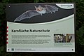 Habichtswald - Kernfläche Naturschutz 2020-09-26 b.JPG 3,648 × 2,432; 3.72 MB
-
 Habichtswald - Zum Silbersee 2021-08-29.JPG 3,648 × 2,736; 3.82 MB
-
 Habichtswald bei Dörnberg - panoramio (58).jpg 4,608 × 2,304; 9.46 MB
-
 Habichtswald bei Elmshagen d schmidt 04 2009.jpg 2,592 × 1,456; 1,000 KB
-
 Habichtswald bismarckturm blick ks brasselsberg ds wv 02 2011.jpg 1,600 × 1,200; 331 KB
-
 Habichtswald bismarckturm blick ks wilhelmshoehe ds wv 02 2011.jpg 1,333 × 1,000; 228 KB
-
 Habichtswald bismarckturm westblick ds wv 02 2011.jpg 1,000 × 750; 160 KB
-
 Habichtswald Forest Germany (43243637864).jpg 4,896 × 3,672; 6.08 MB
-
 Habichtswald Forest Germany (43913932852).jpg 4,896 × 3,672; 8.41 MB
-
 Habichtswald hirzstein aussichtspunkt ds wv 10 2009.jpg 1,800 × 1,350; 435 KB
-
 Habichtswald hirzstein guckpfahl detail ds wv 10 2009.jpg 1,333 × 1,000; 195 KB
-
 Habichtswald hirzstein guckpfahl ganz ds wv 10 2009.jpg 1,000 × 1,333; 325 KB
-
 Habichtswald im Winter01.jpg 1,806 × 1,200; 926 KB
-
 Habichtswald im Winter02.jpg 1,806 × 1,200; 759 KB
-
 Habichtswald near Kassel (Germany) (33103962991).jpg 3,648 × 2,736; 3.6 MB
-
 Habichtswald near Kassel (Germany) (33190531776).jpg 3,648 × 2,736; 3.05 MB
-
 Habichtswald near Kassel (Germany) (50874248957).jpg 3,672 × 4,896; 7.59 MB
-
 Habichtswald near Kassel, Germany (44266456575).jpg 3,672 × 4,896; 8.95 MB
-
 Habichtswald near Kassel, Germany (44266474855).jpg 4,896 × 3,672; 8.35 MB
-
 Habichtswald, 1, Kirchditmold, Kassel.jpg 3,264 × 2,448; 4.91 MB
-
 Habichtswälder Bergland Übersichtskarte.png 744 × 510; 461 KB
-
 Hessisches Landesmuseum Kassel-05-Aussicht West.jpg 4,320 × 3,240; 5.54 MB
-
 Hessisches Landesmuseum Kassel-08-Panorama.jpg 3,040 × 864; 1.23 MB
-
 Hirzstein, 1, Großenritte, Baunatal, Landkreis Kassel.jpg 4,320 × 3,240; 4.3 MB
-
 Hirzstein, 2, Großenritte, Baunatal, Landkreis Kassel.jpg 4,320 × 3,240; 4.22 MB
-
 Hoher doernberg alpenpfad blick habichtswald ds wv 06 2010.jpg 1,500 × 1,125; 437 KB
-
 Hoher Dörnberg, 2, Dörnberg, Habichtswald, Landkreis Kassel.jpg 3,264 × 2,448; 4.54 MB
-
 Hoher Habichtswald.JPG 6,300 × 2,700; 6.27 MB
-
 Hoher Habichtswald.png 744 × 510; 461 KB
-
 Hohes gras blick nordost ds 08 2009.jpg 1,333 × 1,000; 161 KB
-
 Hoofer pforte von weidelsburg ds 07 2009.jpg 2,250 × 830; 311 KB
-
 Höllchen Habichtswald.JPG 3,264 × 2,448; 3.56 MB
-
 Kaffeemühle Habichtswald.JPG 3,264 × 2,448; 4.24 MB
-
 Kasseler Becken im Nebel.jpg 5,858 × 1,631; 3.63 MB
-
 Kleiner Auskopf, 1, Dörnberg, Habichtswald, Landkreis Kassel.jpg 3,456 × 2,592; 6.21 MB
-
 Kleiner Auskopf, 2, Dörnberg, Habichtswald, Landkreis Kassel.jpg 3,456 × 2,592; 6.29 MB
-
 Kleiner Auskopf, 3, Dörnberg, Habichtswald, Landkreis Kassel.jpg 3,456 × 2,592; 6.3 MB
-
 Kleiner Auskopf, 4, Dörnberg, Habichtswald, Landkreis Kassel.jpg 3,456 × 2,592; 6.64 MB
-
 Kleiner Auskopf, 5, Dörnberg, Habichtswald, Landkreis Kassel.jpg 3,456 × 2,592; 5.3 MB
-
 Kleiner Steinkopf, 1, Bad Wilhelmshöhe, Kassel.jpg 3,456 × 2,592; 2.68 MB
-
 Konrad-Göbel-Hütte.JPG 3,264 × 2,448; 3.68 MB
-
 Kubergraben, 3, Harleshausen, Kassel.jpg 3,264 × 2,448; 4.82 MB
-
 Kuhnen (Hoher) Dörnberg.JPG 3,264 × 2,448; 3.7 MB
-
 Lake near Kassel (Germany) (30495263340).jpg 6,000 × 4,000; 10.75 MB
-
 Lichtung Am Ziegenkopf Habichtswald.JPG 3,264 × 2,448; 2.75 MB
-
 Lichtung Forsthaus Haide.JPG 3,264 × 2,448; 1.82 MB
-
 Lichtung Hoofer Gutsforst.JPG 3,264 × 2,448; 2.37 MB
-
 LSG 378517, Stadt Kassel, Baunsberg, 14, Nordshausen, Kassel.jpg 3,264 × 2,448; 3.31 MB
-
 LSG 378517, Stadt Kassel, Geilebachtal, 11, Jungfernkopf, Kassel.jpg 3,264 × 2,448; 2.05 MB
-
 LSG 378517, Stadt Kassel, Geilebachtal, 19, Jungfernkopf, Kassel.jpg 3,264 × 2,448; 1.53 MB
-
 LSG 378517, Stadt Kassel, Haardtweg, 8, Kirchditmold, Kassel.jpg 3,264 × 2,448; 2.79 MB
-
 LSG 378517, Stadt Kassel, Langes Feld, 7, Niederzwehren, Kassel.jpg 3,456 × 2,592; 4.76 MB
-
 Naturdenkmal Kaiserbuche.JPG 3,264 × 2,448; 3.36 MB
-
 ND 633.304, Kaiserbuche, 1, Dörnberg, Habichtswald, Landkreis Kassel.jpg 3,456 × 2,592; 6.46 MB
-
 ND 633.304, Kaiserbuche, 2, Dörnberg, Habichtswald, Landkreis Kassel.jpg 3,456 × 2,592; 6.72 MB
-
 Odenbergturm-11-Panorama 3-Besse.jpg 7,423 × 2,784; 6.97 MB
-
 Panoramaweg Drusel.JPG 3,264 × 2,448; 3.37 MB
-
 Panoramaweg Habichtswald.JPG 3,264 × 2,448; 2.76 MB
-
 Schreckenbergturm.jpg 3,240 × 4,320; 4.42 MB
-
 Schutzhütte Langenberge.JPG 3,264 × 2,448; 4.1 MB
-
 Schwengeberg Gipfelbereich.JPG 4,320 × 3,240; 5.71 MB
-
 Schwengeberg Hutestein.JPG 3,240 × 4,320; 5.53 MB
-
 Seilerberg, 1, Ehlen, Habichtswald, Landkreis Kassel.jpg 3,264 × 2,448; 3.25 MB
-
 Seilerberg, 2, Ehlen, Habichtswald, Landkreis Kassel.jpg 3,456 × 2,592; 4.86 MB
-
 Seilerberg, 3, Ehlen, Habichtswald, Landkreis Kassel.jpg 4,320 × 3,240; 3.43 MB
-
 Skipiste hohes gras wv ds 02 2009.jpg 4,068 × 1,258; 602 KB
-
 Staubecken, 1, Dörnberg, Habichtswald.jpg 3,264 × 2,448; 5.35 MB
-
 Staubecken, 11, Dörnberg, Habichtswald.jpg 3,456 × 2,592; 5.95 MB
-
 Staubecken, 12, Dörnberg, Habichtswald.jpg 3,456 × 2,592; 6.12 MB
-
 Staubecken, 2, Dörnberg, Habichtswald.jpg 3,264 × 2,448; 5.52 MB
-
 Staubecken, 3, Dörnberg, Habichtswald.jpg 3,264 × 2,448; 4.99 MB
-
 Staubecken, 4, Dörnberg, Habichtswald.jpg 3,264 × 2,448; 5.09 MB
-
 Staubecken, 5, Dörnberg, Habichtswald.jpg 3,264 × 2,448; 4.32 MB
-
 Vogelrain Langenberge.JPG 3,264 × 2,448; 4.04 MB
-
 Waldgaststätte „Silbersee“ - panoramio.jpg 4,608 × 3,456; 8.33 MB
-
 Wallanlage Hirzstein Relief-Umzeichnung.png 2,154 × 1,310; 1.96 MB
-
 Wanderung hohes gras hirzstein bismarckturm brasselsberg stand 25 10 2012.png 1,562 × 1,309; 1.17 MB
-
 Wanderweg Igelsburg.JPG 3,264 × 2,448; 3.08 MB
-
 Wanderweg zum Silbersee - panoramio.jpg 4,608 × 3,456; 9.64 MB
-
 Wegweiser Habichtswald.JPG 3,264 × 2,448; 2.38 MB
-
 Weidegatter Konrad-Göbel-Hütte.JPG 3,264 × 2,448; 3.89 MB
-
 Willi-Seidel-Weg.jpg 530 × 613; 118 KB
-
 Wuhlhagen, 1, Dörnberg, Habichtswald.jpg 3,264 × 2,448; 5.41 MB
-
 Wuhlhagen, 3, Dörnberg, Habichtswald, Landkreis Kassel.jpg 3,456 × 2,592; 6.54 MB
-
 Wuhlhagen, 4, Dörnberg, Habichtswald, Landkreis Kassel.jpg 3,456 × 2,592; 3.53 MB
-
 Wuhlhagen, 5, Dörnberg, Habichtswald, Landkreis Kassel.jpg 3,456 × 2,592; 5.7 MB

_(33297965678).jpg)
_(50544638178).jpg)
_(50545504942).jpg)
_(50545505352).jpg)


.jpg)


.JPG)
.JPG)


_(47170366291).jpg)


.jpg)
_(51241709607).jpg)
_(29899615190).jpg)
_(30110204171).jpg)
_(30113874151).jpg)
_(30160984476).jpg)
_(30495392080).jpg)
_(30679221322).jpg)
_(32)_(47121271132).jpg)
_(37)_(47173168371).jpg)
_(42469496412).jpg)
_(48646718458).jpg)
_(49882678876).jpg)
_(49882679261).jpg)
_(50544638478).jpg)
_(50545366881).jpg)
_(50545367141).jpg)
_(50545371346).jpg)
_(50545488052).jpg)
_(50545505117).jpg)
_(50545505682).jpg)
_(50545506107).jpg)
_(50545508292).jpg)
_(50545508537).jpg)
_(50874290167).jpg)
_(20)_(44561449205).jpg)
_(30535428377).jpg)
_(30535455447).jpg)
_(33)_(31600951088).jpg)
_(5)_(43658235110).jpg)
_(6)_(44750445544).jpg)
_(4)_(35931205251).jpg)
_(42)_(35252196423).jpg)
_(43)_(36019284686).jpg)
_(7)_(36063678445).jpg)


.jpg)


.jpg)
.jpg)


_(33103962991).jpg)
_(33190531776).jpg)
_(50874248957).jpg)
.jpg)
.jpg)


_D%C3%B6rnberg.JPG)
_(30495263340).jpg)


