Category:Hürbener Wasserschloss (Krumbach)
Jump to navigation
Jump to search
| Object location | | View all coordinates using: OpenStreetMap |
|---|
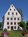
building in Hürben, Swabia, Germany  | |||||
| Upload media | |||||
| Instance of | |||||
|---|---|---|---|---|---|
| Location | |||||
| Street address |
| ||||
| Heritage designation | |||||
 | |||||
This is the category of the Bavarian Baudenkmal (cultural heritage monument) with the ID D-7-74-150-25 (Wikidata)
|
Media in category "Hürbener Wasserschloss (Krumbach)"
The following 4 files are in this category, out of 4 total.
-
 Hürben.Schloss.JPG 1,704 × 2,272; 860 KB
-
 KRU-WaSchl01.jpg 776 × 1,024; 518 KB
-
 Schl.Hürben.JPG 1,485 × 1,745; 282 KB
-
 Schloss.Hürben.JPG 1,921 × 1,703; 655 KB


